わからない
質問になるんですけどこの何も書いてないところは飛ばしていいんですか?


Yes, Drone Maps Japan is completely free and it doesn't have any in-app purchases or subscriptions.
🤔 The Drone Maps Japan app's quality is mixed. Some users are satisfied, while others report issues. Consider reading individual reviews for more context.
Drone Maps Japan is free.
To get estimated revenue of Drone Maps Japan app and other AppStore insights you can sign up to AppTail Mobile Analytics Platform.

質問になるんですけどこの何も書いてないところは飛ばしていいんですか?
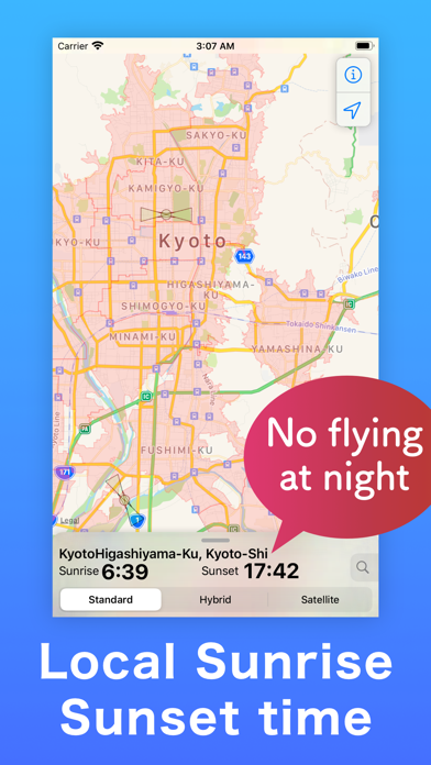
位置情報ONで使用すると常に現在地に戻される。 他の場所を見ようと地図を動かしたり拡大縮小したくても出来ない。 なにこれ?
「重要施設の周辺地域の上空における小型無人機等の飛行の禁止に関する法律(小型無人機等飛行禁止法)」で定められた「対象施設周辺地域(イエロー・ゾーン)」で表示されないものがありました。 三浦半島西岸の和田長浜海水浴場から長浜横穴墓群にかけては「横須賀海軍施設」である「アメリカ海軍長井通信試験施設」の「イエロー・ゾーン」ですが、本アプリの地図には表示されませんでした。 「小型無人機等飛行禁止法」の「イエロー・ゾーン」の全てを確認したわけではないですが、1カ所あるということは他にもある可能性があり、やや不安です。 航空法および小型無人機等飛行禁止法の飛行禁止エリアの確認は、DIPS2.0の 「飛行計画の通報・確認へ」→「飛行計画の参照」の地図で「禁止エリア表示」にチェックを入れて確認するのが確実ではないかと思います。 2024/05/25 追記 作者さんからすぐに修正対応いただけるとの返答をいただき、ユーザーフィードバックを速やかに実施する取組には好感が持てます。 当初は、禁止エリア情報は、各省庁にばらけており、個別に全てを確認するのは大変だったので、本アプリは非常に便利でした。 上に記載したように、DIPS2.0で公的に禁止エリアの確認ができるようになっています。 禁止エリアをざっと確認するならUIは本ソフトが楽ですが、確実に確認するときはDIPS2.0という感じかなぁと思いました。
追加した機体の削除が「管理」の項目から選べるのですが、機体を選んで削除すると別の機体が削除されてしまいます。 レンタルすることが多いのでやりくりしたいのですが手持ちの機体がどんどん消えてしまうので困っています。ご対応いただけると助かります。
人口密集地でもトイドローンなら飛ばし放題……ではなく、小型無人機等飛行禁止法は違反しないようにアプリを使い始めました 確かに都道府県条例や敷地管理者の指示、民事までありますが、航空法違反と小型無人機等飛行禁止法違反は重大事案、知らなかったで済まされないですから…… その観点で言うと赤色DIDを除外した、トイドローン向け表示があると良いかもですね
昨年6月より、北海道美唄市東四条南1丁目3-1 北海道せき損センターを中心に半径1km圏内が有人機離発着エリアに指定され、ドローンの飛行禁止区域となりましたので更新して頂けるとより分かりやすいと思います まあ飛行計画の登録時にハジかれるので知らずに飛ばしちゃいましたσ(^◇^;)は、通用しないと思いますが
飛行制限空域の参考になります。 実際に飛行させる時には自身で関係各所に確認するのは忘れずに。 ドローンは基本的に自己責任なのでこれくらいの情報で充分です。 DIPSにもアプリから飛べるため申請や飛行計画にアクセスしやすいです。 非常に便利でありがたいです😄
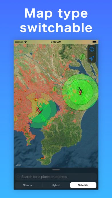
色分けされており、わかりやすいが、広告が多すぎて、時間がかかる。初心者で場所がわからない時にはぜひ一度でもお使いくださいませ。
今いる位置の制限が一目でわかってとても助かります! ただ、色付けの意味を調べるのに「地図の色について」を開いて確認する必要があるので、マップをタップすると、その場所の制限がポップアップしてくれるとより素早く制限内容が見れてありがたいです。
this Drone map helps a lot.
|
Chart
|
Category
|
Rank
|
|---|---|---|
|
Top Grossing
|

|
46
|
|
Top Grossing
|

|
76
|
|
Top Free
|
|
136
|
|
Top Free
|

|
234
|
|
Top Free
|
|
285
|
