
Description
Create, import, export tracks with waypoints. Supports offline maps, no time limits, no ads, no in-app purchases.
The main functions of the application:
- loading and unlimited storage of maps of the travel area.
- built-in barometer and pedometer running in the background when the application is closed.
- supports all import and export methods available for your device with services, friends and applications in .gpx format.
- color gradient for speed and height, if this information is in the imported track.
- color gradient for speed and height for recorded tracks.
- recording speed and altitude in the track.
- extended track information: average and maximum speed, track duration by time and distance, number of waypoints.
- relief lines in outdoor mode.
- different units of measurement: miles, kilometers, feet, meters.
- free search for places by address or place name
- free building routes for different driving modes (no more than 300 per month).
- storage and export of routes.
- building routes from the current position to a point or from point to point.
- the ability to record tracks in the background.
- does not contain in-app purchases, additional payments for cards, advertisements and has no time limits for use.
- viewing one or several tracks in any application mode, including the recording mode of another track.
- installation, editing, deletion of waypoints in any application mode and anywhere.
- the ability to adjust the quality of the track, distance filters, energy saving mode.
- export and import of tracks and waypoints to various services - Open Street Map and others.
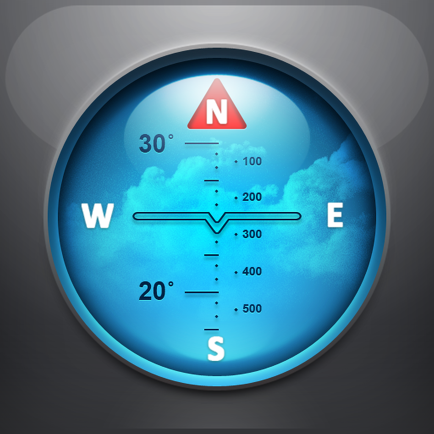
- display of additional information - scale, coordinates, height, speed.
- shows the current distance traveled by the track and the travel or walk time.
- has several map styles - satellite, streets, combo and dark.
- Supports dark theme for iOS 13-14.
- easy start and stop of tracking in several ways.
- the ability to continue any previously recorded or imported track.
- several modes of map orientation - by the heading of the phone, in the direction of travel, centering and to the north.
- Possibility of tilting the map with double pinch.
- quick and easy selection and viewing of saved tracks, waypoints and maps.
- speed and altitude graphs can be scaled and scrolled.
Hide..
Show more..
The main functions of the application:
- loading and unlimited storage of maps of the travel area.
- built-in barometer and pedometer running in the background when the application is closed.
- supports all import and export methods available for your device with services, friends and applications in .gpx format.
- color gradient for speed and height, if this information is in the imported track.
- color gradient for speed and height for recorded tracks.
- recording speed and altitude in the track.
- extended track information: average and maximum speed, track duration by time and distance, number of waypoints.
- relief lines in outdoor mode.
- different units of measurement: miles, kilometers, feet, meters.
- free search for places by address or place name
- free building routes for different driving modes (no more than 300 per month).
- storage and export of routes.
- building routes from the current position to a point or from point to point.
- the ability to record tracks in the background.
- does not contain in-app purchases, additional payments for cards, advertisements and has no time limits for use.
- viewing one or several tracks in any application mode, including the recording mode of another track.
- installation, editing, deletion of waypoints in any application mode and anywhere.
- the ability to adjust the quality of the track, distance filters, energy saving mode.
- export and import of tracks and waypoints to various services - Open Street Map and others.
- display of additional information - scale, coordinates, height, speed.
- shows the current distance traveled by the track and the travel or walk time.
- has several map styles - satellite, streets, combo and dark.
- Supports dark theme for iOS 13-14.
- easy start and stop of tracking in several ways.
- the ability to continue any previously recorded or imported track.
- several modes of map orientation - by the heading of the phone, in the direction of travel, centering and to the north.
- Possibility of tilting the map with double pinch.
- quick and easy selection and viewing of saved tracks, waypoints and maps.
- speed and altitude graphs can be scaled and scrolled.
Screenshots


User Rating
3.25 out of 5
4 ratings in Hong Kong
5 star
1
4 star
1
3 star
1
2 star
0
1 star
1
Ratings History
Offline Maps Installs
Last 30 days
Offline Maps Revenue
Last 30 daysOffline Maps Reviews
Store Rankings
Ranking History
App Ranking History not available yet
Category Rankings
|
Chart
|
Category
|
Rank
|
|---|---|---|
|
Top Paid
|

|
7
|
|
Top Grossing
|
|
45
|
|
Top Paid
|

|
45
|
|
Top Paid
|

|
60
|
|
Top Paid
|

|
72
|
Keywords
Offline Maps Competitors
| Name | Reviews | Recent release | |
|---|---|---|---|
Commander Compass
Compass, GPS & Offline Maps
|
1
|
1 year ago | |

Multi Translate Voice
Translate Conversation & Text
|
2
|
1 year ago | |

Anchor Pointer: 步行路线
安全旅行地圖工具包
|
2
|
1 month ago | |

Navigate to Photo
with any navigation app
|
2
|
3 months ago | |

Track4Facts PRO
Performance Analysis 2.0
|
0
|
11 months ago | |

我的足跡: GPS記錄儀
戶外地圖導航與軌跡記錄、健行登山滑雪路徑回溯
|
2
|
2 weeks ago | |

Dash Cam - Record Trips
Up to 4K ultra wide angle
|
0
|
1 week ago | |

Measure Map GPS Field
Area Calculator
|
1
|
2 years ago | |

altitude speed location
ASL
|
0
|
1 year ago | |

Altimeter Just Altitude
Easy use Altimeter for hiking
|
0
|
10 months ago |
Offline Maps Revenue and Downloads
Gain valuable insights into Offline Maps performance with our analytics.
Sign up now to access downloads, revenue, and more.
Sign up now to access downloads, revenue, and more.
App Info
- Category
- Navigation
- Publisher
- SERGEY BEZDENEZHNYKH
- Languages
- English, French, German, Russian, Chinese, Spanish
- Recent version
- 3.3.7 (4 weeks ago )
- Released on
- Jan 24, 2021 (3 years ago )
- Also available in
- China, United States, Russia, Saudi Arabia, Hong Kong, Egypt, Germany, South Korea, Philippines, United Arab Emirates, Vietnam, Taiwan, Australia, United Kingdom, France, Peru, Kazakhstan, Ukraine, Brazil, Spain, Finland, Italy, Malaysia, Canada, Austria, Romania, Switzerland, New Zealand, Netherlands, Norway, India, Pakistan, Poland, Portugal, Sweden, Singapore, Slovakia, Thailand, Turkey, South Africa, Ecuador, Argentina, Azerbaijan, Belgium, Belarus, Chile, Colombia, Czechia, Denmark, Dominican Republic, Algeria, Nigeria, Greece, Hungary, Indonesia, Ireland, Israel, Japan, Kuwait, Lebanon, Mexico
- Last updated
- 3 days ago