Maps! What more do you want?
The app is a bit clunky to use, but once you get past the initial learning curve, it has an extensive collection of maps. I haven’t used any of the other features, but I can imagine weather being a helpful feature, too.

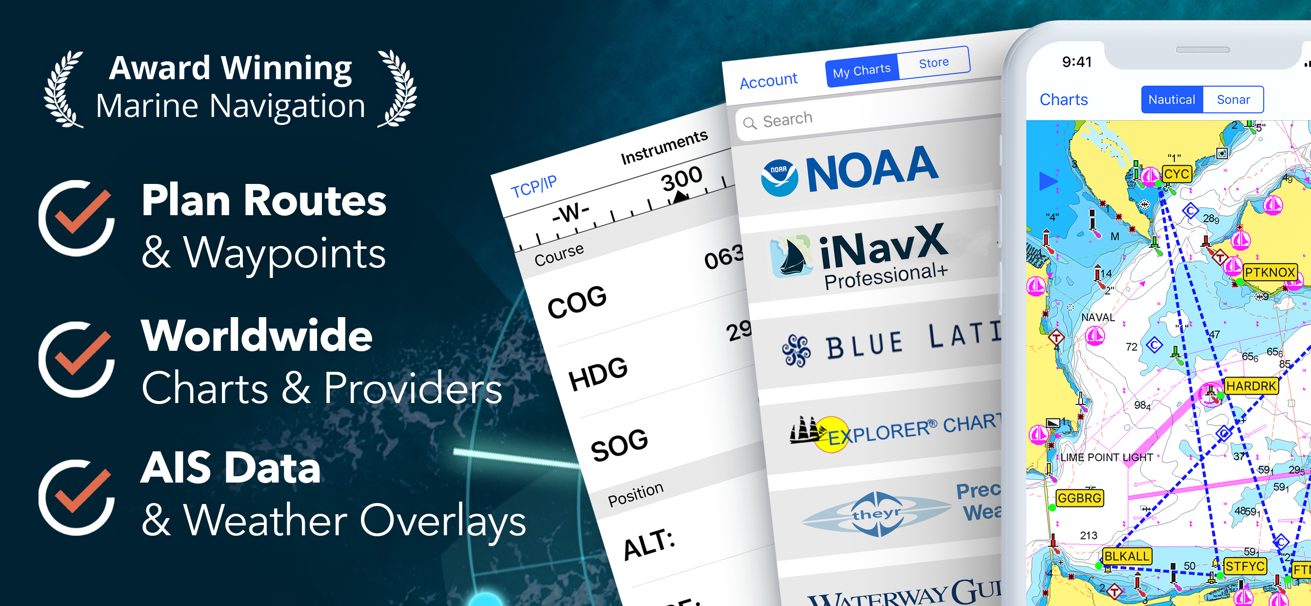


Yes, INavX is free to download, however it contains in-app purchases or subscription offerings.
⚠️ The INavX app has poor ratings and negative feedback. Users seem unsatisfied with its performance or features.
INavX has several in-app purchases/subscriptions, the average in-app price is $86.99.
To get estimated revenue of INavX app and other AppStore insights you can sign up to AppTail Mobile Analytics Platform.

4.59 out of 5
1,269 ratings in Canada
The app is a bit clunky to use, but once you get past the initial learning curve, it has an extensive collection of maps. I haven’t used any of the other features, but I can imagine weather being a helpful feature, too.
Of no use in Canadian Pacific waters.
I’ve been using iNavX (or it’s predecessor) for years. It’s solid and dependable. Never any problems. If you are iOS, don’t hesitate. If you want a professional, easy to use nav app: Just get it.
It’s slow to respond, not intuitive. There’s way better stuff out there like Aquamaps and Navionics.
The app is useless unless you subscribe to the charts. $149.99 yearly fee for a single chart.
I have used this app for years but in its current form, where you need to download small areas of chart individually, it is very poor. If you have a previous version, don’t bother updating it, you’ll only be disappointed. It seems they lost their licensing for Navionics and are now using a much inferior C-map chart system
im a professional mariner having used Inavx for almost 10 years. It was good and the navionics vector charts were okay. then some genius a few months ago introduced an allaine with CMap. since I did not renew my subscription with Navionics The only choice is CMap. The cmap download only allows about 30 square miles at a time. !!!!! it would take me days to download a trip between just Vancouver and Prince Rupert. I do have the option to download raster charts .. but that would cost me hundreds and hundreds of dollars. Someone butchered this app. NOT RECCOMENDED (unless an alliance with navionics is re-established).
I didn’t find the app immediately intuitive; however, watching a couple of easily accessible YouTube videos was all it took. Navigated a 5 day and a 10 day sailing trips on Lake Ontario over the summer using only iNavX on my iPhone.
Bonjour , je n’arrive pas à récupérer mes carte sur mon 2ème appareil
Spin wheels are frustrating to use for inputting latitude and longitude for waypoints. Why can’t this be done using a number pad?
|
Chart
|
Category
|
Rank
|
|---|---|---|
|
Top Grossing
|

|
20
|
|
Top Grossing
|

|
21
|
|
Top Grossing
|

|
33
|
|
Top Grossing
|

|
36
|
|
Top Grossing
|

|
47
|

