TrailLink: Bike, Run, Walk
Trail Maps for Outdoor Fitness
#1 Keyword Rankings
Today
Top 10 Rankings
Today
Top 30 Rankings
Today
Top 100 Rankings
Today

Description

TrailLink is the ultimate trail-finder app to help you stay active and get outdoors. Enjoy full-length trail descriptions, reviews, photos, and detailed trail maps not found anywhere else!

Discover amazing trails near you that are perfect for cycling, jogging, walking, workouts and more. Explore over 40,000 miles of multi-use trails in the US, all carefully curated for quality.

Want to get started biking, walking trails or jogging? Subscribe to TrailLink Unlimited for detailed offline trail maps, plus tens of thousands of trail amenity waypoints.

Find walking trails with exercise stations, biking trails with great views and much more. Find fitness anywhere you walk or ride with the best trails near you.

Empower your next on-the-trail adventures, whether you’re hiking, biking, jogging or walking.

TrailLink is powered by Rails-to-Trails Conservancy (RTC) expert trails database which offers unique trail-finder functionality. Plus, TrailLink Unlimited lets you search Google Places for easy access to trail-side businesses.

Rails-to-Trails Conservancy's GIS mapping initiatives have produced more than 40,000 miles of highly accurate trail maps. Download trail maps and access them any time, then share your trail photos and trips with friends.

Take TrailLink with you today and let Rails-to-Trails Conservancy be your expert guide out on the trail. Try it out today and register to get your first map for free!

Download TrailLink today for:

OUTDOOR EXERCISE
• Discover the joys out the outdoors with scenic walking and biking trails near you.
• Get outside and get in shape whether you’re a beginner or an outdoor enthusiast.

FIND TRAILS
• Search for trails near you or by location
• Search for trails on the map
• Search for Google Places on the map
• Download trail maps for offline use
• Find the best trails for jogging, walking or biking

TRAILS FOR ALL TRIPS
• Find trails for jogging
• Biking routes
• Walking trails
• Hiking trails
• And more!

TRAIL REVIEWS
• Read RTC's expert trail descriptions
• Read and write trail reviews
• Save your trail favorites

SHARE YOUR ROUTES
• Upload trail photos
• Share trails with friends

TRAIL DIRECTIONS & INFORMATION
• See your location on the trail
• Generate driving directions
• Amenity waypoints like exercise stations, trailheads, tunnels and drinking fountains
• Find restrooms, parking & much more

RAILS-TO-TRAILS CONNECTION
• Sync your account with TrailLink's website
• Support the mission of Rails-to-Trails Conservancy!

Download the TrailLink app today and let RTC guide your way!


The TrailLink app offers the Unlimited subscription in the app directly through your iTunes Account for only $29.99 for 12 months of unlimited offline map downloads. The TrailLink Unlimited subscription will automatically renew for $29.99 after 12 months unless you cancel your subscription at least 24hrs before the end of the current subscription period. You can cancel at any time and manage your subscription, including turning off auto-renewal, in your Account Settings.

To view TrailLink Terms of Use policy, please visit: https://www.traillink.com/terms-of-use/

To view Rails-to-Trails Conservancy's Privacy Policy, please visit: https://www.railstotrails.org/privacy/
Hide.. Show more..

In-Apps

TrailLink Unlimited
$29.99

Screenshots

User Rating

4.56 out of 5

6,631 ratings in United States

5 star
5,168
4 star
798
3 star
211
2 star
119
1 star
335

Ratings History

Reviews

Learned so much

ArdnaelSerrot on

I had no idea there were so many accesible beautiful trails near me that connected across my state and even further.

Great view of map

OmaColt on

Not sure to how “start trail”. GUI doesn’t make it obvious if that can be done.

Waste of time and money!

Alfa Agent Jamie Dukus on

Just use google earth. It shows more than this app!

Wallkill Valley rail trail

Flyer 334 on

11/20/23 can’t say enough great trail plenty to see .

Gratitude for the Metropolitan Branch Trail

Kitty444444 on

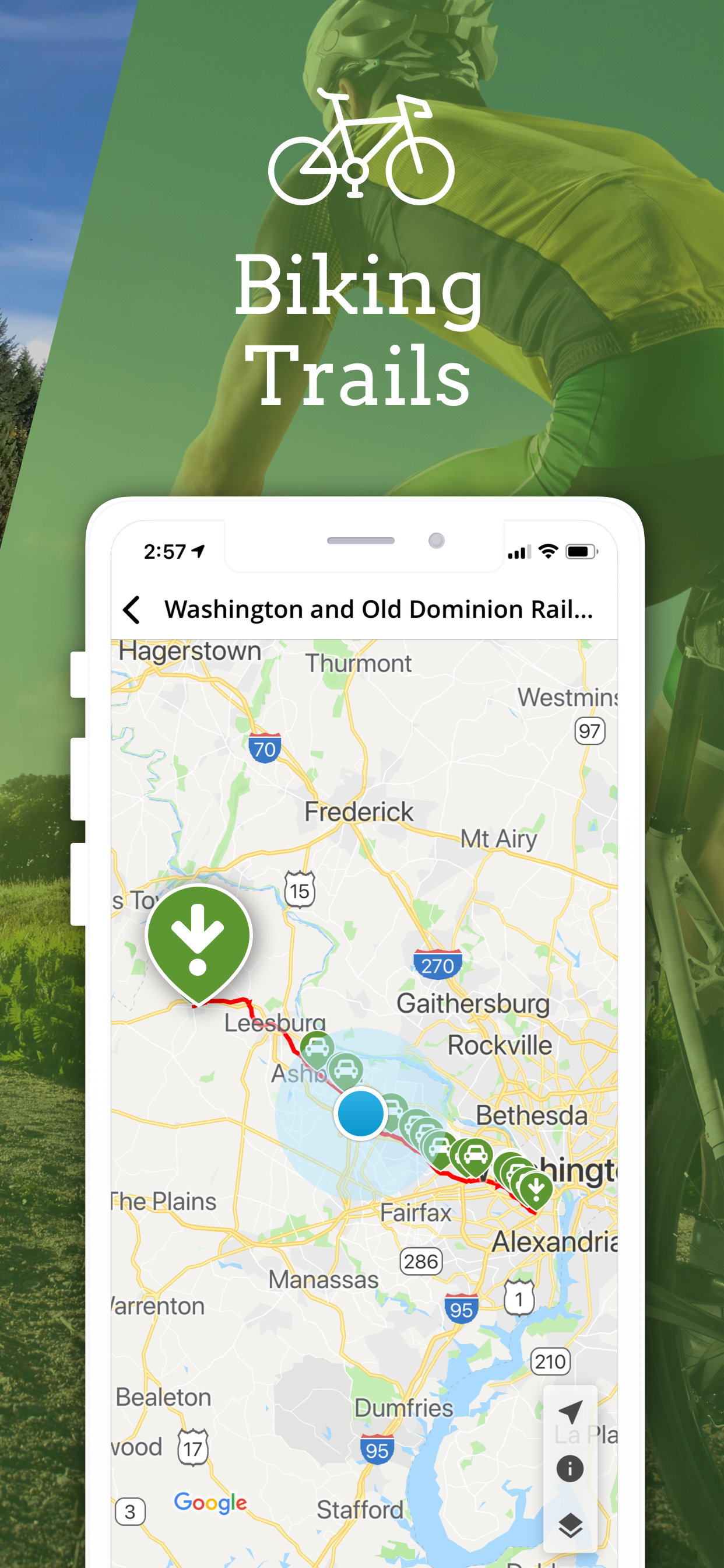
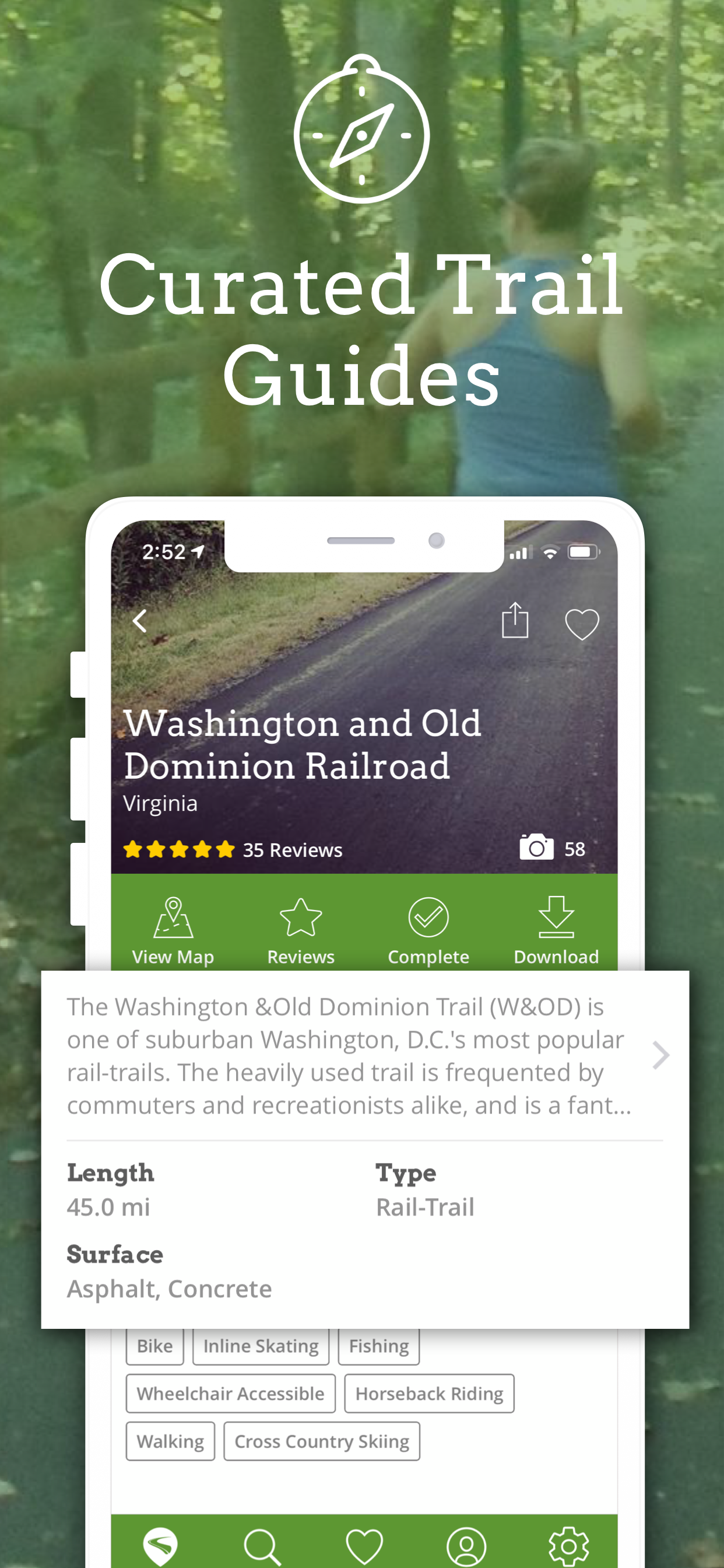
Red line is closing on June 1 2024 for a whole month. So glad I can ride downtown from Silver Spring on the Metropolitan Branch Trail!

Good information on trails

Thirteen Dogs! on

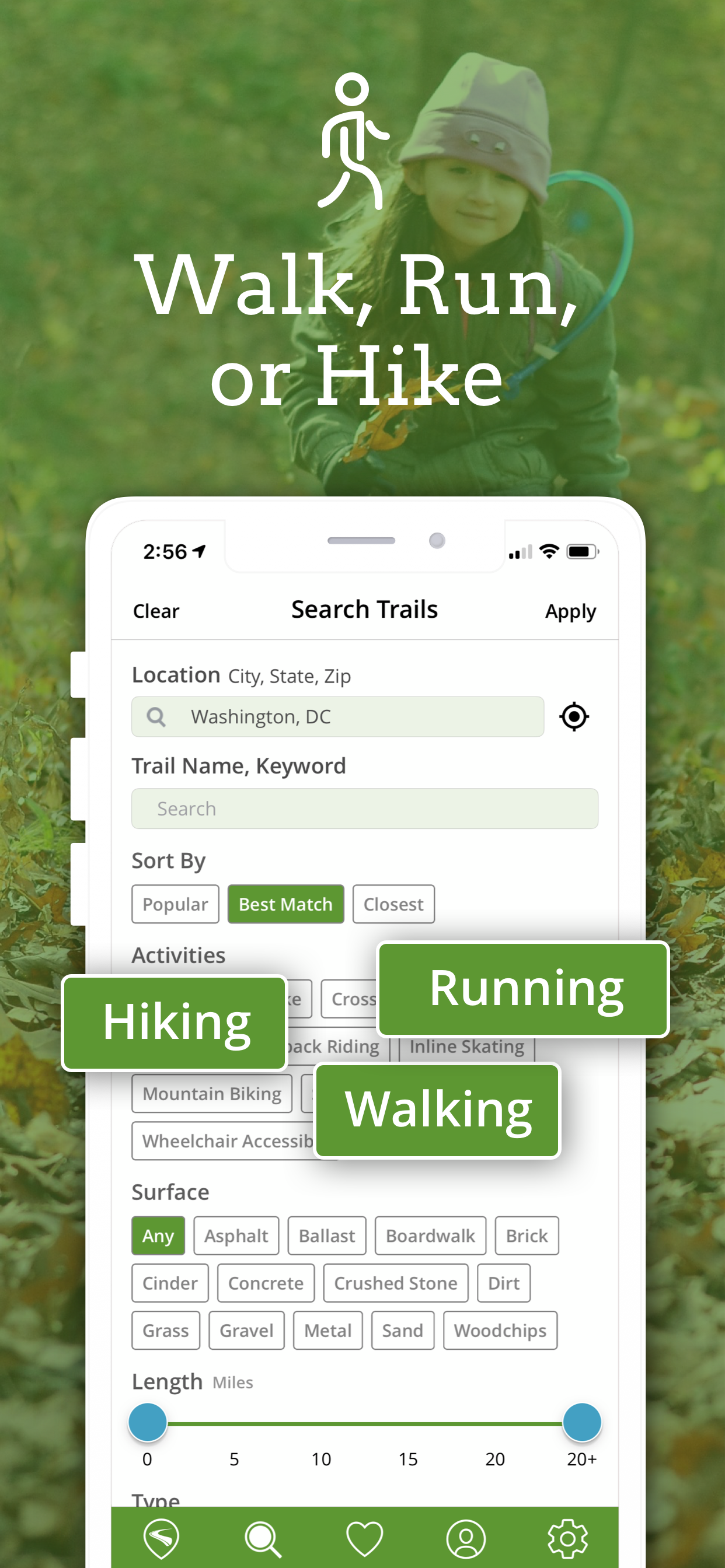
This app is very informative in helping to discover hiking and biking trails, especially if you have only a day to ride. It helps to select a trail that is easy enough to get to and long enough to be worth the effort.

Pretty good little app

PThrasha on

New to cycling and didn’t know of many places to ride and this app is full of great trail maps

Excellent

The Video Game Fan on

Very helpful to have this app, thank you!

Great trail finder

MotionMatt on

Shows several trails in one area

E Bike Friendly

Nate - Yo Soy Un Viejo Salsero on

Very helpful and one of the best I’ve seen in terms of organization and clarity.

Store Rankings

Ranking History

Category Rankings

Chart
Category
Rank
Top Free
309

Keywords

Users may also like

Name
Map My Ride by Under Armour
GPS Cycling & Workout Tracker
AllTrails: Hike, Bike & Run
GPS Hiking & Biking Trail Maps
RaceJoy
Ride with GPS: Bike Navigation
Plan, Navigate, & Live Track
Wahoo ELEMNT Companion
Run With Hal - Training Plans
Marathon, Running Workout App
Wahoo
Workout & Fitness Tracker
SilverSneakers GO
Fullscript
Supplements made easier
Specialized
Unleash your dream ride
Show More

Revenue and Downloads

Gain valuable insights into TrailLink: Bike, Run, Walk performance with our analytics. Sign up now to access downloads, revenue, and more.

App Info

Publisher
Rails-to-Trails Conservancy
Languages
English
Recent version
2.6.1 (1 year ago )
Released on
Nov 11, 2013 (10 years ago )
Last updated
1 week ago