US EFB - Aviation Charts
Charts & Weather for pilots
#1 Keyword Rankings
Today
Top 10 Rankings
Today
Top 30 Rankings
Today
Top 100 Rankings
Today

Description

This in-flight aeronautical system contains full airport database of the United States (more than 4.000 airports and 24.000 charts and diagrams) including aeronautical charts and real-time weather information. All flight charts of VFR and IFR airports are regularly updated according to FAA (Federal Aviation Administration) regulations to make our app useful and reliable for every pilot.

DETAILED WEATHER INFORMATION
METAR (Meteorological Terminal Air Report) and TAF (Terminal Aerodrome Forecast) data are continuously updated online thus users do not need to refresh data manually. Airport weather information is marked with green (VFR), blue (MVFR), red (IFR) and purple (LIFR) according to the aviation standards. By choosing any of the listed airports you can check the time of latest weather report.

METAR AND TAF DATA ARE DISPLAYED IN A USER-FRIENDLY WAY
Raw weather information is processed into a more understandable transcriptions. METAR data provides information of the following parameters: observation time, flight category, temperature, dewpoint, wind, windgust, visibility, pressure and clouds while TAF data includes detailed weather forecast of the airport.

DETAILED CHARTS AND PUBLICATIONS
This aeronautical app provides detailed information of all airfields and allows them to be displayed in various categories. This easy access categorizing function helps users to find information more quickly thus makes IFR procedures easier:
• Instrument Approach Procedures - IAP

• Standard Terminal Arrivals - STAR

• Departure Procedures - DP

• Airport Diagrams - APD

• Airport Minimums – MIN

AIRFIELD CHARTS ARE AVAILABLE OFFLINE
After downloading US EFB Aviation Chart you will have access to all data the app provides. The app will update aeronautical charts and documents continuously online but all your charts are going to be stored on your device so you can always use them with no internet conenction.

MAP VIEW FOR BETTER WEATHER INFORMATION
This app allows users to choose airports in a map view. It highlights airports with different colors referring to different weather conditions. This map view helps users to instantly see the most important weather information and choose other airports nearby if necessary.

ADVANCED AERONAUTICAL CHART BROWSING SYSTEM
This comfortable digital flight bag provides users an advanced chart browsing function. The browser let users to search charts according to FAA, ICAO, IATA airport codes.

DISPLAY INFORMATION IN DIFFERENT UNITS
Users can change the default units according to their needs. The following units are available in US EFB Aviation Charts:
• Pressure: hPA – inHG – mmHg
• Temperature: Celsius – Fahrenheit
• Visibility: Km – Sm – Nm
• Elevation: Feet – Meter
• Wind: knot – m/s – km/h – mph
• Altitude (cloud): Feet – Meter

MORE INFORMATION
Please note that, free version allows users to choose 5 airports. With subscription to 'US EFB - Aviation Charts - Charts & Weather for pilots' you can enjoy premium features including: unlimited offline charts (after download), aviation weather (online access) with continuous updates.

If you choose to purchase US EFB - Aviation Charts - Charts & Weather for pilots, payment will be charged to your iTunes account, and your account will be charged for renewal within 24-hours prior to the end of the current period. Auto-renewal may be turned off at any time by going to your settings in the iTunes Store after purchase. Prices are in U.S. dollars, may vary in countries other than the U.S. and are subject to change without notice. No cancellation of the current subscription is allowed during the active subscription period.

Privacy policy: https://www.flygo-aviation.com/privacy-policy-flygo/
Terms of use: https://www.flygo-aviation.com/terms-of-use-flygo/

Enjoy our app & FLY SAFE!

FlyGo-Aviation Team
Hide.. Show more..

In-Apps

All Access (1 month)
$3.99
All Access Half Price 6 Months
$11.49

Screenshots

User Rating

4.32 out of 5

44 ratings in United States

5 star
28
4 star
10
3 star
2
2 star
0
1 star
4

Ratings History

Reviews

I paid and don’t work for i

unhappy jsjsj on

I paid and don’t work

Downloaded then deleted

Chente Vicente Machete on

Downloaded App and deleted three times and still doesn’t work. All this app does is tell me to update it once opened then it freezes once you click “ yes update”.

Terrible interface not user friendly

Brinut on

This app is useless. The GUI is non existent, great for adventure seekers but not good for any pilot at any level. Do not waste your time. If you do sign up for the “free trial” There is no way to cancel it until after you have been billed. Total scam.

Awesome!

MikeInGeorgia on

So much value for the price.

Very lousy

Michael8171010 on

Won't even open after download. Don't waste your time!

Intelligent App

motngaydesong2011 on

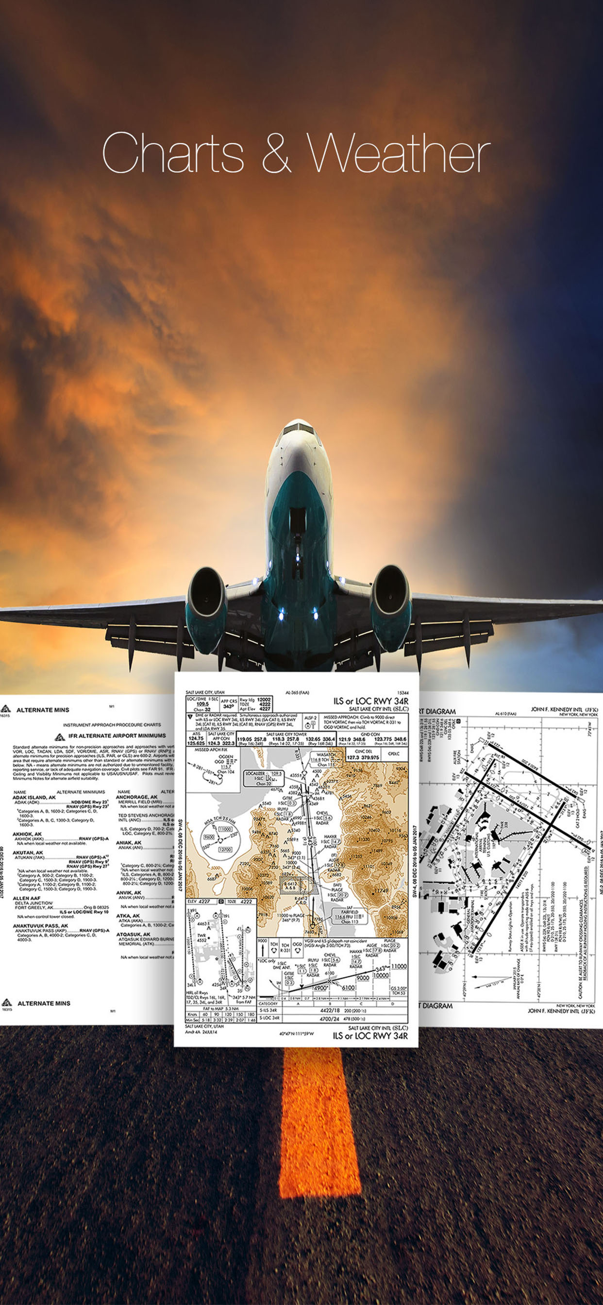
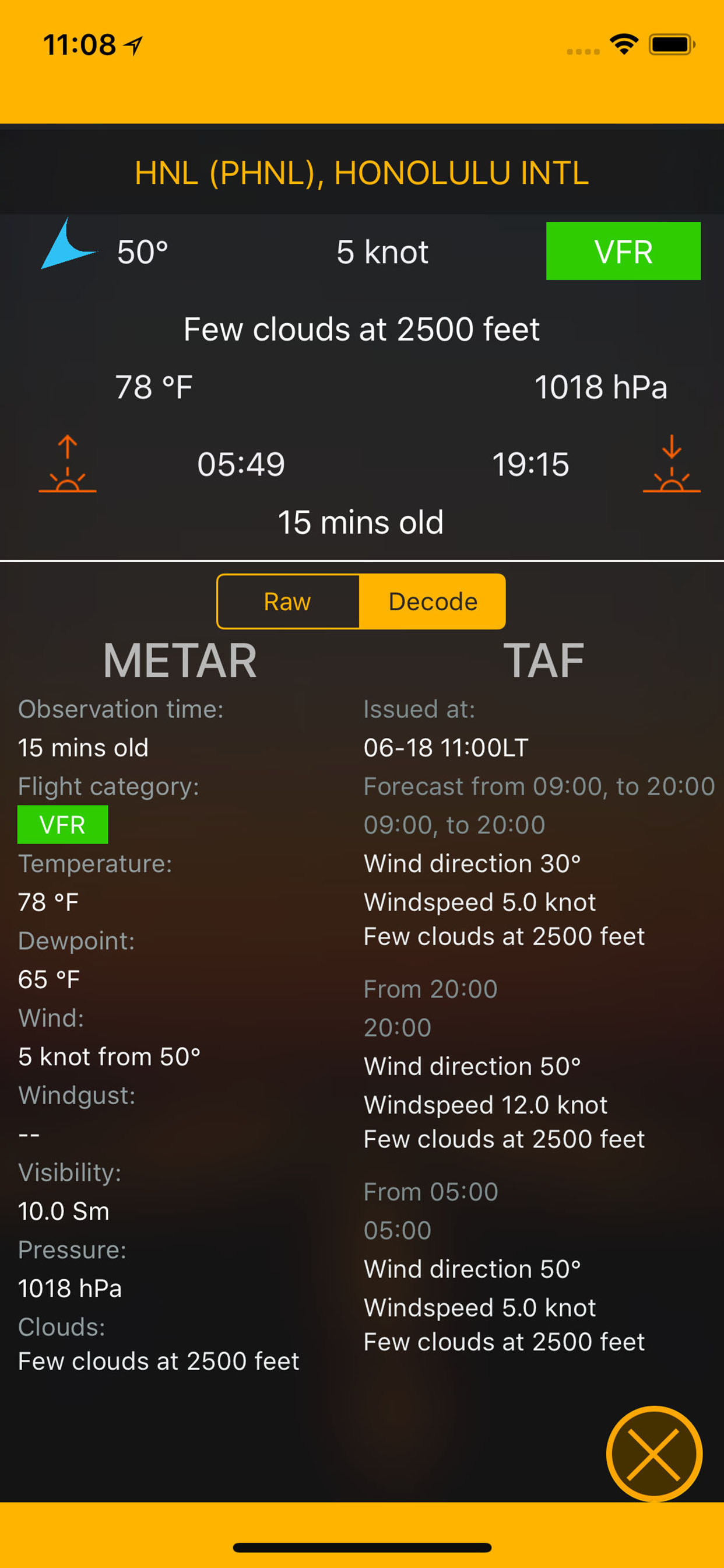
weather reports updated by METAR and TAF. Pretty advanced app.

Savior

divenoixa on

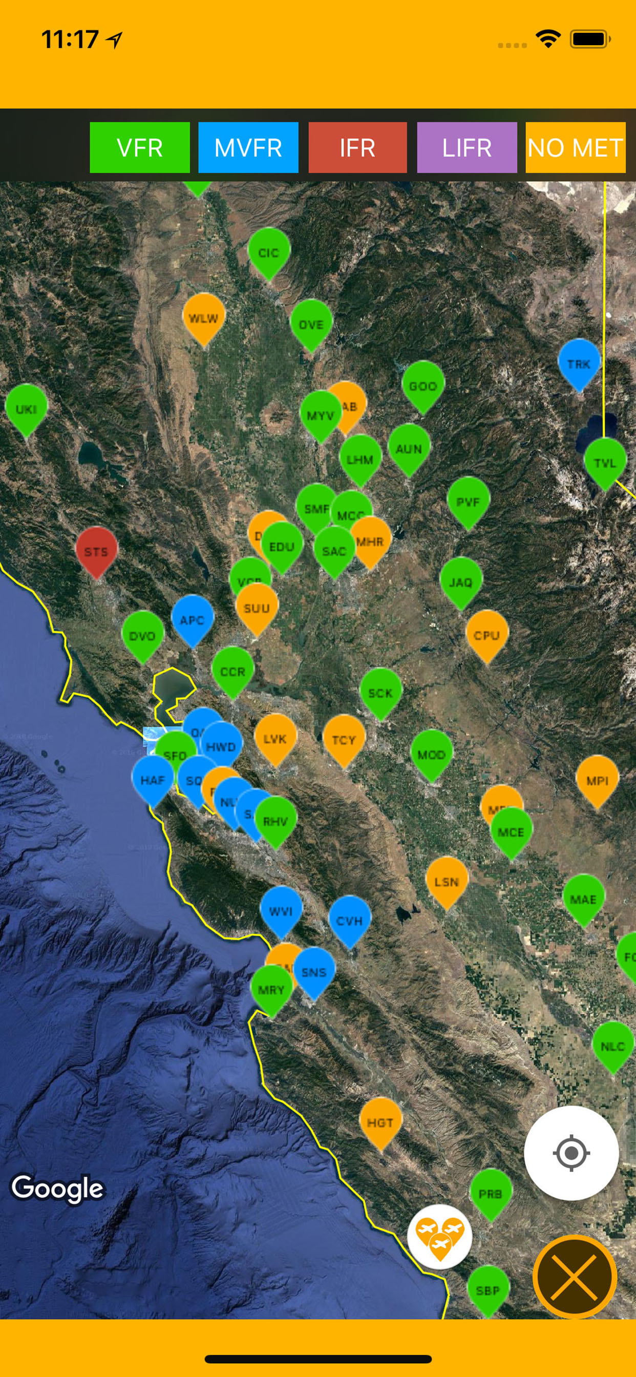
Being a Pilot means keeping a tab on everything i.e. weather, flight schedules, etc. This app helps me get all the information under one hood.

Organaized App

neuchicon54 on

Flight charts appropriately categorized. Helps to identify the details with ease.

Reasonable

vienkiemsoat54 on

I would really suggest everyone who installs this App, to subscribe for the premium version. It is really reasonable.

Easy To Use

khongcochuyen600 on

I would highly recommend it to every pilot out there. Easy to use and nice design.

Store Rankings

Ranking History

App Ranking History not available yet

Category Rankings

Chart
Category
Rank
Top Free
476
Top Free
481
Top Free
498

Keywords

Users may also like

Name
RocketRoute FlightPlan
RunwayMap - #1 Pilot Community
Pilot App & Aviation Weather
Easy Aviation Weather - WX
METAR TAF NOTAM Pilot Weather
Stratus Insight EFB
Your Digital Copilot
iFlightPlanner
Web and mobile flight planning
WilCo - Pilot Aviation Weather
Airport 3D Map & Charts NOTAM
NOAA Aviation Live Sky Weather
Constant WX Brief
Aviation Weather - METARs/TAFs
Aviator Assistant: Weather EFB
Planning, Navigation, Weather
Show More

Revenue and Downloads

Gain valuable insights into US EFB - Aviation Charts performance with our analytics. Sign up now to access downloads, revenue, and more.

App Info

Category
Weather
Publisher
Flygo-Aviation Ltd
Languages
English
Recent version
3.9 (2 months ago )
Released on
Mar 23, 2017 (7 years ago )
Last updated
3 weeks ago