Beschreibung
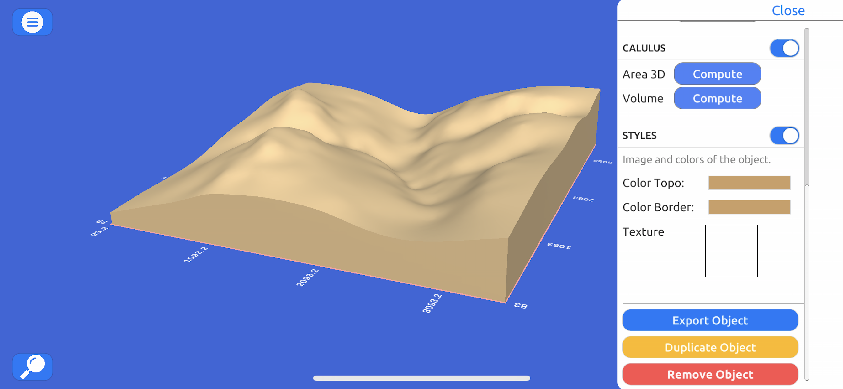
Directly from the internet; Bing Maps, Mapbox, and ArcGIS or from a cloud point stored locally.
Export real data:
From point cloud data in CSV or TXT to 3D models in STL or OBJ and satellite images.
Operate:
Cut, re-scale, and animate models for representation, analysis, and calculations.
Compute operations:
Calculate surface areas and volumes of a model in real-world units with little difference compared to ArcGIS.
Explore:
Character controller geo positioned in real-world coordinate systems such as UTM and Geographic Coordinate System.
In-App-Käufe
- Weekly License
- $4.99
- Yearly License
- $139.99
- Monthly License
- $13.49
Screenshots
3D GIS Digital Elevation Model Häufige Fragen
-
Ist 3D GIS Digital Elevation Model kostenlos?
Ja, 3D GIS Digital Elevation Model ist kostenlos herunterzuladen, enthält jedoch In-App-Käufe oder Abonnements.
-
Ist 3D GIS Digital Elevation Model seriös?
Nicht genügend Bewertungen, um eine zuverlässige Einschätzung vorzunehmen. Die App benötigt mehr Nutzerfeedback.
Danke für die Stimme -
Wie viel kostet 3D GIS Digital Elevation Model?
3D GIS Digital Elevation Model bietet mehrere In-App-Käufe/Abonnements, der durchschnittliche In-App-Preis beträgt 52.82 $.
-
Wie hoch ist der Umsatz von 3D GIS Digital Elevation Model?
Um geschätzte Einnahmen der 3D GIS Digital Elevation Model-App und weitere AppStore-Einblicke zu erhalten, können Sie sich bei der AppTail Mobile Analytics Platform anmelden.


3D GIS Digital Elevation Model Bewertungen
Store-Rankings


|
Diagramm
|
Kategorie
|
Rang
|
|---|---|---|
|
Top Kostenlos
|

|
357
|
3D GIS Digital Elevation Model Konkurrenten
| Name | Downloads (30d) | Monatlicher Umsatz | Rezensionen | Bewertungen | Letzte Veröffentlichung | |
|---|---|---|---|---|---|---|
|
Scenic Map
3D topo maps of the world
|
Freischalten
|
Freischalten
|
0
|
|
vor 10 Monaten | |
|
topoXpress
GIS & Survey
|
Freischalten
|
Freischalten
|
0
|
|
vor 1 Monat | |
|
MineAR: Augmented Reality Map
Upload & view your data in 3D
|
Freischalten
|
Freischalten
|
0
|
|
vor 2 Jahren | |
|
Topo Nomad
USGS Topographical Maps
|
Freischalten
|
Freischalten
|
0
|
|
vor 2 Jahren | |
|
Route3D 3.0
Topo map navigation
|
Freischalten
|
Freischalten
|
0
|
|
vor 2 Jahren | |
|
Compass Eye Bearing Compass
Augmented Reality compass
|
Freischalten
|
Freischalten
|
2
|
|
vor 2 Jahren | |
|
MyGIS
Your Navigation Companion
|
Freischalten
|
Freischalten
|
0
|
|
vor 10 Monaten | |
|
Topo Reader
USGS Topographical Maps
|
Freischalten
|
Freischalten
|
1
|
|
vor 2 Jahren | |
|
LiveTopo
Maps for Geology Lovers
|
Freischalten
|
Freischalten
|
0
|
|
vor 1 Jahr | |
|
Scenic Map Grand Canyon
Offline 3D topo maps
|
Freischalten
|
Freischalten
|
0
|
|
vor 10 Monaten |
3D GIS Digital Elevation Model Installationen
Letzte 30 Tage3D GIS Digital Elevation Model Umsatz
Letzte 30 Tage3D GIS Digital Elevation Model Einnahmen und Downloads
Melden Sie sich jetzt an, um Zugriff auf Downloads, Einnahmen und mehr zu erhalten.
App-Informationen
- Kategorie
- Navigation
- Herausgeber
- Andres Narvaez
- Sprachen
- English
- Letzte Veröffentlichung
- 1.1 (vor 3 Jahren )
- Veröffentlicht am
- Jun 15, 2021 (vor 3 Jahren )
- Auch verfügbar in
- Peru, Ecuador, Vereinigte Staaten, Chile, Mexiko, Neuseeland, Norwegen, Niederlande, Nigeria, Malaysia, Pakistan, Libanon, Kasachstan, Kuwait, Südkorea, Japan, Italien, Philippinen, Israel, Polen, Portugal, Russland, Saudi-Arabien, Schweden, Singapur, Thailand, Türkei, Taiwan, Ukraine, Vietnam, Südafrika, Dänemark, Argentinien, Österreich, Australien, Aserbaidschan, Belgien, Brasilien, Belarus, Kanada, Schweiz, China, Kolumbien, Tschechien, Deutschland, Indien, Dominikanische Republik, Algerien, Ägypten, Spanien, Finnland, Frankreich, Vereinigtes Königreich, Griechenland, Sonderverwaltungsregion Hongkong, Ungarn, Indonesien, Irland, Vereinigte Arabische Emirate
- Zuletzt aktualisiert
- vor 22 Stunden
- © 2024 AppTail.
- Unterstützung
- Privacy
- Terms
- All Apps


