Beschreibung
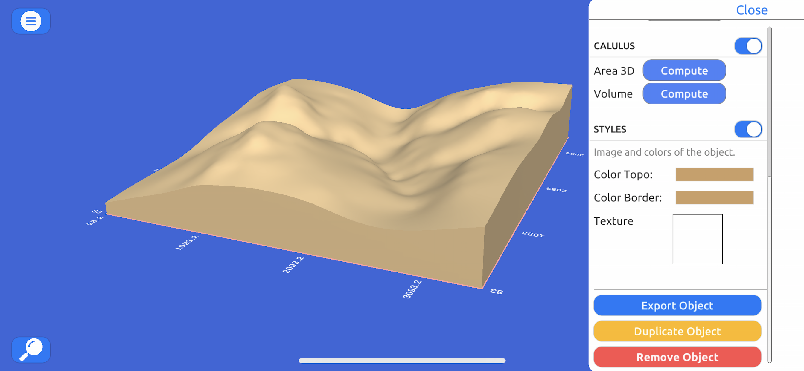
Directamente desde Bing Maps, Mapbox, ArcGIS o desde una nube de puntos local.
Exporta datos reales:
Desde un archivo nube de puntos en formato CSV o TXT hasta modelos en 3D como STL u OBJ e imágenes satelitales.
Opera:
Realiza cortes, re escala y haz animaciones en los modelos para una mayor representación o hacer análisis y cálculos.
Computar operaciones:
Calculo de superficies o volúmenes de un modelo a escala, con variaciones muy pequeñas comparadas a softwares como ArcGIS.
Explora:
Con un control de personaje geoposisionado con coordinadas del mundo real en UTM y el Sistema de Coordenadas Geográficas.
In-App-Käufe
- Weekly License
- 12.99 د.إ.
- Yearly License
- 384.99 د.إ.
- Monthly License
- 36.99 د.إ.
Screenshots
3D GIS Digital Elevation Model Häufige Fragen
-
Ist 3D GIS Digital Elevation Model kostenlos?
Ja, 3D GIS Digital Elevation Model ist kostenlos herunterzuladen, enthält jedoch In-App-Käufe oder Abonnements.
-
Ist 3D GIS Digital Elevation Model seriös?
Nicht genügend Bewertungen, um eine zuverlässige Einschätzung vorzunehmen. Die App benötigt mehr Nutzerfeedback.
Danke für die Stimme -
Wie viel kostet 3D GIS Digital Elevation Model?
3D GIS Digital Elevation Model bietet mehrere In-App-Käufe/Abonnements, der durchschnittliche In-App-Preis beträgt 144.99 د.إ..
-
Wie hoch ist der Umsatz von 3D GIS Digital Elevation Model?
Um geschätzte Einnahmen der 3D GIS Digital Elevation Model-App und weitere AppStore-Einblicke zu erhalten, können Sie sich bei der AppTail Mobile Analytics Platform anmelden.


3D GIS Digital Elevation Model Bewertungen
Store-Rankings


3D GIS Digital Elevation Model Konkurrenten
| Name | Downloads (30d) | Monatlicher Umsatz | Rezensionen | Bewertungen | Letzte Veröffentlichung | |
|---|---|---|---|---|---|---|
|
Scenic Map
3D topo maps of the world
|
View
|
View
|
0
|
|
vor 11 Monaten | |
|
MineAR: Augmented Reality Map
Upload & view your data in 3D
|
View
|
View
|
0
|
|
vor 2 Jahren | |
|
Topo Nomad
USGS Topographical Maps
|
View
|
View
|
0
|
|
vor 2 Jahren | |
|
Route3D 3.0
N/V
|
View
|
View
|
0
|
|
vor 2 Jahren | |
|
MyGIS
Your Navigation Companion
|
View
|
View
|
0
|
|
vor 11 Monaten | |
|
Topo Reader
USGS Topographical Maps
|
View
|
View
|
0
|
|
vor 2 Jahren | |
|
LiveTopo
Maps for Geology Lovers
|
View
|
View
|
0
|
|
vor 1 Jahr | |
|
Scenic Map Grand Canyon
N/V
|
View
|
View
|
0
|
|
vor 11 Monaten | |
|
Elevation For Real
|
View
|
View
|
0
|
|
vor 4 Monaten | |
|
Theodolite HD
AR Navigation Viewfinder
|
View
|
View
|
0
|
|
vor 1 Jahr |
3D GIS Modelo Digital Terreno Installationen
Letzte 30 Tage3D GIS Modelo Digital Terreno Umsatz
Letzte 30 Tage3D GIS Digital Elevation Model Einnahmen und Downloads
Melden Sie sich jetzt an, um Zugriff auf Downloads, Einnahmen und mehr zu erhalten.
App-Informationen
- Kategorie
- Navigation
- Herausgeber
- Andres Narvaez
- Sprachen
- English
- Letzte Veröffentlichung
- 1.1 (vor 3 Jahren )
- Veröffentlicht am
- Jun 15, 2021 (vor 3 Jahren )
- Auch verfügbar in
- Ecuador , Vereinigte Staaten , Peru , Chile , Malaysia , Philippinen , Neuseeland , Norwegen , Niederlande , Nigeria , Polen , Mexiko , Libanon , Kasachstan , Kuwait , Südkorea , Japan , Pakistan , Indien , Portugal , Russland , Saudi-Arabien , Schweden , Singapur , Slowenien , Thailand , Türkei , Taiwan , Ukraine , Vietnam , Südafrika , Dominikanische Republik , Argentinien , Österreich , Australien , Aserbaidschan , Belgien , Brasilien , Belarus , Kanada , Schweiz , China , Kolumbien , Tschechien , Deutschland , Dänemark , Italien , Algerien , Ägypten , Spanien , Finnland , Frankreich , Vereinigtes Königreich , Griechenland , Sonderverwaltungsregion Hongkong , Ungarn , Indonesien , Irland , Israel , Vereinigte Arabische Emirate
- Zuletzt aktualisiert
- vor 1 Woche
- © 2025 AppTail.
- Unterstützung
- Privacy
- Terms
- All Apps


