Foto-GIS

Veröffentlicht von: Unknown

Beschreibung

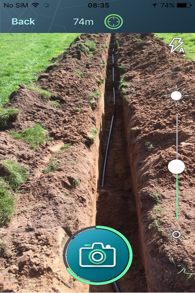
Foto-GIS application allows you to conveniently and professionally automate your construction site
foto documentation. Save up to 80% of your time and energy.
Images are automatically assigned to individual projects on the basis of the geo-coordinates (e.g
districts/ new construction areas/ construction sites/ defined GIS polygons) by means of the photo
location (GPS). However, individual construction project has to be created previously and released to
the system.
The photo is then available through the state-of-the-art GIS-based web user interface to all the users
you specify. Group rights can be assigned individually.
All of the photos are automatically synchronized with dedicated online archive (GIS Cloud Storage). Data are stored only on the European servers.
The photo archive collects up to 1 milion pictures and displays them precisely on the map, including the direction of the picture. The online archive is permanent and always safer than any data carrier.
Ausblenden Mehr anzeigen...

Screenshots

Foto-GIS Häufige Fragen

  • Ist Foto-GIS kostenlos?

    Ja, Foto-GIS ist komplett kostenlos und enthält keine In-App-Käufe oder Abonnements.

  • Ist Foto-GIS seriös?

    Nicht genügend Bewertungen, um eine zuverlässige Einschätzung vorzunehmen. Die App benötigt mehr Nutzerfeedback.

    Danke für die Stimme

  • Wie viel kostet Foto-GIS?

    Foto-GIS ist kostenlos.

  • Wie hoch ist der Umsatz von Foto-GIS?

    Um geschätzte Einnahmen der Foto-GIS-App und weitere AppStore-Einblicke zu erhalten, können Sie sich bei der AppTail Mobile Analytics Platform anmelden.

Benutzerbewertung
Die App ist in Schweden noch nicht bewertet.
Bewertungsverlauf

Foto-GIS Bewertungen

Verbesserungsvorschlag

robbe29 on

Deutschland

Ich nutze die App um mir Baustellenbilder anzuschauen. Was mich dabei extrem nervt, man landet immer wieder auf der Übersichtsseite der App, sobald man länger als ein paar Sekunden aus dieser raustabbt. Da ich mich selbst nicht am Aufnahmeort der Bilder befinde muss ich den gewünschten Ort dann jedes Mal erstmal wieder auf der Karte suchen.

Top zufrieden

Kastrati-Bau GmbH on

Deutschland

👍👍👍👍👍

iOS 17.1.2

Roland2286 on

Deutschland

Leider bei meine neue iPhone funktioniert nicht mehr. Hat vorher funktioniert ganz gut. Aber jetz nicht mehr

GPS Abbruch

Matrixdeal on

Deutschland

Ich nutze die App seit ca 2 Monaten, im Grunde ist sie ganz gut, aber der ständige Abbruch des GPS Signals und der damit verbundene Abbruch der Fotoserie beim aufmessen von Gruben und Gräben, ist SEHR ärgerlich!! Bereits erstellte Fotos können im Serienmodus nicht gespeichert oder beendet werden, denn man muss die Serie abbrechen und neu beginnen. Bitte lasst euch eine Lösung für das Problem einfallen.

Verschiedene Baustellen

Ma_Ot on

Deutschland

Alle Bilder übersichtlich dokumentiert, klasse

Store-Rankings

Ranking-Verlauf
App-Ranking-Verlauf noch nicht verfügbar
Kategorien-Rankings
App ist noch nicht gerankt

Foto-GIS Installationen

Letzte 30 Tage

Foto-GIS Umsatz

Letzte 30 Tage

Foto-GIS Einnahmen und Downloads

Gewinnen Sie wertvolle Einblicke in die Leistung von Foto-GIS mit unserer Analytik.
Melden Sie sich jetzt an, um Zugriff auf Downloads, Einnahmen und mehr zu erhalten.

App-Informationen

Kategorie
Utilities
Herausgeber
Unknown
Sprachen
Croatian, Dutch, English, French, German, Polish, Spanish
Letzte Veröffentlichung
2.41 (vor 3 Monaten )
Veröffentlicht am
May 14, 2020 (vor 4 Jahren )
Zuletzt aktualisiert
vor 2 Wochen
This page includes copyrighted content from third parties, shared solely for commentary and research in accordance with fair use under applicable copyright laws. All trademarks, including product, service, and company names or logos, remain the property of their respective owners. Their use here falls under nominative fair use as outlined by trademark laws and does not suggest any affiliation with or endorsement by the trademark holders.