
3D Mappa - GIS & Contour Maps
GIS Made Easy on-the-go.
#1 Keyword Rankings
Today
Top 10 Rankings
Today
Top 30 Rankings
Today
Top 100 Rankings
Today
Description
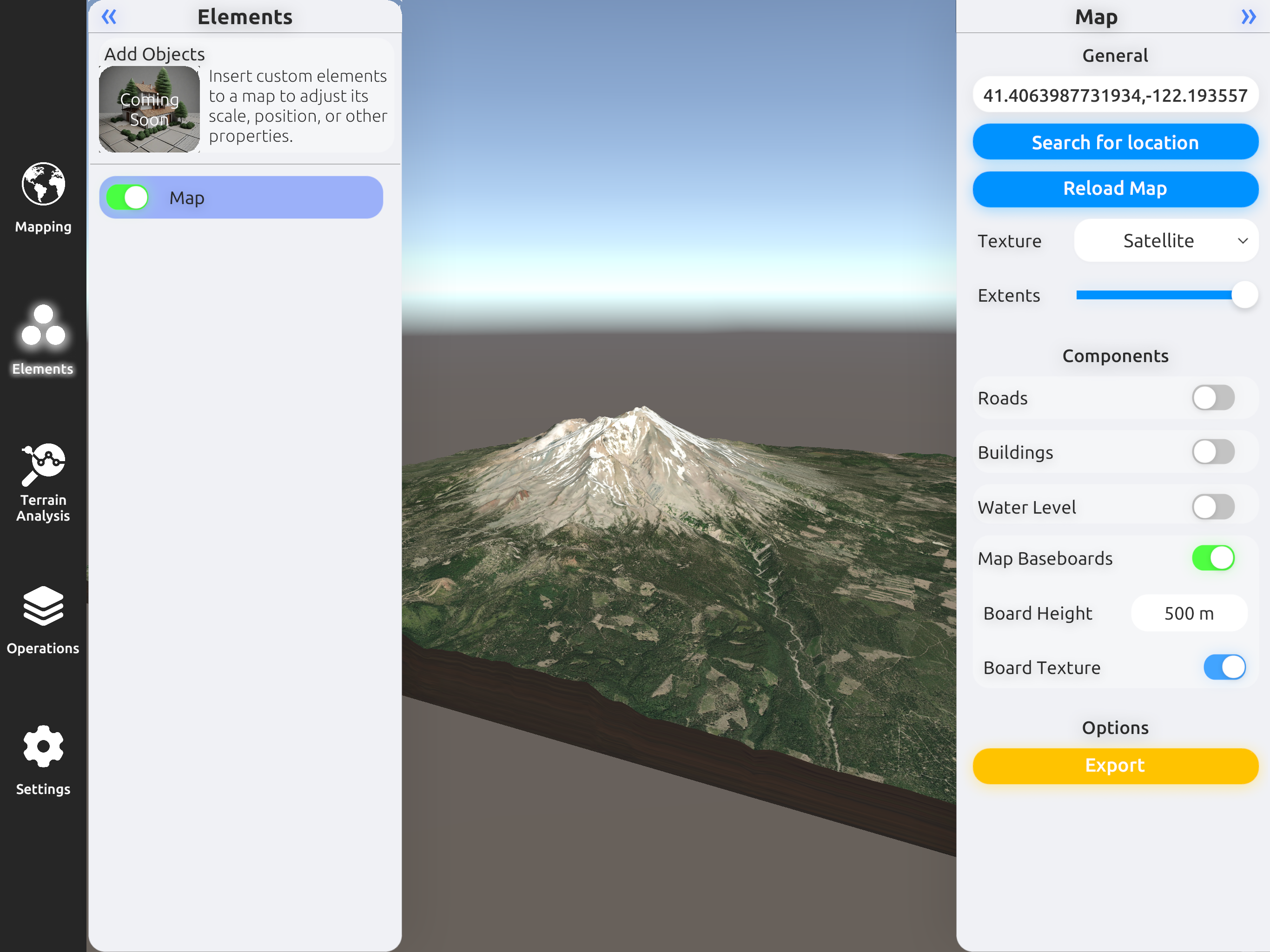
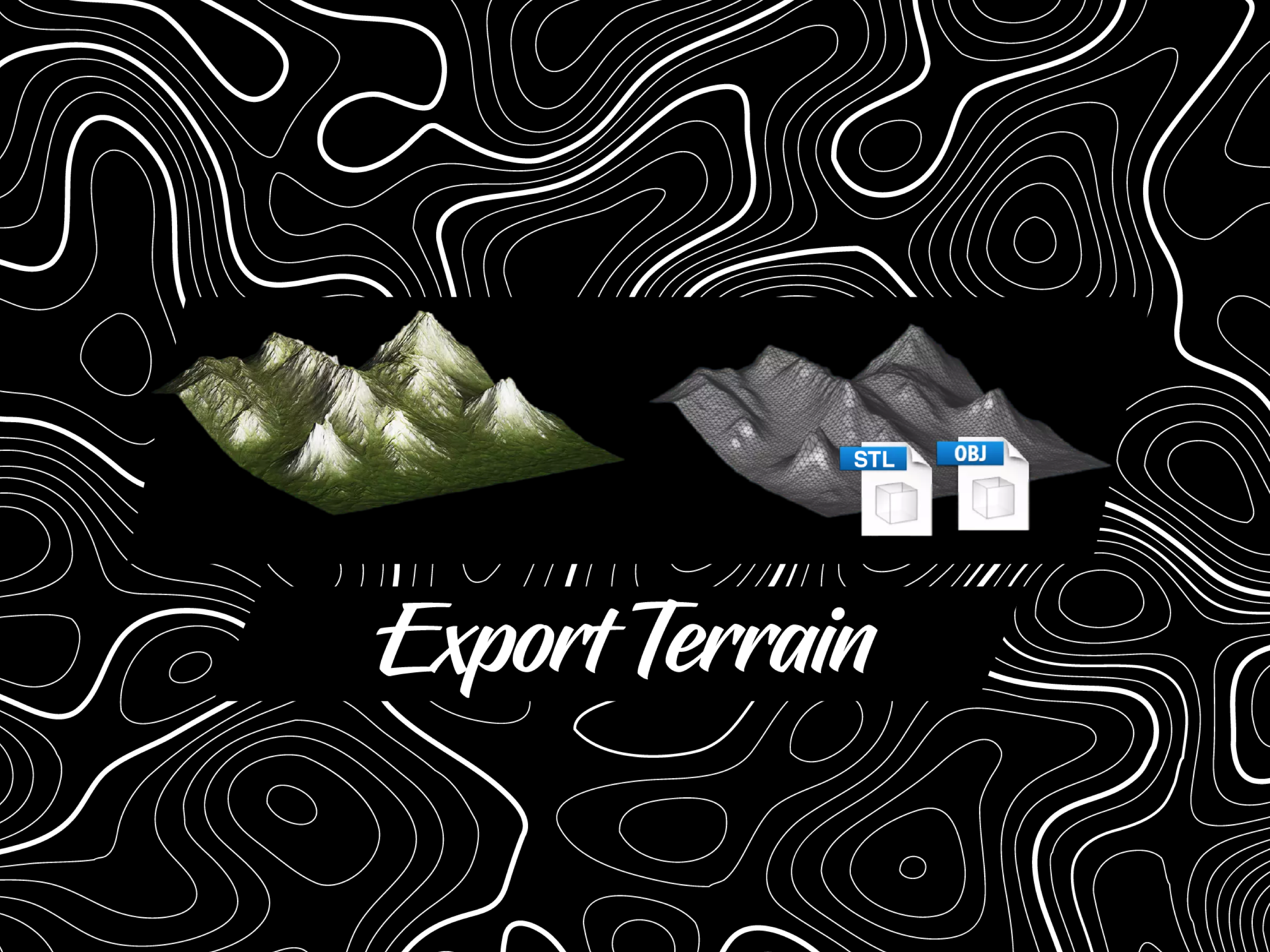
3D Mappa revolutionizes GIS on mobile. Our app puts powerful terrain analysis tools in the palm of your hand, making complex tasks effortless. Instantly visualize elevation, slope, contours, and more. Simplify workflows with intuitive features designed for speed and efficiency. Export data in seconds to industry-standard formats like DXF, SHP, CSV, OBJ, glTIF, and STL, ensuring compatibility with AutoCAD, and GIS software. Say goodbye to cumbersome processes and hello to streamlined GIS on mobile.
Key features:
- Contour Map: Represents lines connecting points of equal elevation on the terrain.
- Elevation Map: Depicts the elevation or height values of the terrain as a grayscale or color image.
- Slope Map: Represents the steepness or incline of the terrain at each location.
- Aspect Map: Shows the compass direction that a slope faces.
- Normal Map: Shows the surface orientation and angle of each point.
- Flow Map: Illustrates the direction of water flow or drainage patterns across the landscape.
- Landform Map: Depicts the different types of landforms or land features present in the area.
- Curvature Map: Indicates the amount and direction of curvature of the terrain.
- Residual Map: Highlights variations or deviations from a baseline, often used in geological analysis.
Terms of Use: https://www.apple.com/legal/internet-services/itunes/dev/stdeula/
Hide..
Show more..
Key features:
- Contour Map: Represents lines connecting points of equal elevation on the terrain.
- Elevation Map: Depicts the elevation or height values of the terrain as a grayscale or color image.
- Slope Map: Represents the steepness or incline of the terrain at each location.
- Aspect Map: Shows the compass direction that a slope faces.
- Normal Map: Shows the surface orientation and angle of each point.
- Flow Map: Illustrates the direction of water flow or drainage patterns across the landscape.
- Landform Map: Depicts the different types of landforms or land features present in the area.
- Curvature Map: Indicates the amount and direction of curvature of the terrain.
- Residual Map: Highlights variations or deviations from a baseline, often used in geological analysis.
Terms of Use: https://www.apple.com/legal/internet-services/itunes/dev/stdeula/
In-Apps
- Pro
- ₪199.90
- Basic
- ₪29.90
- Pack 1
- ₪14.90
- Pack 2
- ₪29.90
- Pack 3
- ₪59.90
- Business
- ₪699.90
Screenshots


 User Rating
0 out of 5
0 ratings in Israel
Ratings History
Reviews
App doesn't have any reviews yet
Store Rankings
Ranking History
App Ranking History not available yet
Category Rankings
|
Chart
|
Category
|
Rank
|
|---|---|---|
|
Top Free
|

|
223
|
|
Top Free
|

|
409
|
Keywords
Users may also like
| Name | Reviews | Recent release | |
|---|---|---|---|

MineAR: Augmented Reality Map
Upload & view your data in 3D
|
0
|
2 years ago | |

Route3D 3.0
Topo map navigation
|
0
|
1 year ago | |

Global Traveler Magazine
|
0
|
1 year ago | |

FunTreks 4x4 Offroad Trails
Maps & GPS Navigation
|
0
|
1 month ago | |

MapTool - GPS, Compass, Altitu
|
0
|
9 years ago | |

World GPS coordinates
|
0
|
2 years ago | |

Agri-Tour 360
Consumers meeting producers
|
0
|
1 year ago | |

Map Data Explorer
|
0
|
1 month ago | |

Wilco Map Weather Navigation
3D Navigation Motion Map
|
0
|
1 year ago | |

Altimeter Just Altitude
Easy use Altimeter for hiking
|
0
|
7 months ago |
Show More
Revenue and Downloads
Gain valuable insights into 3D Mappa - GIS & Contour Maps performance with our analytics. Sign up now
to
access downloads, revenue, and more.
App Info
- Category
- Navigation
- Publisher
- Andres Narvaez
- Languages
- English
- Recent version
- 1.1.0 (1 month ago )
- Released on
- Apr 11, 2024 (2 months ago )
- Also available in
- United Kingdom, Peru, South Korea, Kuwait, Kazakhstan, Lebanon, Mexico, Nigeria, Netherlands, Azerbaijan, Pakistan, Portugal, Romania, Russia, Saudi Arabia, Sweden, Turkey, Taiwan, Japan, Israel, Argentina, Finland, Ecuador, Dominican Republic, Belgium, Denmark, Germany, Czechia, Brazil, Chile, Ukraine, Canada, Colombia, Norway, Greece, India
- Last updated
- 1 month ago