Help!
The app worked great at first until I received an ad that would not go away and was not in English. If it continues I can’t even use it!

Yes, Active Wildfire Tracker Map is completely free and it doesn't have any in-app purchases or subscriptions.
Not enough reviews to make a reliable assessment. The app needs more user feedback.
Active Wildfire Tracker Map is free.
To get estimated revenue of Active Wildfire Tracker Map app and other AppStore insights you can sign up to AppTail Mobile Analytics Platform.
2.75 out of 5
12 ratings in United States
The app worked great at first until I received an ad that would not go away and was not in English. If it continues I can’t even use it!
App hasn’t worked in over a week.
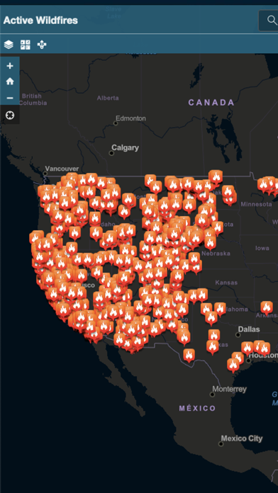
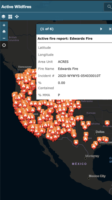
No filter for wildfire info...totally overwhelming amount of active fires listed and many of them show “area burned: 0” makes it too hard to see the important information.
|
Chart
|
Category
|
Rank
|
|---|---|---|
|
Top Free
|

|
330
|
|
Top Free
|

|
423
|
|
Top Free
|

|
488
|
| Name | Downloads (30d) | Monthly Revenue | Reviews | Ratings | Recent release | |
|---|---|---|---|---|---|---|
Lightning Tracker
Real Time Lightning Map
|
Unlock
|
Unlock
|
96
|
5
|
6 months ago | |

Firesource - Live Wildfires
Fires, Air Quality, Detections
|
Unlock
|
Unlock
|
27
|
14
|
1 year ago | |

Wildfire Info
MODIS/VIIRS, Inciweb, CAL FIRE
|
Unlock
|
Unlock
|
33
|
|
4 months ago | |

Firespot: Wildfire app
Wildfire photos, alerts, more
|
Unlock
|
Unlock
|
42
|
33
|
1 year ago | |

Air Quality Index
Smoke Prediction Maps
|
Unlock
|
Unlock
|
6
|
|
3 months ago | |

Fire, Weather & Avalanche Ctr
FWAC
|
Unlock
|
Unlock
|
3
|
|
2 years ago | |

Wildfire - Fire Map Info
NOAA Wildfires & Weather Data
|
Unlock
|
Unlock
|
26
|
1
|
1 year ago | |

Wildfire Map Tracker
Fire Map Tracker
|
Unlock
|
Unlock
|
0
|
|
2 years ago | |

SOPFEU
|
Unlock
|
Unlock
|
0
|
|
5 months ago | |

The Wildfire Tracker
Wildfire Maps, NWS Alerts, AQI
|
Unlock
|
Unlock
|
1
|
3
|
4 months ago |
