App is temporarily unavailable
Description
AirMap is the leading global provider of aeronautical data & services to unmanned aircraft, or drones. Use AirMap to maintain situational awareness, request digital authorization, get traffic alerts, & more.
AirMap offers these features and more:
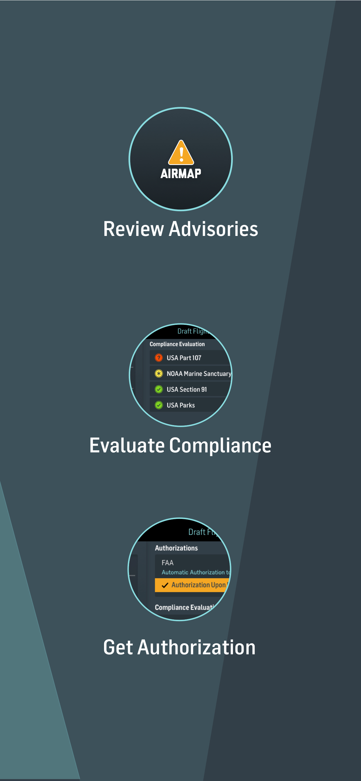
- Can I fly here? Get real-time feedback of airspace rules and conditions pertaining to your flight specifications, with national rulesets for 20 countries, including Canada, Germany, Japan, New Zealand, United Kingdom, and the United States.
- Toggle between multiple map styles
- Discover airspace rules and advisories by searching for a location or panning and zooming AirMap's responsive vector maps
- Create and manage your pilot profile and UAV aircraft
- Plan a flight path to specific duration, altitude, and airspace requirements
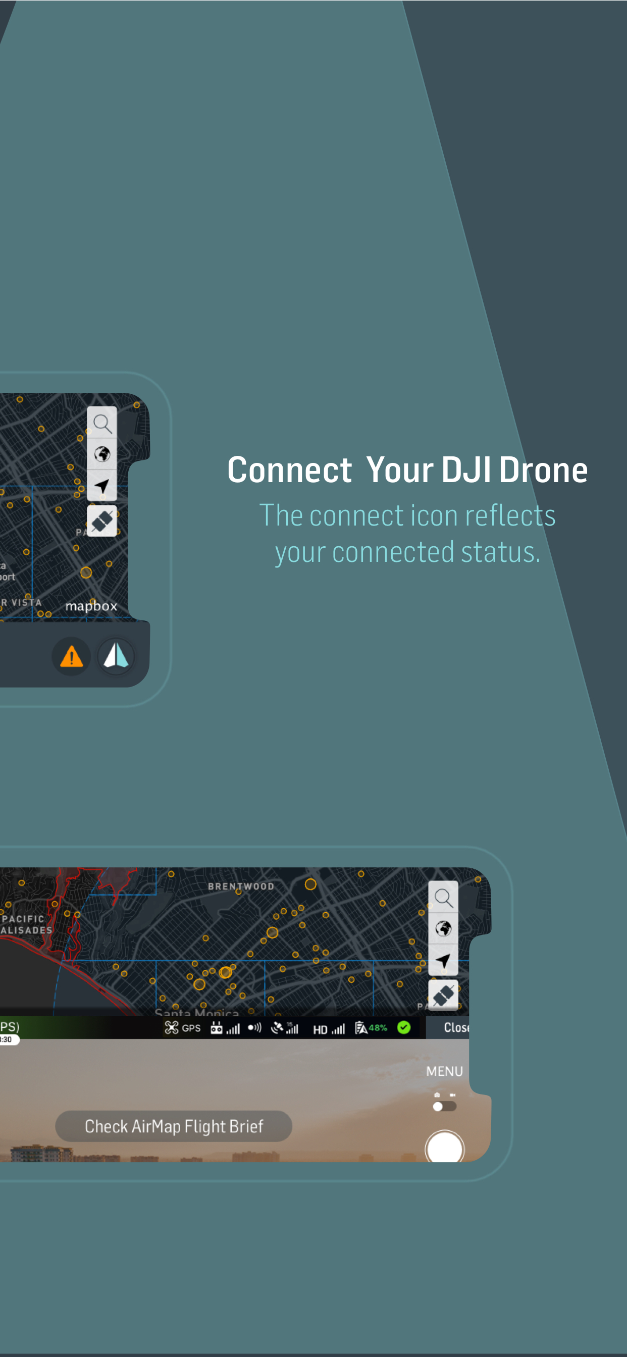
- Connect to any supported DJI drone to fly and toggle camera settings directly from the AirMap app
- Request digital authorization for commercial operations in LAANC-enabled U.S. controlled airspaces
- Send digital flight notice to participating U.S. airports
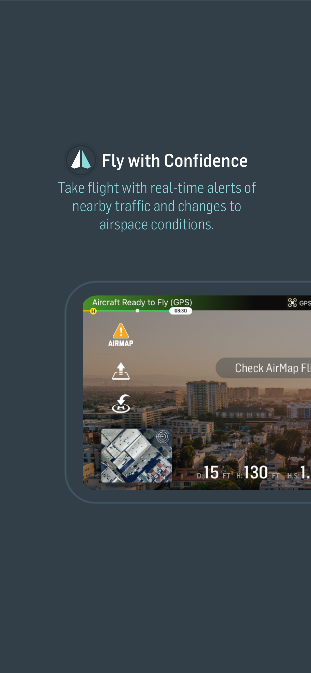
- Get real-time traffic alerts for nearby manned aircraft
- View publicly-shared flights happening around the world
Hide..
Show more..
AirMap offers these features and more:
- Can I fly here? Get real-time feedback of airspace rules and conditions pertaining to your flight specifications, with national rulesets for 20 countries, including Canada, Germany, Japan, New Zealand, United Kingdom, and the United States.
- Toggle between multiple map styles
- Discover airspace rules and advisories by searching for a location or panning and zooming AirMap's responsive vector maps
- Create and manage your pilot profile and UAV aircraft
- Plan a flight path to specific duration, altitude, and airspace requirements
- Connect to any supported DJI drone to fly and toggle camera settings directly from the AirMap app
- Request digital authorization for commercial operations in LAANC-enabled U.S. controlled airspaces
- Send digital flight notice to participating U.S. airports
- Get real-time traffic alerts for nearby manned aircraft
- View publicly-shared flights happening around the world
Screenshots


User Rating
5 out of 5
2 ratings in Belarus
5 star
2
4 star
0
3 star
0
2 star
0
1 star
0
Ratings History
AirMap for Drones Installs
Last 30 days
AirMap for Drones Revenue
Last 30 daysAirMap for Drones Reviews
Keywords
AirMap for Drones Revenue and Downloads
Gain valuable insights into AirMap for Drones performance with our analytics.
Sign up now to access downloads, revenue, and more.
Sign up now to access downloads, revenue, and more.
App Info
- Category
- Utilities
- Publisher
- Unknown
- Languages
- Arabic, Czech, Dutch, English, French, German, Hindi, Italian, Japanese, Norwegian Bokmål, Polish, Chinese, Spanish, Swedish, Thai
- Recent version
- 2.18.0 (1 year ago )
- Released on
- May 2, 2016 (8 years ago )
- Also available in
- United States, Germany, Australia, United Kingdom, Italy, Canada, Spain, Switzerland, Netherlands, France, Mexico, Czechia, Thailand, Colombia, Poland, Sweden, New Zealand, South Korea, Austria, Japan, Belgium, China, Indonesia, Russia, Chile, Brazil, Ireland, Singapore, Denmark, Portugal, Argentina, Taiwan, India, Peru, Turkey, Norway, South Africa, Malaysia, Philippines, Dominican Republic, Romania, Hong Kong, Ecuador, Vietnam, Finland, Ukraine, Greece, Pakistan, Belarus, Nigeria, Egypt, Lebanon, Israel, United Arab Emirates
- Last updated
- 2 months ago