認識山
讓我知道山名

Yes, AR AlpineGuide is free to download, however it contains in-app purchases or subscription offerings.
‼️️ The AR AlpineGuide app seems suspicious. Many reviews appear fake or manipulated. Exercise caution.
AR AlpineGuide has several in-app purchases/subscriptions, the average in-app price is 23.99 د.إ..
To get estimated revenue of AR AlpineGuide app and other AppStore insights you can sign up to AppTail Mobile Analytics Platform.

5 out of 5
11 ratings in United Arab Emirates
讓我知道山名
讚👍
請問要怎麼打開鏡頭
點選拍照後就當機!
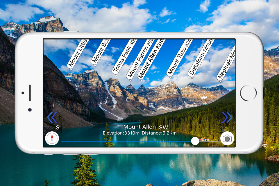
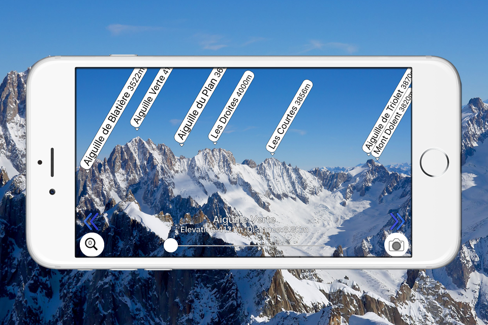
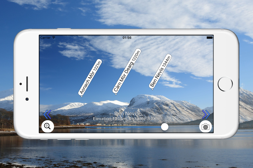
I downloaded this app for free. However, there’s Chinese mountain names (And I haven’t found the names incorrect) and friendly interface. The AR is working but not very accurate and hasn’t succeed to show correct figures if I opened this app within mountains. This app worked perfectly when I am at around sea attitude with some manual adjustment (the direction wasn’t right so moved by hand. I think it’s due to the accuracy of my iPhone built-in compass). Any way it is a recommended app for those who loves mountains.
如標題
更新後影像變綠頻
點選拍照後要按儲存就閃退
如標題
如標題,一直閃退
|
Chart
|
Category
|
Rank
|
|---|---|---|
|
Top Free
|

|
62
|
|
Top Free
|

|
88
|
|
Top Free
|

|
100
|
|
Top Free
|

|
101
|
|
Top Free
|

|
108
|
