Description
ArcGIS Flight makes it easy to collect images to create accurate, high-resolution maps and 3D models using drones.
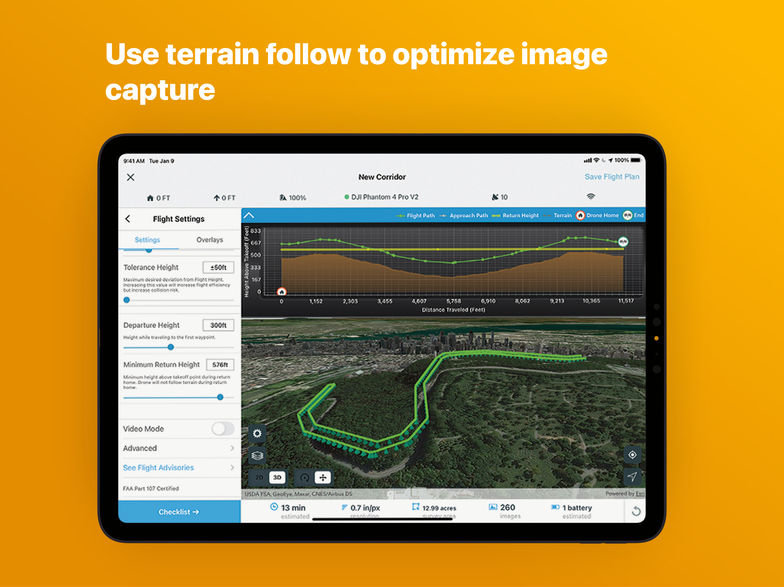
Choose from a variety of flight modes tailored to the type of site being scanned, and the app will automatically define the optimal flight path and allow you to preview it in 2D or 3D. Experienced pilots can use Terrain Follow, which enhances imagery quality by adjusting the drone's height to follow the terrain.
After completing your organizations custom preflight checklist, the app automatically conducts aircraft checks and executes the flight. Long flights are automatically split, allowing you to change your drone’s battery and resume where you left off. After completing the flight, wirelessly transfer the images to your iPad and upload them along with your Fleet Management information to Site Scan Manager for processing on the cloud. It is also possible to transfer the images captured during a flight for processing using ArcGIS Drone2Map or ArcGIS Pro using the ArcGIS Reality for ArcGIS Pro extension.
Compatibility:
Requires compatible drone: Freefly Astro, DJI Phantom 4 Advanced, DJI Phantom 4 Pro (v1 & v2), DJI P4 RTK, Mavic Pro, Mavic 2 Pro, M200 series, M200 series V2, Inspire 2, M300.
Check the latest documented drone matrix for supported firmware versions.
Requires an ArcGIS account with mobile worker or higher license or a Site Scan operator license.
Hide
Show More...
Choose from a variety of flight modes tailored to the type of site being scanned, and the app will automatically define the optimal flight path and allow you to preview it in 2D or 3D. Experienced pilots can use Terrain Follow, which enhances imagery quality by adjusting the drone's height to follow the terrain.
After completing your organizations custom preflight checklist, the app automatically conducts aircraft checks and executes the flight. Long flights are automatically split, allowing you to change your drone’s battery and resume where you left off. After completing the flight, wirelessly transfer the images to your iPad and upload them along with your Fleet Management information to Site Scan Manager for processing on the cloud. It is also possible to transfer the images captured during a flight for processing using ArcGIS Drone2Map or ArcGIS Pro using the ArcGIS Reality for ArcGIS Pro extension.
Compatibility:
Requires compatible drone: Freefly Astro, DJI Phantom 4 Advanced, DJI Phantom 4 Pro (v1 & v2), DJI P4 RTK, Mavic Pro, Mavic 2 Pro, M200 series, M200 series V2, Inspire 2, M300.
Check the latest documented drone matrix for supported firmware versions.
Requires an ArcGIS account with mobile worker or higher license or a Site Scan operator license.
Screenshots
ArcGIS Flight FAQ
-
Is ArcGIS Flight free?
Yes, ArcGIS Flight is completely free and it doesn't have any in-app purchases or subscriptions.
-
Is ArcGIS Flight legit?
Not enough reviews to make a reliable assessment. The app needs more user feedback.
Thanks for the vote -
How much does ArcGIS Flight cost?
ArcGIS Flight is free.
-
What is ArcGIS Flight revenue?
To get estimated revenue of ArcGIS Flight app and other AppStore insights you can sign up to AppTail Mobile Analytics Platform.

User Rating
4.68 out of 5
19 ratings in United States
5 star
16
4 star
1
3 star
1
2 star
1
1 star
0

Ratings History
ArcGIS Flight Reviews
App doesn't have any reviews yet
Store Rankings

Ranking History
App Ranking History not available yet

Category Rankings
App is not ranked yet
ArcGIS Flight Competitors
| Name | Downloads (30d) | Monthly Revenue | Reviews | Ratings | Recent release | |
|---|---|---|---|---|---|---|
|
Flight1
Skycatch Drone Mission Planner
|
View
|
View
|
11
|
|
10 months ago | |
|
DroneDeploy Ground App
360 Walkthrough Capture
|
View
|
View
|
14
|
|
3 weeks ago | |
|
Measure Ground Control
Drone Flight & Data Management
|
View
|
View
|
6
|
|
1 year ago | |
|
DroneLogbook Companion
|
View
|
View
|
7
|
|
3 months ago | |
|
Hammer Missions
Quality Drone Data, A to Z.
|
View
|
View
|
7
|
|
2 years ago | |
|
FieldAgent •
In-Field Agriculture Analytics
|
View
|
View
|
12
|
|
7 months ago | |
|
vSite AR
Augmented reality for GIS
|
View
|
View
|
0
|
|
3 weeks ago | |
|
AuGeo
|
View
|
View
|
0
|
|
3 years ago | |
|
Assemble Mobile
BIM at your fingertips
|
View
|
View
|
0
|
|
1 year ago | |
|
DJI GS Pro
|
View
|
View
|
25
|
|
1 year ago |
ArcGIS Flight Installs
Last 30 daysArcGIS Flight Revenue
Last 30 daysArcGIS Flight Revenue and Downloads
Gain valuable insights into ArcGIS Flight performance with our analytics.
Sign up now to access downloads, revenue, and more.
Sign up now to access downloads, revenue, and more.
This page includes copyrighted content from third parties, shared solely for commentary and research in accordance with fair use under applicable copyright laws. All trademarks, including product, service, and company names or logos, remain the property of their respective owners. Their use here falls under nominative fair use as outlined by trademark laws and does not suggest any affiliation with or endorsement by the trademark holders.


