
Description
Mapitech launches Atlas, a worldwide digital cartography that combines vector data with the best official up-to-date paper charts ie marinas, depth contours, wrecks, fishing spots, boat ramps, POI and many other features.
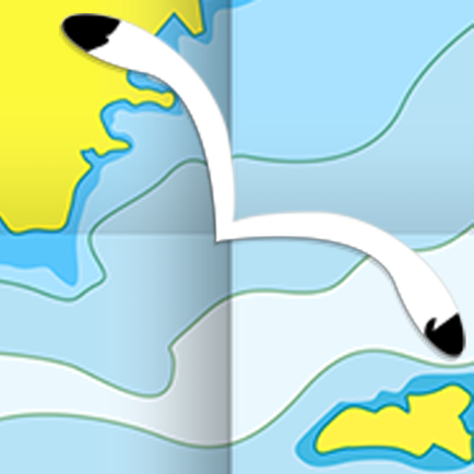
The beauty of paper charts enriched with digital cartography.
Chart details and performance of a professional GPS chart plotter in the palm of your hand.
Appealing appearance, easy to use, useful to have on board with you.
The app works without mobile coverage (offline).
The interactive menu is intuitive and allows you to purchase maps for offline use at an amazing price.
Free Features and Functions:
•Powerful search
•Multiple overlays for different use (fishing, sailing or cruising)
•KML data shareable
•Very detailed and updated charts
•Unlimited Waypoints
•Markers & Favorites
•Magnifying Lens for all info
•Multiple tracks: Record your track, instant speed time, COG - course over ground
•Route planning, Waypoints - Insert the destination and see in real time your speed, distance and bearing
•Geo-tagged photo management, Share via email, visible on Google
•Distance Measurement Tool to easily calculate the distance
•Compass
•GPS window with very detailed info
•User friendly on latest IOS
- MARINE MAPS
Detailed Electronic Nautical Charts (ENC) which include Coastline, Anchoring areas, Fishing areas, Restricted areas, Obstructions, Rocks, Buoys, Beacons, Lights, Depth contours, Spot Soundings and more.
- LAKE MAPS
High quality lake maps with detailed information and important features: Depth Contours, Boat Ramps, Fishing spots etc. Maps also include Trails, Roads and Railways information.
PURCHASING INCLUDES:
•Offline Chart: Choose your favorite area from our catalogue and get a detailed chart of your area
•Subscription for 1 year: Get a trial of all our charts and features and subscribe for one year
•Lifetime Purchase: Get all our charts and features for Lifetime
MORE INFO:
Terms of Use: https://mapitech.com/disclaimer/
Privacy Policy: https://mapitech.com/privacy-policy/
Hide
Show More...
The beauty of paper charts enriched with digital cartography.
Chart details and performance of a professional GPS chart plotter in the palm of your hand.
Appealing appearance, easy to use, useful to have on board with you.
The app works without mobile coverage (offline).
The interactive menu is intuitive and allows you to purchase maps for offline use at an amazing price.
Free Features and Functions:
•Powerful search
•Multiple overlays for different use (fishing, sailing or cruising)
•KML data shareable
•Very detailed and updated charts
•Unlimited Waypoints
•Markers & Favorites
•Magnifying Lens for all info
•Multiple tracks: Record your track, instant speed time, COG - course over ground
•Route planning, Waypoints - Insert the destination and see in real time your speed, distance and bearing
•Geo-tagged photo management, Share via email, visible on Google
•Distance Measurement Tool to easily calculate the distance
•Compass
•GPS window with very detailed info
•User friendly on latest IOS
- MARINE MAPS
Detailed Electronic Nautical Charts (ENC) which include Coastline, Anchoring areas, Fishing areas, Restricted areas, Obstructions, Rocks, Buoys, Beacons, Lights, Depth contours, Spot Soundings and more.
- LAKE MAPS
High quality lake maps with detailed information and important features: Depth Contours, Boat Ramps, Fishing spots etc. Maps also include Trails, Roads and Railways information.
PURCHASING INCLUDES:
•Offline Chart: Choose your favorite area from our catalogue and get a detailed chart of your area
•Subscription for 1 year: Get a trial of all our charts and features and subscribe for one year
•Lifetime Purchase: Get all our charts and features for Lifetime
MORE INFO:
Terms of Use: https://mapitech.com/disclaimer/
Privacy Policy: https://mapitech.com/privacy-policy/
In-Apps
- George's Bank
- 1,790.00 Ft
- Albemarle Sound
- 1,790.00 Ft
- Florida South West
- 1,790.00 Ft
- Cape Elizabeth to Cape Ann
- 1,790.00 Ft
- All charts lifetime download
- 8,990.00 Ft
- Bahamas Caribbean GPS Charts
- 2,490.00 Ft
- Lake Balaton Nautical Charts
- 1,990.00 Ft
- All charts 1 year subscription
- 3,590.00 Ft
Screenshots


Atlas Nautical Charts FAQ
-
Is Atlas Nautical Charts free?
Yes, Atlas Nautical Charts is free to download, however it contains in-app purchases or subscription offerings.
-
Is Atlas Nautical Charts legit?
Not enough reviews to make a reliable assessment. The app needs more user feedback.
Thanks for the vote -
How much does Atlas Nautical Charts cost?
Atlas Nautical Charts has several in-app purchases/subscriptions, the average in-app price is 3,027.50 Ft.
-
What is Atlas Nautical Charts revenue?
To get estimated revenue of Atlas Nautical Charts app and other AppStore insights you can sign up to AppTail Mobile Analytics Platform.

User Rating
App is not rated in Hungary yet.
Ratings History
Atlas Nautical Charts Reviews
Store Rankings
Ranking History
App Ranking History not available yet
Category Rankings
|
Chart
|
Category
|
Rank
|
|---|---|---|
|
Top Grossing
|

|
55
|
|
Top Free
|

|
170
|
|
Top Free
|

|
342
|
|
Top Free
|

|
350
|
|
Top Free
|

|
444
|
Atlas Nautical Charts Competitors
| Name | Downloads (30d) | Monthly Revenue | Reviews | Ratings | Recent release | |
|---|---|---|---|---|---|---|
AIS Maps: Marine & Lake charts
Detailed nautical & topo maps
|
View
|
View
|
0
|
|
2 months ago | |

i-Boating: Marine Charts & Gps
Lake Maps & Fishing Spots
|
View
|
View
|
2
|
|
2 weeks ago | |

PRO CHARTS - Marine Navigation
|
View
|
View
|
0
|
|
1 year ago | |

Aqua Map Boating
Marine navigation and fishing
|
View
|
View
|
0
|
|
2 weeks ago | |

NV Charts GPS Navigation AIS
Marine Navigation and Boating
|
View
|
View
|
0
|
|
6 months ago | |

WinGPS Marine
|
View
|
View
|
0
|
|
3 months ago | |

SeaNav
Marine Charts and Navigation
|
View
|
View
|
0
|
|
2 weeks ago | |

Seawell Navigation Charts
Sea Navigation Marine Offline
|
View
|
View
|
0
|
|
2 years ago | |

N/A
Offline GPS tracker for boat
|
View
|
View
|
0
|
|
9 months ago | |

iAIS
|
View
|
View
|
0
|
|
3 years ago |
Atlas Nautical Charts Installs
Last 30 days
Atlas Nautical Charts Revenue
Last 30 daysAtlas Nautical Charts Revenue and Downloads
Gain valuable insights into Atlas Nautical Charts performance with our analytics.
Sign up now to access downloads, revenue, and more.
Sign up now to access downloads, revenue, and more.
App Info
- Category
- Navigation
- Publisher
-
MAPITECH

- Languages
- German, English, French, Italian, Spanish
- Recent release
- 1.5.23 (1 year ago )
- Released on
- Jul 3, 2019 (5 years ago )
- Also available in
- United States, Germany, Austria, Spain, Italy, Switzerland, United Kingdom, Netherlands, Singapore, Greece, France, Poland, Russia, Ireland, Czechia, Colombia, Canada, Türkiye, New Zealand, Lebanon, Norway, Peru, Philippines, Nigeria, Malaysia, Mexico, India, Pakistan, Portugal, Romania, Saudi Arabia, Sweden, Slovenia, Thailand, Tunisia, Taiwan, Ukraine, Vietnam, South Africa, Algeria, Argentina, Australia, Azerbaijan, Belgium, Bulgaria, Brunei, Brazil, Belarus, Chile, China, Cyprus, Dominican Republic, Kazakhstan, Ecuador, Egypt, Finland, Hong Kong SAR China, Hungary, Indonesia, Israel, United Arab Emirates, Iceland, Japan, South Korea, Kuwait
- Last Updated
- 1 week ago
This page includes copyrighted content from third parties, shared solely for commentary and research in accordance with fair use under applicable copyright laws. All trademarks, including product, service, and company names or logos, remain the property of their respective owners. Their use here falls under nominative fair use as outlined by trademark laws and does not suggest any affiliation with or endorsement by the trademark holders.