Hunting
I love everything about the field maps. Thanks.


Yes, BaseMap is free to download, however it contains in-app purchases or subscription offerings.
🤔 The BaseMap app's quality is mixed. Some users are satisfied, while others report issues. Consider reading individual reviews for more context.
BaseMap has several in-app purchases/subscriptions, the average in-app price is $63.99.
To get estimated revenue of BaseMap app and other AppStore insights you can sign up to AppTail Mobile Analytics Platform.

4.61 out of 5
9,034 ratings in United States
I love everything about the field maps. Thanks.
No instructions. Seems that if you dont pay you get nothing to show land boundaries. I needed to find BLM etc. Nope.
Cannot add offline maps, blank screen. Will not connect to sig 3k range finder . The is no button to cancel $99 dollars a year for #%<€p software.
No notification of renewal. I want to delete my subscription
App would get more stars from me but it is very annoying having to delete the app and reinstall it every time they do a major update. I’ve been using the app for several years and I have complained many times about this issue. It’s the only app I use that requires deleting from my phone and reinstalling. And that is what basemap tells me to do every time it starts having an issue with any functions. Most of the time the issue is layers stop showing even when active. Not sure why their app can’t update without deleting like the hundreds of thousands other apps people use daily. If they could finally fix this issue it would be a 5 star app.
Map works great for tracking yourself I like the satellite map and the landowner’s features. However, I find I have to constantly delete the app and reinstall it because it freezes when I try and stop tracking. So then I just tracks me every single place I go whether I’m driving or walking because it won’t let me stop the track.
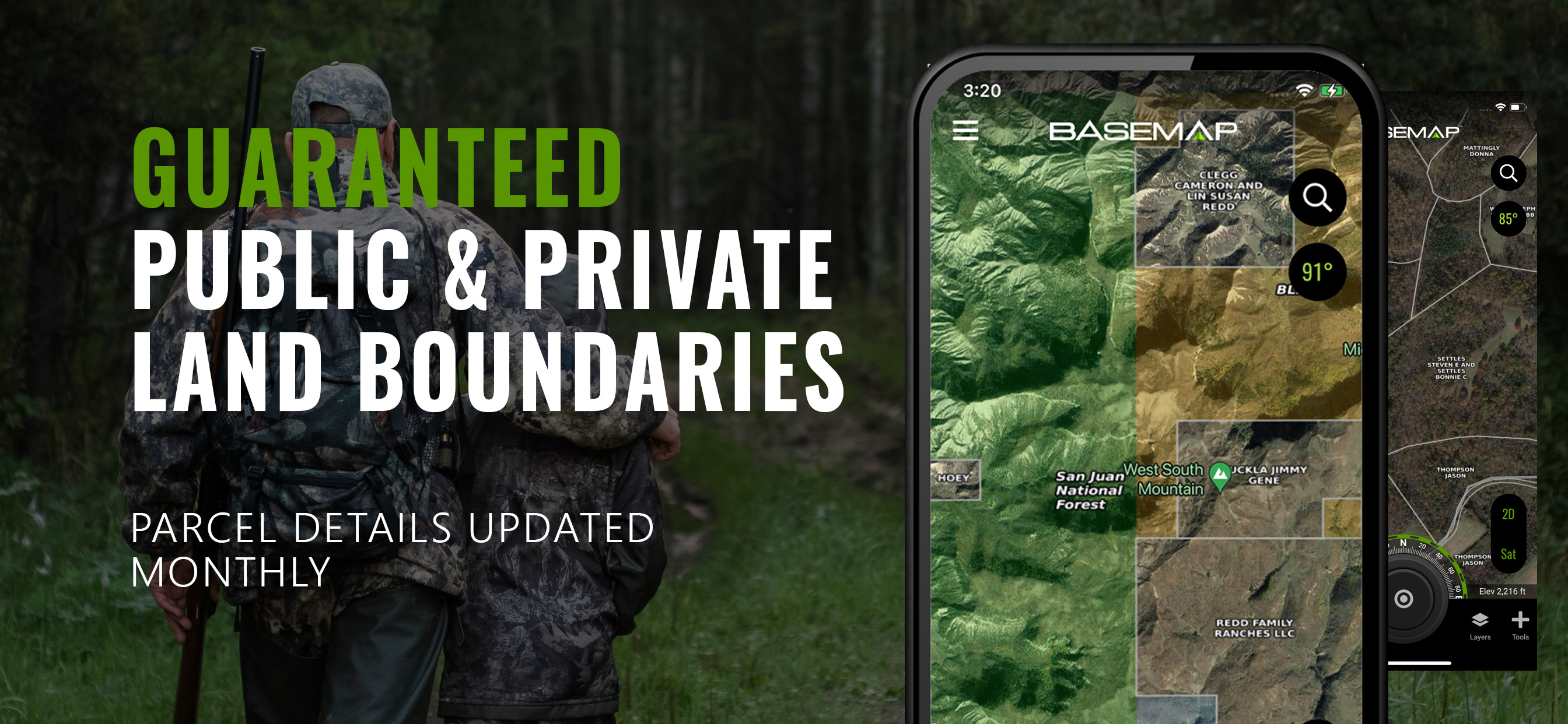
I’ve been using Base Map for almost a year now and am very impressed with all their features. What is even more impressive is their support team. I was having troubles with my app on two deferent occasions and they fix and help me in record time. I have switch two of my friends from OnX to BaseMap and they love it more. I use BaseMap for finding out what land I can and cannot hunt on and land that is Blm or state land. Saves a lot of guessing. I use it to find ways to rivers and steams to fish. But most of all it has supplied me with a lot of horns I couldn’t find without the app. It allowed me to locate places that I thought were private but wasn’t!!! Their satellite imagery is the best and really detailed. I’ll be using BaseMap for life!!
Location is pretty good, the ability to draw out hunting boundaries is helpful as well as designate different stands on the icon, and the wind direction feature is really nice, I'd give it five stars if you got ads instead of needing to pay a subscription.
This app never seems to work properly. Try to set a point , NOPE. Try and download a new map (for 3 days I tried before my hunt) NOPE. Try and use downloaded maps, NOPE; the app is constantly closing out and has to zoom way back in then reload, not handy at all. Even in “high res” downloads, try and zoom in closer and it will immediately not show you the actual property lines. Save your money with this app and just use ON-X. I’ve been a subscriber for about 5+ years and I have finally had enough
Been an avid BaseMap customer for a number of years! Love the app and maps and FINALLY after asking for this several times you can do custom colors on the pins! Thank you BaseMap!
|
Chart
|
Category
|
Rank
|
|---|---|---|
|
Top Grossing
|
|
22
|
|
Top Free
|
|
216
|
