
Published by:
NIXANZ
Description
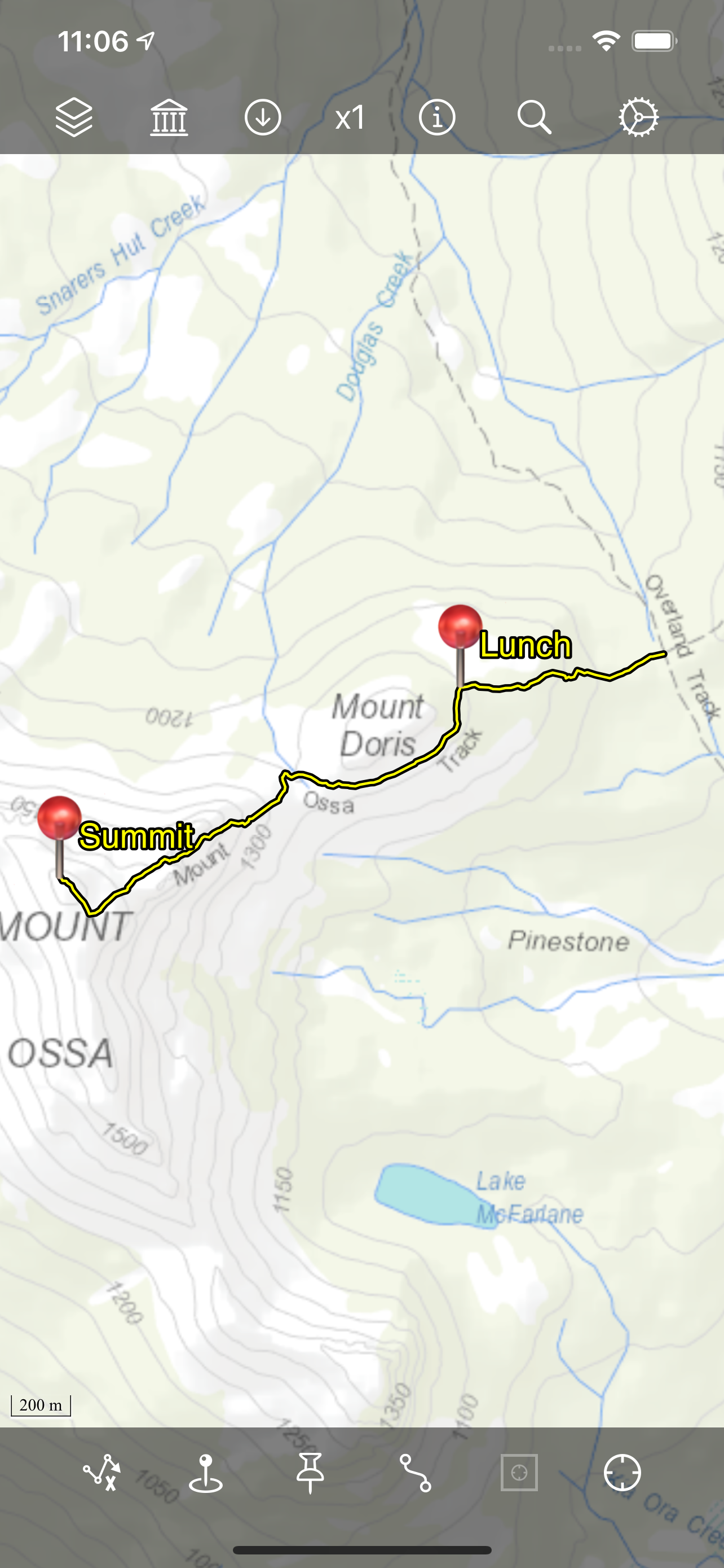
Bit Map provides mapping and navigation with offline maps (inc. JPEG, TIFF, PNG), online vector or raster map services (inc. WFS, WMTS, TMS, XYZ, OSM-compatible services), and offline vector layers (inc. GeoPackage, Shapefile, File Geodatabase, GPX, KML).
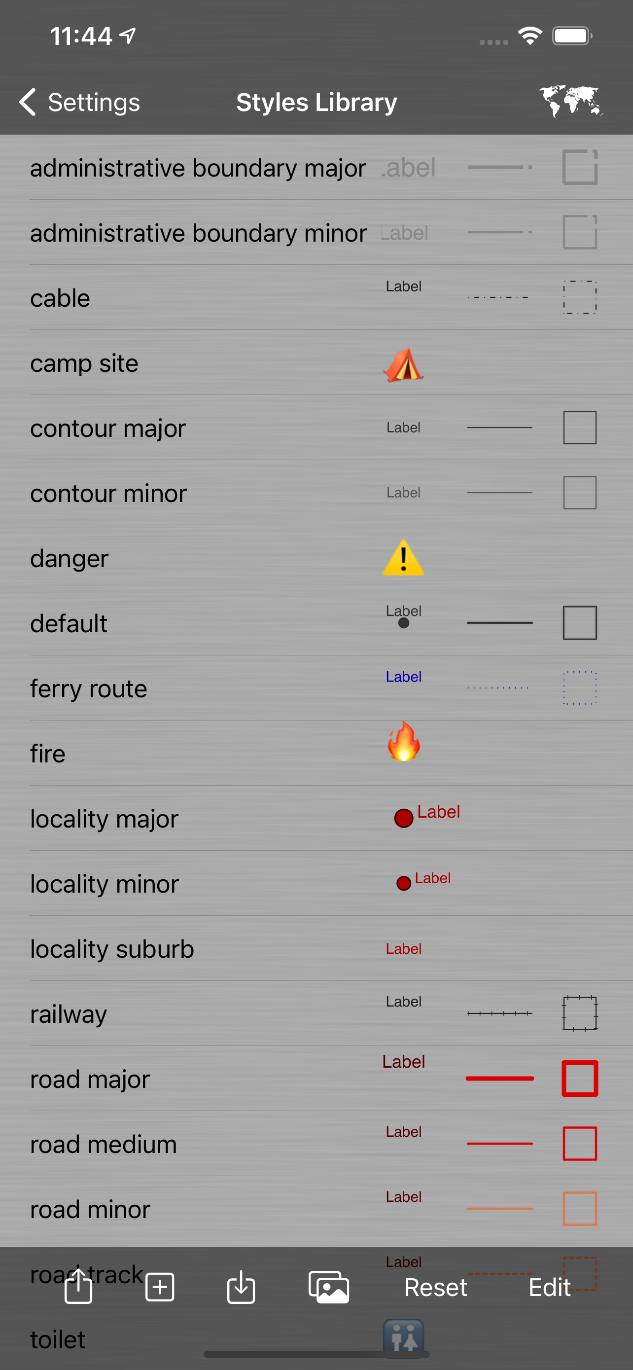
Record locations as tracks and waypoints. Create and update custom layers and attributes. Style (symbology) of vector layers is highly customisable.
Bit Map was the first iOS app to provide navigation with arbitrary user-supplied maps in 2009.
Map image files need not be georeferenced before importing, as Bit Map includes 4 methods to georeference map images within the app.
Bit Map can even publish your map layers to a Web Map and automatically keep them in sync with the web map!
Bit Map is built on a true GIS foundation and can manage data in hundreds of different coordinate systems, projections and geographic datums. Layers with different projections can be displayed simultaneously in the same map.
Disclaimer:
Do not use Bit Map while operating a motor vehicle, other vehicle, machinery or in any potentially dangerous situation. Do not rely on Bit Map, or on the accuracy of data presented by Bit Map, for any purpose in which inaccuracies or any app behaviour could cause danger, loss, damage or problems of any kind to the user or to any third party.
Users are responsible for abiding by the copyright and license terms of any data, maps and services that they import, configure or use in Bit Map.
Some features are not available in the 'Lite' version (see web site for details).
Hide
Show More...
Record locations as tracks and waypoints. Create and update custom layers and attributes. Style (symbology) of vector layers is highly customisable.
Bit Map was the first iOS app to provide navigation with arbitrary user-supplied maps in 2009.
Map image files need not be georeferenced before importing, as Bit Map includes 4 methods to georeference map images within the app.
Bit Map can even publish your map layers to a Web Map and automatically keep them in sync with the web map!
Bit Map is built on a true GIS foundation and can manage data in hundreds of different coordinate systems, projections and geographic datums. Layers with different projections can be displayed simultaneously in the same map.
Disclaimer:
Do not use Bit Map while operating a motor vehicle, other vehicle, machinery or in any potentially dangerous situation. Do not rely on Bit Map, or on the accuracy of data presented by Bit Map, for any purpose in which inaccuracies or any app behaviour could cause danger, loss, damage or problems of any kind to the user or to any third party.
Users are responsible for abiding by the copyright and license terms of any data, maps and services that they import, configure or use in Bit Map.
Some features are not available in the 'Lite' version (see web site for details).
Screenshots

FAQ
-
Is Bit Map free?
Bit Map is not free (it costs 3.99), however it doesn't contain in-app purchases or subscriptions.
-
Is Bit Map legit?
Not enough reviews to make a reliable assessment. The app needs more user feedback.
Thanks for the vote -
How much does Bit Map cost?
The price of Bit Map is 3.99.
-
What is Bit Map revenue?
To get estimated revenue of Bit Map app and other AppStore insights you can sign up to AppTail Mobile Analytics Platform.

User Rating
App is not rated in Slovenia yet.
Ratings History
Reviews
Store Rankings
Ranking History
App Ranking History not available yet
Category Rankings
|
Chart
|
Category
|
Rank
|
|---|---|---|
|
Top Paid
|

|
55
|
|
Top Paid
|

|
89
|
|
Top Paid
|

|
170
|
|
Top Paid
|

|
204
|
|
Top Paid
|

|
244
|
Bit Map Installs
Last 30 days
Bit Map Revenue
Last 30 daysRevenue and Downloads
Gain valuable insights into Bit Map performance with our analytics.
Sign up now to access downloads, revenue, and more.
Sign up now to access downloads, revenue, and more.
App Info
- Category
- Navigation
- Publisher
- NIXANZ
- Languages
- English
- Recent release
- 10.1 (4 months ago )
- Released on
- Sep 1, 2021 (4 years ago )
- Also available in
- Australia, United States, United Kingdom, Ireland, Sweden, Ghana, Brazil, Bulgaria, United Arab Emirates, Tunisia, Armenia, Netherlands, Slovakia, Lithuania, Bahrain, Slovenia, Luxembourg, Estonia, Brunei, Latvia, Qatar, North Macedonia, Ukraine, China, India, Belarus, Russia, Argentina, Azerbaijan, Canada, Chile, Czechia, Denmark, Dominican Republic, Algeria, Egypt, Greece, Hungary, Israel, Japan, Kuwait, Mexico, Indonesia, New Zealand, Peru, Pakistan, Romania, Saudi Arabia, Singapore, Türkiye, Taiwan, Vietnam, Thailand, France, Poland, Iceland, South Korea, Malta, Ecuador, Colombia, Portugal, Switzerland, Lebanon, Finland, Kazakhstan, Germany, Hong Kong SAR China, Spain, Philippines, Sri Lanka, Malaysia, Uzbekistan, Cyprus, Norway, South Africa, Belgium, Madagascar, Austria, Nigeria, Italy, Namibia, Croatia
- Last Updated
- 8 months ago
This page includes copyrighted content from third parties, shared solely for commentary and research in accordance with fair use under applicable copyright laws. All trademarks, including product, service, and company names or logos, remain the property of their respective owners. Their use here falls under nominative fair use as outlined by trademark laws and does not suggest any affiliation with or endorsement by the trademark holders.