Double the cost
Trying to figure out who to contact. Yearly fee advertised in multiple places $7.49/yr I was charged $14.98.


Yes, Colorado Pocket Maps is free to download, however it contains in-app purchases or subscription offerings.
Not enough reviews to make a reliable assessment. The app needs more user feedback.
Colorado Pocket Maps has several in-app purchases/subscriptions, the average in-app price is USD 6.99.
To get estimated revenue of Colorado Pocket Maps app and other AppStore insights you can sign up to AppTail Mobile Analytics Platform.

Trying to figure out who to contact. Yearly fee advertised in multiple places $7.49/yr I was charged $14.98.
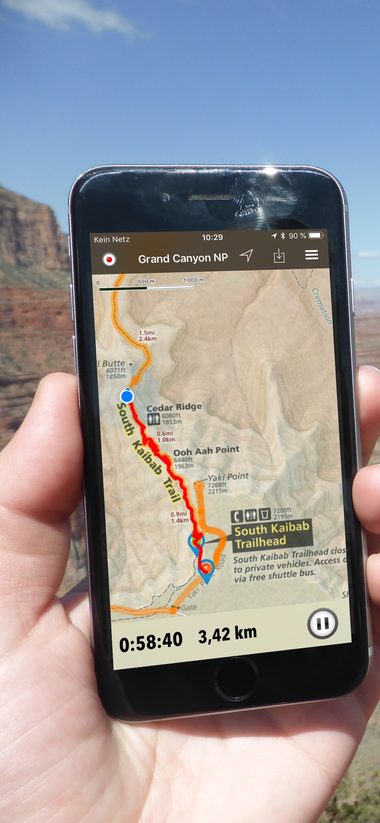
Nice app, helps with not only the hike but also finding the trailhead.
| Name | Downloads (30d) | Monthly Revenue | Reviews | Ratings | Recent release | |
|---|---|---|---|---|---|---|

Colorado Trail Explorer
Colorado's Official Trail Map
|
Unlock
|
Unlock
|
0
|
|
1 month ago | |

14ers.com
|
Unlock
|
Unlock
|
0
|
|
3 weeks ago | |

NP Maps
National Park & Topos maps USA
|
Unlock
|
Unlock
|
0
|
|
1 year ago | |

Colorado Traveler
|
Unlock
|
Unlock
|
0
|
|
1 year ago | |

Colorado 14ers
Save & Share Summits
|
Unlock
|
Unlock
|
0
|
|
8 months ago | |

Rocky Mountain: National Park
Self-Guided GPS Colorado Tours
|
Unlock
|
Unlock
|
0
|
|
1 month ago | |

Day Hikes Near Denver
Discover Denver Hiking Trails
|
Unlock
|
Unlock
|
0
|
|
1 year ago | |

Colorado Guide
|
Unlock
|
Unlock
|
0
|
|
9 months ago | |

Rocky Mountain Channel
Nature and Wildlife
|
Unlock
|
Unlock
|
0
|
|
1 month ago | |

Rocky-Mountain-National-Park
|
Unlock
|
Unlock
|
0
|
|
3 years ago |

