
Description
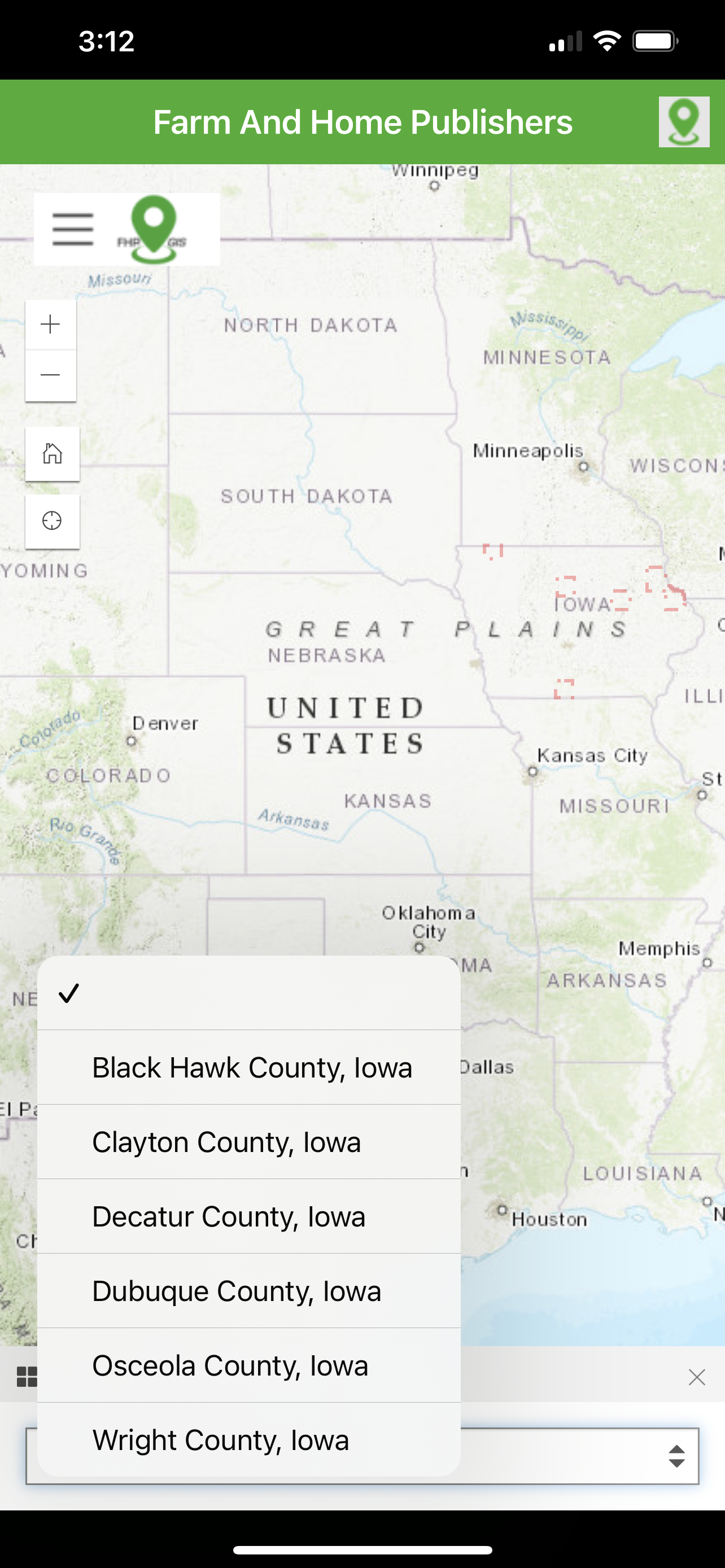
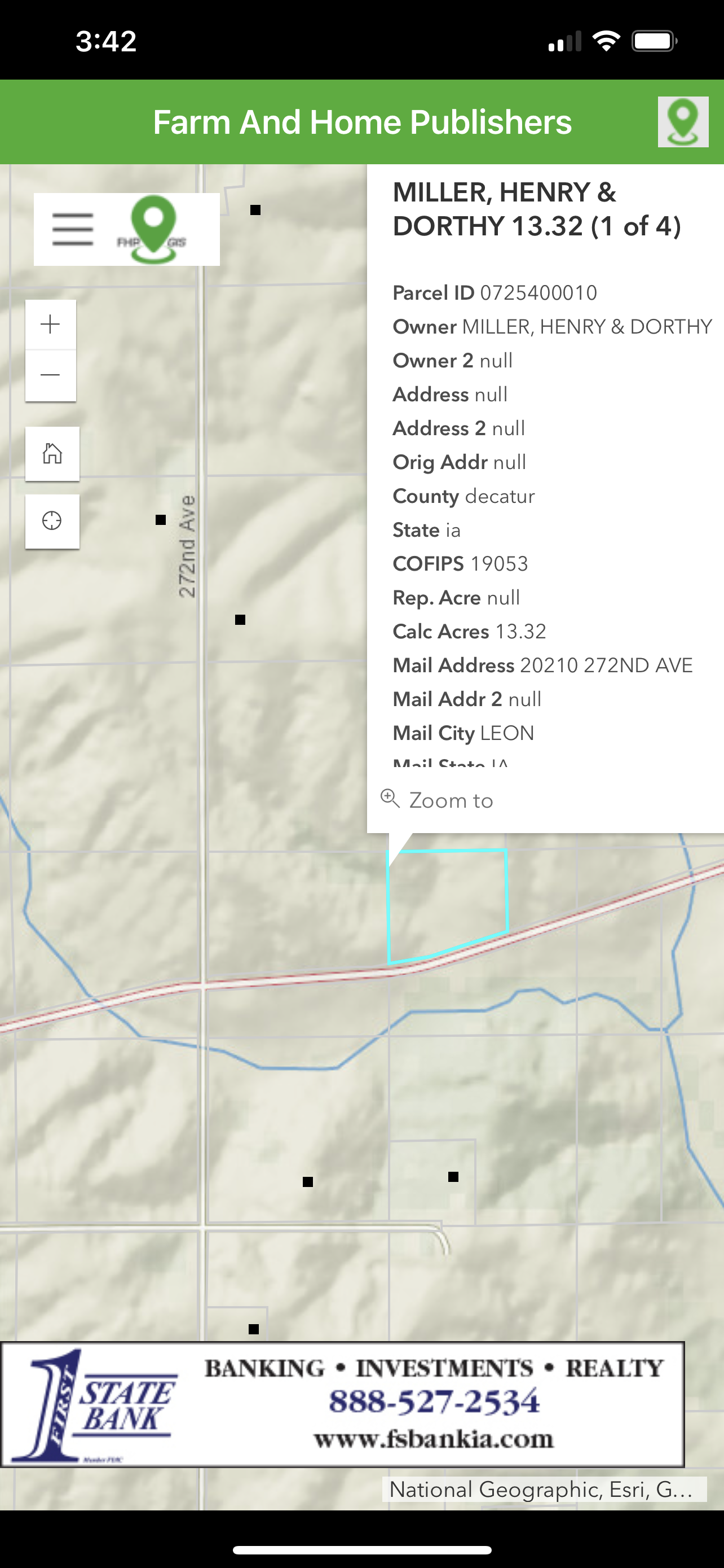
The FHP GIS App provides a nationwide map-based view of parcel boundary and owner
information across over 3,200 counties (99% of the US). In addition, the App also provides
access to residential addresses and contact information in over 500 counties, primarily across
the Midwest. Local, regional, and national businesses are shown on the map and are invited to
be represented in the App alongside other organizations.
Several unique data sets are included in the FHP GIS App. These include:
- Nationwide parcel ownership data, including addresses, property values, owner
information, and much more.
- Regional geocoded residential data, including contact information
- Businesses and organizations, as geocoded locations and scrolling banners
- Public Land Survey System (PLSS) Townships and Sections, nationwide
- Nationwide US Census Subdivisions (Civil Townships and Census County Division (CCDs))
- Nationwide counties and states
- Worldwide satellite imagery
- Worldwide street and administrative areas
- Nationwide National Agriculture Imagery Program (NAIP) imagery in real-color
- Nationwide National Agriculture Imagery Program (NAIP) imagery in infrared-color
- Real-time traffic feeds
- Real-time weather feeds
- Real-time natural disaster feeds
- More.
Additionally, several unique tools and functions are included in the FHP GIS App. These include:
- A custom search tool, by parcel owner, resident name, business owner, as well as
searching by location, place name, or address
- A secure login experience manages the user’s map experience.
- Filtering the user experience, specifically on Parcels and Resident data, to select
counties based on accessible counties to that particular user
- Map interactions are customized to retrieve information from select layers through
interactive click events
- Layers are interactively turned on and off in the map view
- A map key/legend is dynamically generated based on the visible map layers
- Measuring tools to help determine area, length, and XY location, in several different
unit-of-measurement options
- Drawing tools to allow temporary markups and notes
- Additional layers accessible from external web feeds
- Bookmarks to establish stored locations and zoom extents for the user’s map view
- Screenshot and print-to-file for storing information for later
For the customer already familiar with Farm and Home Publisher’s Plat Books, the FHP GIS App
extends the printed books and provides a digital, interactive view of the same map contents. In
addition, it adds more layers and will be ever-expanding to incorporate the needs and wishes of
the FHP community.
Hide
Show More...
information across over 3,200 counties (99% of the US). In addition, the App also provides
access to residential addresses and contact information in over 500 counties, primarily across
the Midwest. Local, regional, and national businesses are shown on the map and are invited to
be represented in the App alongside other organizations.
Several unique data sets are included in the FHP GIS App. These include:
- Nationwide parcel ownership data, including addresses, property values, owner
information, and much more.
- Regional geocoded residential data, including contact information
- Businesses and organizations, as geocoded locations and scrolling banners
- Public Land Survey System (PLSS) Townships and Sections, nationwide
- Nationwide US Census Subdivisions (Civil Townships and Census County Division (CCDs))
- Nationwide counties and states
- Worldwide satellite imagery
- Worldwide street and administrative areas
- Nationwide National Agriculture Imagery Program (NAIP) imagery in real-color
- Nationwide National Agriculture Imagery Program (NAIP) imagery in infrared-color
- Real-time traffic feeds
- Real-time weather feeds
- Real-time natural disaster feeds
- More.
Additionally, several unique tools and functions are included in the FHP GIS App. These include:
- A custom search tool, by parcel owner, resident name, business owner, as well as
searching by location, place name, or address
- A secure login experience manages the user’s map experience.
- Filtering the user experience, specifically on Parcels and Resident data, to select
counties based on accessible counties to that particular user
- Map interactions are customized to retrieve information from select layers through
interactive click events
- Layers are interactively turned on and off in the map view
- A map key/legend is dynamically generated based on the visible map layers
- Measuring tools to help determine area, length, and XY location, in several different
unit-of-measurement options
- Drawing tools to allow temporary markups and notes
- Additional layers accessible from external web feeds
- Bookmarks to establish stored locations and zoom extents for the user’s map view
- Screenshot and print-to-file for storing information for later
For the customer already familiar with Farm and Home Publisher’s Plat Books, the FHP GIS App
extends the printed books and provides a digital, interactive view of the same map contents. In
addition, it adds more layers and will be ever-expanding to incorporate the needs and wishes of
the FHP community.
Screenshots

FHP GIS App FAQ
-
Is FHP GIS App free?
Yes, FHP GIS App is completely free and it doesn't have any in-app purchases or subscriptions.
-
Is FHP GIS App legit?
Not enough reviews to make a reliable assessment. The app needs more user feedback.
Thanks for the vote -
How much does FHP GIS App cost?
FHP GIS App is free.
-
What is FHP GIS App revenue?
To get estimated revenue of FHP GIS App app and other AppStore insights you can sign up to AppTail Mobile Analytics Platform.

User Rating
App is not rated in Canada yet.
Ratings History
FHP GIS App Reviews
Store Rankings
Ranking History
App Ranking History not available yet
Category Rankings
App is not ranked yet
FHP GIS App Competitors
FHP GIS App Installs
Last 30 days
FHP GIS App Revenue
Last 30 daysFHP GIS App Revenue and Downloads
Gain valuable insights into FHP GIS App performance with our analytics.
Sign up now to access downloads, revenue, and more.
Sign up now to access downloads, revenue, and more.
App Info
- Category
- Navigation
- Publisher
- Farm and Home Publishers LTD
- Languages
- Recent release
- 2.0.2 (2 years ago )
- Released on
- Oct 2, 2022 (2 years ago )
- Also available in
- United States, Canada
- Last Updated
- 4 months ago
This page includes copyrighted content from third parties, shared solely for commentary and research in accordance with fair use under applicable copyright laws. All trademarks, including product, service, and company names or logos, remain the property of their respective owners. Their use here falls under nominative fair use as outlined by trademark laws and does not suggest any affiliation with or endorsement by the trademark holders.