FireMapper
Published by: Fire Front Solutions Pty

Description
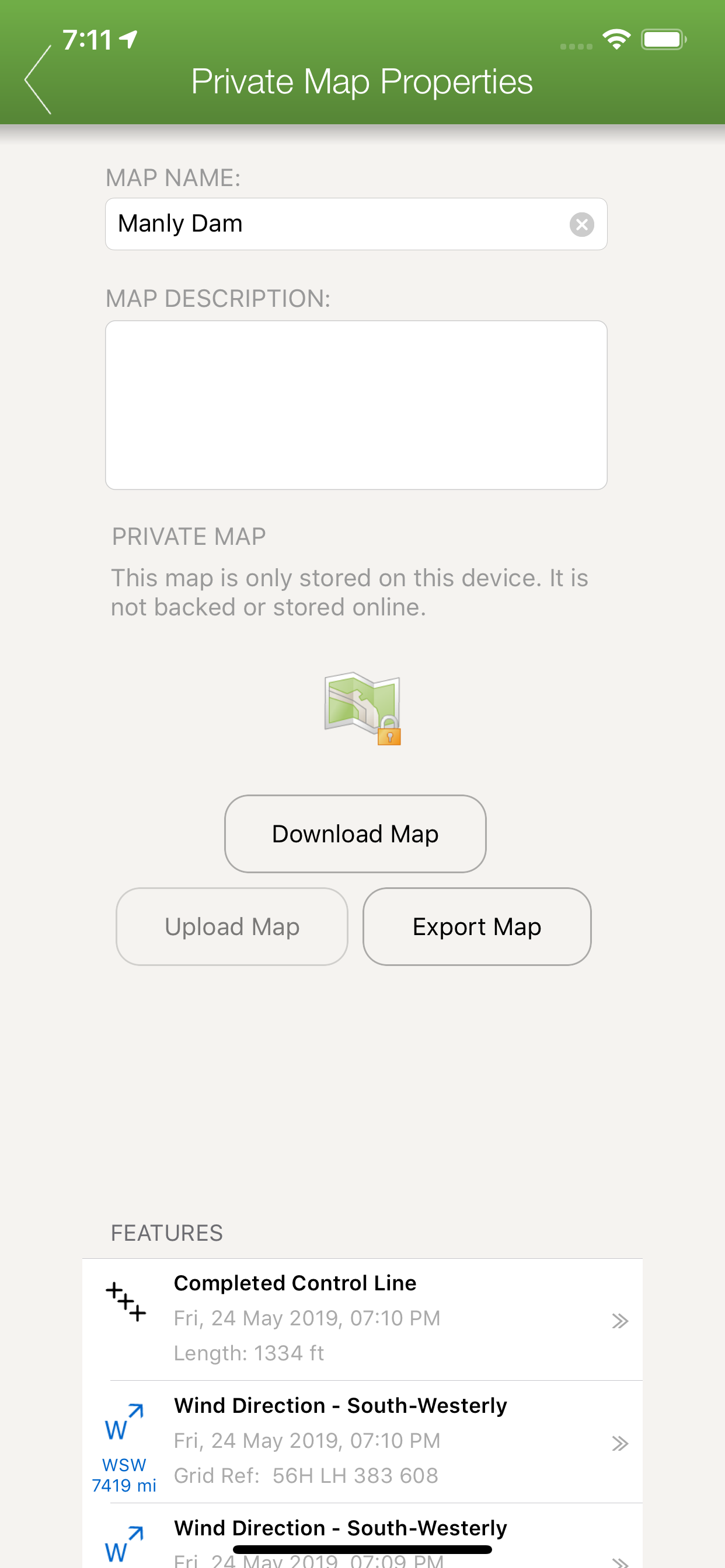
FireMapper is designed for firefighters for quickly generating bushfire and other incident maps. The applications provides a simple interface for drawing maps and exporting via Email.
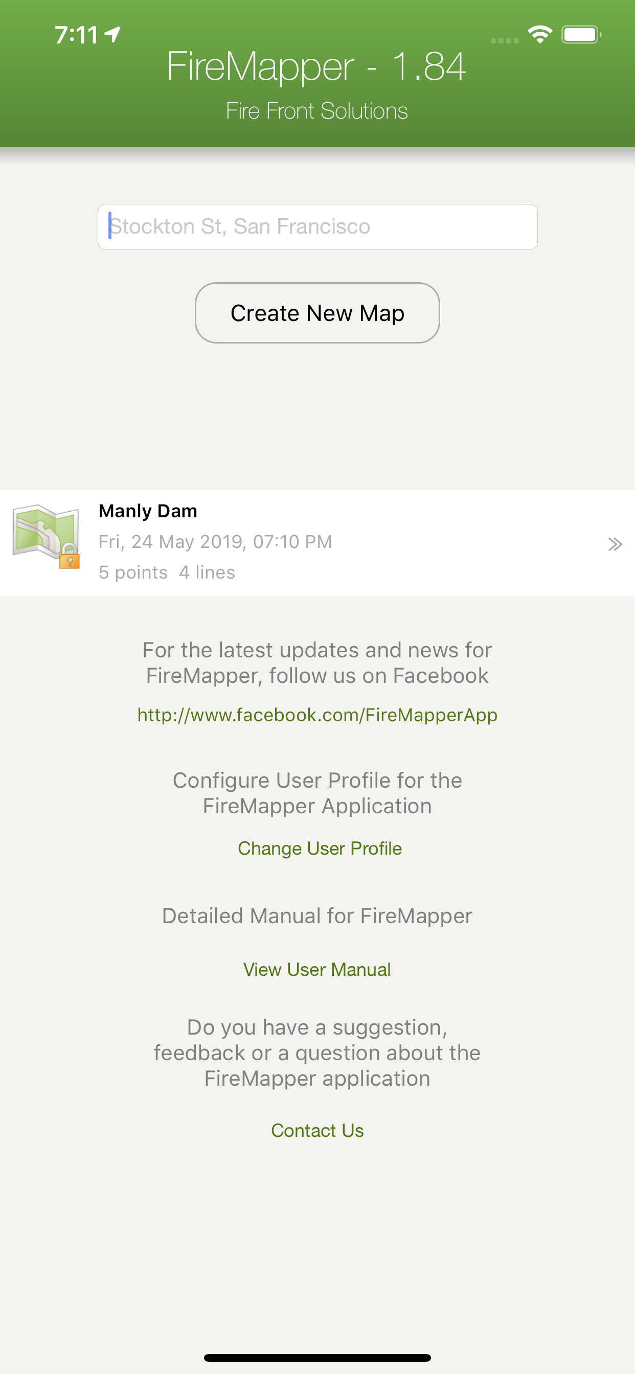
Maps are stored on the local device and can be created or used offline. No internet connection is required for collecting data.
FACEBOOK & SUPPORT:
Like us on Facebook to be notified of future updates and developments.
http://www.facebook.com/FireMapperApp
MAP EXPORT FORMATS:
Multiple points can be drawn on the map and exported in the same email. The map data can be exported as:
* GPX (suitable for ArcGIS, MapDesk and other popular GIS products, QGIS)
* KML (suitable for Google Maps & Google Earth)
* CSV (suitable for Microsoft Excel & Google Spreadsheets)
* JPG (photo of the map)
You can also send points & lines as a text message.
GPS CAMERA:
Take geo-referenced photos and display the location and bearing on the map.
GPS RECORDING:
FireMapper supports GPS recording in the background. Continued use of GPS running in the background can dramatically decrease battery life.
BUSHFIRE SYMBOLS:
This version contains bush firefighting symbols that are commonly used in Australia, USA & Canada with support for:
* National All Hazards Symbology Set
* USA Interagency Wildfire Point Symbols
Including the following icons:
Hydrant, Water Point, Fire Origin, Spot Fire, Aerial Ignition, Hotspot, Defendable/Not Defendable Asset, Threatened Asset, Indigenous Site, Historic Site, Hazmat,Flora/Fauna, Airbase, Helibase, Helibase,Smoker Standing/Down,Tree Down, Medical, Mobile Weather Station, Portable Communications, Access Point, Control Point, Road Closure, RAFT, Drop Zone, Assembly area, Staging area, Base camp, Control Centre, Divisonal/Sector Command, Evacuation Area/Center, Escape Route, Refuge area, Property damage and more....
LOCATION FORMATS:
-Latitude/Longitude (Decimal Degrees and Degree Minutes/Aviation)
- UTM Coordinates
- 1:25 000, 1:50 000 & 1:100 000 map sheet references
- UBD Map References (Sydney, Canberra, Adelaide, Perth)
INTEGRATED SEARCH:
Search by address, suburb, latitude/longitude, utm coordinates, grid references, place name, point type and more.
OFFLINE SUPPORT:
Maps can be created offline without an internet connection. Map layers are cached for offline support
MULTIPLE MAP LAYERS:
- Standard
- Satellite/Hybrid
- Terrain/Topographic
- US Topographic
- Australian Topographic
- NZ Topographic
and more....
Hide
Show More...
Maps are stored on the local device and can be created or used offline. No internet connection is required for collecting data.
FACEBOOK & SUPPORT:
Like us on Facebook to be notified of future updates and developments.
http://www.facebook.com/FireMapperApp
MAP EXPORT FORMATS:
Multiple points can be drawn on the map and exported in the same email. The map data can be exported as:
* GPX (suitable for ArcGIS, MapDesk and other popular GIS products, QGIS)
* KML (suitable for Google Maps & Google Earth)
* CSV (suitable for Microsoft Excel & Google Spreadsheets)
* JPG (photo of the map)
You can also send points & lines as a text message.
GPS CAMERA:
Take geo-referenced photos and display the location and bearing on the map.
GPS RECORDING:
FireMapper supports GPS recording in the background. Continued use of GPS running in the background can dramatically decrease battery life.
BUSHFIRE SYMBOLS:
This version contains bush firefighting symbols that are commonly used in Australia, USA & Canada with support for:
* National All Hazards Symbology Set
* USA Interagency Wildfire Point Symbols
Including the following icons:
Hydrant, Water Point, Fire Origin, Spot Fire, Aerial Ignition, Hotspot, Defendable/Not Defendable Asset, Threatened Asset, Indigenous Site, Historic Site, Hazmat,Flora/Fauna, Airbase, Helibase, Helibase,Smoker Standing/Down,Tree Down, Medical, Mobile Weather Station, Portable Communications, Access Point, Control Point, Road Closure, RAFT, Drop Zone, Assembly area, Staging area, Base camp, Control Centre, Divisonal/Sector Command, Evacuation Area/Center, Escape Route, Refuge area, Property damage and more....
LOCATION FORMATS:
-Latitude/Longitude (Decimal Degrees and Degree Minutes/Aviation)
- UTM Coordinates
- 1:25 000, 1:50 000 & 1:100 000 map sheet references
- UBD Map References (Sydney, Canberra, Adelaide, Perth)
INTEGRATED SEARCH:
Search by address, suburb, latitude/longitude, utm coordinates, grid references, place name, point type and more.
OFFLINE SUPPORT:
Maps can be created offline without an internet connection. Map layers are cached for offline support
MULTIPLE MAP LAYERS:
- Standard
- Satellite/Hybrid
- Terrain/Topographic
- US Topographic
- Australian Topographic
- NZ Topographic
and more....
Screenshots


User Rating
App is not rated in Chile yet.
Ratings History
FireMapper Installs
Last 30 days
FireMapper Revenue
Last 30 daysFireMapper Reviews
Store Rankings
Ranking History
App Ranking History not available yet
Category Rankings
|
Chart
|
Category
|
Rank
|
|---|---|---|
|
Top Paid
|
|
18
|
|
Top Grossing
|
|
82
|
|
Top Paid
|

|
109
|
|
Top Paid
|

|
202
|
|
Top Paid
|

|
227
|
Keywords
FireMapper Competitors
| Name | Reviews | Recent release | |
|---|---|---|---|

Sun Seeker Golden Hour Tracker
Sunlight, Sunrise Sunset Times
|
6
|
2 months ago | |

Opal Travel
|
1
|
2 weeks ago | |

Virgin Australia
|
0
|
2 weeks ago | |

Brújula 55. Mapa y GPS kit.
Planifica,mide,navega,rastrea.
|
1
|
2 weeks ago | |

OilTrails
GPS Nav, Well Info and Weather
|
0
|
1 week ago | |

Fires - WILDFIRE INFO & ATLAS
Wildfires, Weather, 3D Maps
|
0
|
20 hours ago | |

RadarBox - Rastreo de Vuelos
Rastreador del ruta del avión
|
2
|
3 days ago | |

AnyTrip
Real-time transport tracker
|
0
|
11 months ago | |

Flight Tracker Pr Air Radar 24
Vuelos en vivo | plane aware
|
1
|
3 weeks ago | |

Ember Map
Fire Maps & Navigation
|
0
|
3 weeks ago |
FireMapper Revenue and Downloads
Gain valuable insights into FireMapper performance with our analytics.
Sign up now to access downloads, revenue, and more.
Sign up now to access downloads, revenue, and more.
App Info
- Category
- Navigation
- Publisher
-
Fire Front Solutions Pty
- Languages
- English
- Recent release
- 1.258 (1 year ago )
- Released on
- Apr 25, 2014 (10 years ago )
- Also available in
- Australia, Romania, South Korea, Kuwait, Kazakhstan, Malaysia, Nigeria, Netherlands, Norway, New Zealand, Peru, Philippines, Pakistan, Poland, India, Russia, Saudi Arabia, Sweden, Singapore, Thailand, Türkiye, Taiwan, Ukraine, United States, Vietnam, South Africa, Egypt, Austria, Azerbaijan, Belgium, Brazil, Canada, Switzerland, Chile, China, Colombia, Czechia, Germany, Denmark, Japan, Spain, Finland, France, United Kingdom, Greece, Hong Kong SAR China, Hungary, Indonesia, Ireland, Israel, United Arab Emirates
- Last Updated
- 1 week ago