Not a serious app
This is not a serious attempt to create a useful app. The interface is terrible and the map data can be found elsewhere with a usable interface.

Yes, Fishing Points is free to download, however it contains in-app purchases or subscription offerings.
🤔 The Fishing Points app's quality is mixed. Some users are satisfied, while others report issues. Consider reading individual reviews for more context.
Fishing Points has several in-app purchases/subscriptions, the average in-app price is $22.37.
To get estimated revenue of Fishing Points app and other AppStore insights you can sign up to AppTail Mobile Analytics Platform.

4.45 out of 5
2,074 ratings in United States
This is not a serious attempt to create a useful app. The interface is terrible and the map data can be found elsewhere with a usable interface.
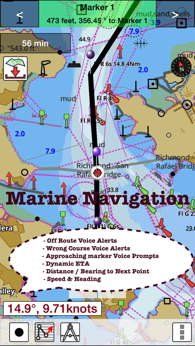
App doesn’t pinpoint my location accurately and the depths have been off by several feet which makes a big difference in smaller lakes.
I bought the subscription yet it keeps asking me to buy more layers. Not to be trusted.
I purchased for an upgrade expecting more detailed maps.Instead I got the same thing as if I never paid into this app. Very disappointed.
I like the app but every so often you need to get a new pin to put in to refresh maps. That’s fine until recently when the pins they send me are no good. And no one from customer service has emails me back about a new one. I have Emailed two time now with no response.
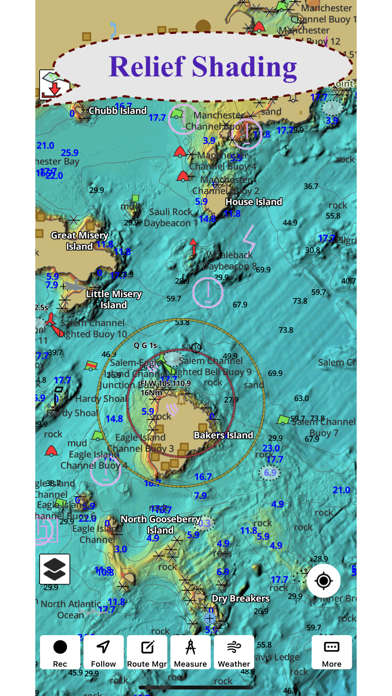
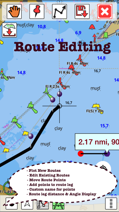
I had the old version for years and it was great. The new, updated version (green badging & label) does not have as much info on it as the old one! Specifically, depth topo maps for certain lakes are gone. For instance, Lake Murray in San Diego California no longer has a bathymetry map. Just disappeared. Gone, no reason.
I have really enjoyed this app. I use it for everything fishing related.
I bought this app on my I phone 13 I upgraded to I phone 15 and all that I have now is the light version.
It needs more info and some lakes displayed aren’t actual lakes they are just swimming pools
I was fishing a new area and after a day or too of nothing I downloaded this app and was able to pinpoint where a shelf and shelter rocks were and I limited out after a few hours, great app and easy to use and very simple which is perfect!
|
Chart
|
Category
|
Rank
|
|---|---|---|
|
Top Free
|

|
346
|
|
Top Free
|

|
477
|
