GNSS View
#1 Keyword Rankings
Today
Top 10 Rankings
Today
Top 30 Rankings
Today
Top 100 Rankings
Today
Description
This application enables you to see where the Quasi-Zenith Satellite System in the sky!
●What is QZSS?
Quasi-Zenith Satellite System (QZSS) is a Japanese satellite positioning system composed mainly of satellites in quasi-zenith orbits (QZO).
Satellite positioning systems use satellite signals to calculate position information. One famous example is the American Global Positioning System (GPS) and the QZSS is sometimes called the Japanese GPS.
For details, please refer to the following Website "Quasi-Zenith Satellite System".
URL : https://qzss.go.jp/en
●What is GNSS View?
GNSS View provides that iOS version application that is based on the website application "GNSS View".
This application enables you to know position of positioning satellites such as QZSS and GPS in the specified time and location.
The positioning satellites displayed in the GNSS View are not based on the satellite information directly received by the smartphone but are displayed based on the satellite arrangement calculated based on the publicly released orbit information.
●GNSS View 3 functions
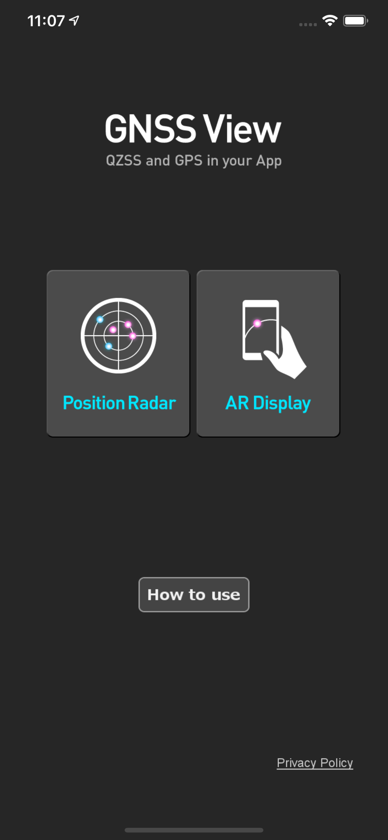
【Main】
・You can move to the Position Radar screen or AR Display screen from the application startup screen.
・You can see the operating manual and privacy policy of this application via the website.
【Position Radar】
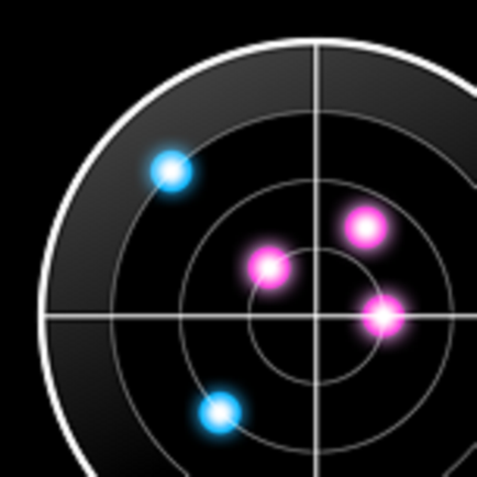
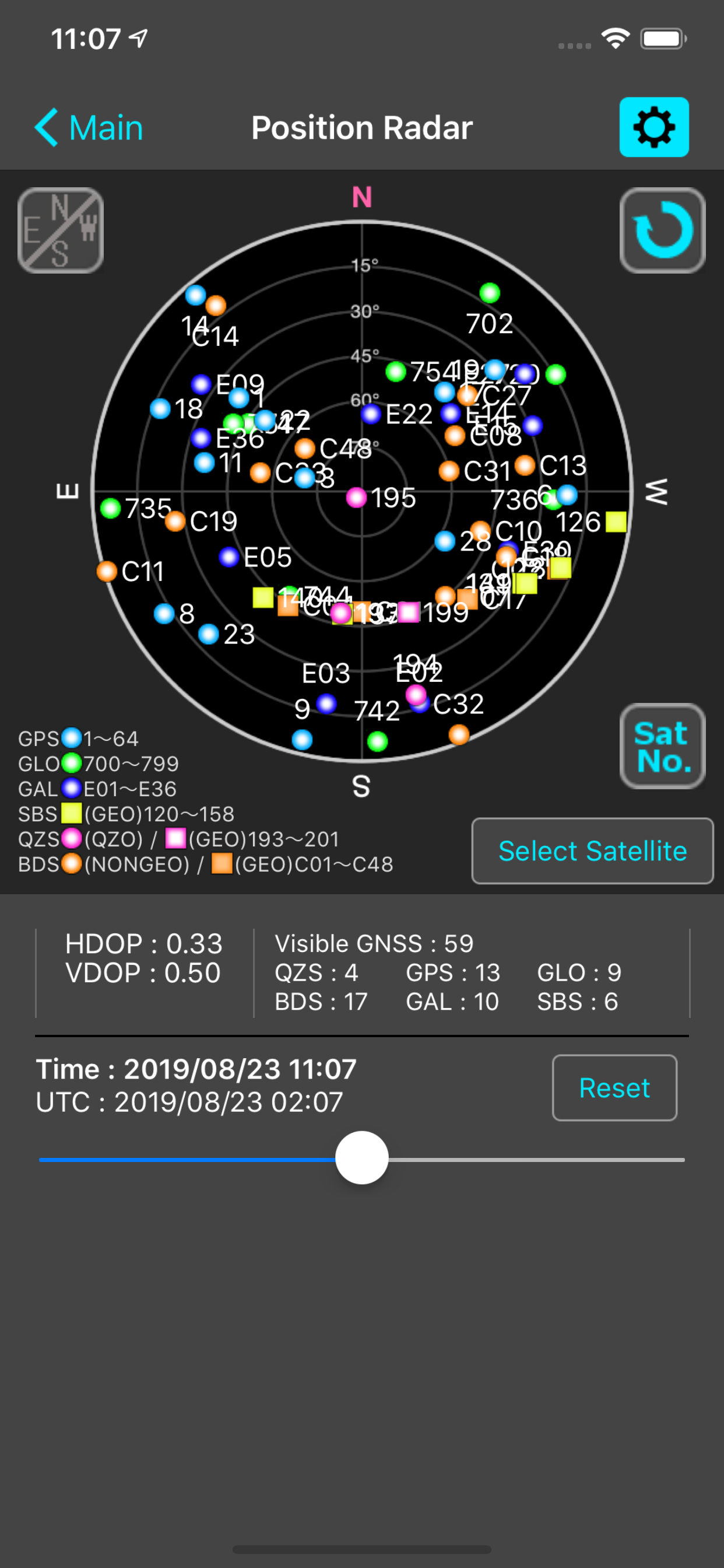
・It is provided radar view of positioning satellites such as QZSS and GPS as a sky plot at the specified time and location.
・Positioning satellites can be specified from QZSS, GPS, GLONASS, BeiDou, Galileo, SBAS.
・You can also select specified signal satellites to see on the radar.
・You can see selected satellites by setting elevation mask angle.
・You can switch east and west of satellite arrangement, turn on / off rotation, and switch on / off display of satellite number.
・It displays HDOP, VDOP, the total number of satellites and the number of each positioning satellites in the satellite arrangement displayed on the radar.
【AR Display】
・Position of positioning satellites such as QZSS and GPS on the sky from your current location is able to see through your camera at the specified time.
・In order to display satellites, it is necessary to turn on the position information of the smartphone and complete the positioning. Therefore, it may take time to display.
・Positioning satellites can be specified from QZSS, GPS, GLONASS, BeiDou, Galileo, SBAS.
・You can also select specified signal satellites to see on the radar.
・You can see selected satellites by setting elevation mask angle.
●Supported versions
・iOS 17
・iOS 16
・iOS 15
・iOS 14
・iOS 13
・iOS 12
Hide..
Show more..
●What is QZSS?
Quasi-Zenith Satellite System (QZSS) is a Japanese satellite positioning system composed mainly of satellites in quasi-zenith orbits (QZO).
Satellite positioning systems use satellite signals to calculate position information. One famous example is the American Global Positioning System (GPS) and the QZSS is sometimes called the Japanese GPS.
For details, please refer to the following Website "Quasi-Zenith Satellite System".
URL : https://qzss.go.jp/en
●What is GNSS View?
GNSS View provides that iOS version application that is based on the website application "GNSS View".
This application enables you to know position of positioning satellites such as QZSS and GPS in the specified time and location.
The positioning satellites displayed in the GNSS View are not based on the satellite information directly received by the smartphone but are displayed based on the satellite arrangement calculated based on the publicly released orbit information.
●GNSS View 3 functions
【Main】
・You can move to the Position Radar screen or AR Display screen from the application startup screen.
・You can see the operating manual and privacy policy of this application via the website.
【Position Radar】
・It is provided radar view of positioning satellites such as QZSS and GPS as a sky plot at the specified time and location.
・Positioning satellites can be specified from QZSS, GPS, GLONASS, BeiDou, Galileo, SBAS.
・You can also select specified signal satellites to see on the radar.
・You can see selected satellites by setting elevation mask angle.
・You can switch east and west of satellite arrangement, turn on / off rotation, and switch on / off display of satellite number.
・It displays HDOP, VDOP, the total number of satellites and the number of each positioning satellites in the satellite arrangement displayed on the radar.
【AR Display】
・Position of positioning satellites such as QZSS and GPS on the sky from your current location is able to see through your camera at the specified time.
・In order to display satellites, it is necessary to turn on the position information of the smartphone and complete the positioning. Therefore, it may take time to display.
・Positioning satellites can be specified from QZSS, GPS, GLONASS, BeiDou, Galileo, SBAS.
・You can also select specified signal satellites to see on the radar.
・You can see selected satellites by setting elevation mask angle.
●Supported versions
・iOS 17
・iOS 16
・iOS 15
・iOS 14
・iOS 13
・iOS 12
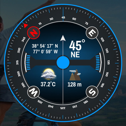
Screenshots
 User Rating
0 out of 5
0 ratings in Belarus
Ratings History
Reviews
App doesn't have any reviews yet
Store Rankings
Ranking History
App Ranking History not available yet
Category Rankings
|
Chart
|
Category
|
Rank
|
|---|---|---|
|
Top Free
|

|
136
|
|
Top Free
|

|
176
|
|
Top Free
|

|
236
|
|
Top Free
|

|
269
|
|
Top Free
|

|
271
|
Keywords
Users may also like
| Name | Reviews | Recent release | |
|---|---|---|---|

GPS information
GPS, Altitude, Speed & Map
|
0
|
6 days ago | |

スーパー地形
GPS対応3D地図アプリ〜山から街まで高低差を極めるツール
|
0
|
1 week ago | |

Drone Maps Japan
UAS/UAV No-fly Zones in Japan
|
0
|
1 month ago | |

My GPS Coordinates
Find your current location.
|
0
|
2 weeks ago | |

NMEA Gps
|
0
|
2 years ago | |

Eos Tools Pro
|
0
|
1 month ago | |
AR地形模型
ARで地形模型が出現!さらにGPS軌跡も表示
|
0
|
3 months ago | |

Satellite Info GPS Status
|
0
|
2 years ago | |
GPS Tools® - Find,Track & Trek
Location,Speed,Compass & More
|
0
|
2 years ago | |

RouteHistory
Record and display routes
|
0
|
3 weeks ago |
Show More
Revenue and Downloads
Gain valuable insights into GNSS View performance with our analytics. Sign up now
to
access downloads, revenue, and more.
App Info
- Category
- Navigation
- Publisher
- NEC Corporation
- Languages
- English
- Recent version
- 5.0.2 (3 months ago )
- Released on
- Oct 31, 2014 (9 years ago )
- Also available in
- Japan, United States, Germany, United Kingdom, China, Belgium, France, Canada, Switzerland, Italy, Czechia, Pakistan, Portugal, Hong Kong, Greece, Finland, Thailand, Colombia, Brazil, South Africa, New Zealand, Peru, Philippines, Norway, Netherlands, Nigeria, India, Malaysia, Poland, Romania, Russia, Saudi Arabia, Sweden, Singapore, Turkey, Taiwan, Ukraine, Vietnam, Egypt, Argentina, Austria, Australia, Azerbaijan, Belarus, Chile, Denmark, Dominican Republic, Algeria, Ecuador, Mexico, Spain, Hungary, Indonesia, Ireland, Israel, United Arab Emirates, South Korea, Kuwait, Kazakhstan, Lebanon
- Last updated
- 2 weeks ago