A good OSM editor
It really is
Yes, Go Map!! is completely free and it doesn't have any in-app purchases or subscriptions.
✅ The Go Map!! app appears to be high-quality and legitimate. Users are very satisfied.
Go Map!! is free.
To get estimated revenue of Go Map!! app and other AppStore insights you can sign up to AppTail Mobile Analytics Platform.

5 out of 5
13 ratings in Ukraine
It really is
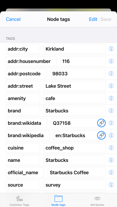
Такими темпами не далеко и JOSM переплюнуть ;) Please add tags name:en, name:ru, name:uk etc.
Very useful and nice OSM editor. I like it, really. Many thanks to creator.
Best OSM editing app I know so far. Good fatures like a set of open Maps to start with. Easy handling. Intuitive UI.
this is one of the best OpenStreetMap editors considering all platforms, and easily the best on iOS.
Perfekt, um unterwegs spontan kleine Änderungen einzupflegen.
Really like this app for using while hiking. I suggest to activate the quests by default, to get more users contributing. Could you please add the missing attribute translations from official OSM translation? Thanks for the great work!
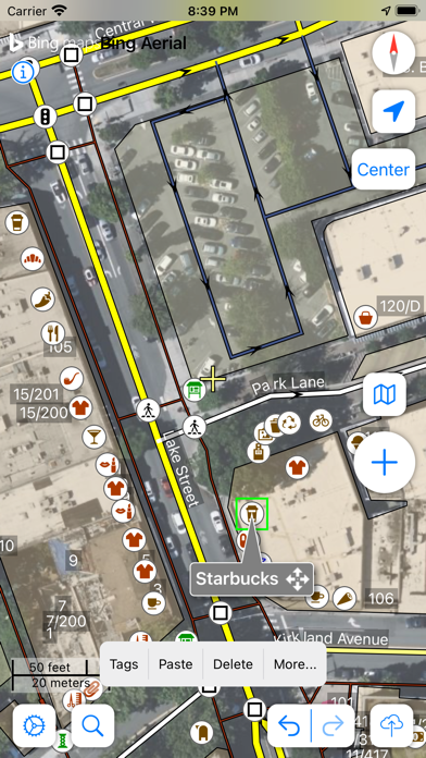
Die Steuerung mit dem Fadenkreuz war erst etwas seltsam, wenn man Maus Schubser ist. Im Nachhinein aber für unterwegs eine geniale Idee. Man kann präzise positionieren, ohne stehen bleiben zu müssen 👍 sehr geil ist auch die Überlagerung mit Orthofotos, Kataster Karten und Hillshades. Großen Respekt und Dank an den Entwickler!
The updated color and font scheme looks absolutely awful, especially with the aliasing, and makes me want to switch to another app. What was wrong with the old color scheme? It was perfectly useable, while the new one is absolutely not.
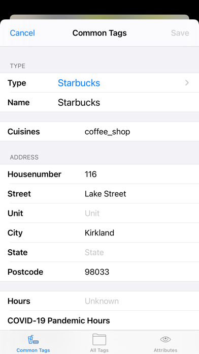
Kein Ersatz für JOSM, aber es ist eine stabile, zuverlässige Software, die auch auf älteren Mobiltelefonen gut läuft - genau richtig für Erfassungen, die nur vor Ort gut gehen. Punkte, aber auch Wege und Flächen können erstellt und geändert werden. Das Duplizieren ist bei gleichartigen Objekten wie Bänken, Briefkästen oder Straßenlampen sehr hilfreich, wenn man sich etwas eingewöhnt hat. Die Darstellung wahlweise mit Karte oder Karte und Luftbild hilft sehr bei der Positionierung neuer Objekte. Mit Augenmaß, denn immer aktives Luftbild schröpft das Volumen mobiler Daten deutlich! Bei der Eingabe werden frühere Eingaben vorgeschlagen, leider keine Werte aus der aktuellen Kartenumgebung. Typische Attribute werden aber angezeigt, nachdem ein Schlüssel gesetzt ist.
