great and simple to use
best simple gps app around ... only snag when using on an aircraft the speed and altitude overwrites the max speed as it has not enough space for 700 km and 12000 m .. need to truncate the max more to the right


Yes, GPS & Maps is completely free and it doesn't have any in-app purchases or subscriptions.
🤔 The GPS & Maps app's quality is mixed. Some users are satisfied, while others report issues. Consider reading individual reviews for more context.
GPS & Maps is free.
To get estimated revenue of GPS & Maps app and other AppStore insights you can sign up to AppTail Mobile Analytics Platform.

4.53 out of 5
34 ratings in South Africa
best simple gps app around ... only snag when using on an aircraft the speed and altitude overwrites the max speed as it has not enough space for 700 km and 12000 m .. need to truncate the max more to the right
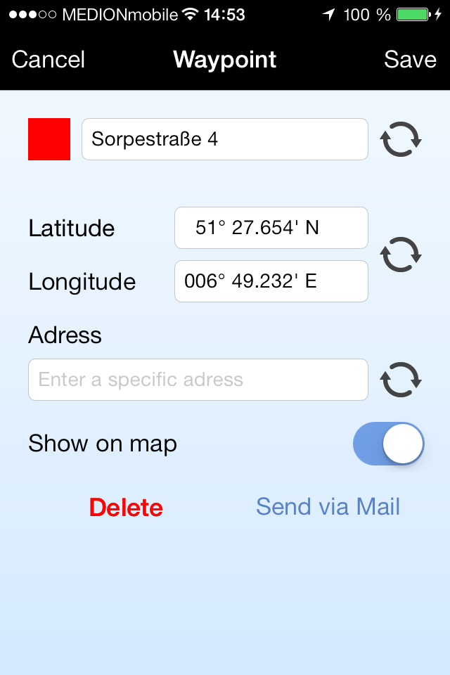
Could you try to add an option of saving waypoints and perhaps downloading them?
When I type in an address it says that it cannot find the address. It doesn’t find my co ordinates either. Not too impressed
Maps are good but out of date
I can not add coordinates and let the gos take me there.
Does not display full screen on the iPad which what I use off-roading . Disappointing
Clear and precise. Easy to use. Not weighed down by ads or cluttered by
How do I activate the compass function ? I have an iPhone8 running iOS 16.7.11
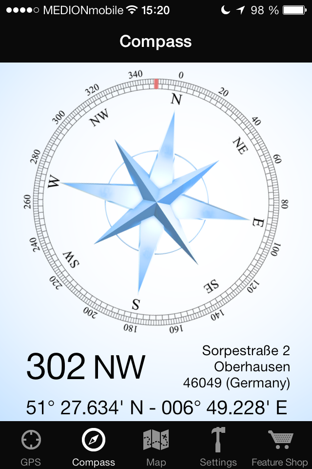
Seems to be quite accurate
Appreciate all the features this has to offer, really enjoy it, very useful, Recommend.
|
Chart
|
Category
|
Rank
|
|---|---|---|
|
Top Grossing
|

|
11
|
|
Top Free
|

|
35
|
|
Top Grossing
|
|
53
|
|
Top Grossing
|

|
99
|
|
Top Grossing
|

|
100
|
