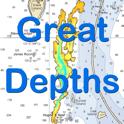
Great Depths
#1 Keyword Rankings
Today
Top 10 Rankings
Today
Top 30 Rankings
Today
Top 100 Rankings
Today
Description
Turn your iOS device into a digital depth finder. Great Depths offers coverage of the entire US coast, the Great Lakes, Lake Champlain and more... Know exactly where you are on the water and cruise to your port of call directly and safely. Sail with Great Depths for iPhone and iPad.
Great Depths offers digital depth readouts, live tide data and NOAA RNC nautical charts in 60 bargain-priced packages. Digital depth readouts are automatically adjusted based on current tide/lake level and are updated as you move or viewed anywhere with the touch of a finger.
-- The handy mileage menu calculates distance between any two points instantly.
-- Purchases are automatically synced across all your iOS devices and downloaded packages are stored locally on your devices so you don’t have to rely on cell service.
-- Best of all, Great Depths is FREE and never has adds! You can download the app and preview the available charts packages without spending a dime.
Chart coverage includes the entire coast of the contiguous USA, the Great Lakes, Lake Champlain, the Erie, Oswego and Champlain Canals, Lake Mead, Lake Oswego, Lake Pend Oreille, Lake Okeechobee, Lake Winnebago, Franklin D. Roosevelt Lake, Lake Cayuga, Lake Seneca Lakes, Wake Island and more....
Hide..
Show more..
Great Depths offers digital depth readouts, live tide data and NOAA RNC nautical charts in 60 bargain-priced packages. Digital depth readouts are automatically adjusted based on current tide/lake level and are updated as you move or viewed anywhere with the touch of a finger.
-- The handy mileage menu calculates distance between any two points instantly.
-- Purchases are automatically synced across all your iOS devices and downloaded packages are stored locally on your devices so you don’t have to rely on cell service.
-- Best of all, Great Depths is FREE and never has adds! You can download the app and preview the available charts packages without spending a dime.
Chart coverage includes the entire coast of the contiguous USA, the Great Lakes, Lake Champlain, the Erie, Oswego and Champlain Canals, Lake Mead, Lake Oswego, Lake Pend Oreille, Lake Okeechobee, Lake Winnebago, Franklin D. Roosevelt Lake, Lake Cayuga, Lake Seneca Lakes, Wake Island and more....
In-Apps
- All the Charts
- $ 0,00
- Two Chart Pack
- $ 4.900,00
- The Connecticut River
- $ 4.900,00
- Southern Mass. and Rhode Island Coast
- $ 9.900,00
- Maine, New Hampshire and Northern Mass.
- $ 14.900,00
- Puerto Rico, the Virgin Islands and Navassa Island
- $ 4.900,00
Screenshots


 User Rating
0 out of 5
0 ratings in Colombia
Ratings History
Reviews
App doesn't have any reviews yet
Store Rankings
Ranking History
App Ranking History not available yet
Category Rankings
App is not ranked yet
Keywords
Users may also like
| Name | Reviews | Recent release | |
|---|---|---|---|

AIS Maps: Marine & Lake charts
Detailed nautical & topo maps
|
0
|
1 month ago | |

i-Boating: Marine Charts & Gps
Lake Maps & Fishing Spots
|
0
|
2 weeks ago | |

Atlas Cartas Náuticas
Mares y Lagos Cartas Náuticas
|
0
|
1 year ago | |

PRO CHARTS - Marine Navigation
|
0
|
8 months ago | |

Aqua Map Boating
Navegación GPS, vela y pesca
|
0
|
2 weeks ago | |

NV Charts GPS Navigation AIS
Marine Navigation and Boating
|
0
|
1 month ago | |

WinGPS Marine
|
0
|
2 months ago | |

USA Lakes and Parks trails
Lakes And Parks Offline Charts
|
0
|
2 years ago | |

Nautical Charts & Maps
Nautical Charts & Marine Maps
|
0
|
3 months ago | |

iSailGPS : NOAA USA RNC Charts
Marine Nautical Chart Plotter
|
0
|
1 week ago |
Show More
Revenue and Downloads
Gain valuable insights into Great Depths performance with our analytics. Sign up now
to
access downloads, revenue, and more.
App Info
- Category
- Navigation
- Publisher
- Tyler Elko
- Languages
- English
- Recent version
- 4.0 (6 years ago )
- Released on
- May 16, 2013 (11 years ago )
- Also available in
- United States, Canada, Malaysia, New Zealand, Philippines, Hong Kong, Argentina, South Korea, Kazakhstan, Mexico, Netherlands, India, Poland, Saudi Arabia, Taiwan, Vietnam, South Africa, United Kingdom, Greece, Australia, Azerbaijan, Finland, Brazil, China, Egypt, Dominican Republic, Colombia, Germany, Austria, Turkey, Romania, Czechia, Norway, Denmark, Lebanon, Spain, Kuwait, Italy, France, Indonesia
- Last updated
- 1 month ago