Ótimo App
Muito prático e cumpri o que promete.


iMapIt Pro is not free (it costs 39.00), however it doesn't contain in-app purchases or subscriptions.
🤔 The iMapIt Pro app's quality is mixed. Some users are satisfied, while others report issues. Consider reading individual reviews for more context.
The price of iMapIt Pro is 39.00.
To get estimated revenue of iMapIt Pro app and other AppStore insights you can sign up to AppTail Mobile Analytics Platform.

Muito prático e cumpri o que promete.
Falta so a opção de adicionar área manualmente só visualizando o mapa!!! Obrigado pelo aplicativo muito bom, porém falta essa opção.
Recomendo. Só deveria ter uma interface mais bonita.
O app não está abrindo mais.... Quando eu clico ele abri e fecha automaticamente !
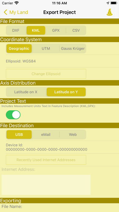
Estou tentando enviar pontos por e-mail e não está dando certo, ao aplicar em exportar o programa fecha.
Da pra ganhar dinheiro fácil, com conhecimento na área é claro. Deveriam apenas aperfeiçoa o App, mais no geral é o melhor.
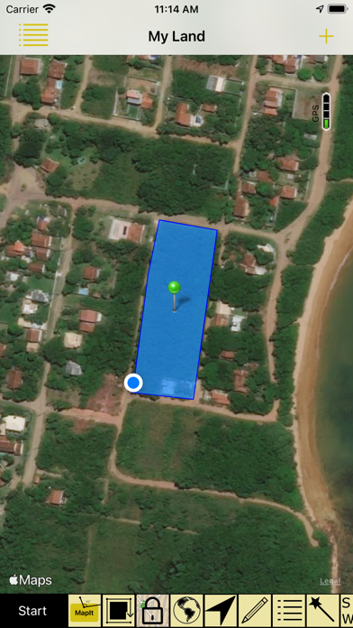
Ótimo App para medições de área sem necessidade de internet/rede operadora. Apenas pelo sinal GPS é possivel realizar as medições. Vale a pena!
Péssimo. Não funciona. PIOR APP que comprei.
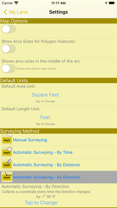
Muito bom, você marca os pontos e vai ligando os vértices. Vou sugerir que poderia ter uma opção para registrar o deslocamento continuamente, porém o aplicativo atende as necescidades
Otimo!
|
Chart
|
Category
|
Rank
|
|---|---|---|
|
Top Paid
|

|
81
|
|
Top Paid
|

|
99
|
|
Top Paid
|

|
149
|
|
Top Paid
|

|
170
|
|
Top Paid
|

|
264
|
| Name | Downloads (30d) | Monthly Revenue | Reviews | Ratings | Recent release | |
|---|---|---|---|---|---|---|

Planimeter GPS Area Measure
agriculture field calculator
|
Unlock
|
Unlock
|
0
|
|
3 months ago | |

JCB Crew Manager
Snow Removal Crew Manager
|
Unlock
|
Unlock
|
0
|
|
1 year ago | |

AMOS Mobile Solution
Built for mining and quarrying
|
Unlock
|
Unlock
|
0
|
|
3 weeks ago | |

HVAC Psychrometric LT
Single-air stream psych calcs
|
Unlock
|
Unlock
|
0
|
|
8 months ago | |

topoArea
|
Unlock
|
Unlock
|
0
|
|
3 years ago | |
Distance and Area Measure
Distance and Area Measure
|
Unlock
|
Unlock
|
0
|
|
2 years ago | |

DockMaster Mobile App
Time Clock | Card | Scheduling
|
Unlock
|
Unlock
|
0
|
|
4 days ago | |

KUHN TELEMETRIA
|
Unlock
|
Unlock
|
0
|
|
3 months ago | |

Geo Survey - Land Survey
Geo Survey - Area and Distance
|
Unlock
|
Unlock
|
0
|
|
1 year ago | |

HVAC ResLoad-J
ACCA Manual-J8 HVAC Load Calcs
|
Unlock
|
Unlock
|
0
|
|
3 years ago |
