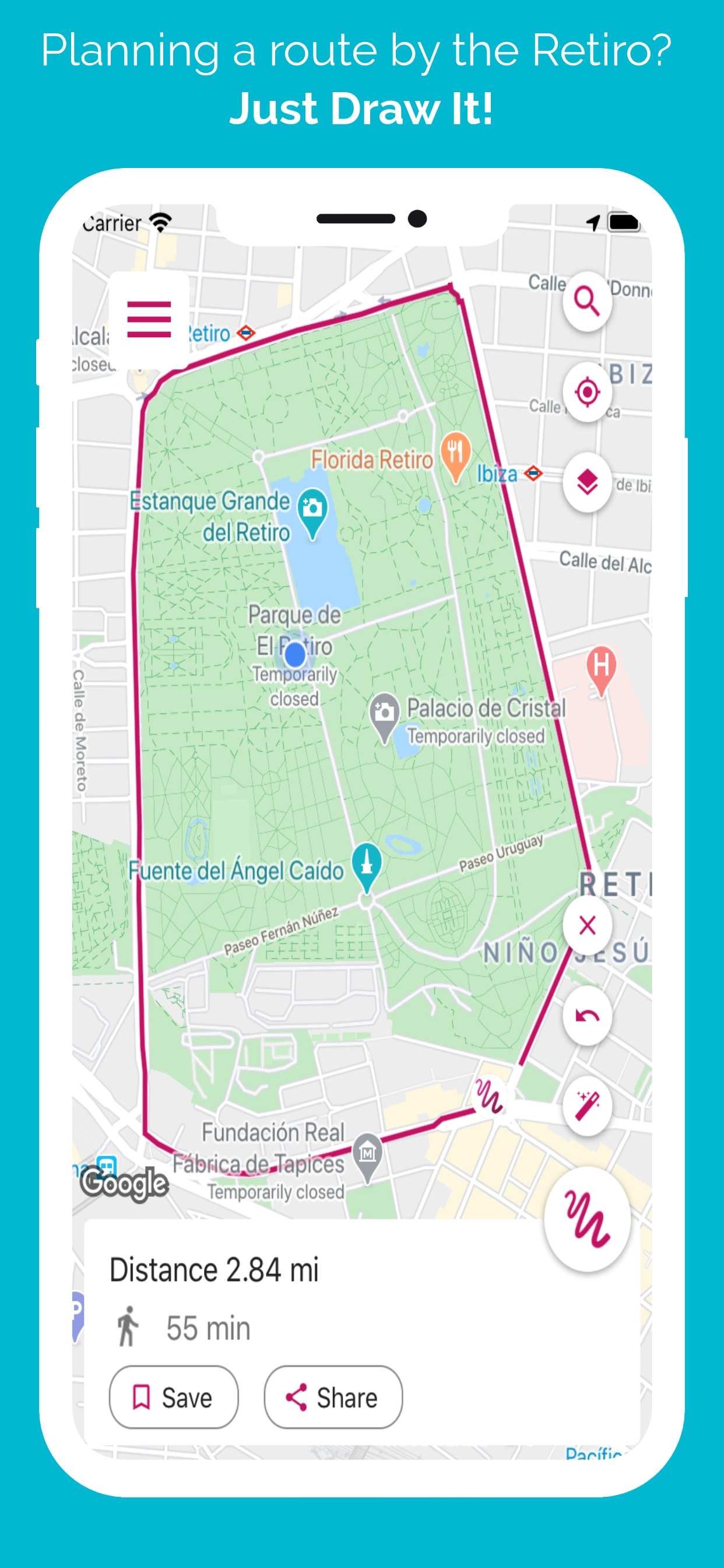
Just draw your route on the map merely swiping your finger and get the route total distance right away. As easy as drawing it. No more headaches about where to go next to reach those 10 miles you were planning to run. No more stress finding the right path to walk your dog. Quick and easy to use, just draw it!
Perfect for all kind of activities, including:
- Hiking
- Walking
- Running
- Jogging
- Strolling
- Tourism
- Golf
- Hunting
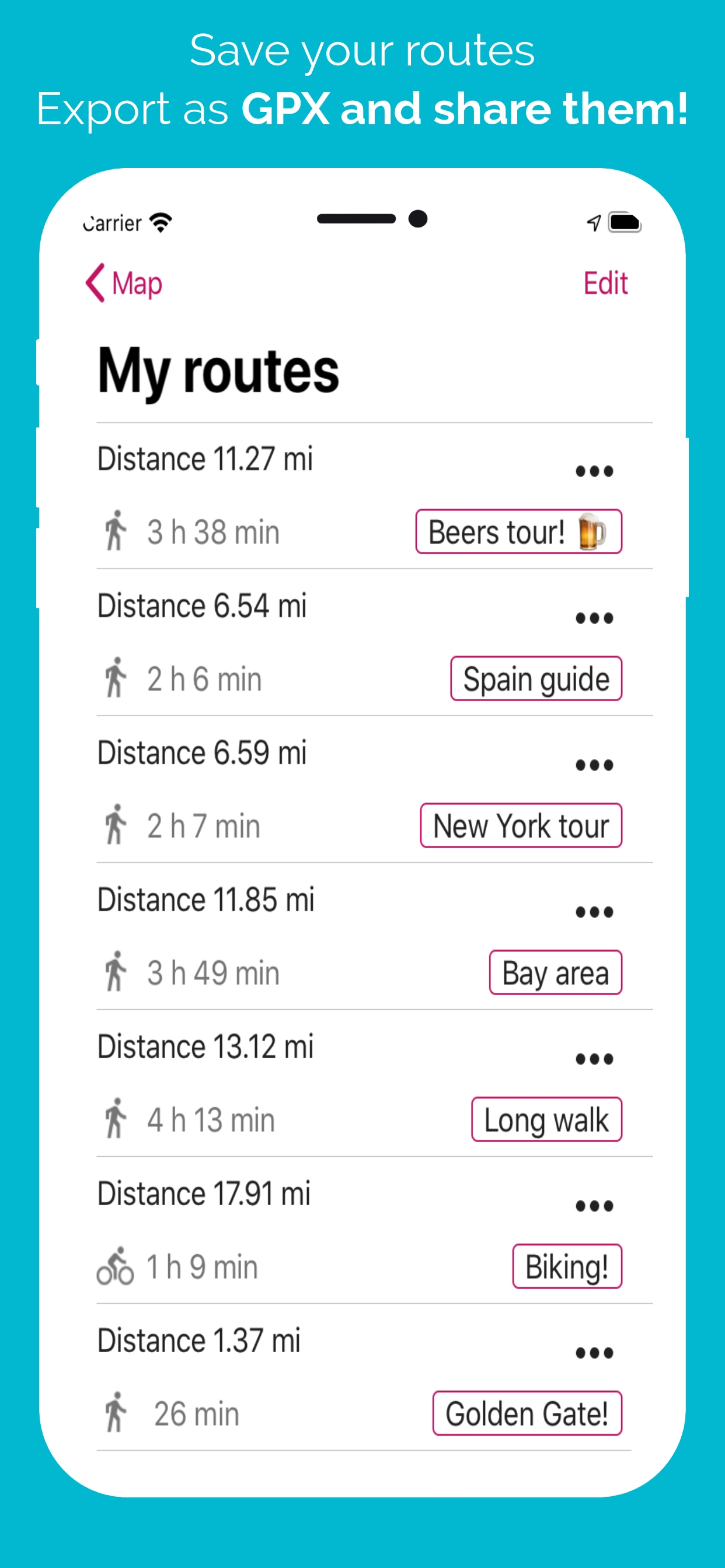
How to use it: Use your finger to draw on the map, plan your route easy and accurate, and get total distance. You can also save your preferred routes and use them later. Or
import GPX files and edit them as you wish. You can also export your routes as GPX, share them and open them wherever you want to!
Features:
- Draw route with a finger.
- Import and export GPX files.
- Calculate distance between two points.
- Save preferred routes.
- Share GPX files.
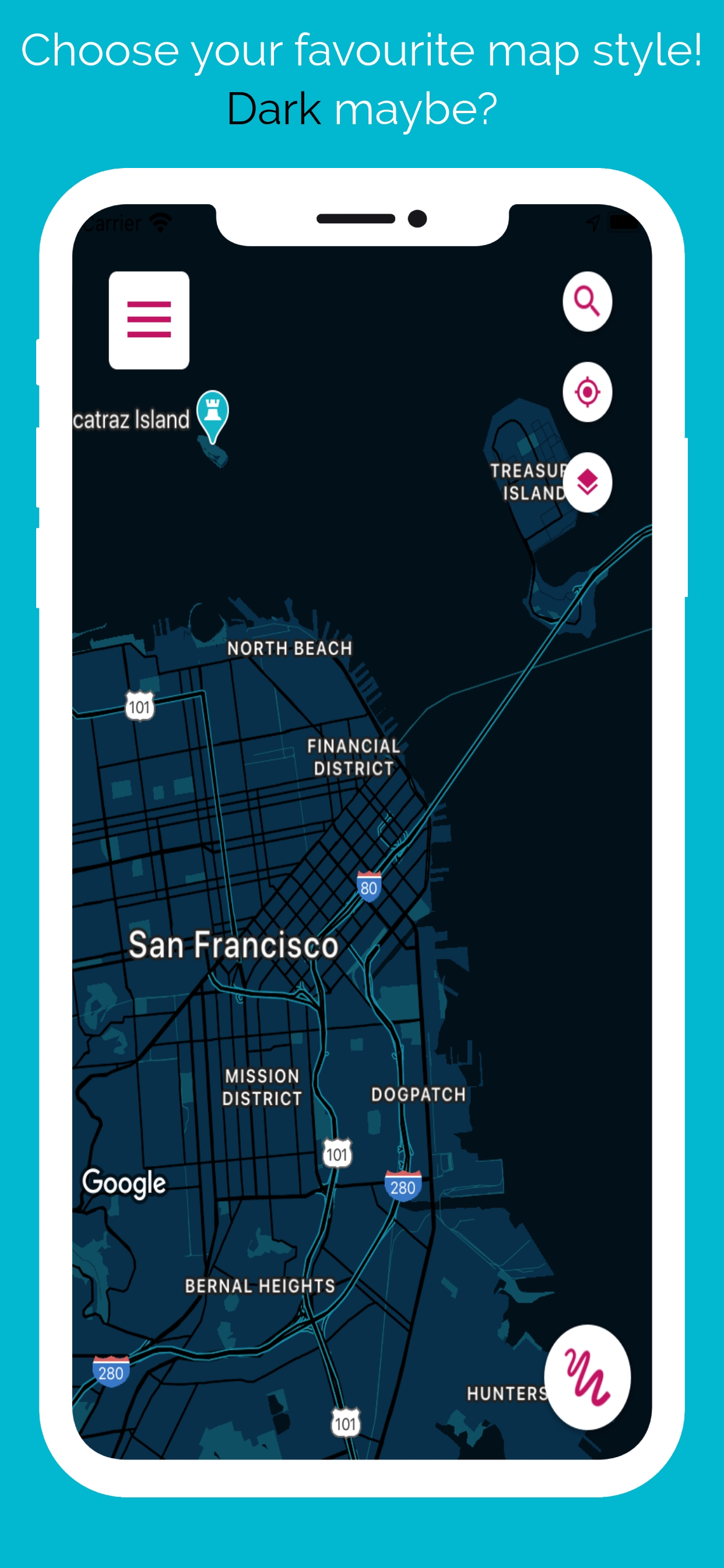
- Snap to roads: Re-align your routes to paths and roads.
- Places search: Search any place to start your route from.
And stay tuned! We keep working on bringing you the best app ever!
Hide..Show more..
In-Apps
JDI VIP
$7.99
JDI VIP Plus
$17.99
Screenshots
User Rating
4.25 out of 5
8 ratings
in Australia
5 star
5
4 star
1
3 star
1
2 star
1
1 star
0
Ratings History
Reviews
Loading problem
Hi I really like your app and have bought the premium version.
I am having major issues with loading after even drawing 300 meters and is making the process of drawing my trip around Australia very painful.
I have even taken off the snap to roads automatically to make the app not work as hard and have now shut down any other options in the settings menu bit it has made no difference at all .
I have a I phone Xs max and have 4G service so I don’t know why I’m having problems.
I hope you can help .
Thanks
Guy
Solid route planner.
Basically you draw a line and save it. You can then follow this. For me that's allowing me to drive along unfamiliar suburban routes.
(This is a planner app, not a route recorder app, in case the reader is also looking at that)
Trial mode is just one short route but MOST importantly, purchase is a reasonable price, you don't get charged for features, and it's not that stupid subscription model which I will never do.
Don't zoom out too far or the snap-to-roads goes all over the shop. I presume that's the google API?
To Jose..
It would be good to have an Open Street Map option.
It would be good if the app didn't default to opening a route with the final node in edit mode. An accidental gesture can mess with the route. Oddly the rest of the settings have no option after save to modify anything so I can't change the route colour or style.
A feature I want to see implemented is a toggle (using the existing centre-my-location button) to keep the current position centered so that I don't have to keep adjusting the map at every stoplight. If you could redraw the blue dot over the top of the route-line that would also help while driving.
Not terribly important but it's odd that only one route can be displayed at a time. A checkbox style route selector could be used to toggle visibility of multiple routes (for comparison or as optional paths while driving).
There's a noticeable lack of bloat which I appreciate but a simple page of helpful notes under the 'about' menu-option would have been good.
I use a completely different tool to _record_ tracks in real time, which this app doesn't do. I haven't needed to import any of those to this app but I'm glad that I can.
Cheers ../cb
It could be awesome
I do a lot of walking and knowing how far l am going to have to walk is important. I love your app but when l use the snap to street function it adds little bits that l dont want. In one trip it added a block to my walk in two different places in another it has me walking through peoples houses.
Im finding that l have to draw my line on the street with no tiny deviations at all otherwise it adds a bit. If l have to do this why have l paid for the snap function as all its doing is making my line straight.