WTH
I get the 1.99 cost for this app,but what was the extra 42.39 for,if you are going to charge this for an app put the full cost up front and not try to rip someone off


Yes, Land Nav Assistant is completely free and it doesn't have any in-app purchases or subscriptions.
✅ The Land Nav Assistant app appears to be high-quality and legitimate. Users are very satisfied.
Land Nav Assistant is free.
To get estimated revenue of Land Nav Assistant app and other AppStore insights you can sign up to AppTail Mobile Analytics Platform.

I get the 1.99 cost for this app,but what was the extra 42.39 for,if you are going to charge this for an app put the full cost up front and not try to rip someone off
This app is awesome, brings you right where you need to go. I downloaded other apps like MIL GPS that cost $12 and this one is much better for 1/6 the cost. Highly recommend!
The application is perfect for training, with integration of satellite imagery it makes land nav a breeze. Needs Apple Watch integration to make it the perfect app for all land nave needs.
Crashes constantly, not useful.
This app would be a 5 stars if the developer adds the Apple Watch functionality to the app. Looking at my phone every time makes the whole event a bit clunky. I should be able to start the app on my phone and then sync it to my watch to me the whole navigation easier. I would pay extra just to have that functionality. I hope the developers hear me out
This is hands down the best app to use to cheat durning land nav as a private helped me sham out and turned what would have taken me 4 hours into an hour long endeavor
Works great on the red diamond course.
Would appreciate an Apple Watch version of the app but it is the best at what it does.
I have used this on several land nav courses and on military convoys. It works perfectly!
Best one hands down. Now I gotta make sure these privates are not using it during land nav ha! Apple watch app next maybe. I'll pay for that
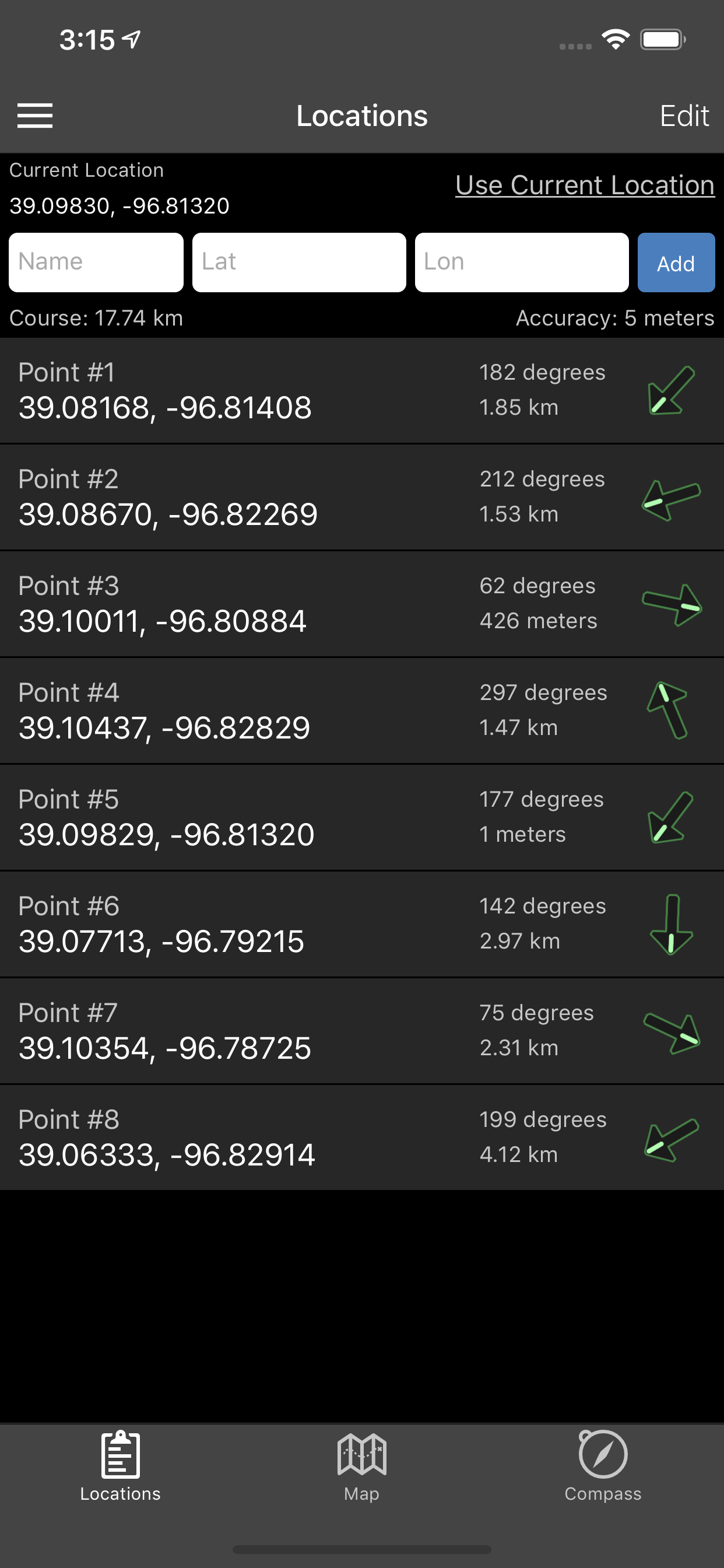
|
Chart
|
Category
|
Rank
|
|---|---|---|
|
Top Paid
|

|
5
|
|
Top Paid
|

|
23
|
|
Top Paid
|

|
29
|
|
Top Paid
|

|
29
|
|
Top Paid
|

|
35
|
