
Description
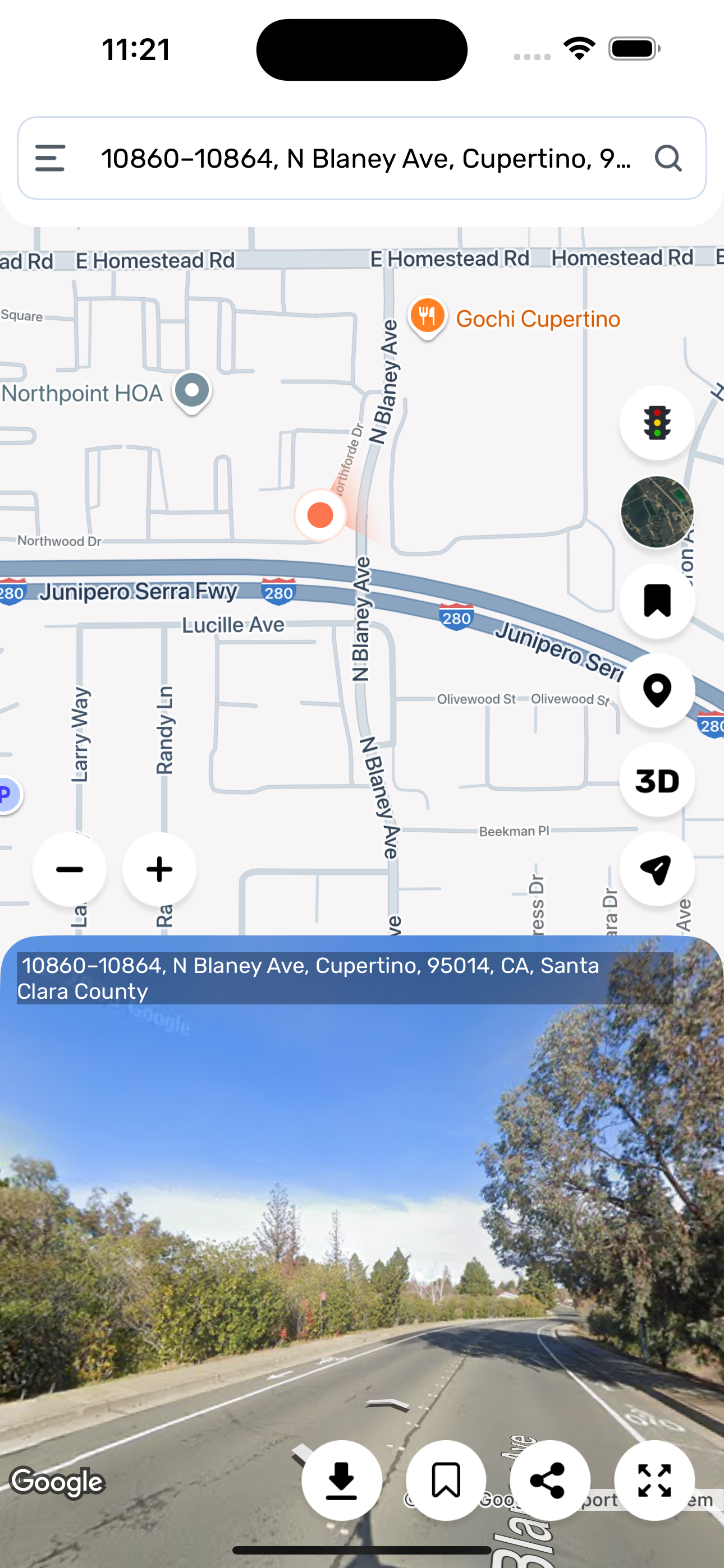
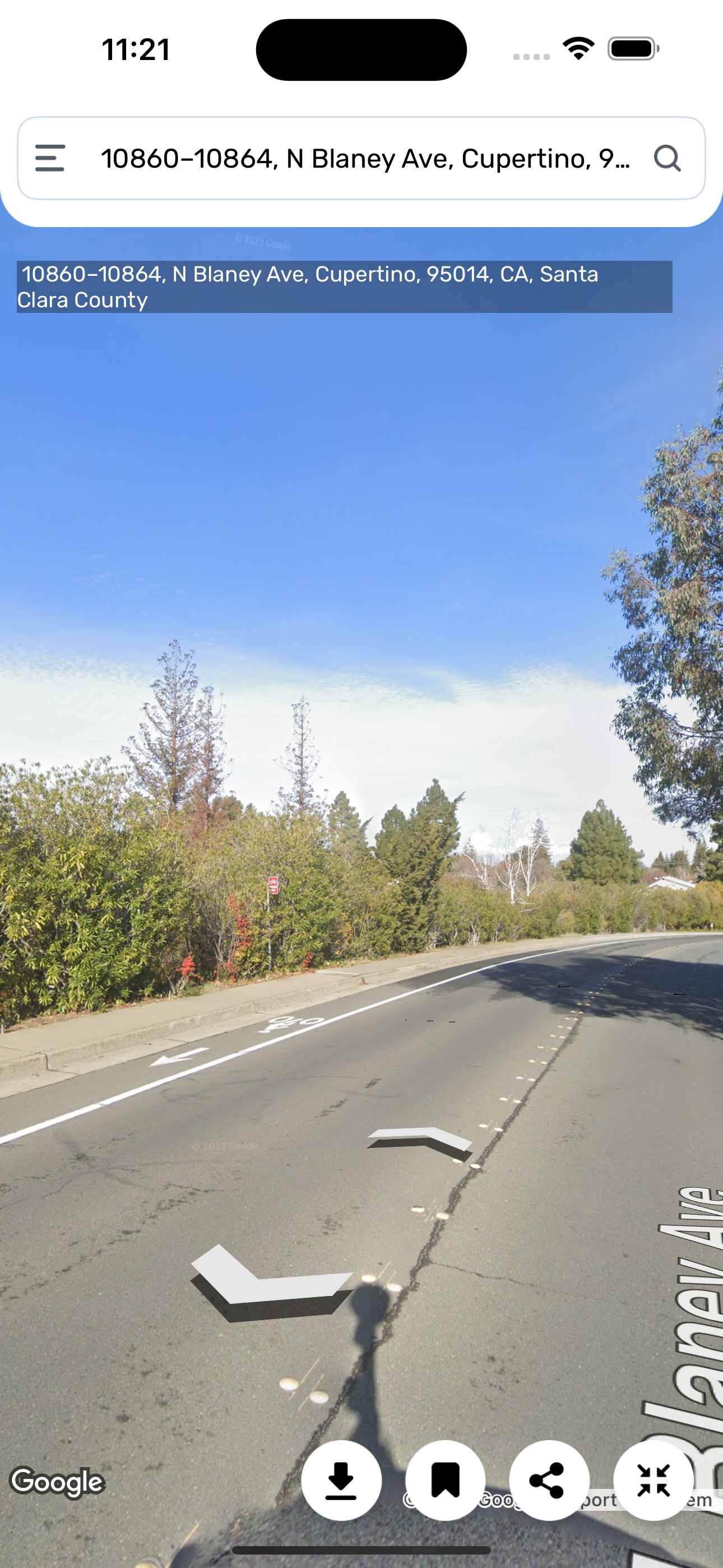
Street View is an app featured in Maps and Earth that provides interactive panoramas from positions along many streets in the world.
Street View earth app has several cities in the United States, and has since expanded to include all of the country's major and minor cities, as well as the cities and rural areas of many other countries worldwide. Streets with Street View imagery available are shown as clickable blue lines on Maps.
Street View displays interactive panoramas of stitched VR photographs. Most photography is done by car, but some is done by tricycle, camel, boat, snowmobile, underwater apparatus, and on foot.
The Live Satellite View GPS Map app includes the Live Earth Camera, Satellite Street View, My Location, Famous Attraction, and Area Distance Calculator. Live Satellite View GPS Map displays interactively panoramas of stitched VR photographs. Photographs are captured by car, But some are captured by tricycle, camel, boat, snowmobile, underwater apparatus, and on foot.
You can explore places from around the world or use your phone to add new images for street view with these options:
• Photo Spheres (360° panoramas)
• Photo Paths (a series of connected photos along a street or trail)
• Street View (connected panoramas from a 360° camera)
Street View Map webcams are an instant source to provide you with views of the place in the world. It is the best app for street views & earth map explorers. Discover the world map with the global map in the Live Satellite View GPS Map app. This app allows you to explore the street view map of the earth globally in 3D. Animated Globe Map 3D makes it trouble-free for you to explore street views & world maps in 3D view. Live Satellite View GPS Map contains GPS Navigation & Voice Navigation to make your drive comfortable.
Benefits:
- Street View Map in 3D.
- 3D panorama street view and show 360 global map navigation.
- Real-time live earth GPS maps Using Speed Cams.
- HD live earth map to discover Famous Places.
your GPS location on Live Street Map App.
Live Satellite View GPS Map app helps you to find hotels, bus stations, banks, and airports. So, You can enjoy your trip and reach your desired location without hassle.
Features:
Live Earth Map HD
- The Satellite World app of world satellite maps can allow you to view the street in your area directly for a 3D panoramic view, find a live map and see both functions. GPS Satellite Direct Maps navigation and direction, finds information about your street.
Live Street View 360°
- Do you want to have a street view panorama 3D live map? It is worth downloading a free Live Street View to see any street live satellite view in real-time. As your Live Street GPS Navigation, you can also arrange your travel plan.
Latest Traffic Highlights
- Mobile Earth Camera and Satellite Mapping share current news for traffic in the area. Live satellite street view. Traffic obstructions and clearances will be mentioned from time to time on Live street view 360.
Download the free Live Satellite View GPS Map app and enjoy a live tour of the world with a live street view.
Subscription Details:
- Payment will be charged to iTunes Account at confirmation of purchase.
- Subscription automatically renews unless auto-renew is turned off at least 24 hours before the end of the current period.
- Account will be charged for renewal within 24 hours before the end of the current period, and identify the renewal cost.
- No cancellation of the current subscription is allowed during the active subscription period.
- Any unused portion of a free trial period, if offered, will be forfeited when the user purchases a subscription to that publication, where applicable.
Important:
Privacy Policy :- https://www.privacypolicycenter.com/view_custom.php?v=QkRoRFh3Q1IzcTlaaE1EaGQ0cTBYQT09&n=Privacy-Policy
Terms of Use :- https://www.privacypolicycenter.com/view_custom.php?v=TXJyWmF1SjFqb0tWeC9yYjVQU0VHQT09&n=Terms-Of-Use
Hide
Show More...
Street View earth app has several cities in the United States, and has since expanded to include all of the country's major and minor cities, as well as the cities and rural areas of many other countries worldwide. Streets with Street View imagery available are shown as clickable blue lines on Maps.
Street View displays interactive panoramas of stitched VR photographs. Most photography is done by car, but some is done by tricycle, camel, boat, snowmobile, underwater apparatus, and on foot.
The Live Satellite View GPS Map app includes the Live Earth Camera, Satellite Street View, My Location, Famous Attraction, and Area Distance Calculator. Live Satellite View GPS Map displays interactively panoramas of stitched VR photographs. Photographs are captured by car, But some are captured by tricycle, camel, boat, snowmobile, underwater apparatus, and on foot.
You can explore places from around the world or use your phone to add new images for street view with these options:
• Photo Spheres (360° panoramas)
• Photo Paths (a series of connected photos along a street or trail)
• Street View (connected panoramas from a 360° camera)
Street View Map webcams are an instant source to provide you with views of the place in the world. It is the best app for street views & earth map explorers. Discover the world map with the global map in the Live Satellite View GPS Map app. This app allows you to explore the street view map of the earth globally in 3D. Animated Globe Map 3D makes it trouble-free for you to explore street views & world maps in 3D view. Live Satellite View GPS Map contains GPS Navigation & Voice Navigation to make your drive comfortable.
Benefits:
- Street View Map in 3D.
- 3D panorama street view and show 360 global map navigation.
- Real-time live earth GPS maps Using Speed Cams.
- HD live earth map to discover Famous Places.
your GPS location on Live Street Map App.
Live Satellite View GPS Map app helps you to find hotels, bus stations, banks, and airports. So, You can enjoy your trip and reach your desired location without hassle.
Features:
Live Earth Map HD
- The Satellite World app of world satellite maps can allow you to view the street in your area directly for a 3D panoramic view, find a live map and see both functions. GPS Satellite Direct Maps navigation and direction, finds information about your street.
Live Street View 360°
- Do you want to have a street view panorama 3D live map? It is worth downloading a free Live Street View to see any street live satellite view in real-time. As your Live Street GPS Navigation, you can also arrange your travel plan.
Latest Traffic Highlights
- Mobile Earth Camera and Satellite Mapping share current news for traffic in the area. Live satellite street view. Traffic obstructions and clearances will be mentioned from time to time on Live street view 360.
Download the free Live Satellite View GPS Map app and enjoy a live tour of the world with a live street view.
Subscription Details:
- Payment will be charged to iTunes Account at confirmation of purchase.
- Subscription automatically renews unless auto-renew is turned off at least 24 hours before the end of the current period.
- Account will be charged for renewal within 24 hours before the end of the current period, and identify the renewal cost.
- No cancellation of the current subscription is allowed during the active subscription period.
- Any unused portion of a free trial period, if offered, will be forfeited when the user purchases a subscription to that publication, where applicable.
Important:
Privacy Policy :- https://www.privacypolicycenter.com/view_custom.php?v=QkRoRFh3Q1IzcTlaaE1EaGQ0cTBYQT09&n=Privacy-Policy
Terms of Use :- https://www.privacypolicycenter.com/view_custom.php?v=TXJyWmF1SjFqb0tWeC9yYjVQU0VHQT09&n=Terms-Of-Use
Screenshots

Q7 Survey FAQ
-
Is Q7 Survey free?
Yes, Q7 Survey is completely free and it doesn't have any in-app purchases or subscriptions.
-
Is Q7 Survey legit?
Not enough reviews to make a reliable assessment. The app needs more user feedback.
Thanks for the vote -
How much does Q7 Survey cost?
Q7 Survey is free.
-
What is Q7 Survey revenue?
To get estimated revenue of Q7 Survey app and other AppStore insights you can sign up to AppTail Mobile Analytics Platform.

User Rating
App is not rated in Malta yet.
Ratings History
Q7 Survey Reviews
Store Rankings
Ranking History
App Ranking History not available yet
Category Rankings
App is not ranked yet
Live Street View Earth Installs
Last 30 days
Live Street View Earth Revenue
Last 30 daysQ7 Survey Revenue and Downloads
Gain valuable insights into Live Street View Earth performance with our analytics.
Sign up now to access downloads, revenue, and more.
Sign up now to access downloads, revenue, and more.
App Info
- Category
- Utilities
- Publisher
- Shraddha Limbasiya
- Languages
- Arabic, Bengali, English, French, German, Hindi, Italian, Japanese, Malay, Persian, Portuguese, Russian, Chinese, Spanish, Urdu
- Recent release
- 1.4 (2 months ago )
- Released on
- Apr 10, 2024 (1 year ago )
- Also available in
- United States, India, Canada, Brazil, Belgium, Kazakhstan, Poland, Nepal, Kuwait, Slovakia, Saudi Arabia, North Macedonia, Malta, Lebanon, Chile, Algeria, South Korea, Ecuador, Sweden, Dominican Republic, Türkiye, Nigeria, Egypt, Philippines, United Kingdom, Czechia, Switzerland, Japan, Brunei, Madagascar, Sri Lanka, South Africa, Ireland, Vietnam, Spain, Romania, Peru, Pakistan, Italy, Bulgaria, Latvia, France, Thailand, Hungary, Israel, Finland, New Zealand, Armenia, Colombia, Croatia, Belarus, Bahrain, Denmark, Malaysia, United Arab Emirates, Lithuania, Uzbekistan, Iceland, Austria, Slovenia, Mexico, Luxembourg, Taiwan, Indonesia, Greece, Tunisia, Cyprus, Azerbaijan, Portugal, Norway, Netherlands, China, Russia, Argentina, Hong Kong SAR China, Singapore, Ukraine, Germany, Australia
- Last Updated
- 6 months ago
This page includes copyrighted content from third parties, shared solely for commentary and research in accordance with fair use under applicable copyright laws. All trademarks, including product, service, and company names or logos, remain the property of their respective owners. Their use here falls under nominative fair use as outlined by trademark laws and does not suggest any affiliation with or endorsement by the trademark holders.