
Marine Chart Symbols
#1 Keyword Rankings
Today
Top 10 Rankings
Today
Top 30 Rankings
Today
Top 100 Rankings
Today
Description
Complete reference for symbols, abbreviations and terms used in marine charts. Useful as an aid for teaching and learning, or as reminder for experienced sailors and sea cartography users.
INCLUDES
- Comprehensive coverage: more than 800 symbols and abbreviations.
- Full content tree, organised for ease of use.
- Index and grouped index for all entries.
- Search facility.
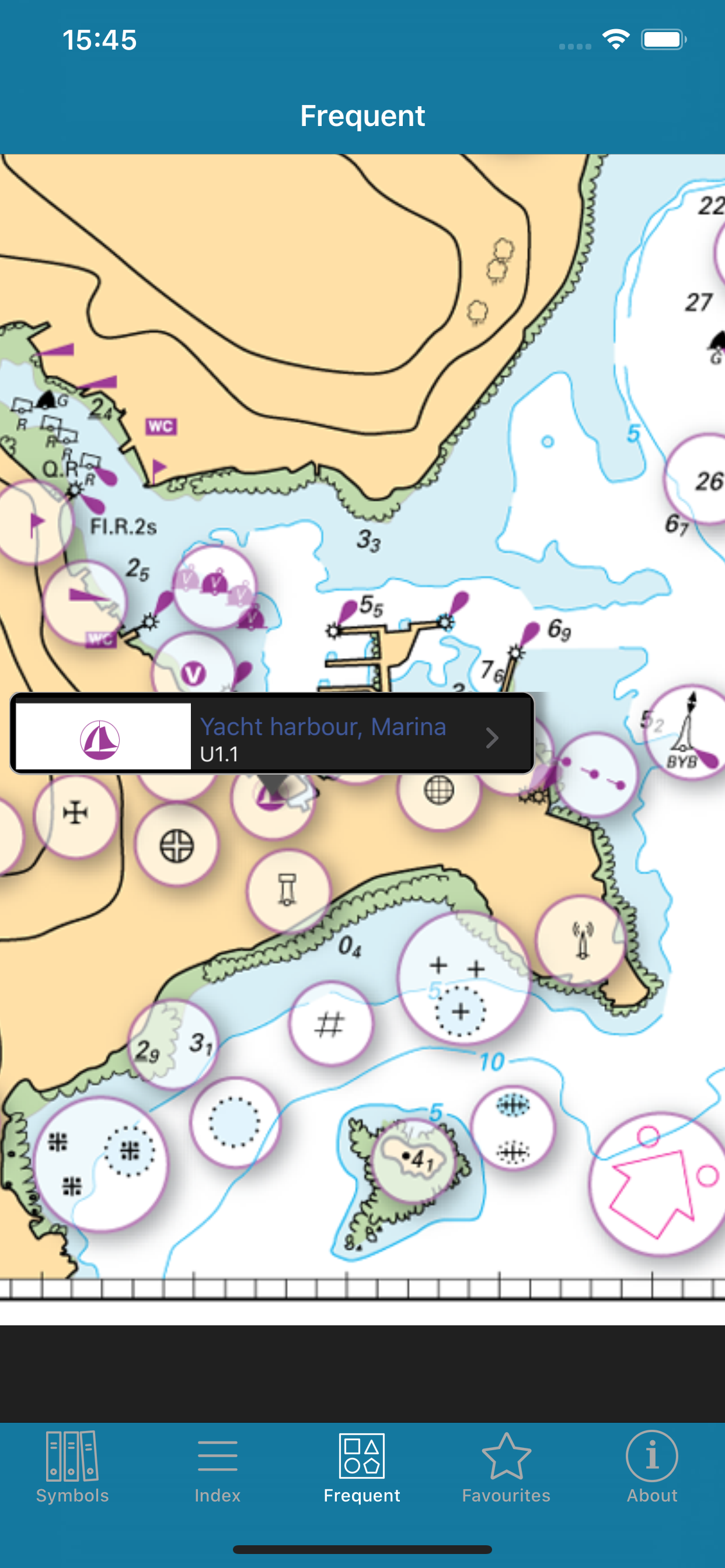
- Sample chart with visual popups for commonly used symbols.
- Favourites: archive your best symbols.
- Multi-language within the app (English/French).
Full international standard from the IHO.All topics from the IHO, UKHO, SHOM, NOAA, CHS and other hydrographic offices:
position, distance, direction, compass, features, landmarks, ports, tides, currents, seabed, rocks, wrecks, obstructions, offshore, tracks, routes, areas, limits, lights, buoys, beacons, fog, radar, radio, services, small craft.
LANGUAGES
English, French, German, Italian, Spanish
ABOUT US
Imray are a leading chart and marine book publishers, based in England and with a catalogue of charts for Europe, the Mediterranean and the Caribbean. Imray's pilot books cover the whole world in extensive detail.
In partnership with Imray, software developers and sailors.
Follow us on Twitter - http://twitter.com/imray_charts
Facebook - imraynautical
Look out for other applications in the Marine Navigation Series from Imray:
TIDES PLANNER - tide predictions any date
RULES & SIGNALS- Rule of the Road, signals at sea.
RACING RULES - RYA Handy Guide to rules for sailing races
Hide..
Show more..
INCLUDES
- Comprehensive coverage: more than 800 symbols and abbreviations.
- Full content tree, organised for ease of use.
- Index and grouped index for all entries.
- Search facility.
- Sample chart with visual popups for commonly used symbols.
- Favourites: archive your best symbols.
- Multi-language within the app (English/French).
Full international standard from the IHO.All topics from the IHO, UKHO, SHOM, NOAA, CHS and other hydrographic offices:
position, distance, direction, compass, features, landmarks, ports, tides, currents, seabed, rocks, wrecks, obstructions, offshore, tracks, routes, areas, limits, lights, buoys, beacons, fog, radar, radio, services, small craft.
LANGUAGES
English, French, German, Italian, Spanish
ABOUT US
Imray are a leading chart and marine book publishers, based in England and with a catalogue of charts for Europe, the Mediterranean and the Caribbean. Imray's pilot books cover the whole world in extensive detail.
In partnership with Imray, software developers and sailors.
Follow us on Twitter - http://twitter.com/imray_charts
Facebook - imraynautical
Look out for other applications in the Marine Navigation Series from Imray:
TIDES PLANNER - tide predictions any date
RULES & SIGNALS- Rule of the Road, signals at sea.
RACING RULES - RYA Handy Guide to rules for sailing races
Screenshots


 User Rating
0 out of 5
0 ratings in Russia
Ratings History
Reviews
App doesn't have any reviews yet
Store Rankings
Ranking History
App Ranking History not available yet
Category Rankings
|
Chart
|
Category
|
Rank
|
|---|---|---|
|
Top Paid
|

|
34
|
|
Top Paid
|

|
35
|
|
Top Paid
|

|
41
|
|
Top Paid
|

|
42
|
|
Top Paid
|

|
44
|
Keywords
Users may also like
| Name | Reviews | Recent release | |
|---|---|---|---|

Boat Beacon
AIS Marine Navigation
|
0
|
7 months ago | |

Anchor Watch
Guardian of your vessel
|
2
|
10 months ago | |

Premier Marinas
Weather & Tidal Information
|
0
|
2 weeks ago | |

iStreams Solent
|
0
|
3 months ago | |

SailTies: Logbook GPS Tracking
Sailing Resume, Qualifications
|
0
|
1 month ago | |

iStreams English Channel
Smart tidal streams utility
|
0
|
3 months ago | |
iStreams Thames Estuary
|
0
|
3 months ago | |

iStreams Channel Islands
|
0
|
3 months ago | |

iStreams North Sea (NW)
|
0
|
3 months ago | |

AngelNav
Charting app made by sailors
|
1
|
1 month ago |
Show More
Revenue and Downloads
Gain valuable insights into Marine Chart Symbols performance with our analytics. Sign up now
to
access downloads, revenue, and more.
App Info
- Category
- Navigation
- Publisher
- Imray, Laurie, Norie & Wilson LTD
- Languages
- English, French, German, Italian, Japanese, Spanish
- Recent version
- 2.1.2 (1 day ago )
- Released on
- Feb 19, 2010 (14 years ago )
- Also available in
- United States, United Kingdom, Germany, Italy, United Arab Emirates, Spain, Portugal, Malaysia, New Zealand, Norway, Netherlands, Nigeria, Pakistan, Mexico, Lebanon, Kazakhstan, Kuwait, South Korea, Peru, Philippines, India, Poland, Romania, Russia, Saudi Arabia, Sweden, Singapore, Thailand, Turkey, Taiwan, Ukraine, Vietnam, South Africa, Denmark, Argentina, Austria, Australia, Azerbaijan, Belgium, Brazil, Belarus, Canada, Switzerland, Chile, China, Colombia, Czechia, Japan, Dominican Republic, Algeria, Ecuador, Egypt, Finland, France, Greece, Hong Kong, Hungary, Indonesia, Ireland, Israel
- Last updated
- 1 month ago