Marine Navigation - Canada
Fishing Spots + Depth Charts
#1 Keyword Rankings
Today
Top 10 Rankings
Today
Top 30 Rankings
Today
Top 100 Rankings
Today
Description
GPS Marine Charts App offers access to charts covering Canada (derived from CHS data). Only marine GPS app to have route assistance with Voice Prompts for marine navigation. It has route manager to create new boating routes or import existing GPX/KML routes. It supports Nautical Charts course up orientation.
Please visit
http://gpsnauticalcharts.com/main/ca-nautical-charts-by-folio.html for
complete list. If you don't find the chart for Canada , please contact us at support at gpsnauticalcharts.com.
(Includes coverage for Trent Severn Waterway incl. lake Simcoe etc.)
* Voice Prompts for marine navigation (requires GPS )
-prompts when approaching a boating route marker
-Continous distance and ETA updates
-Alerts when sailing/boating off route
-Alerts when boating in wrong direction
*Route Editing/Creation
-Create routes from scratch
-Edit existing GPX/KML routes.
-Add custom description to any route point.
-Drop markers along route.
* Offline charts derived from CHS data.
-Visually draw area to download
-Textual search
-Catalog (By state, region and coast guard district)
-Charts reprojected for WGS84 datum
*Seamless chart quilting of marine charts
*Distance Bearing tool
*Create custom way points
- Using GPS
-Select point on map
-Manually enter latitude & longitude coordinates
*POI layer for marine charts
- Overlay POIs
- POI list derived from the equivalent ENC and contains all categories including Buoy, Light, Harbour facility, Obstr.
*Search POIs/Way points
*Pan/Zoom/My Location
* Record Marine GPS tracks
* View tracks overlay
* Live track animation
* Track analytics/stats
* Export GPX tracks.
-Export to SDCard
-Share GPX trakcs with friends.
* Auto Follow Mode (Course up)
-Continuously updates boat's location on chart
- Adjustable update frequency
Sample Nautical Charts (please visit http://www.gpsnauticalcharts.com/ for complete list)
Pacific Coast - Vancouver Island East & West - Haida Gwaii
Great lakes Canada and St. Lawrence river
Trent-Severn Waterway
BALSAM LAKE
BALSAM LAKE TO/À BOLSOVER (LOCK/ÉCLUSE)
BOLSOVER (LOCK/ÉCLUSE) TO/AU LAKE SIMCOE
CAMERON LAKE
CHEMONG LAKE
ÉCLUSES DE HEALY FALLS LOCKS TO/AU RICE LAKE
LAKE COUCHICHING - LAKE SIMCOE TO/À COUCHICHING LOCK/L'ÉCLUSE DE COUCHICHING
LAKEFIELD
LAKEFIELD LOCK/ÉCLUSE 26
LAKEFIELD TO/À BURLEIGH FALLS
LAKE SCUGOG
LAKE SIMCOE
PETERBOROUGH TO/À LAKEFIELD
PIGEON LAKE (NORTH PORTION/PARTIE NORD)
PIGEON LAKE (SOUTH PORTION/PARTIE SUD)
RICE LAKE
RICE LAKE TO/À PETERBOROUGH
STONY LAKE
STURGEON LAKE
Lake Erie \ Lac Erie
Lake Huron\Lac Huron
Lake Huron\Lac Huron (Southern Portion\Partie sud)
Lake Ontario\Lac Ontario
Lake Ontario\Lac Ontario, Western Portion\Partie ouest
Lake St. Francis
Lake Superior\Lac Superieur
Vancouver Harbour, Central Portion\Partie Centrale
Vancouver Harbour, Eastern Portion\Partie Est
Vancouver Harbour, Western Portion\Partie Ouest
Vancouver Island\Ile de Vancouver, Juan de Fuca Strait to\a Queen Charlotte
Strait of Georgia
BARRIE
BATAWA LOCK / ÉCLUSE 4
BEAVERTON HARBOUR
BENSFORT BRIDGE TO/À PETERBOROUGH
BIG CHUTE
BIG CHUTE MARINE RAILWAYS BER ROULANT
BIG CHUTE TO / À PORT SEVERN
BOBCAYGEON - LOCK/ÉCLUSE 32
BOBCAYGEON - LOCK/ÉCLUSE 32
BOBGAYGEON - LOCK/ÉCLUSE 32
BUCKHORN
BUCKHORN - LOCK/ÉCLUSE 31
BUCKHORN TO/À GANNON NARROWS AND/ET HARRINGTON NARROWS
BURLEIGH FALLS
BURLEIGH FALLS LOCK/ÉCLUSE 28
BURLEIGH FALLS TO/À BUCKHORN
CAMPBELLFORD LOCK / ÉCLUSE 13
COOK'S BAY AND/ET HOLLAND RIVER
COUCHICHING LOCK / ÉCLUSE 42
COUCHICHING LOCK TO BIG CHUTE ÉCLUSE COUCHICHING À BIG CHUTE
CROWE BAY LOCK / ÉCLUSE 14
DOURO LOCK/ÉCLUSE 24
FENELON FALLS - LOCK/ÉCLUSE 34
FRANKFORD LOCK / ÉCLUSE 6
GANNON NARROWS TO/À BOBCAYGEON
GLEN MILLER LOCK / ÉCLUSE
GLEN ROSS LOCK
PLEASE NOTE: Continued use of GPS running in the background can dramatically decrease battery life.
Hide..
Show more..
Please visit
http://gpsnauticalcharts.com/main/ca-nautical-charts-by-folio.html for
complete list. If you don't find the chart for Canada , please contact us at support at gpsnauticalcharts.com.
(Includes coverage for Trent Severn Waterway incl. lake Simcoe etc.)
* Voice Prompts for marine navigation (requires GPS )
-prompts when approaching a boating route marker
-Continous distance and ETA updates
-Alerts when sailing/boating off route
-Alerts when boating in wrong direction
*Route Editing/Creation
-Create routes from scratch
-Edit existing GPX/KML routes.
-Add custom description to any route point.
-Drop markers along route.
* Offline charts derived from CHS data.
-Visually draw area to download
-Textual search
-Catalog (By state, region and coast guard district)
-Charts reprojected for WGS84 datum
*Seamless chart quilting of marine charts
*Distance Bearing tool
*Create custom way points
- Using GPS
-Select point on map
-Manually enter latitude & longitude coordinates
*POI layer for marine charts
- Overlay POIs
- POI list derived from the equivalent ENC and contains all categories including Buoy, Light, Harbour facility, Obstr.
*Search POIs/Way points
*Pan/Zoom/My Location
* Record Marine GPS tracks
* View tracks overlay
* Live track animation
* Track analytics/stats
* Export GPX tracks.
-Export to SDCard
-Share GPX trakcs with friends.
* Auto Follow Mode (Course up)
-Continuously updates boat's location on chart
- Adjustable update frequency
Sample Nautical Charts (please visit http://www.gpsnauticalcharts.com/ for complete list)
Pacific Coast - Vancouver Island East & West - Haida Gwaii
Great lakes Canada and St. Lawrence river
Trent-Severn Waterway
BALSAM LAKE
BALSAM LAKE TO/À BOLSOVER (LOCK/ÉCLUSE)
BOLSOVER (LOCK/ÉCLUSE) TO/AU LAKE SIMCOE
CAMERON LAKE
CHEMONG LAKE
ÉCLUSES DE HEALY FALLS LOCKS TO/AU RICE LAKE
LAKE COUCHICHING - LAKE SIMCOE TO/À COUCHICHING LOCK/L'ÉCLUSE DE COUCHICHING
LAKEFIELD
LAKEFIELD LOCK/ÉCLUSE 26
LAKEFIELD TO/À BURLEIGH FALLS
LAKE SCUGOG
LAKE SIMCOE
PETERBOROUGH TO/À LAKEFIELD
PIGEON LAKE (NORTH PORTION/PARTIE NORD)
PIGEON LAKE (SOUTH PORTION/PARTIE SUD)
RICE LAKE
RICE LAKE TO/À PETERBOROUGH
STONY LAKE
STURGEON LAKE
Lake Erie \ Lac Erie
Lake Huron\Lac Huron
Lake Huron\Lac Huron (Southern Portion\Partie sud)
Lake Ontario\Lac Ontario
Lake Ontario\Lac Ontario, Western Portion\Partie ouest
Lake St. Francis
Lake Superior\Lac Superieur
Vancouver Harbour, Central Portion\Partie Centrale
Vancouver Harbour, Eastern Portion\Partie Est
Vancouver Harbour, Western Portion\Partie Ouest
Vancouver Island\Ile de Vancouver, Juan de Fuca Strait to\a Queen Charlotte
Strait of Georgia
BARRIE
BATAWA LOCK / ÉCLUSE 4
BEAVERTON HARBOUR
BENSFORT BRIDGE TO/À PETERBOROUGH
BIG CHUTE
BIG CHUTE MARINE RAILWAYS BER ROULANT
BIG CHUTE TO / À PORT SEVERN
BOBCAYGEON - LOCK/ÉCLUSE 32
BOBCAYGEON - LOCK/ÉCLUSE 32
BOBGAYGEON - LOCK/ÉCLUSE 32
BUCKHORN
BUCKHORN - LOCK/ÉCLUSE 31
BUCKHORN TO/À GANNON NARROWS AND/ET HARRINGTON NARROWS
BURLEIGH FALLS
BURLEIGH FALLS LOCK/ÉCLUSE 28
BURLEIGH FALLS TO/À BUCKHORN
CAMPBELLFORD LOCK / ÉCLUSE 13
COOK'S BAY AND/ET HOLLAND RIVER
COUCHICHING LOCK / ÉCLUSE 42
COUCHICHING LOCK TO BIG CHUTE ÉCLUSE COUCHICHING À BIG CHUTE
CROWE BAY LOCK / ÉCLUSE 14
DOURO LOCK/ÉCLUSE 24
FENELON FALLS - LOCK/ÉCLUSE 34
FRANKFORD LOCK / ÉCLUSE 6
GANNON NARROWS TO/À BOBCAYGEON
GLEN MILLER LOCK / ÉCLUSE
GLEN ROSS LOCK
PLEASE NOTE: Continued use of GPS running in the background can dramatically decrease battery life.
In-Apps
- MARINE NAVIGATION / CHARTS USA
- ¥2,200
- MARINE NAVIGATION/CHART-CANADA
- ¥3,000
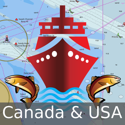
- Canada & USA - GPS Nautical Charts
- ¥3,500
Screenshots


 User Rating
0 out of 5
0 ratings in Japan
Ratings History
Reviews
App doesn't have any reviews yet
Store Rankings
Ranking History
App Ranking History not available yet
Category Rankings
|
Chart
|
Category
|
Rank
|
|---|---|---|
|
Top Paid
|

|
48
|
|
Top Grossing
|
|
64
|
|
Top Paid
|

|
362
|
|
Top Paid
|

|
421
|
Keywords
Users may also like
| Name | Reviews | Recent release | |
|---|---|---|---|

USA Lakes and Parks trails
Lakes And Parks Offline Charts
|
0
|
2 years ago | |

iSailGPS : NOAA USA RNC Charts
Marine Nautical Chart Plotter
|
0
|
2 weeks ago | |

Flytomap All in One HD Charts
Charts & Maps GPS Navigator
|
0
|
2 weeks ago | |
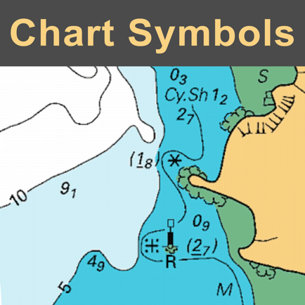
NAUTICAL CHART SYMBOLS & ABBRE
Essential reference
|
0
|
6 years ago | |
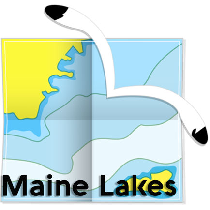
Maine Lakes - GPS fishing maps
|
0
|
1 year ago | |

Minnesota Lakes Fishing Charts
Same detail as a Chart Plotter
|
0
|
2 years ago | |

Bike Path Toronto
Bike paths and bike racks
|
0
|
2 months ago | |

Great Lakes HD Nautical Charts
Same detail as a Chart plotter
|
0
|
1 year ago | |

Ghosts of St Augustine
Walking audio tour
|
0
|
3 years ago | |

Zas Tours - Greek Excursions
Tours & Activities in Greece
|
0
|
10 months ago |
Show More
Revenue and Downloads
Gain valuable insights into Marine Navigation - Canada performance with our analytics. Sign up now
to
access downloads, revenue, and more.
App Info
- Category
- Navigation
- Publisher
- Bist LLC
- Languages
- English, Dutch, Finnish, French, German, Norwegian Bokmål, Russian, Swedish
- Recent version
- 136.0.0 (8 months ago )
- Released on
- Feb 25, 2013 (11 years ago )
- Also available in
- Canada, United States, France, United Kingdom, Peru, Pakistan, New Zealand, Norway, Netherlands, Nigeria, Malaysia, Mexico, Lebanon, Kazakhstan, Kuwait, South Korea, Japan, Philippines, India, Poland, Portugal, Romania, Russia, Saudi Arabia, Sweden, Singapore, Thailand, Turkey, Taiwan, Ukraine, Vietnam, South Africa, Denmark, Argentina, Austria, Australia, Azerbaijan, Belgium, Brazil, Belarus, Switzerland, Chile, China, Colombia, Czechia, Germany, Italy, Dominican Republic, Algeria, Ecuador, Egypt, Spain, Finland, Greece, Hong Kong, Hungary, Indonesia, Ireland, Israel, United Arab Emirates
- Last updated
- 1 month ago