For everyday, leisure, mountain bike and racing bike Naviki provides ideal connections between any start and destination, it immediately shows your routes on a map and navigates to your target by spoken navigation instructions and arrows on the displayed map. Naviki easily records your own trips and synchronises them with www.naviki.org. The result is an impressive personal collection of routes. Simple and practical: Plan routes on www.naviki.org and transmit them to the App by just one click.
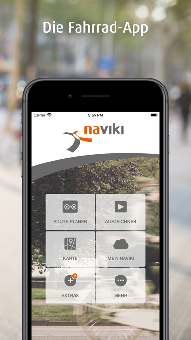
Naviki’s most important functions at a glance:
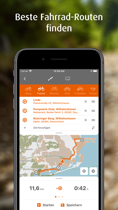
ROUTE PLANNER
Simply enter your start and destination, immediately get your customised route with the most important additional information.
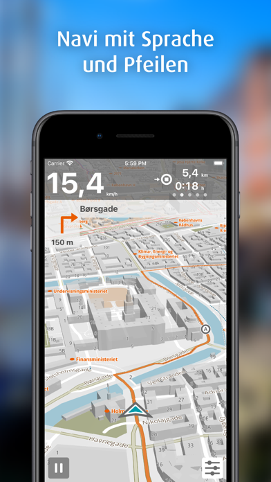
TURN-BY-TURN NAVIGATION
Spoken instructions and pleasantly large navigation arrows on your display. By means of spoken instructions, the phone can remain in your pocket which is energy-saving. Spontaneous deviation from a planned route is no problem - Naviki automatically calculates a new route to your destination.
EVERYDAY ROUTING
Gives you the cycle tracks for your daily activities. Prefers minor roads, bicycle lanes, rather short and straight routes as well as easy accessible and solid surfaces.
LEISURE ROUTING
Your cycle routes for tourism and leisure activities. Prefers officially signposted cycle tracks, easy accessible and solid surfaces, minor roads and a nice natural environment.
MOUNTAIN BIKE ROUTING
Your routes for great MTB experiences! Prefers unsealed surfaces, single trails, distinguished and signposted MTB routes as well as forest and country tracks.
RACING BIKE ROUTING
Racing bike routes for fascinating fast trips! Prefers sealed and smooth surfaces, tracks allowing high-speed cycling, minor roads, a scenic environment.
S-PEDELEC ROUTING
Tailored routes for fast e-bikes up to 30 mph on roads allowing power-driven vehicles. Prefers minor roads and a nice environment whenever possible.
ROUND TRIPS
Just enter a start and a required length – Naviki calculates numerous alternative round trips to choose from for immediate navigation.
OFFLINE MAPS
Download high quality Naviki maps on your smartphone and use them independent of internet access.
HEIGHT PROFILE
For all routes Naviki provides a height profile, the highest and lowest points and the total altitude to be cycled upwards.
SPEED PROFILE
Records your speed data in the course of your trips and shows it as a graph.
CONNECT FITNESS DEVICES
Connect fitness devices via Bluetooth Low Energy (BLE) and see your pulse and cadence data as a graph.
CONVENIENT COCKPIT
Speed, average speed, distance traveled and distance to your target always in view.
MAP VIEWS
A proper map always at hand: choose between standard and bicycle map view.
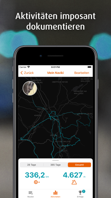
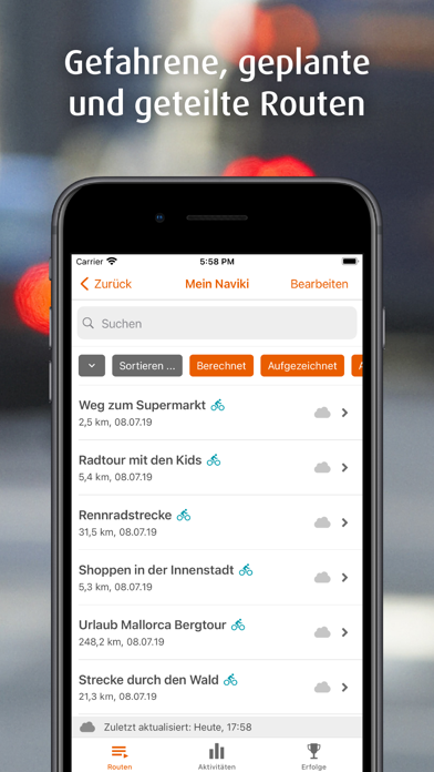
RECORD YOUR OWN TRIPS
Just one tap and Naviki records the trip you cycle and stores it in your personal Naviki Cloud. Easily create an impressive overview on www.naviki.org! You can add an individual description to each route.
MEMORISE ROUTES
Plan comfortably on the web and transmit your routes from www.naviki.org to your Naviki App by just one click.
TURN BY TURN INSTRUCTIONS FOR ALL ROUTES
Naviki provides turn-by-turn instructions for paths of arbitrary origin, including those you recorded with Naviki.
MY ROUTES
Clearly arranged lists show your recorded paths and the routes you calculated via web or Naviki App.
CONNECTIVITY
Via Bluetooth Naviki sends the distance to the next turn and navigation arrows to the coachsmart display (www.o-synce-shop.de – saves battery power, your phone remains in the pocket).
Apple Health integration on the Apple Watch app
The continuous use of GPS in the background can significantly shorten battery life.
EULA: https://www.apple.com/legal/internet-services/itunes/dev/stdeula/
Die Naviki-App ist schön gestaltet, aber es hapert ausgerechnet in der Kernfunktionalität. Was soll ein Fahrradnavi tun: Es soll gute Strecken finden, sodass man sich für eine entscheiden und sie dann vom Navi geleitet fahren kann. Aber bereits das Finden der Strecken ist mühsam: Man muss zur Streckensuche zurück und die Adresse jedes Mal neu eingeben, wenn man das Streckenprofil ändern will (Alltag/ Rennrad/ Freizeit/ S-Pedelec), was soll das? Es werden teils abenteuerliche Strecken vorgeschlagen, die über schmale, steile Kieswege führen, die man ganz einfach umfahren könnte. Und die Navigation ist schlimm: Denn die Standortanzeige hält sich nicht an die Straßen und Wege, sondern bewegt sich frei auf der Karte. Das heißt wenn das Navi an unübersichtlichen Stellen, z.B. einem Kreisel, nicht mehr auf den Meter genau weiß, wo man ist, verliert man schnell den Überblick, wo man denn nun langfahren soll. Ganz ehrlich, wer hat das programmiert? Ich habe verschiedene In-App-Pakete gekauft, u.a. für Sprachnavigation, Freizeit und Rennrad, aber ich bereue es.
Fehlerhaft
Der chatbot ist unbrauchbar.
Meine Frage war: seit kurzem funktioniert die Höhenangabe nicht mehr. Es steht immer 0 Meter nach einer Tour.
Chatbot‘s Antwort: schade dass sie die app löschen möchten. So ein Unsinn.
Was ist nun die Antwort auf meine Frage?
Danke!
Top app ebike
Excellente application le top Pour tous utilisation en vélo.
Dommage qu’on ne puisse afficher plus de cinq catégorie d’information.
Sehr gute grenzüberschreitende Radapp
Nach 4 Jahren auf vielen Langstrecken Touren in CH - D - A immer noch die zuverlässige App die jede Adresse findet und die Route zu 99% perfekt legt. Praktisch und ohne Schnickschnack.
Ungeeignet in der Schweiz
Die ist in der Schweiz für S-Pedelecs nicht brauchbar. Sie nutzt nicht die Velowege die hier erlaubt sind, sondern schickt einen über Strassen. Dadurch sind die Routen völlig unbrauchbar.
Kein Hinweis beim Kaufen, einfach Abzocke - Finger weg!
Offline-Karten nicht in Familienfreigabe
Offline-Karten sind nicht Teil der Familienfreigabe!
Unfangreiches, nützliches Velo-Navi
Jetzt funktiniert es, wie gewünscht. Registrierungsprozess klemmt, aber über Apple-ID klappt es.
Sehr gut mit kleinen Einschränkungen
Die App zeigt mir sehr gute MTB-Routen hier in den Alpen. Damit bin ich sehr zufrieden!
Meine Anregungen:
-Oft liegen die MTB-Routen weit über meinem persönlichen Niveau, da würde ich sehr gerne den Schwierigkeitsgrad regulieren können.
-Wenn ich den vorgesehenen Weg nicht schaffe, wäre ein Button „Schlag was anderes vor“ überaus hilfreich.
-Und wenn ich meine Route für einen Kilometer verlassen habe, allerspätestens dann sollte das Programm verstehen, dass ich nun nicht mehr umkehren will, sondern sollte die Route einfach neu berechnen. Oder eben einen Knopf für Alternativen haben.
Und dann gibt’s auch 5 Sterne. Könnte man 20 vergeben, ich gäbe Euch 19 😉
Routen ok
Karten runterladen sehr wenig intuitiv
Alle Jahre gerne wieder
Bin seit 2019 jedes Jahr über 1‘000 km auf längeren Touren unterwegs. Die App hat mich noch nie im Stich gelassen und findet wirklich alles und vorallem tolle Routen. Immer wieder begeistert (Kaufversion lohnt sich)