
Oceanodesy
#1 Keyword Rankings
Today
Top 10 Rankings
Today
Top 30 Rankings
Today
Top 100 Rankings
Today
Description
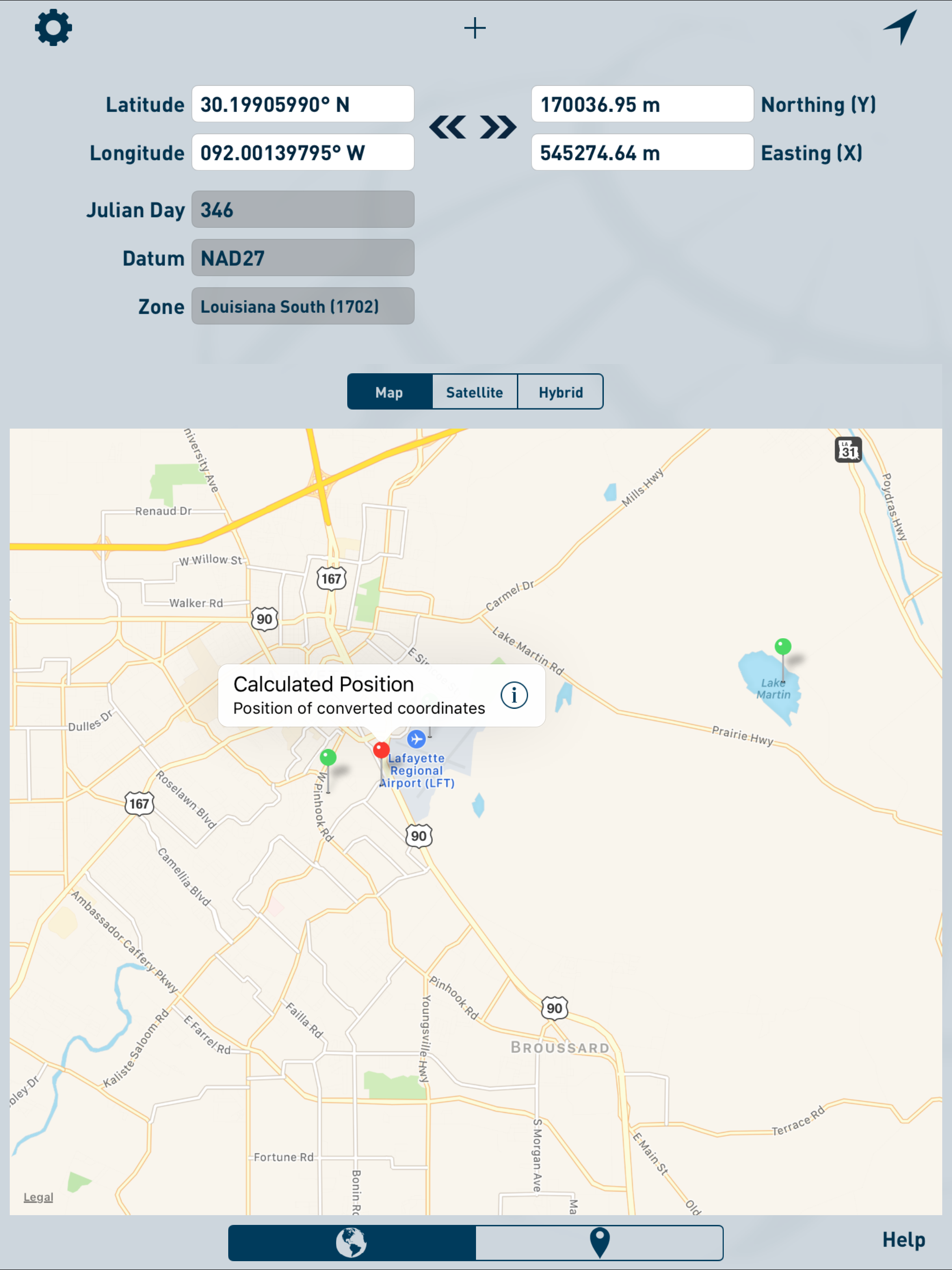
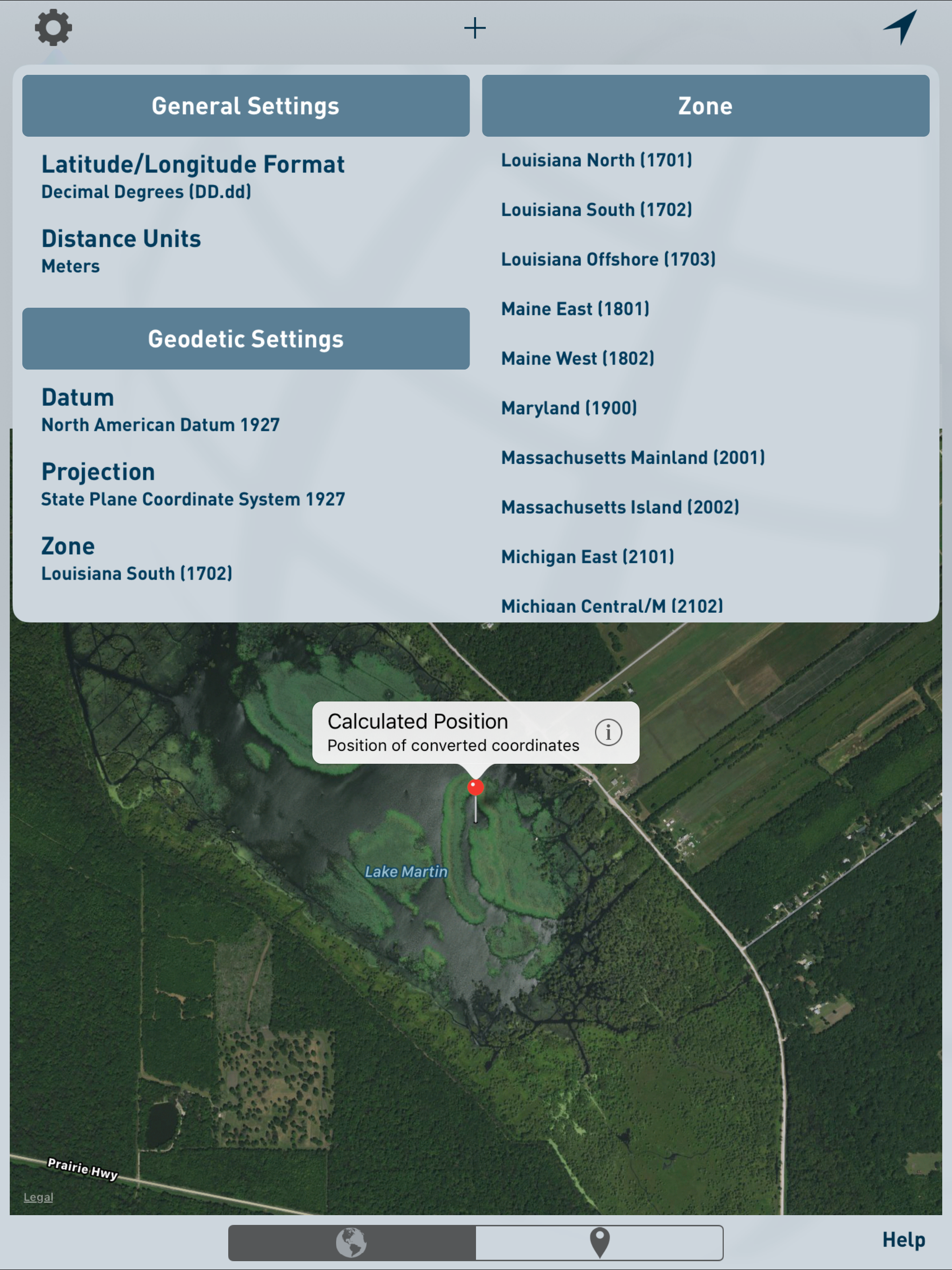
Oceanodesy projects and inverses between geodetic coordinates (latitude and longitude) and grid coordinates (easting and northing). Latitude and longitude coordinates are accepted and displayed in Decimal Degrees (DD.dd), Decimal Minutes (DD MM.mm), and Decimal Seconds (DD MM SS.ss). Grid coordinates are accepted and displayed in US Feet, International Feet, and Meters.
Projected coordinates can be stored for later reference or export.
Available Datums:
- World Geodetic System 1984 (WGS84)
- North American Datum 1927 (NAD27)
- North American Datum 1983 (NAD83)
- Sistema de Referencia Geocentrico para las AmericaS 2000 (SIRGAS2000)
- Indian 1975 Datum
- Hartebeesthoek 1994 Datum
- European Datum 1950
Available Projections:
- Universal Transverse Mercator (UTM)
- State Plane Coordinate System 1927 (SPCS27)
- State Plane Coordinate System 1983 (SPCS83)
Hide..
Show more..
Projected coordinates can be stored for later reference or export.
Available Datums:
- World Geodetic System 1984 (WGS84)
- North American Datum 1927 (NAD27)
- North American Datum 1983 (NAD83)
- Sistema de Referencia Geocentrico para las AmericaS 2000 (SIRGAS2000)
- Indian 1975 Datum
- Hartebeesthoek 1994 Datum
- European Datum 1950
Available Projections:
- Universal Transverse Mercator (UTM)
- State Plane Coordinate System 1927 (SPCS27)
- State Plane Coordinate System 1983 (SPCS83)
Screenshots


 User Rating
0 out of 5
0 ratings in Sweden
Ratings History
Reviews
App doesn't have any reviews yet
Store Rankings
Ranking History
App Ranking History not available yet
Category Rankings
App is not ranked yet
Keywords
Revenue and Downloads
Gain valuable insights into Oceanodesy performance with our analytics. Sign up now
to
access downloads, revenue, and more.
App Info
- Category
- Utilities
- Publisher
- Oceaneering International, Inc.
- Languages
- English
- Recent version
- 2.0.1 (7 years ago )
- Released on
- Mar 29, 2012 (12 years ago )
- Also available in
- United States, Thailand, Australia, Turkey, Italy, Saudi Arabia, Indonesia, Philippines, Poland, Mexico, Malaysia, Nigeria, Netherlands, New Zealand, Pakistan, Kuwait, Portugal, Romania, Sweden, Singapore, Vietnam, South Africa, Kazakhstan, Japan, India, Israel, Ireland, Lebanon, Greece, United Kingdom, Finland, Egypt, Canada, Denmark, Czechia, Azerbaijan, Belgium, Chile, Algeria, France, Hungary
- Last updated
- 2 months ago