Ottima app, versione 4.05
Dopo aver sperimentato dei problemi, con la versione corrente, tutto é tornato nella normalità, ovvero nella piacevole affidabilità dell'app. Grazie per il cortese supporto.
OkMap Mobile is not free (it costs 3.99), however it doesn't contain in-app purchases or subscriptions.
🤔 The OkMap Mobile app's quality is mixed. Some users are satisfied, while others report issues. Consider reading individual reviews for more context.
The price of OkMap Mobile is 3.99.
To get estimated revenue of OkMap Mobile app and other AppStore insights you can sign up to AppTail Mobile Analytics Platform.

Dopo aver sperimentato dei problemi, con la versione corrente, tutto é tornato nella normalità, ovvero nella piacevole affidabilità dell'app. Grazie per il cortese supporto.
Ho provato tante app simili, ma questa credo sia la migliore in assoluto. La possibilità di inserire mappe personalizzate è indubbiamente un aspetto importantissimo. Per ogni traccia che salvi hai sempre sottomano tutte le statistiche, ma quello che mi ha convinto a dare una recensione iperpositiva é che lo sviluppatore é sempre pronto a darti assistenza e a recepire consigli su come migliorare l’app. Io uso questa app solo per trekking sul mio Appennino ma pensò che possa essere utilissima anche per i bikers o chiunque si cimenti in escursioni di vario tipo sia al mare che in montagna.
Trovo la nuova versione di OkMap mobile molto interessante e versatile per molte attività in cui necessità disporre di una navigazione corretta e puntuale utilizzando diverse tipologie di mappe. Ritengo di dare un ottimo giudizio con 5 stelle. Sarebbe gradito come già implementato su OkMap desktop di disporre anche delle mappe catastali WMS.
Inutilizzabile totalmente dopo l’ultimo aggiornamento, prima funzionava a meraviglia ed era sempre utilizzata in ogni uscita, ora un disastro totale la devo eliminare: tutte le mappe utente che avevo prima non funzionano più e neppure le centinaia di tracce gpx che avevo salvato, in entrambi i casi dopo il caricamento l’applicazione dice che l’estensione è errata. Ho provato a risolvere il problema convertendo una trentina di mappe utente dal formato vecchio funzionante al formato mbtiles (come ora richiesto), peccato però che da 15MB a mappa il formato mbtiles richiede 150MB, praticamente prima mi stava tutto in meno di mezzo giga, ora servono piu di 4 GB per le stesse mappe che inoltre hanno il problema dello zoom minimo (15x). Non capisco perché sia stato necessario rompere in questo modo una cosa che funzionava veramente bene. Fate funzionare le mappe KMZ e le tracce GPX per favore, possibilmente senza un limite cosi basso di zoom
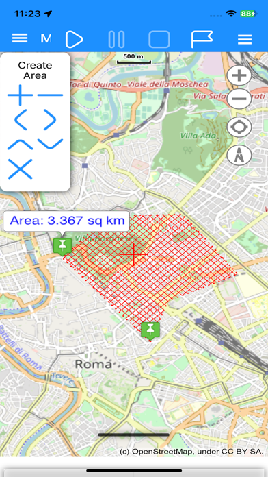
Bell’idea e molto utile si possono inserire tantissime mappa di ogni tipo
Un ottimo compagno di avventura, mi accompagna nelle mie escursioni ormai da anni e non mi ha mai tradito. Spesso lo utilizzo con mappe personalizzate e mi sono sempre trovato benissimo.
App molto completa e personalizzabile con le mappe utente. Molto utile la possibilità di lavorare da pc e ritrovare il lavoro su smartphone. Molto veloce, disponibile ed efficiente il supporto in caso di dubbi o problemi. Aperto a suggerimenti per il miglioramento dell’app.
Ottima app per tutti gli escursionisti in particolare per chi vuole utilizzare mappe personalizzate e caricarle nell App. Si possono avere molte informazioni sul tracciamento e crearsi un database di tracce Unica nota negativa per me è L avvio , dove devi avviare il gps, nonostante nel tracciamento sia stato impostato “sempre” e la selezione della mappa custom ogniqualvolta apri L App per il resto è tutto funzionale all uso specifico.
Al di là del prodotto molto curato con molte funzionalità e di facile uso( in attesa di mappe satellitari, credo per via di permessi o accordi legati a servizi geospazali) di cui in realtà potrei farne anche a meno, avendo maps o simili. Questo gioiellino più o meno si avvicina a palmari gps. Fra L’ altro L’ assistenza è ad un livello superiore, non ho ancora provato a fondo tutte le funzioni e se devo essere onesto, dopo aver visto grafica, impostazioni, completezza, non ci ho pensato su più di tanto ed ho preso la premium. Un bravo al tecnico che lo ha ideato.
Con OkMaps navigo con le mie mappe dove inserisco tutte le informazioni sempre visibili istante per istante, insomma una “ figata”. Faiti 17.
|
Chart
|
Category
|
Rank
|
|---|---|---|
|
Top Paid
|

|
13
|
|
Top Paid
|

|
22
|
|
Top Paid
|

|
94
|
|
Top Paid
|

|
104
|
|
Top Paid
|

|
106
|
| Name | Downloads (30d) | Monthly Revenue | Reviews | Ratings | Recent release | |
|---|---|---|---|---|---|---|

EasyTrails GPS Lite
|
Unlock
|
Unlock
|
0
|
|
4 months ago | |

georesq
|
Unlock
|
Unlock
|
0
|
|
5 months ago | |

Terra Map - Trail Explorer
Outdoor trails & topo charts
|
Unlock
|
Unlock
|
0
|
|
1 month ago | |

OpenMaps - Topographic maps
Open source topographic maps
|
Unlock
|
Unlock
|
0
|
|
4 months ago | |

WHIP LIVE Moto, Bike, Trekking
Track • Navigate • Explore
|
Unlock
|
Unlock
|
0
|
|
4 months ago | |

Sentieri in Tasca
|
Unlock
|
Unlock
|
0
|
|
7 months ago | |

Hiking Route Lite
GPS for trekking
|
Unlock
|
Unlock
|
0
|
|
2 years ago | |

Mappa Digitale Sentiero Italia
La mappa digitale ufficiale
|
Unlock
|
Unlock
|
0
|
|
2 weeks ago | |

MyGIS
Your Navigation Companion
|
Unlock
|
Unlock
|
0
|
|
9 months ago | |

Cartograph Maps 3
Mapsforge offline vector maps.
|
Unlock
|
Unlock
|
0
|
|
2 weeks ago |
