Description
Explore Your Next Adventure with OpenMaps Topographic Maps!
Gear up for your next outdoor escapade with our comprehensive digital topographic maps. Designed for hikers, explorers, and outdoor enthusiasts, OpenMaps offers detailed insights into a myriad of routes, from footpaths to countryside trails, all sourced from OpenStreetMap (OSM) – your go-to for accurate and up-to-date mapping data.
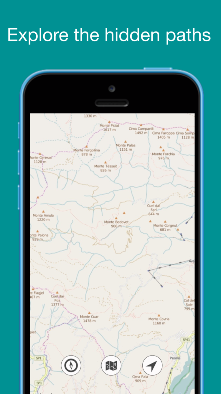
Never Lose Your Way: Planning a day hike but forgot your map? Fear not! With OpenMaps, you gain access to a diverse range of detailed and freely editable topographic maps. Our maps, sourced from the renowned OpenStreetMap (OSM) project, ensure precision and reliability for all your hiking, mountaineering, or mountain biking adventures.
Why Opt for OpenMaps?
Live Tile Mapping: Immerse yourself in cutting-edge mapping technology with live tile maps sourced from OSM and other open-source servers.
Essential for Outdoor Enthusiasts: Whether you're an avid hiker, seasoned mountaineer, passionate mountain biker, or simply a nature enthusiast, OpenMaps serves as your essential guide.
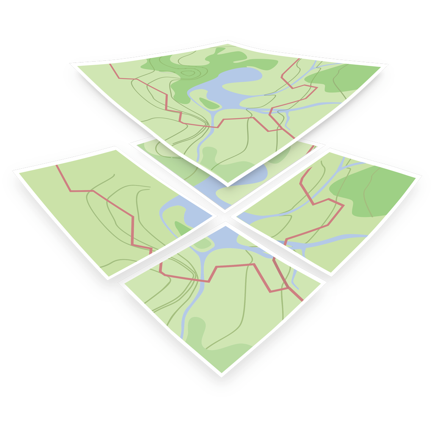
Community-Driven Data: OSM is a collaborative endeavor that crafts a free and editable global map. Local volunteers contribute GPS data and local knowledge to maintain the most accurate and current information.
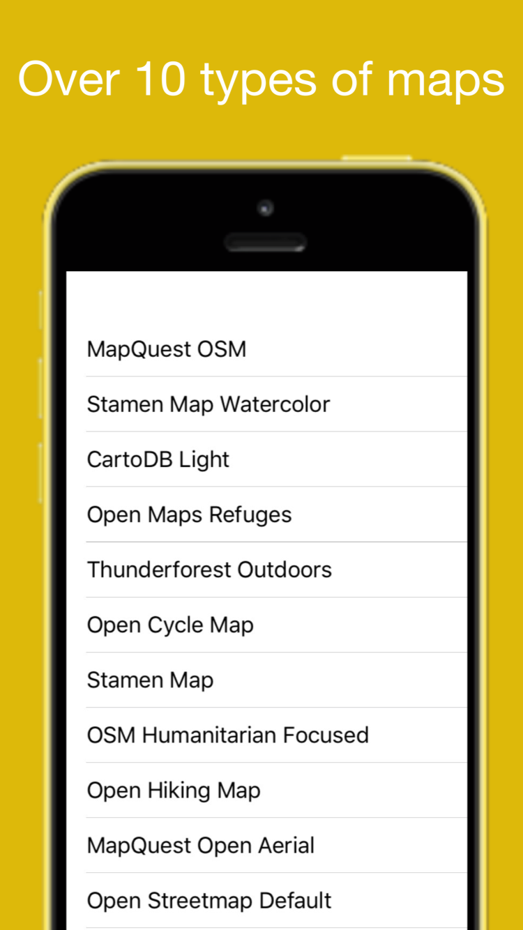
Featuring 6 Open-Source Topographic Maps.
Embark on Your Next Outdoor Expedition with OpenMaps – Your Gateway to Global Trails and Routes!
An app like OpenMaps caters to a diverse range of users, including:
Hikers and Mountaineers: Utilize OpenMaps' detailed topographic maps to plan and navigate your routes with confidence, displaying various terrain features critical for safety and efficiency during your adventures.
Mountain Bikers: Find new trails, assess terrain difficulty, and plan your mountain biking excursions seamlessly with OpenMaps.
Explorers and Outdoor Enthusiasts: Unleash your spirit of exploration with OpenMaps' detailed maps, uncovering new areas to explore both locally and internationally.
GIS Professionals and Urban Planners: Harness OpenMaps' OpenStreetMap data for GIS projects, aiding in urban planning and geographical analysis.
Volunteers and Collaborators: Contribute to the accuracy and currency of mapping data by updating and adding information through the OpenMaps app.
In summary, OpenMaps stands as an indispensable companion for outdoor enthusiasts and professionals alike, offering detailed topographic maps and up-to-date mapping data for your adventures. Begin your journey with OpenMaps today!
Hide
Show More...
Gear up for your next outdoor escapade with our comprehensive digital topographic maps. Designed for hikers, explorers, and outdoor enthusiasts, OpenMaps offers detailed insights into a myriad of routes, from footpaths to countryside trails, all sourced from OpenStreetMap (OSM) – your go-to for accurate and up-to-date mapping data.
Never Lose Your Way: Planning a day hike but forgot your map? Fear not! With OpenMaps, you gain access to a diverse range of detailed and freely editable topographic maps. Our maps, sourced from the renowned OpenStreetMap (OSM) project, ensure precision and reliability for all your hiking, mountaineering, or mountain biking adventures.
Why Opt for OpenMaps?
Live Tile Mapping: Immerse yourself in cutting-edge mapping technology with live tile maps sourced from OSM and other open-source servers.
Essential for Outdoor Enthusiasts: Whether you're an avid hiker, seasoned mountaineer, passionate mountain biker, or simply a nature enthusiast, OpenMaps serves as your essential guide.
Community-Driven Data: OSM is a collaborative endeavor that crafts a free and editable global map. Local volunteers contribute GPS data and local knowledge to maintain the most accurate and current information.
Featuring 6 Open-Source Topographic Maps.
Embark on Your Next Outdoor Expedition with OpenMaps – Your Gateway to Global Trails and Routes!
An app like OpenMaps caters to a diverse range of users, including:
Hikers and Mountaineers: Utilize OpenMaps' detailed topographic maps to plan and navigate your routes with confidence, displaying various terrain features critical for safety and efficiency during your adventures.
Mountain Bikers: Find new trails, assess terrain difficulty, and plan your mountain biking excursions seamlessly with OpenMaps.
Explorers and Outdoor Enthusiasts: Unleash your spirit of exploration with OpenMaps' detailed maps, uncovering new areas to explore both locally and internationally.
GIS Professionals and Urban Planners: Harness OpenMaps' OpenStreetMap data for GIS projects, aiding in urban planning and geographical analysis.
Volunteers and Collaborators: Contribute to the accuracy and currency of mapping data by updating and adding information through the OpenMaps app.
In summary, OpenMaps stands as an indispensable companion for outdoor enthusiasts and professionals alike, offering detailed topographic maps and up-to-date mapping data for your adventures. Begin your journey with OpenMaps today!
Screenshots


OpenMaps FAQ
-
Is OpenMaps free?
Yes, OpenMaps is completely free and it doesn't have any in-app purchases or subscriptions.
-
Is OpenMaps legit?
Not enough reviews to make a reliable assessment. The app needs more user feedback.
Thanks for the vote -
How much does OpenMaps cost?
OpenMaps is free.
-
What is OpenMaps revenue?
To get estimated revenue of OpenMaps app and other AppStore insights you can sign up to AppTail Mobile Analytics Platform.

User Rating
App is not rated in Philippines yet.
Ratings History
OpenMaps Reviews
No Reviews in Philippines
App doesn't have any reviews in Philippines yet.
Store Rankings
Ranking History
Category Rankings
|
Chart
|
Category
|
Rank
|
|---|---|---|
|
Top Free
|

|
215
|
|
Top Free
|

|
217
|
|
Top Free
|

|
249
|
|
Top Free
|

|
348
|
|
Top Free
|

|
424
|
Keywords
OpenMaps Competitors
| Name | Downloads (30d) | Monthly Revenue | Reviews | Ratings | Recent release | |
|---|---|---|---|---|---|---|

TwoNav: Rutas Mapas
|
View
|
View
|
0
|
|
5 months ago | |

Topo Maps+
Offline Topographic Maps & GPS
|
View
|
View
|
0
|
|
2 weeks ago | |

Mapillary
Street-level imagery
|
View
|
View
|
0
|
|
2 weeks ago | |

Terra Map - Trail Explorer
Outdoor trails & topo charts
|
View
|
View
|
0
|
|
2 months ago | |

Open GPX Tracker
No ads, no in-app purchases
|
View
|
View
|
0
|
|
1 year ago | |

Карта охотника. GPS навигатор.
Офлайн карты охотугодий России
|
View
|
View
|
0
|
|
4 years ago | |
OpenMapTiles
|
View
|
View
|
0
|
|
3 years ago | |

OpenStreets 4 Open Street Map
Amazing Ways to See the World
|
View
|
View
|
0
|
|
4 months ago | |

OkMap Mobile
|
View
|
View
|
0
|
|
4 months ago | |

Mapply for Open Street Map
Street, Topo, Railway & Sea
|
View
|
View
|
0
|
|
7 months ago |
OpenMaps Installs
Last 30 days
OpenMaps Revenue
Last 30 daysOpenMaps Revenue and Downloads
Gain valuable insights into OpenMaps performance with our analytics.
Sign up now to access downloads, revenue, and more.
Sign up now to access downloads, revenue, and more.
App Info
- Category
- Navigation
- Publisher
- Immaginet Srl
- Languages
- English
- Recent release
- 6.16 (5 months ago )
- Released on
- Sep 22, 2015 (9 years ago )
- Also available in
- United States, Germany, United Kingdom, France, Italy, Netherlands, Russia, Canada, Spain, Austria, Croatia, Egypt, Poland, Norway, Finland, Romania, China, Japan, Vietnam, Pakistan, Nigeria, Malaysia, Mexico, Malta, Nepal, New Zealand, North Macedonia, Madagascar, Latvia, Luxembourg, Peru, Philippines, South Africa, Portugal, Saudi Arabia, Sweden, Singapore, Slovenia, Slovakia, Thailand, Türkiye, Taiwan, Ukraine, Uzbekistan, United Arab Emirates, Brunei, Denmark, Czechia, Cyprus, Colombia, Chile, Switzerland, Belarus, Brazil, Dominican Republic, Bahrain, Bulgaria, Belgium, Azerbaijan, Australia, Argentina, Armenia, Lithuania, Algeria, Ecuador, Estonia, Greece, Hong Kong SAR China, Hungary, Indonesia, Ireland, Israel, India, Iceland, South Korea, Kuwait, Kazakhstan, Lebanon
- Last Updated
- 2 weeks ago
This page includes copyrighted content from third parties, shared solely for commentary and research in accordance with fair use under applicable copyright laws. All trademarks, including product, service, and company names or logos, remain the property of their respective owners. Their use here falls under nominative fair use as outlined by trademark laws and does not suggest any affiliation with or endorsement by the trademark holders.