
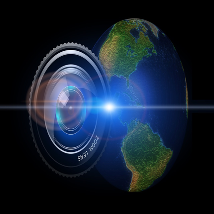
Orbiter - Earth Visualizer
Satellite data and photos
#1 Keyword Rankings
Today
Top 10 Rankings
Today
Top 30 Rankings
Today
Top 100 Rankings
Today
Description
See planet Earth as never before. Using current and past data from satellites, Orbiter presents beautiful unfiltered satellite images and time-lapse overlays of Earth data. See invisible phenomena like atmospheric pollution, ozone, sea temperature, and more.
• RECENT SATELLITE IMAGES collected from the ESA’s Sentinel-2 satellites
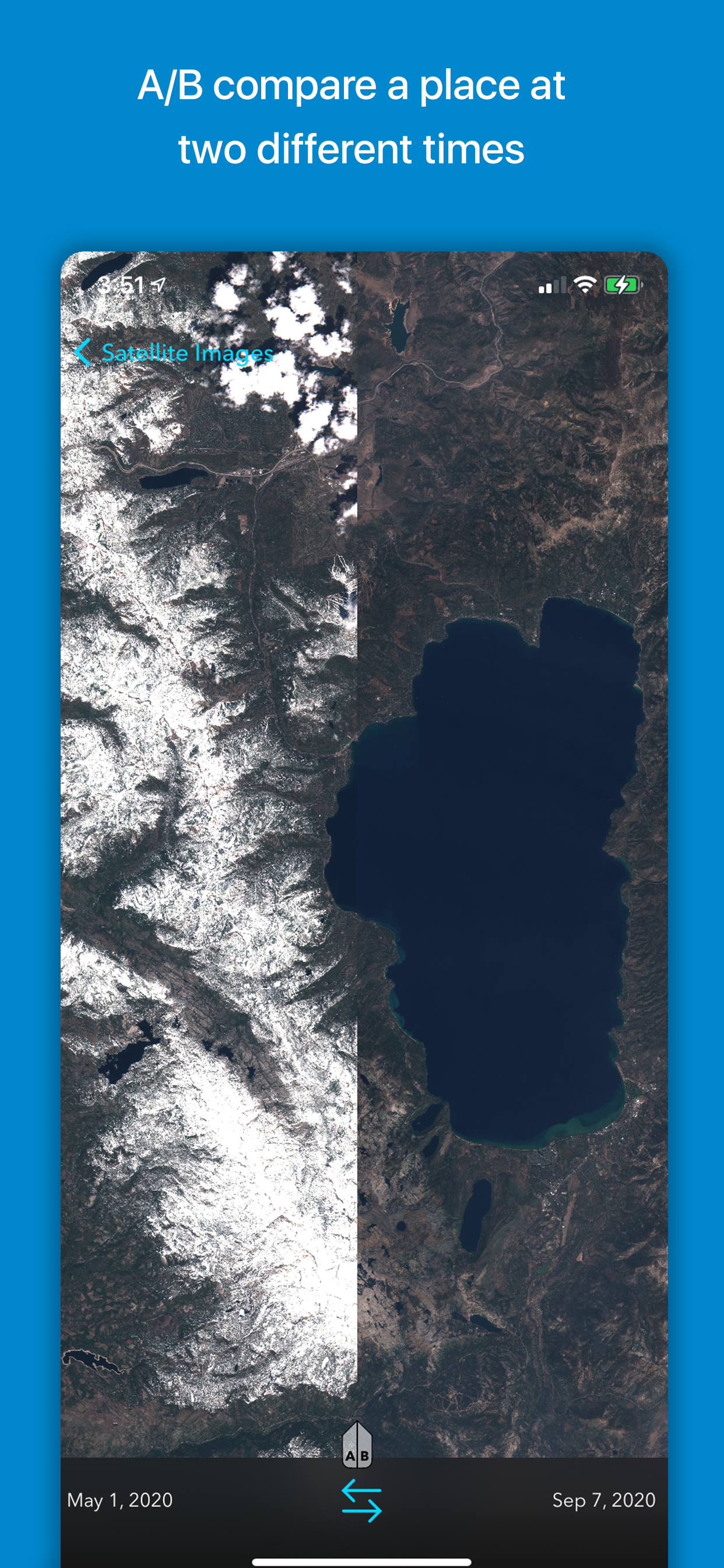
• COMPARE IMAGES with an A/B slider to see how landscapes change over time
• VISUALIZE DATA including air pollution, vegetation, soil moisture, temperature, sea ice, snow, and more
• EXPLORE TRENDS in satellite-collected data, and see how an area changes throughout the seasons
• ANALYZE NATURAL AND HUMAN-MADE PATTERNS as reflected in Earth data. See how human activity affects air pollution, view before-and-after comparisons of major construction projects and see the effects of disasters such as the Beirut explosion of August 2020.
• AUGMENTED REALITY lets you project the globe as if it were in your room. Hold your phone and move around the see the world from all sides.
Orbiter is built atop a new data engine called OPIE (Orbiter Planetary Intelligence Engine.) This server-side system collects raw numeric data from satellites and converts them into human-friendly formats.
Orbiter’s data visualizations represent a new way of perceiving satellite-collected Earth data. Whereas this data traditionally had to be viewed using slow, technical tools, Orbiter presents it in the form of beautiful colored animated overlays wrapped around a globe.
Orbiter’s mission is to unlock the massive public investment in the field of Earth observation. The ESA and NASA have spent billions of dollars developing and launching their Earth observation programs. Until now, the data they collect has been used primarily within the domain of professional researchers. Orbiter makes the data accessible to everyone through a visual interface that encourages exploration and discovery.
The Orbiter app is built with Apple's Metal graphics API for maximum performance. Satellite data acquired from the European Space Agency’s Copernicus programme API. iOS exclusive.
Hide..
Show more..
• RECENT SATELLITE IMAGES collected from the ESA’s Sentinel-2 satellites
• COMPARE IMAGES with an A/B slider to see how landscapes change over time
• VISUALIZE DATA including air pollution, vegetation, soil moisture, temperature, sea ice, snow, and more
• EXPLORE TRENDS in satellite-collected data, and see how an area changes throughout the seasons
• ANALYZE NATURAL AND HUMAN-MADE PATTERNS as reflected in Earth data. See how human activity affects air pollution, view before-and-after comparisons of major construction projects and see the effects of disasters such as the Beirut explosion of August 2020.
• AUGMENTED REALITY lets you project the globe as if it were in your room. Hold your phone and move around the see the world from all sides.
Orbiter is built atop a new data engine called OPIE (Orbiter Planetary Intelligence Engine.) This server-side system collects raw numeric data from satellites and converts them into human-friendly formats.
Orbiter’s data visualizations represent a new way of perceiving satellite-collected Earth data. Whereas this data traditionally had to be viewed using slow, technical tools, Orbiter presents it in the form of beautiful colored animated overlays wrapped around a globe.
Orbiter’s mission is to unlock the massive public investment in the field of Earth observation. The ESA and NASA have spent billions of dollars developing and launching their Earth observation programs. Until now, the data they collect has been used primarily within the domain of professional researchers. Orbiter makes the data accessible to everyone through a visual interface that encourages exploration and discovery.
The Orbiter app is built with Apple's Metal graphics API for maximum performance. Satellite data acquired from the European Space Agency’s Copernicus programme API. iOS exclusive.
Screenshots


 User Rating
5 out of 5
1 ratings in United Kingdom
5 star
1
4 star
0
3 star
0
2 star
0
1 star
0
Ratings History
Reviews
Store Rankings
Ranking History
App Ranking History not available yet
Category Rankings
App is not ranked yet
Keywords
Users may also like
| Name | Reviews | Recent release | |
|---|---|---|---|

We Maps 04 | 3D + 2D World Map
3D + 2D Satellite Map App
|
3
|
2 years ago | |
Live Earth Map HD - Live Cam
Live Earth Camera Viewer
|
1
|
7 months ago | |
Earth cameras: street view
planet life around world
|
1
|
2 years ago | |
Scenic Map
3D topo maps of the world
|
0
|
5 months ago | |
Live Webcam
Live webcams around the world
|
2
|
5 months ago | |

Clocks of Cities on Terra
World Timezones
|
0
|
1 year ago | |

TV Maps
Explore maps on your Apple TV
|
1
|
2 years ago | |

Location Finder
|
0
|
6 months ago | |

Dronetag
|
0
|
2 weeks ago | |

NatureStream.TV
|
0
|
3 years ago |
Show More
Revenue and Downloads
Gain valuable insights into Orbiter - Earth Visualizer performance with our analytics. Sign up now
to
access downloads, revenue, and more.
App Info
- Category
- Travel
- Publisher
- Rayner Software
- Languages
- English
- Recent version
- 1.1.1 (2 years ago )
- Released on
- Nov 20, 2020 (3 years ago )
- Also available in
- United States, Italy, Canada, Germany, Sweden, Philippines, Greece, United Kingdom, France, Egypt, Japan, China, Thailand, Switzerland, Taiwan, Brazil, Australia, Portugal, Nigeria, Netherlands, Norway, New Zealand, Peru, Malaysia, Mexico, Lebanon, Pakistan, Poland, Israel, Romania, Russia, Saudi Arabia, Singapore, Ukraine, Vietnam, South Africa, Ecuador, Argentina, Austria, Azerbaijan, Belgium, Belarus, Chile, Colombia, Czechia, Denmark, Dominican Republic, Algeria, Kazakhstan, Spain, Finland, Hong Kong, Indonesia, Ireland, United Arab Emirates, India, South Korea, Kuwait, Hungary
- Last updated
- 1 month ago