Description
Looksee AR for the Peak District, England, is an Augmented Reality (AR) viewer used to find places of interest directly on your phone camera's screen and add fun, knowledge and interest to your adventures and tours.
Ideal for both tourists and locals wishing to explore and find out more about their surroundings and beyond: whether by foot, bicycle,car, taxi or Uber!
It's simple to use - you just point and go! It includes a choice of Map or Satellite Image in view and a Search function to help locate things.
Once downloaded no wi-fi or cellular network is necessary, so you can use when out and about in the Peak District, even when there is no or poor signal coverage.
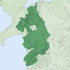
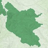
This version, for the Peak District in northern England, locates places in and around the National Park and the wider area, and includes around 16,000 Places of Interest.
The Peak District is characterized by steep limestone valleys like Dovedale, with its famed stepping stones, and Lathkill Dale in the park’s southern area, which is known as White Peak. North, the Dark Peak area has dramatic gritstone ridges and stark moorland plateaus like Kinder Scout, the park’s highest point. The nearby village of Edale marks one end of the iconic Pennine Way footpath.
It reaches a rectangle stretching from and including Manchester in the West to Sheffield in the East, an area of over 3,000 km2.
Categories that can be viewed and selected include Tourist Attractions, Hills, Lakes, Parks & Woodlands, Cities, Towns, Suburban Areas, Villages & Hamlets, Cafes, Restaurants, Cafes, Airports, Train & Major Bus Stations, Municipal Buildings, Places of Worship, Historic Sites and Museums & Arts.
Some of the helpful Looksee features include:
- Interactive objects (that you can touch for more information on them)
- Magic EYE (to declutter the visuals and select only objects within)
- Satellite or Map image in view (can select which or disable completely)
- Search menu (with on-screen directional arrow and indicator graphics)
- Filters menu (using which the categories of points of interest you wish to display can be easily filtered out or selected)
- Distance slider (for an interactive depth of view filter up to 10km)
- Zoom (using an on screen pinch to zoom gesture)
- Snap-shot camera (for annotating your photos)
- Video recorder for saving and sharing interesting places on social media (accessed by holding the camera icon for 1 second)
- Radar view of everything around you on map (hold face down)
So please enjoy adding interest to your Peak District outdoor adventures!
Hide
Show More...
Ideal for both tourists and locals wishing to explore and find out more about their surroundings and beyond: whether by foot, bicycle,car, taxi or Uber!
It's simple to use - you just point and go! It includes a choice of Map or Satellite Image in view and a Search function to help locate things.
Once downloaded no wi-fi or cellular network is necessary, so you can use when out and about in the Peak District, even when there is no or poor signal coverage.
This version, for the Peak District in northern England, locates places in and around the National Park and the wider area, and includes around 16,000 Places of Interest.
The Peak District is characterized by steep limestone valleys like Dovedale, with its famed stepping stones, and Lathkill Dale in the park’s southern area, which is known as White Peak. North, the Dark Peak area has dramatic gritstone ridges and stark moorland plateaus like Kinder Scout, the park’s highest point. The nearby village of Edale marks one end of the iconic Pennine Way footpath.
It reaches a rectangle stretching from and including Manchester in the West to Sheffield in the East, an area of over 3,000 km2.
Categories that can be viewed and selected include Tourist Attractions, Hills, Lakes, Parks & Woodlands, Cities, Towns, Suburban Areas, Villages & Hamlets, Cafes, Restaurants, Cafes, Airports, Train & Major Bus Stations, Municipal Buildings, Places of Worship, Historic Sites and Museums & Arts.
Some of the helpful Looksee features include:
- Interactive objects (that you can touch for more information on them)
- Magic EYE (to declutter the visuals and select only objects within)
- Satellite or Map image in view (can select which or disable completely)
- Search menu (with on-screen directional arrow and indicator graphics)
- Filters menu (using which the categories of points of interest you wish to display can be easily filtered out or selected)
- Distance slider (for an interactive depth of view filter up to 10km)
- Zoom (using an on screen pinch to zoom gesture)
- Snap-shot camera (for annotating your photos)
- Video recorder for saving and sharing interesting places on social media (accessed by holding the camera icon for 1 second)
- Radar view of everything around you on map (hold face down)
So please enjoy adding interest to your Peak District outdoor adventures!
In-Apps
- View All Categories
- SAR 4.99
Screenshots


Peak District Looksee AR FAQ
-
Is Peak District Looksee AR free?
Yes, Peak District Looksee AR is free to download, however it contains in-app purchases or subscription offerings.
-
Is Peak District Looksee AR legit?
Not enough reviews to make a reliable assessment. The app needs more user feedback.
Thanks for the vote -
How much does Peak District Looksee AR cost?
Peak District Looksee AR has several in-app purchases/subscriptions, the average in-app price is SAR 4.99.
-
What is Peak District Looksee AR revenue?
To get estimated revenue of Peak District Looksee AR app and other AppStore insights you can sign up to AppTail Mobile Analytics Platform.

User Rating
App is not rated in Saudi Arabia yet.
Ratings History
Peak District Looksee AR Reviews
No Reviews in Saudi Arabia
App doesn't have any reviews in Saudi Arabia yet.
Store Rankings
Ranking History
App Ranking History not available yet
Category Rankings
App is not ranked yet
Peak District Looksee AR Competitors
| Name | Downloads (30d) | Monthly Revenue | Reviews | Ratings | Recent release | |
|---|---|---|---|---|---|---|
Snowdonia Outdoor Map
Offline outdoor map
|
Unlock
|
Unlock
|
0
|
|
3 years ago | |

Derbyshire Walks
200+ Walks in Derbyshire
|
Unlock
|
Unlock
|
0
|
|
1 year ago | |
Peak District Map Pro
National Park Topo Map
|
Unlock
|
Unlock
|
0
|
|
3 years ago | |
Peak District Map
National Park Topo Map
|
Unlock
|
Unlock
|
0
|
|
3 years ago | |
Yorkshire Dales Map
|
Unlock
|
Unlock
|
0
|
|
3 years ago | |

Geoheritage
|
Unlock
|
Unlock
|
0
|
|
8 months ago | |

Alpha Taxis Sheffield
|
Unlock
|
Unlock
|
0
|
|
7 months ago | |

Roots to Routes
Historical Walking Routes
|
Unlock
|
Unlock
|
0
|
|
2 years ago | |

Rothbury Ramble
A short walking audio trail
|
Unlock
|
Unlock
|
0
|
|
1 year ago | |

GeoparkWay
|
Unlock
|
Unlock
|
0
|
|
1 month ago |
Peak District Looksee AR Installs
Last 30 days
Peak District Looksee AR Revenue
Last 30 daysPeak District Looksee AR Revenue and Downloads
Gain valuable insights into Peak District Looksee AR performance with our analytics.
Sign up now to access downloads, revenue, and more.
Sign up now to access downloads, revenue, and more.
App Info
- Category
- Travel
- Publisher
- Objexs
- Languages
- English
- Recent release
- 9.3 (2 years ago )
- Released on
- Apr 5, 2018 (6 years ago )
- Also available in
- United Kingdom, France, Philippines, Italy, Japan, South Korea, Kazakhstan, Lebanon, Mexico, Malaysia, Nigeria, Netherlands, Norway, New Zealand, Peru, India, Pakistan, Poland, Romania, Russia, Saudi Arabia, Sweden, Singapore, Thailand, Türkiye, Taiwan, Ukraine, United States, Vietnam, South Africa, Germany, Argentina, Austria, Australia, Azerbaijan, Belgium, Bulgaria, Brazil, Canada, Switzerland, Chile, China, Colombia, Czechia, Iceland, Denmark, Dominican Republic, Algeria, Ecuador, Egypt, Spain, Greece, Hong Kong SAR China, Hungary, Indonesia, Ireland, United Arab Emirates
- Last Updated
- 2 months ago