PeakFinder
The mountains are calling!
#1 Keyword Rankings
Today
Top 10 Rankings
Today
Top 30 Rankings
Today
Top 100 Rankings
Today

Description

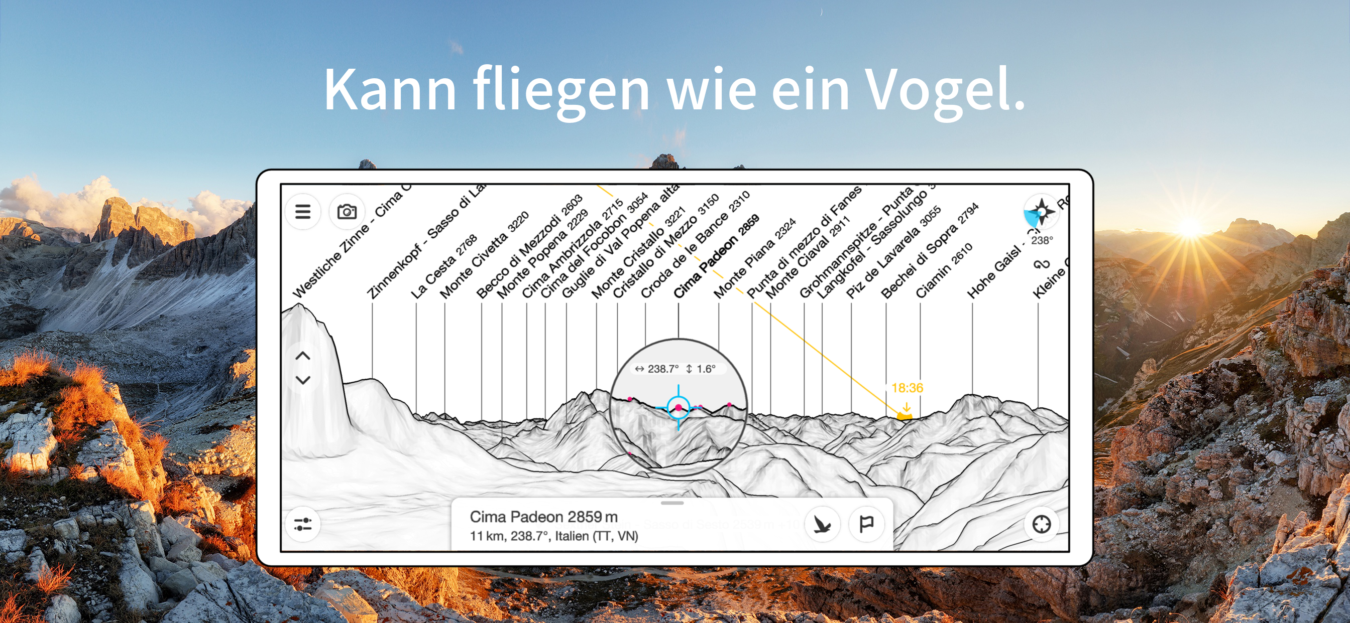
The mountains are calling! Explore more mountains than any mountaineer! PeakFinder makes it possible… and shows the names of all mountains and peaks with a 360° panorama display.
This functions completely offline - and worldwide!

PeakFinder knows more than 1'000'000 peaks - from Mount Everest to the little hill around the corner.

•••••••••
Winner of several prizes like 'Best of AppStore', 'App of the Week', …
Highly recommended by macnewsworld.com, nationalgeographic.com, smokinapps.com, outdoor-magazin.com, themetaq.com, digital-geography.com, …
•••••••••


••• Features •••

• Works offline and worldwide
• Includes more than 1'000'000 peak names
• Overlays the camera image with the panorama drawing
• Realtime rendering of the surrounding landscapes in a range of 300km/200mil
• Digital telescope to select less prominent peaks
• 'Show me'-function for visible peaks
• Selection of the viewpoint by GPS, the peak directory or an (online) map
• Can fly like a bird from peak to peak and vertically upwards
• Mark mountains and places you like
• Shows the solar and lunar orbit with rise and set times
• Uses compass and motion sensors
• Daily updates of the peak directory
• Does not contain any recurring costs. You pay only once
• Is free of advertising


••• Ratings •••

Every good rating (including those following updates) makes me happy. The positive ratings and reviews make it possible for me to continue to improve the app for you. Many thanks!


••• Support •••

In case of questions, problems, mistakes, missing mountain names and ideas for future expansion, I am happy to help you. Please write to [email protected].
Hide.. Show more..

Screenshots

User Rating

4.7 out of 5

5,835 ratings in Austria

5 star
4,763
4 star
683
3 star
200
2 star
63
1 star
126

Ratings History

Reviews

Grundsätzlich tolle App

./._.\. on

Optimal wäre wenn die Beschriftung der Berge noch gedreht oder nach oben und verschoben werden könnte. Satellitenansicht mit Namen der Gebirgszüge fehlt.

Super App mit tollen Kundensupport

Ewi 1412 on

Für alle die gerne in den Bergen unterwegs sind, kann ich die App nur empfehlen. Funktioniert perfekt

Koordinatengitter

Petrojannis on

Danke für die tolle App Wäre es möglich das Koordinatengitter auch über 30 grad hinaus anzuzeigen und es auch beim Foto Export optional einzublenden?

Schweizer Taschenmesser der Bergerkennung

Sto3014 on

Die Bergerkennung ist einfach der Hammer. Aber gerade auch Teillösungen, wie die AR Umsetzung des Konturangleichs, inklusive des Exports des Ergebnisses ist der Hit.

Pflicht App

Anna-Lena 13 12 on

Für alle Bergfexe und Gipfel Stürmer.. ein absolutes muss !!! Top App !

Danke dass es kein Abo ist!

Spoerloso on

Die App ist simpel, funktioniert und das wichtigste: Man kann sie kaufen und dann hat man sie - ohne unnötiges Abo.

Super …

brosensteiner on

… nur lassen sich die Bilder leider nicht im neueren HEIF Format abspeichern (kleiner als JPG, gleiche Qualität). Leider ist man auch auf 3:4 und 16:9 Format beschränkt. Option um alle Metadaten im Foto zu erhalten beim speichern wäre dringend nötig (Ort und Uhrzeit)! Gibt mehr Sterne wenn das funktioniert.

Super 👍

Hans pixner on

Spitze App,👍👍👍

Wonderful experience to feel somehow at home everywere

12cassio on

The closer look at the world in associating views with names suggests becoming more and more familiar… …definetly a different look for your eyes… …name it you would like it!

Immer noch genial!!!

muschelreaktor on

Ich liebe die App, perfekt für die Orientierung, obwohl ich die Berge vor der Haustüre habe!!

Store Rankings

Ranking History

App Ranking History not available yet

Category Rankings

Chart
Category
Rank
Top Paid
1
Top Paid
1
Top Paid
1
Top Paid
1
Top Paid
1

Keywords

Users may also like

Name
SwitzerlandMobility
Non-motorized traffic network
bergfex: Wandern & Tracking
Tourenplaner & GPS-Navigation
TCS - Touring Club Schweiz
Immer an meiner Seite
Berge Erkennen - PeakVisor
Skitouren + Wandern
FATMAP: Ski, Wandern, Fahrrad
3D Karten & Outdoor Guides
alpenvereinaktiv
Tourenportal der Alpenvereine
swisstopo
Official Swiss Maps
Swiss3D
Peak detection
P+Rail
The pocket parking meter.
SAC – Swiss Alpine Club
Mountain tours, huts & more
Show More

Revenue and Downloads

Gain valuable insights into PeakFinder performance with our analytics. Sign up now to access downloads, revenue, and more.

App Info

Category
Travel
Publisher
PeakFinder GmbH
Languages
English, French, German, Italian, Japanese, Korean, Portuguese, Chinese, Spanish
Recent version
4.8.16 (3 weeks ago )
Released on
Mar 12, 2010 (14 years ago )
Last updated
2 days ago