Pennsylvania Pocket Maps
Pennsylvania Outdoor Guide
#1 Keyword Rankings
Today
Top 10 Rankings
Today
Top 30 Rankings
Today
Top 100 Rankings
Today

Description

Be prepared! Plan your next trip to one of the great Pennsylvania parks. Download maps and guides before you venture into the Wi-Fi free wilderness.

Discover

- 75+ national parks, state parks, monuments, forests
- 150+ neatly folded maps by the National Park Service, Bureau of Land Management, United States Forest Services, and other agencies.
- 100+ campgrounds and campsites
- 1,600+ trails and trailheads
- 72,000+ points of interests

Plan

- Download maps, park brochures, and newspapers. These downloads are ready when you are offline and off the grid in the great outdoors.
- Download arbitrary map sections as offline packs.
- Photo galleries, panorama views.
- Share links to parks and maps with friends

Have fun

- GPS and GPX support: record your hikes, import GPX routes, tracks and waypoints for your hiking trails.
- Detailed national park information: alerts, news, visitor centers, campgrounds, driving directions, weather.
- Open your favorite maps app to get a route to the selected park.
- Current weather conditions, easy access to multi-day forecasts, sunrise and sunset times.
- Push notifications for park alerts, park news, weather warnings

So download maps and guides for:

* Allegheny, Allegheny Islands, Allegheny Portage Railroad, Appalachian, Archbald Pothole
* Bald Eagle, Beltzville, Bendigo, Benjamin Rush, Big Pocono, Big Spring, Black Moshannon, Blue Knob, Boyd Big Tree, Buchanan's Birthplace, Bucktail
* Caledonia, Canoe Creek, Captain John Smith Chesapeake, Champman, Cherry Springs, Cherry Valley, Chesapeake Bay, Chesapeake Bay Gateways and Watertrails Network, Codorus, Colonel Denning, Colton Point, Cook Forest, Cowans Gap
* Delaware & Lehigh, Delaware Canal, Delaware Water Gap, Denton Hill
* Edgar Allen Poe, Eisenhower, Elk, Erie, Erie Bluffs, Evansburg
* First State, Flight 93, Fort Necessity, Fort Washington, Fowlers Hollow, Frances Slocum, French Creek, Friendship Hill
* Gettysburg, Gifford Pinchot, Gloria Dei Church, Gouldsboro, Greenwood Furnace
* Hickory Run, Hopewell Furnace
* Independence
* John Heinz at Tinicum, Johnstown Flood, Journey Through Hallowed Ground
* Kinzua Bridge
* Laurel Hill, Laurel Ridge, Lehigh Gorge, Lower Delaware
* Moraine
* Nockamixon, North Country,
* Ohiopyle, Oil Creek, Oil Region
* Potomac Heritage, Presque Isle, Prince Gallitzin, Pymatuning
* Raccoon Creek, Ricketts Glen, Rivers of Steel
* Shawnee, Steamtown,
* Thaddeus Kosciuszko, Tobyhanna
* Upper Delaware
* Valley Forge
* Washington-Rochambeau Revolutionary Route

- FULL ACCESS is available for a for $3.49/three month (after a free 3-days trial period) or $2.49/two months or $7.49/year. You can subscribe and pay through your iTunes account. The account will be charged for renewal within 24-hours prior to the end of the current period, and identify the cost of the renewal. Your subscription will automatically renew unless canceled at least 24 hours before the end of the current period. Auto-renew can be turned off anytime by going to your Account Settings in iTunes after purchase.

- Continued use of GPS running in the background can dramatically decrease battery life.

LEGAL
Terms of Use: https://www.icoat.de/pocketmaps/terms
Privacy Policy: https://www.icoat.de/pocketmaps/privacy
Hide.. Show more..

In-Apps

access all pro features
$2.49

Screenshots

User Rating

4.51 out of 5

61 ratings in United States

5 star
45
4 star
8
3 star
5
2 star
0
1 star
3

Ratings History

Reviews

Buggy

Turok298 on

Constantly getting prompted to subscribe to view maps (every few seconds), even after purchasing a subscription. I’m requesting a refund.

Fishing

Addienewport2007$ on

Great for getting depths on lakes for fishing

Not it

Frazzled at 5 on

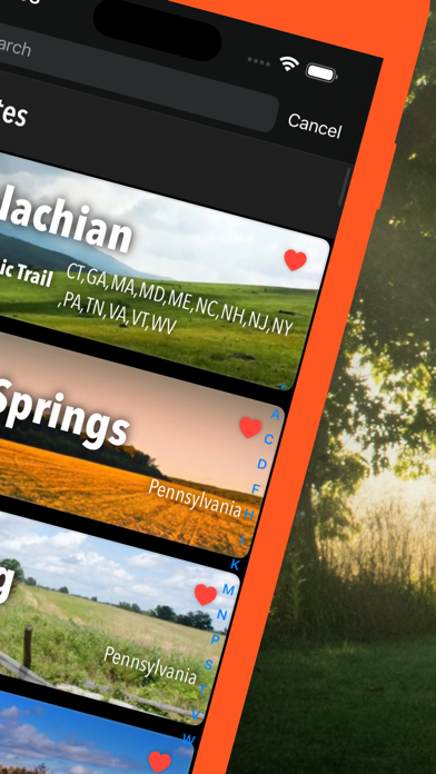
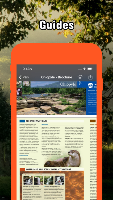
Looking for trail maps and info for all state parks and this is not it. Maybe it’s still in development but that should be stated, not lead you to believe it’s complete. It also has other state’s info which is extra data info we don’t need. There is a nice national park app already.

Store Rankings

Ranking History

App Ranking History not available yet

Category Rankings

App is not ranked yet

Keywords

mpg

Users may also like

Name
Philadelphia Travel Guide
with Offline City & Metro Map
NP Maps
National Park & Topos maps USA
Canyonlands National Park Tour
Moab - Utah - Arches - Hiking
National Park Kiosk
A Guide to the National Parks
ATVTrailz
Offroad navigation
Visit Butler County, PA!
Hello Erie
Visit Valley Forge
Visit Johnstown, PA!
Home of Thunder in the Valley
Allegheny County Parks Trails
Show More

Revenue and Downloads

Gain valuable insights into Pennsylvania Pocket Maps performance with our analytics. Sign up now to access downloads, revenue, and more.

App Info

Category
Travel
Publisher
Alex Gugel
Languages
English, German
Recent version
6.4 (1 month ago )
Released on
Jan 7, 2020 (4 years ago )
Last updated
2 months ago