
PosidoniaMaps
Posidonia High Resolution Maps
#1 Keyword Rankings
Today
Top 10 Rankings
Today
Top 30 Rankings
Today
Top 100 Rankings
Today
Description
Initiated in Formentera, a project to map Posidonia oceanic meadows and make them visible with an app and google earth. Every square meter of mapped and visible Posidonia is a protected meadow.
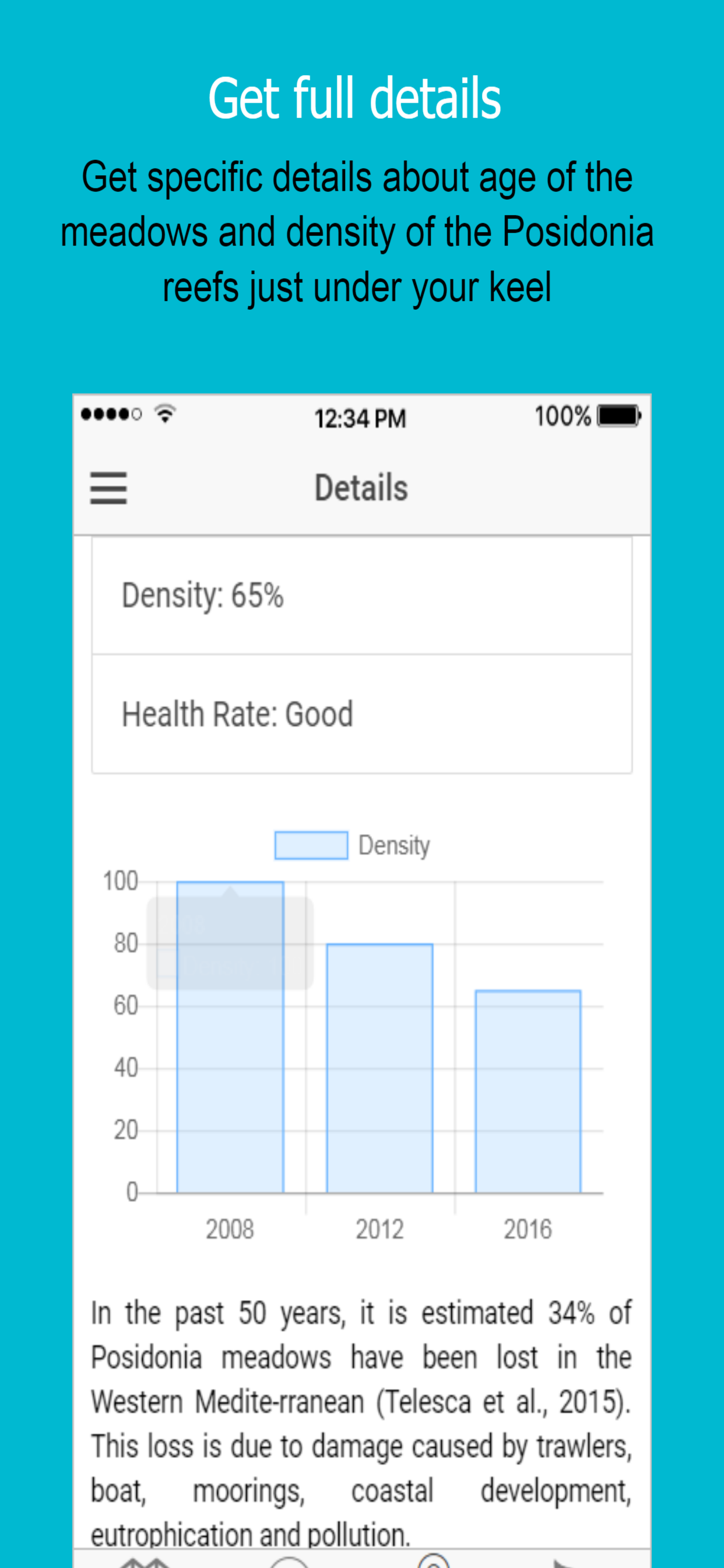
In the past 50 years, it is estimated 34% of Posidonia meadows have been lost in the Western Mediterranean (Telesca et al., 2015). This loss is due to damage caused by trawlers, boat moorings, coastal development, eutrophication, and pollution.
Damage caused by boats’ anchors has been recorded at various coastal marine habitats worldwide; for example, coral reefs (Dinsdale & Harriott, 2004). Anchoring also has negative consequences on
Posidonia (Milazzo M., 2004; Francour P., 1999), and has caused the disappearance of large prairies in
some areas of the Balearic Islands (San Felix, in press, 1994).
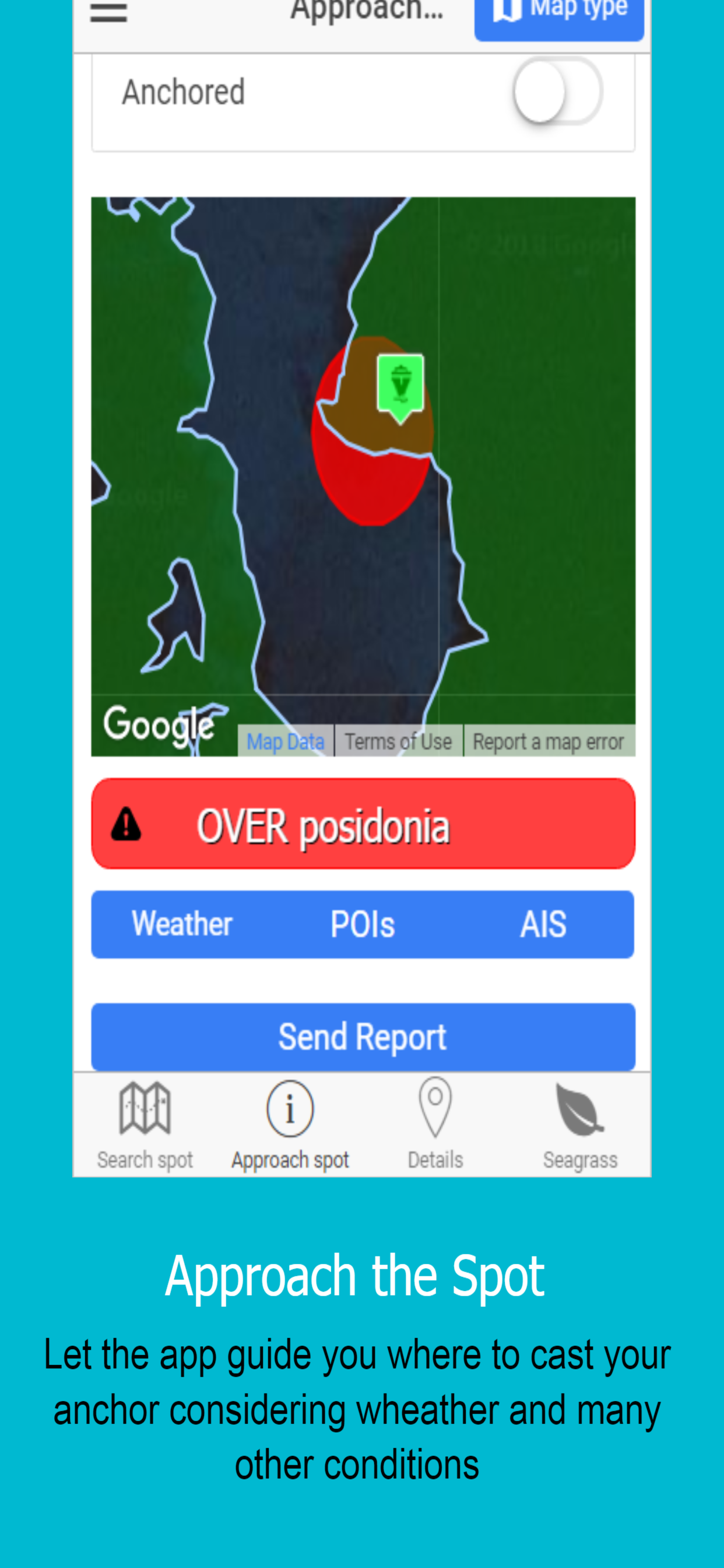
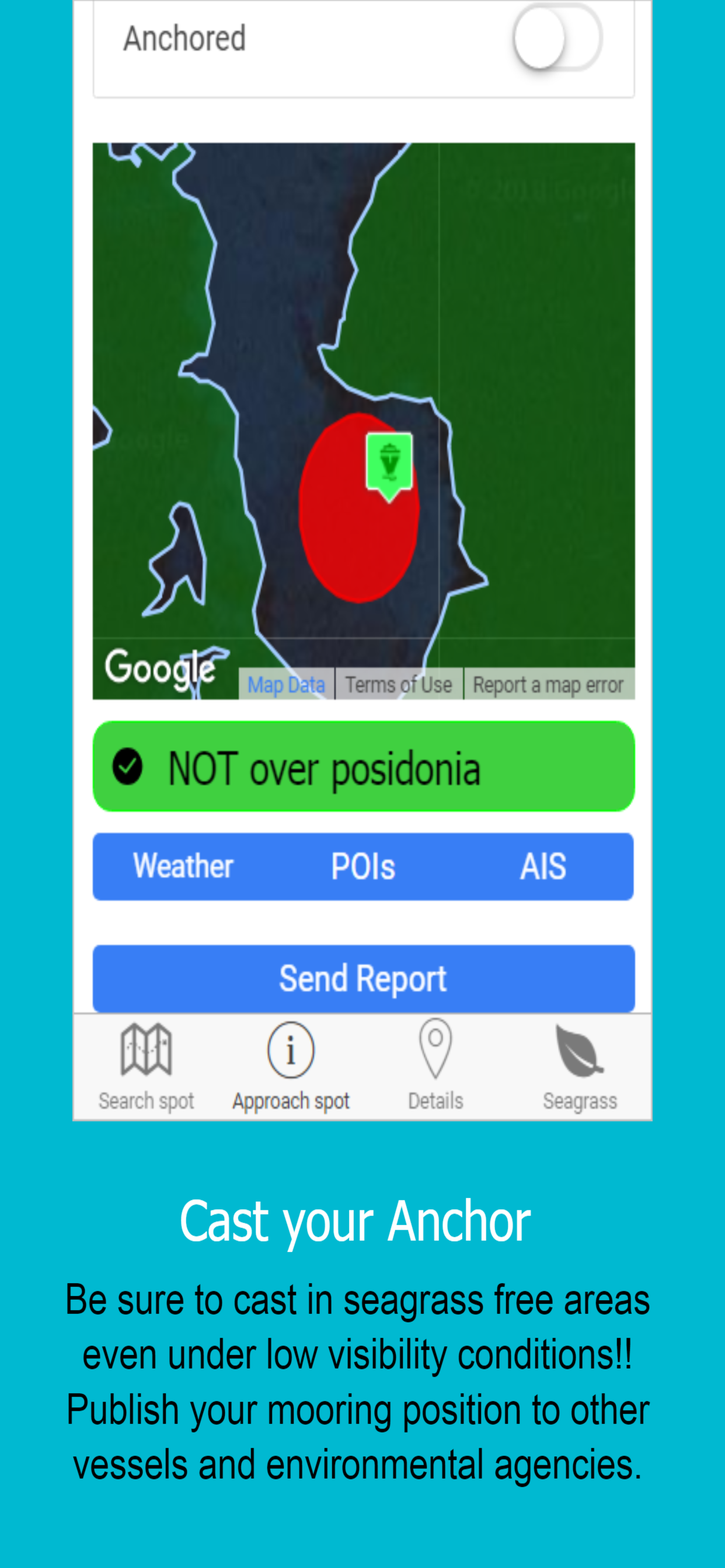
This App provides direct access to high-resolution underwater maps to ensure proper mooring even in low visibility conditions.
Hide..
Show more..
In the past 50 years, it is estimated 34% of Posidonia meadows have been lost in the Western Mediterranean (Telesca et al., 2015). This loss is due to damage caused by trawlers, boat moorings, coastal development, eutrophication, and pollution.
Damage caused by boats’ anchors has been recorded at various coastal marine habitats worldwide; for example, coral reefs (Dinsdale & Harriott, 2004). Anchoring also has negative consequences on
Posidonia (Milazzo M., 2004; Francour P., 1999), and has caused the disappearance of large prairies in
some areas of the Balearic Islands (San Felix, in press, 1994).
This App provides direct access to high-resolution underwater maps to ensure proper mooring even in low visibility conditions.
Screenshots


 User Rating
0 out of 5
0 ratings in Brazil
Ratings History
Reviews
App doesn't have any reviews yet
Store Rankings
Ranking History
App Ranking History not available yet
Category Rankings
|
Chart
|
Category
|
Rank
|
|---|---|---|
|
Top Free
|

|
389
|
Keywords
Users may also like
| Name | Reviews | Recent release | |
|---|---|---|---|

Silence Mobility
Motosharing
|
0
|
1 month ago | |

Anchor Plus
Anchor Alarm Plus much more
|
0
|
4 months ago | |

DONIA
Navigate, Anchor and Protect
|
0
|
2 months ago | |

BarterGO
Recargue su vehículo eléctrico
|
0
|
3 months ago | |

WeBoat
|
0
|
2 years ago | |

Smart Waters
|
0
|
4 days ago | |

Seasy - Making Sea Life Easy
Marina Booking & Sailing Guide
|
0
|
4 months ago | |

iMariner Celestial Navigation
|
0
|
1 year ago | |
SailPilot Italy
|
0
|
3 years ago | |

C Teleport
Automated marine flights
|
0
|
3 months ago |
Show More
Revenue and Downloads
Gain valuable insights into PosidoniaMaps performance with our analytics. Sign up now
to
access downloads, revenue, and more.
App Info
- Category
- Navigation
- Publisher
- Movired 2000 S.L.
- Languages
- English
- Recent version
- 1.5.0 (3 years ago )
- Released on
- Jul 30, 2018 (5 years ago )
- Also available in
- Spain, United Kingdom, Italy, Germany, Philippines, South Korea, Kuwait, Kazakhstan, Lebanon, Mexico, Malaysia, Nigeria, Netherlands, Norway, New Zealand, Peru, India, Poland, Portugal, Romania, Russia, Saudi Arabia, Sweden, Singapore, Turkey, Taiwan, Ukraine, United States, Vietnam, South Africa, Czechia, Argentina, Austria, Australia, Azerbaijan, Belgium, Brazil, Belarus, Canada, Switzerland, Chile, China, Colombia, Japan, Dominican Republic, Algeria, Ecuador, Egypt, Finland, France, Greece, Hungary, Indonesia, Ireland, Israel, United Arab Emirates, Thailand
- Last updated
- 1 month ago