Description
The chart plotter with AIS for inland waters. Rivers & Seas is the iPad navigation system for your boat:
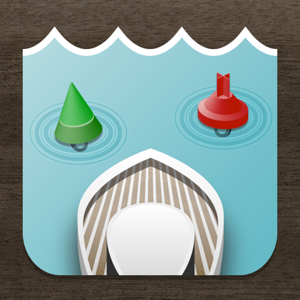
DETAILED WATERS MAPS
Rivers and waterways are listed in detail with buoys, clearances, landmarks, ports and anchorages. In addition landscape, roads and buildings provide orientation. Marinas are shown with piers and service facilities such as gas stations and black water extraction.
AREA GUIDE
VHF channels, phone numbers and opening times of locks and bridges ahead are displayed automatically when driving. You will get a warning if a bridge clearance is too low or a lock will be closed upon arrival.
The display of speed, heading and position also includes the speed limit at the current route segment. Your location is named with river kilometer and name of the river, lake or bay.
SHIP POSITIONS AIS (In App Subscription)
Position of ships with AIS is shown in the map. Ships on the waterway ahead are displayed in the left panel with name , course and speed. No AIS receiver is needed for that.
PLANNED ROUTES
Planned routes can be drawn and used as a guide line for the ride. Rivers & Seas calculates length and travel time of the route. The drawing tool is ideal for routes along winding waterways and chains of lakes.
The planned routes are also ideal on boating holidays for remembering and following the recommendation of a charter basis.
DESTINATIONS AND BOOKMARKS
Rivers & Seas predicts distance and travel time to destinations on the waterway that you mark with pins. The passage time and opening times of locks or bridges are included in the calculation.
OFFLINE MAPS
Routes and areas can be downloaded. Under way or abroad no internet connection is required. Only the areas needed on the route are loaded, without needless land areas.
CLERANCES, OPENING HOURS AND SPEED LIMITS
Bridges and locks on the waterway ahead are displayed in a list with clearances, opening hours, VHF channels and phone numbers along with the distance and remaining driving time to get there. If bridges are to low or locks will be closed upon arrival, a warning is displayed.
FRIENDS RADAR
Even the location of your friends or flotilla is shown in the map. Find anchor position of friends to easily or keep an eye on the distance to the boots of an a convoy with the Friends Radar.
SEARCHING
Search for waters, places, addresses, coordinates and even facilities such as marinas, shops or ATMs.
You will see, Rivers & Seas is the ideal plotter for inland waters. To learn more, visit us at facebook.com/riversandseas or write us at [email protected].
Rivers & Seas is suitable especially for Germany, Netherlands, France, Austria, Switzerland and Baltic Sea, North Sea, Balearic Islands and the Adriatic Sea. The positon of ships in ma (AIS) is useful all over the world.
The map does not show water depths. The display of clearances, speed limits and river kilometer is only available in German and Dutch inland waters.
Rivers & Seas runs on all iPads. The current GPS position can only be displayed on iPads with cellular data. Continued use of GPS running in the background can dramatically decrease battery life. For long-term use of the iPad as a chart plotter a power source is required.
Hide
Show More...
DETAILED WATERS MAPS
Rivers and waterways are listed in detail with buoys, clearances, landmarks, ports and anchorages. In addition landscape, roads and buildings provide orientation. Marinas are shown with piers and service facilities such as gas stations and black water extraction.
AREA GUIDE
VHF channels, phone numbers and opening times of locks and bridges ahead are displayed automatically when driving. You will get a warning if a bridge clearance is too low or a lock will be closed upon arrival.
The display of speed, heading and position also includes the speed limit at the current route segment. Your location is named with river kilometer and name of the river, lake or bay.
SHIP POSITIONS AIS (In App Subscription)
Position of ships with AIS is shown in the map. Ships on the waterway ahead are displayed in the left panel with name , course and speed. No AIS receiver is needed for that.
PLANNED ROUTES
Planned routes can be drawn and used as a guide line for the ride. Rivers & Seas calculates length and travel time of the route. The drawing tool is ideal for routes along winding waterways and chains of lakes.
The planned routes are also ideal on boating holidays for remembering and following the recommendation of a charter basis.
DESTINATIONS AND BOOKMARKS
Rivers & Seas predicts distance and travel time to destinations on the waterway that you mark with pins. The passage time and opening times of locks or bridges are included in the calculation.
OFFLINE MAPS
Routes and areas can be downloaded. Under way or abroad no internet connection is required. Only the areas needed on the route are loaded, without needless land areas.
CLERANCES, OPENING HOURS AND SPEED LIMITS
Bridges and locks on the waterway ahead are displayed in a list with clearances, opening hours, VHF channels and phone numbers along with the distance and remaining driving time to get there. If bridges are to low or locks will be closed upon arrival, a warning is displayed.
FRIENDS RADAR
Even the location of your friends or flotilla is shown in the map. Find anchor position of friends to easily or keep an eye on the distance to the boots of an a convoy with the Friends Radar.
SEARCHING
Search for waters, places, addresses, coordinates and even facilities such as marinas, shops or ATMs.
You will see, Rivers & Seas is the ideal plotter for inland waters. To learn more, visit us at facebook.com/riversandseas or write us at [email protected].
Rivers & Seas is suitable especially for Germany, Netherlands, France, Austria, Switzerland and Baltic Sea, North Sea, Balearic Islands and the Adriatic Sea. The positon of ships in ma (AIS) is useful all over the world.
The map does not show water depths. The display of clearances, speed limits and river kilometer is only available in German and Dutch inland waters.
Rivers & Seas runs on all iPads. The current GPS position can only be displayed on iPads with cellular data. Continued use of GPS running in the background can dramatically decrease battery life. For long-term use of the iPad as a chart plotter a power source is required.
In-Apps
- Show ships
- 22.00 r
Rivers & Seas boat navigation FAQ
-
Is Rivers & Seas boat navigation free?
Yes, Rivers & Seas boat navigation is free to download, however it contains in-app purchases or subscription offerings.
-
Is Rivers & Seas boat navigation legit?
Not enough reviews to make a reliable assessment. The app needs more user feedback.
Thanks for the vote -
How much does Rivers & Seas boat navigation cost?
Rivers & Seas boat navigation has several in-app purchases/subscriptions, the average in-app price is 22.00 r.
-
What is Rivers & Seas boat navigation revenue?
To get estimated revenue of Rivers & Seas boat navigation app and other AppStore insights you can sign up to AppTail Mobile Analytics Platform.

User Rating
App is not rated in Norway yet.
Ratings History
Rivers & Seas boat navigation Reviews
Keywords
Rivers & Seas boat navigation Competitors
Rivers & Seas Installs
Last 30 days
Rivers & Seas Revenue
Last 30 daysRivers & Seas boat navigation Revenue and Downloads
Gain valuable insights into Rivers & Seas performance with our analytics.
Sign up now to access downloads, revenue, and more.
Sign up now to access downloads, revenue, and more.
App Info
- Category
- Navigation
- Publisher
-
mediaworx berlin

- Languages
- German, English, Polish
- Recent release
- 1.5.1 (4 years ago )
- Released on
- May 10, 2012 (13 years ago )
- Last Updated
- 11 months ago
This page includes copyrighted content from third parties, shared solely for commentary and research in accordance with fair use under applicable copyright laws. All trademarks, including product, service, and company names or logos, remain the property of their respective owners. Their use here falls under nominative fair use as outlined by trademark laws and does not suggest any affiliation with or endorsement by the trademark holders.