The new Rother App: Easy route planning with premium maps and over 13,000 tested tours by professional hiking authors. Here comes your reliable companion for the next hike!
With us there is no mess of useless tours, but only tour suggestions from professional authors - tested and regularly updated. With our maps from qualified cartographers, orientation is easy. For beautiful and safe outdoor experiences.
The Rother App is developed and published by Rother Bergverlag, known for reliable hiking guides, and the renowned cartography publisher freytag & berndt.
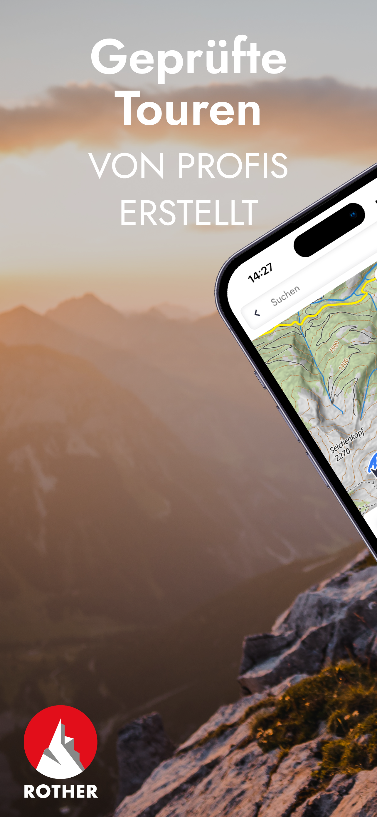
FREE OFFLINE MAPS
You can download our hiking and biking maps for free and use them offline. You can also plan your own routes and record your adventures.
GET ALL TOURS AND MAPS
You have the choice: Unlock individual guides or get them all in the low-priced Gold subscription. This gives you access to all tours from Rother, all premium maps from freytag & berndt, Swisstopo and the satellite map. You can save tours and locations in your own lists, so you can keep track of everything.
EASY TOUR SELECTION
Do you want a leisurely tour today or are you looking for a challenge? Are you looking for a child-friendly hike? No problem: easily filter tours according to your preferences, such as length and difficulty.
HIKING MAPS
Topographic maps in many zoom levels and satellite map. With our premium maps you get the finest cartography from freytag & berndt and others like Swisstopo, BKG, SHOCart, CNIG or Kartverket.
GPS NAVIGATION
While hiking you can always see your location and the track of the tour.
OFFLINE USE
Simply download the map for the desired area and go hiking without an internet connection.
ROUTE DESCRIPTIONS
Reliable tour descriptions and all information about requirements, refreshments, etc.
In a slideshow with photos of the tour you can see what to expect.
PLAN YOUR OWN ROUTE
Route planning with Rother is very easy and understandable: enter your start and destination and we will show you the way - on foot or by bike.
ROTHER GUIDES
You can also get our popular Rother hiking guides. Each guide contains around 50 tested tours by proven area experts.
There are more than 200 guides available for the most beautiful hiking regions worldwide - also for the Way of St. James and long-distance hiking trails as well as for winter (ski tours, snowshoe tours).
If you already have a book from us, you can import the GPS data into the app for free, but not unlock the corresponding guide for free.
ABOUT ROTHER BERGVERLAG
Rother Bergverlag is Europe's most important publisher of hiking guides. The authors are proven area experts who stand for a considered tour selection and the highest quality. All tours are professionally checked in the editorial office.
ABOUT FREYTAG & BERNDT
freytag & berndt is Austria's market leader in the field of cartography. Headquartered in Vienna, the company looks back on 250 years of experience. The extensive product range now includes around 1,500 maps and atlases with a focus on hiking and cycling maps for Austria and Germany, international road and leisure maps, and city maps from Austria and abroad. A team of 50 cartographers ensures that all maps are up-to-date and of high quality.
Terms of Use:
https://www.apple.com/legal/internet-services/itunes/dev/stdeula/
Hide..Show more..
In-Apps
Ibiza
14,99 €
Island
14,99 €
Algarve
14,99 €
Mallorca
14,99 €
La Gomera
14,99 €
Teneriffa
14,99 €
Gran Canaria
14,99 €
Gold subscription
29,99 €
Mallorca – GR 221
14,99 €
Pyrenäen 1 – Spanische Zentral
14,99 €
Screenshots
User Rating
2.6 out of 5
5 ratings
in Spain
5 star
1
4 star
1
3 star
0
2 star
1
1 star
2
Ratings History
Reviews
Nach update nicht zu empfehlen
Vor dem Update war alles übersichtlicher und mit Fotos. Jetzt sind die Fotos weg und die App hat sich betreffs Funktionsfähigkeit verschlechtert. Fand es vorher viel besser. Würde es nicht mehr runterladen.
Bleibe somit bei Komoot. Schade
Why not in english too??
I would like this guide can be written in English too.
No english?
Excellent guide books..but not the app..there’s only in german language and my level is very low..this make the app not downloadable for people don’t speak german..why?i think everybody should to enjoy traveling and exploring with the help of this guide..Is a shame such a helpful app is not translated in other languages..
Super App
Super App mit vielen Details über die erwünschten Routen. Das einzig schlechte ist, dass es sehr das Akku schlaucht..
Great
The app is amazing. I use it for the "Eifel" guide. Nice, complete descriptions of the excursions and the maps works extremely well with the GPS. Fuethermore you can download the maps so you don't need internet access during the hike. Highly recommended!