My scans are bad - any tip?
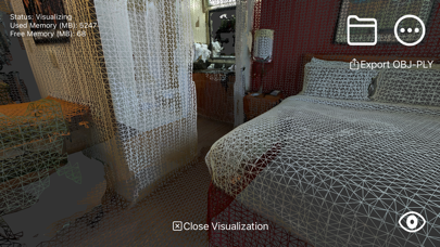
I tired this app often but I always experience drift and misalignments in the mesh Any tip? The video here looks so brilliant

Yes, RTAB-Map is completely free and it doesn't have any in-app purchases or subscriptions.
Not enough reviews to make a reliable assessment. The app needs more user feedback.
RTAB-Map is free.
To get estimated revenue of RTAB-Map app and other AppStore insights you can sign up to AppTail Mobile Analytics Platform.

4.66 out of 5
29 ratings in United States
I tired this app often but I always experience drift and misalignments in the mesh Any tip? The video here looks so brilliant
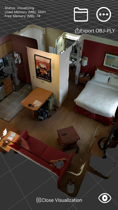
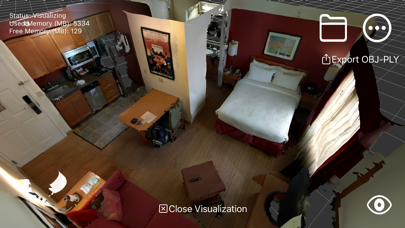
If you’re looking for a 3d scanner app, stop here! You’ve found it. I would give this 6 stars if I could. RTAB-Map is fabulous. It does the job and gets out of the way. No ads, no accounts, no spyware. You open it and it just works. Simple data formats, easy sharing. What a refreshingly straightforward tool—thank you Mathieu!
Exactly what I’ve been looking for…almost. I’m a land surveyor and have been waiting for a self correcting scan app. If able, please provide colorized point cloud export option. This app could prove extremely helpful with that option.
There is no better 3D scanning app for the real 3D scan enthusiast. I have tried all 20 or so of them, with full feature unlocks. The only downside is that big scans need lots of RAM, so go ahead and get yourself a tablet with at least 16GB of RAM. otherwise, it will be unstable and keep closing on you without saving. I’ve had a lot of great scans get lost. But the scans that didn’t get erased are insane. Loop closure is so crazy.

