Description
To get started, tap the arrow button in the toolbar to begin GPS tracking and center the map at your current location. The spinner in the status bar shows that the map is being loaded. The spinner stops when the map is fully cached at that location. You can scroll around the map or tilt the map with a two finger vertical swipe to see it in 3D.
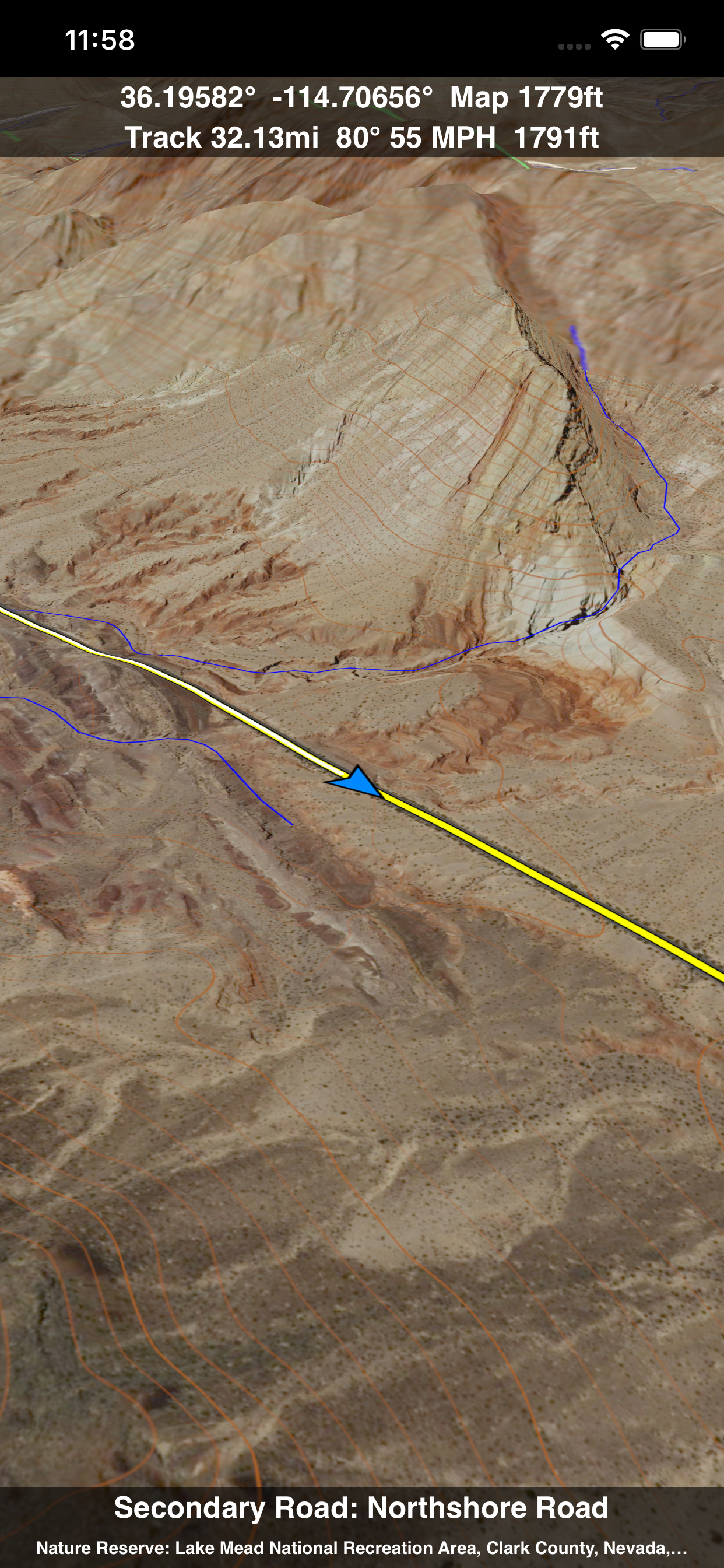
Use the two finger vertical swipe gesture to tilt the map for a 3D view. Scroll like a map or fly like a flight simulator. Enable Joystick Gestures in the Settings menu and then fly around the terrain using a virtual joystick. Prefer only 2D maps? Enable the 2D Map option in the Settings menu.
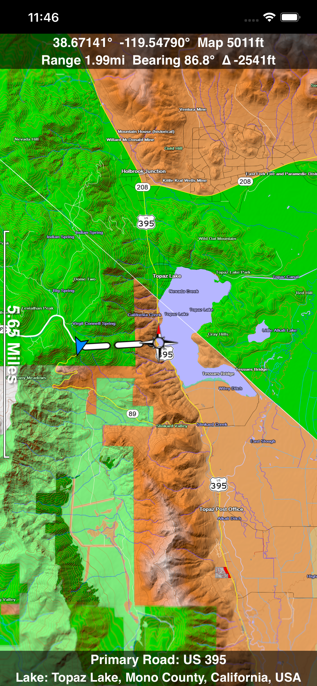
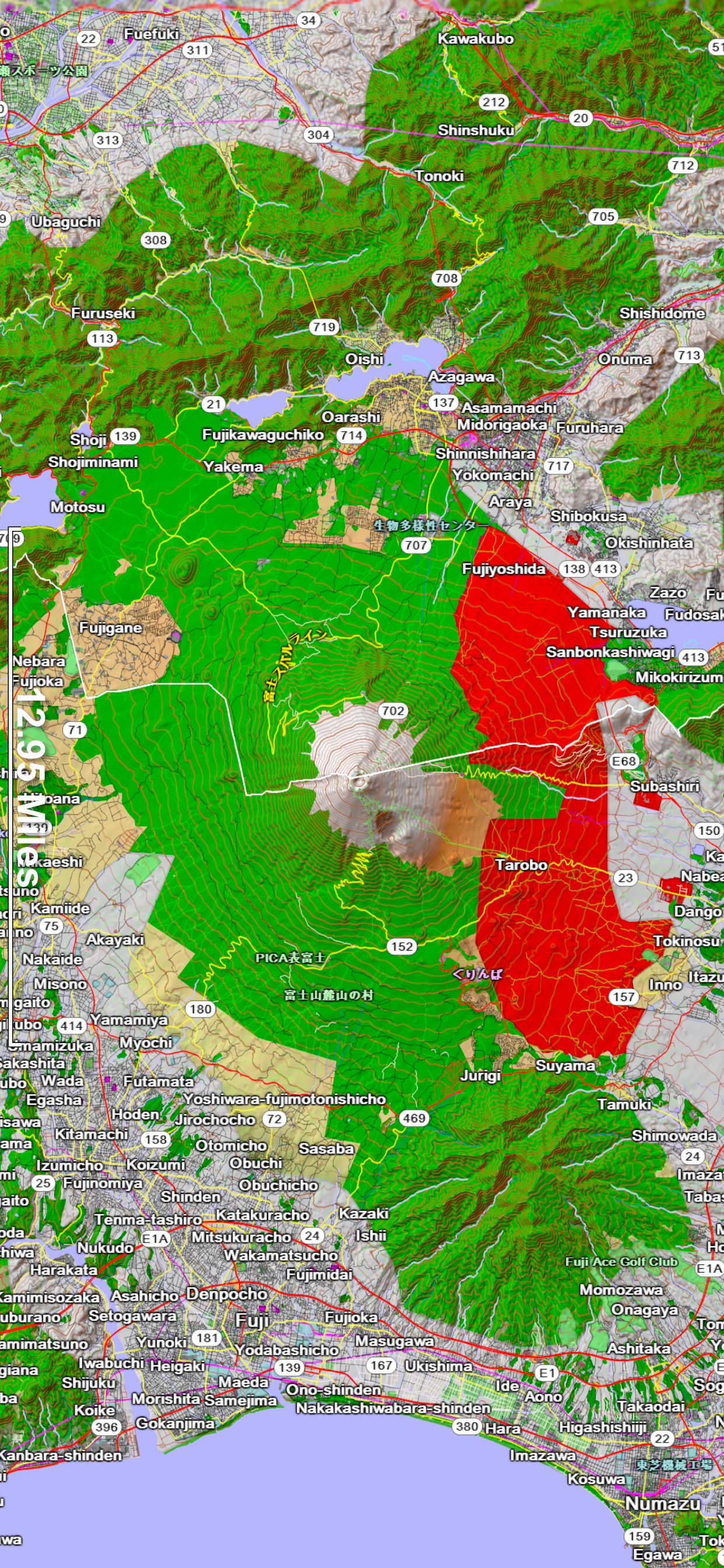
Scenic Map is simply the best 3D topo map available for a mobile device. You will see incredible detail while scrolling, rotating and zooming perfectly smoothly. You will see every road even if you zoom out to the altitude of a satellite. As you zoom in, you will see every small bump and hollow of the Earth and terrain features as small as ten meters. Unlike old fashioned topo maps, Scenic Map’s roads and trails are up to date thanks to OpenStreetMap.org. It contains polygons for urban areas, shopping malls, an ever growing number of buildings and many other features, The best lake, pond, stream and rivers from the USGS and Canadian public databases are also included.
Your tracks can be replayed with video like controls to speed up, slow down, pause, restart or skip to the end. You can display existing tracks while recording another if you want to retrace your route. When online, you can automatically create a route from your current GPS location to any other point on the map. Tracks can be received from or sent to other apps in GPX format. GPS recording stops automatically after you have remained stationary for some time or you can choose to manually stop tracking by tapping on the top track in the Tracks view.
Never before have maps been this customizable. For example, you can turn on or off the roads. You can change the lighting direction or remove terrain shading entirely. You can display contour lines even over satellite images. There are five presets which let you quickly switch between map styles. Use Metric, English or Nautical units and choose one of four different coordinate displays including UTM.
Want to learn more about a map feature? Tap the target icon and center the feature under the compass rose to display its name, type, urban area, county, state, elevation and coordinates. You will also see a bearing line back to your current GPS location or from your location to a selected waypoint. The status bar shows the bearing direction and distance along with the map and GPS elevation, the track length, and your current speed and direction of travel.
In-app documentation is provided in the Help section at the top of the Settings menu. Links are provided in the documentation to detailed coverage maps, tutorial videos, installation guide and blog at ScenicMap.com
Map data © OpenStreetMap and contributors under the Open Database License
Scenic Map supports GPS tracking while the app is in the background.
Caution: Continued use of GPS running in the background can dramatically decrease battery life.
In-Apps
- Scenic Map Features
- $4.99
Screenshots


Scenic Map FAQ
-
Is Scenic Map free?
Yes, Scenic Map is free to download, however it contains in-app purchases or subscription offerings.
-
Is Scenic Map legit?
Not enough reviews to make a reliable assessment. The app needs more user feedback.
Thanks for the vote -
How much does Scenic Map cost?
Scenic Map has several in-app purchases/subscriptions, the average in-app price is $4.99.
-
What is Scenic Map revenue?
To get estimated revenue of Scenic Map app and other AppStore insights you can sign up to AppTail Mobile Analytics Platform.

4.67 out of 5
3 ratings in United States
Scenic Map Reviews
Store Rankings
Keywords
Scenic Map Competitors
Scenic Map Installs
Last 30 days
Scenic Map Revenue
Last 30 daysScenic Map Revenue and Downloads
Sign up now to access downloads, revenue, and more.
App Info
- Category
- Navigation
- Publisher
- Mark Granger
- Languages
- English
- Recent release
- 1.9.2 (1 year ago )
- Released on
- Jun 11, 2015 (9 years ago )
- Also available in
- United States, Lithuania, Peru, New Zealand, Nepal, Norway, Netherlands, Nigeria, Malaysia, Mexico, Latvia, Pakistan, Lebanon, Kazakhstan, Kuwait, South Korea, Japan, Italy, Iceland, Slovenia, South Africa, Vietnam, Uzbekistan, Ukraine, Taiwan, Türkiye, Thailand, Slovakia, Philippines, Singapore, Sweden, Saudi Arabia, Russia, Romania, Portugal, Poland, India, Brunei, Czechia, Colombia, China, Chile, Switzerland, Canada, Belarus, Brazil, Germany, Bahrain, Bulgaria, Belgium, Azerbaijan, Australia, Austria, Argentina, Armenia, France, Israel, Ireland, Indonesia, Hungary, Croatia, Hong Kong SAR China, Greece, United Kingdom, United Arab Emirates, Finland, Spain, Egypt, Estonia, Ecuador, Algeria, Dominican Republic, Denmark
- Last Updated
- 6 days ago