3D Terrain Mapping and Hardscape Leveling System.
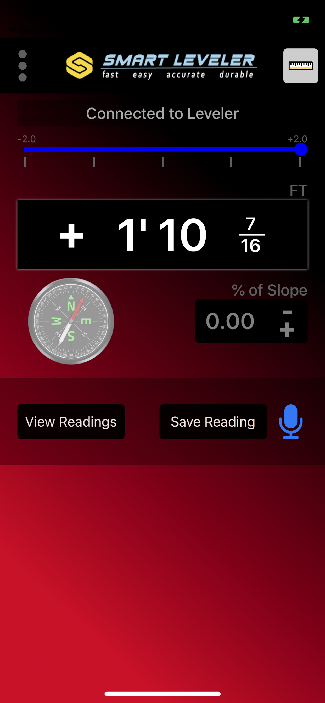
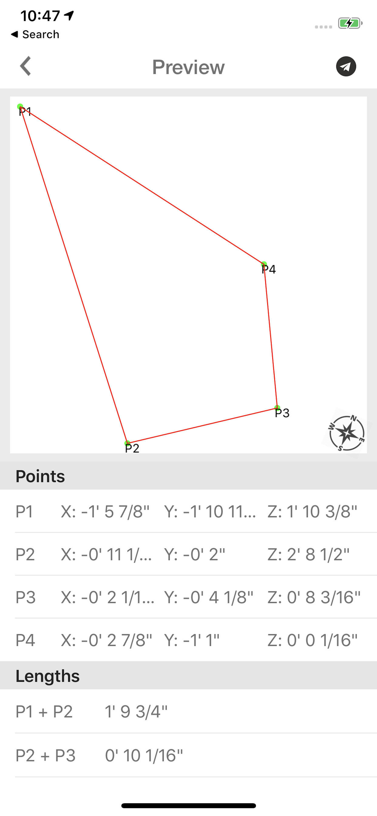
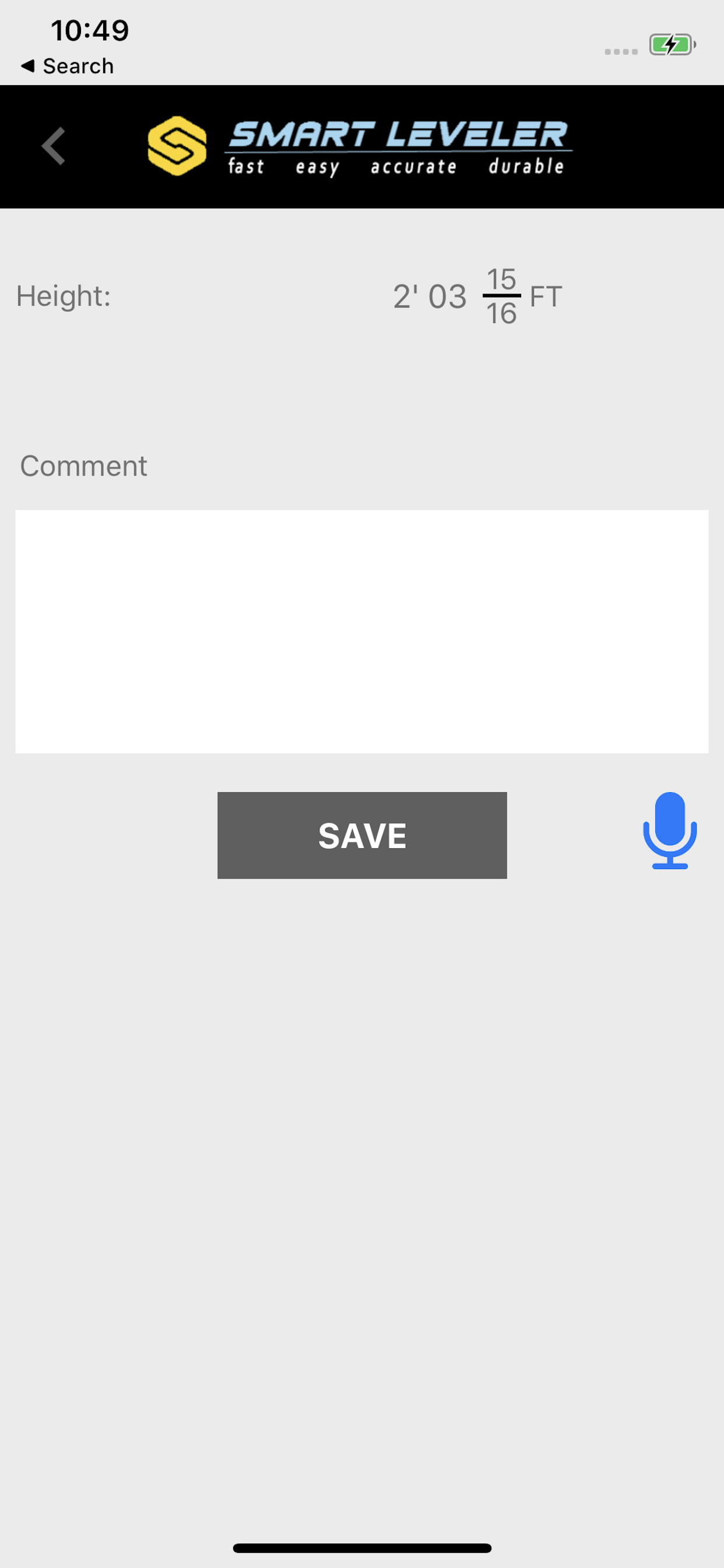
The only Precision Construction Altimeter on the market that allows you to plot or survey true 3D X,Y, and Z measurements then save, email, or upload directly into CAD. The ultimate instrument for bidding jobs. Figures % of Slope, Engineering Scale- Feet above sea level, includes photos with data, and compass.
Designed for the true professional specifically for the Hardscape Industry by Hardscape Pros!
Hide..Show more..
Screenshots
User Rating
4.33 out of 5
6 ratings
in United States
5 star
5
4 star
0
3 star
0
2 star
0
1 star
1
Ratings History
Reviews
Great app. Great machine.
I use this instrument for on- grade foundations and beach houses. I can use it for lot grade as well. It is accurate and easy to use. I don’t have to buy expensive instruments that require periodic factory calibration. This SmartLevel has many industry options.
Jim Hime
Coastal Inspections