
Swiss3D Pro
Peak detection and much more
#1 Keyword Rankings
Today
Top 10 Rankings
Today
Top 30 Rankings
Today
Top 100 Rankings
Today
Description
*** Appreciated by "Le Nouvelliste", "mac4ever.com", "iPhone-blog.ch" and perhaps you!
*** "Best of Swiss Apps Award 2017" nominated
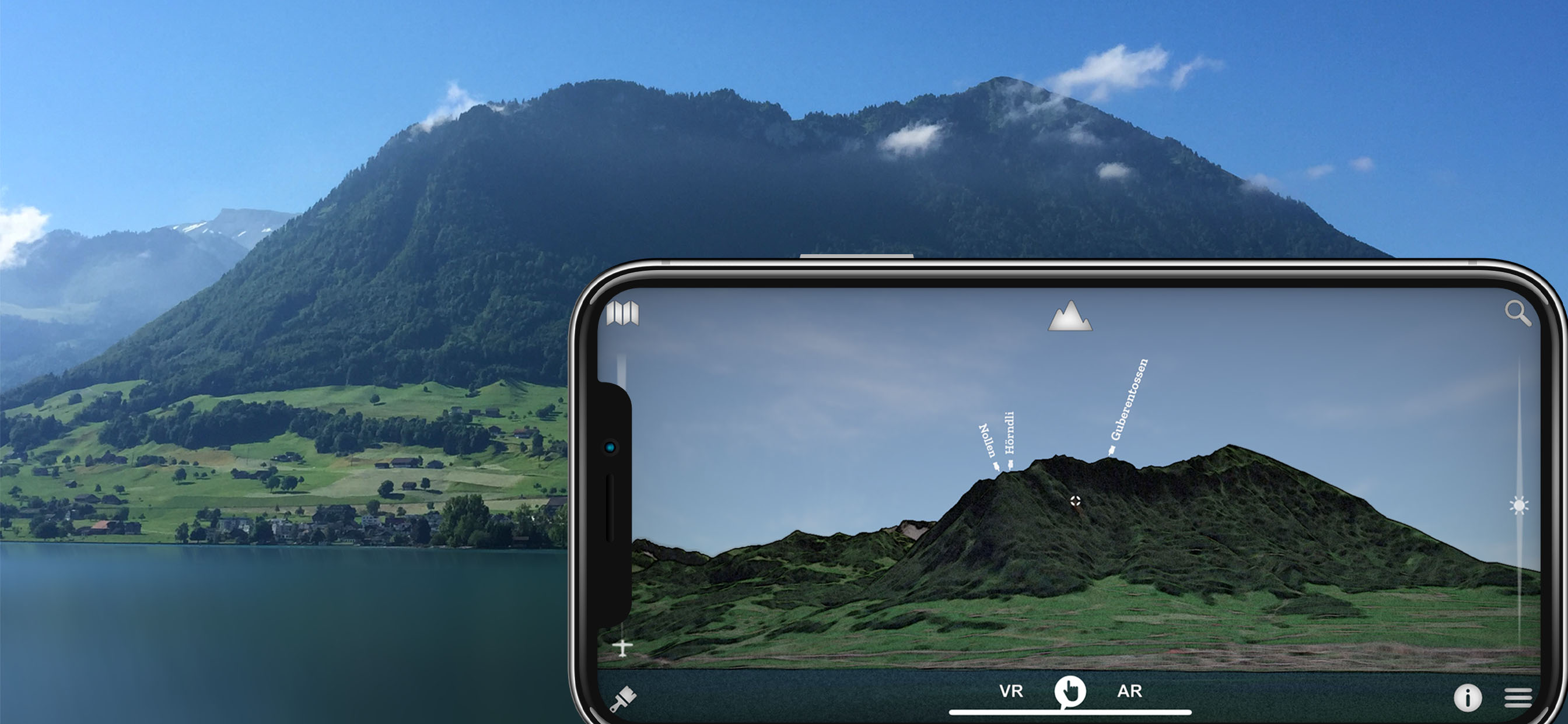
- At which altitude and distance is the cliff over there?
- What is the name of this small town below?
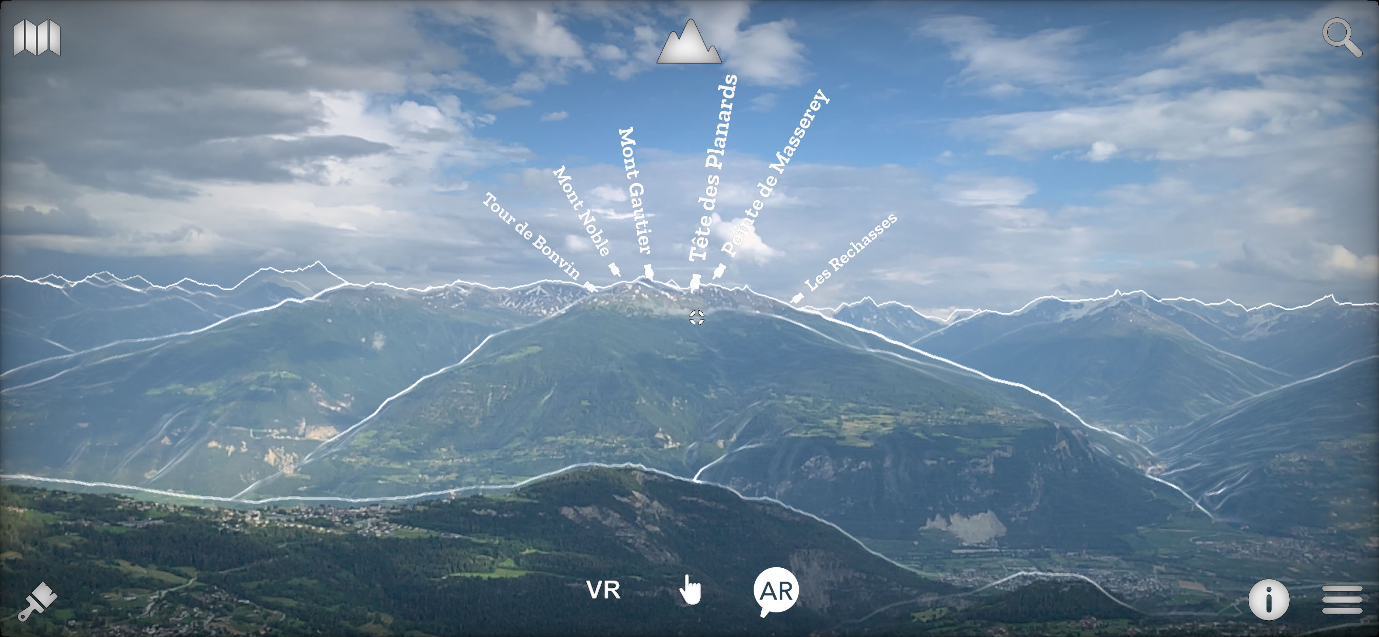
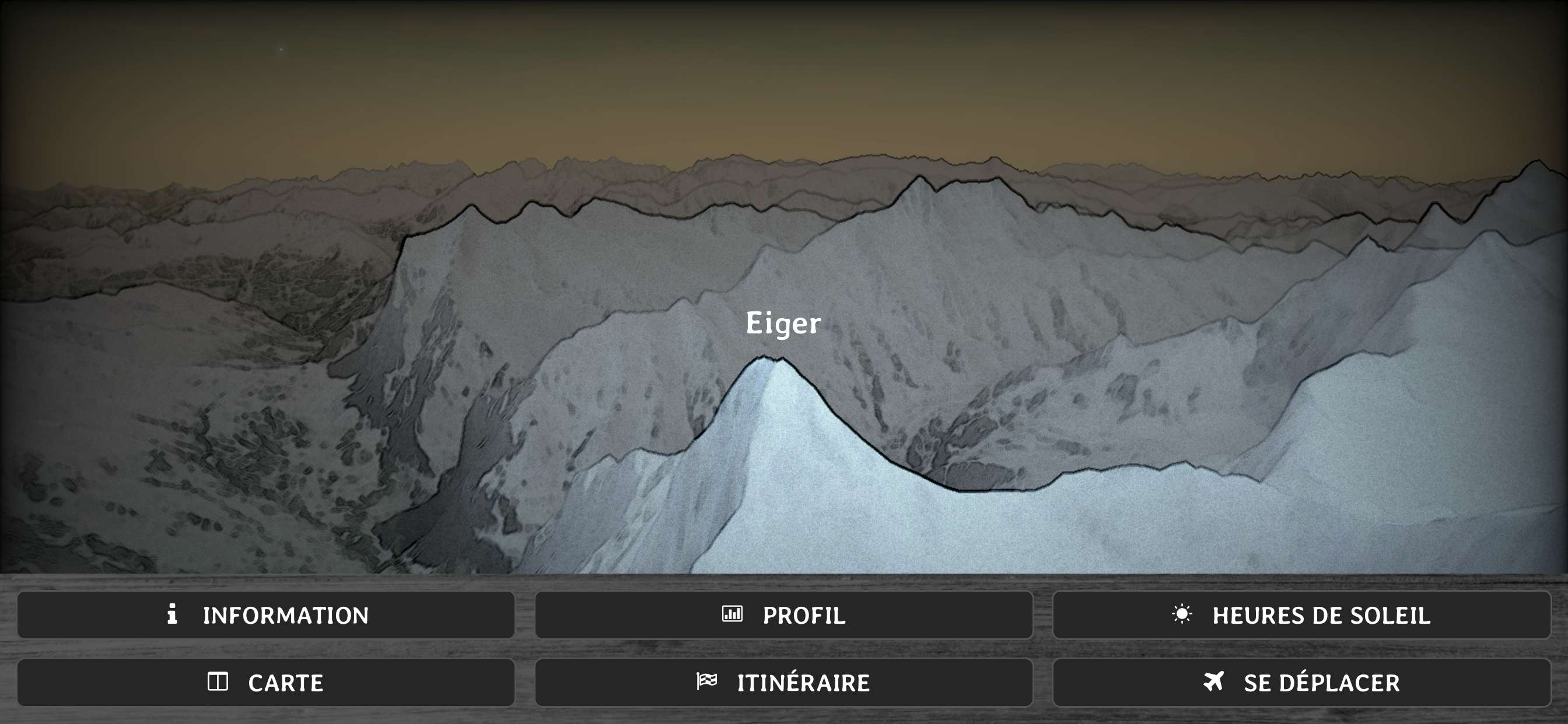
- How is called the peak we are seeing?
- What is the altitude of the Grimsel pass?
- Which mountain is the highest of the region?
- Is there a camping or a mountain refuge nearby?
- What is the name of this glacier or that lake?
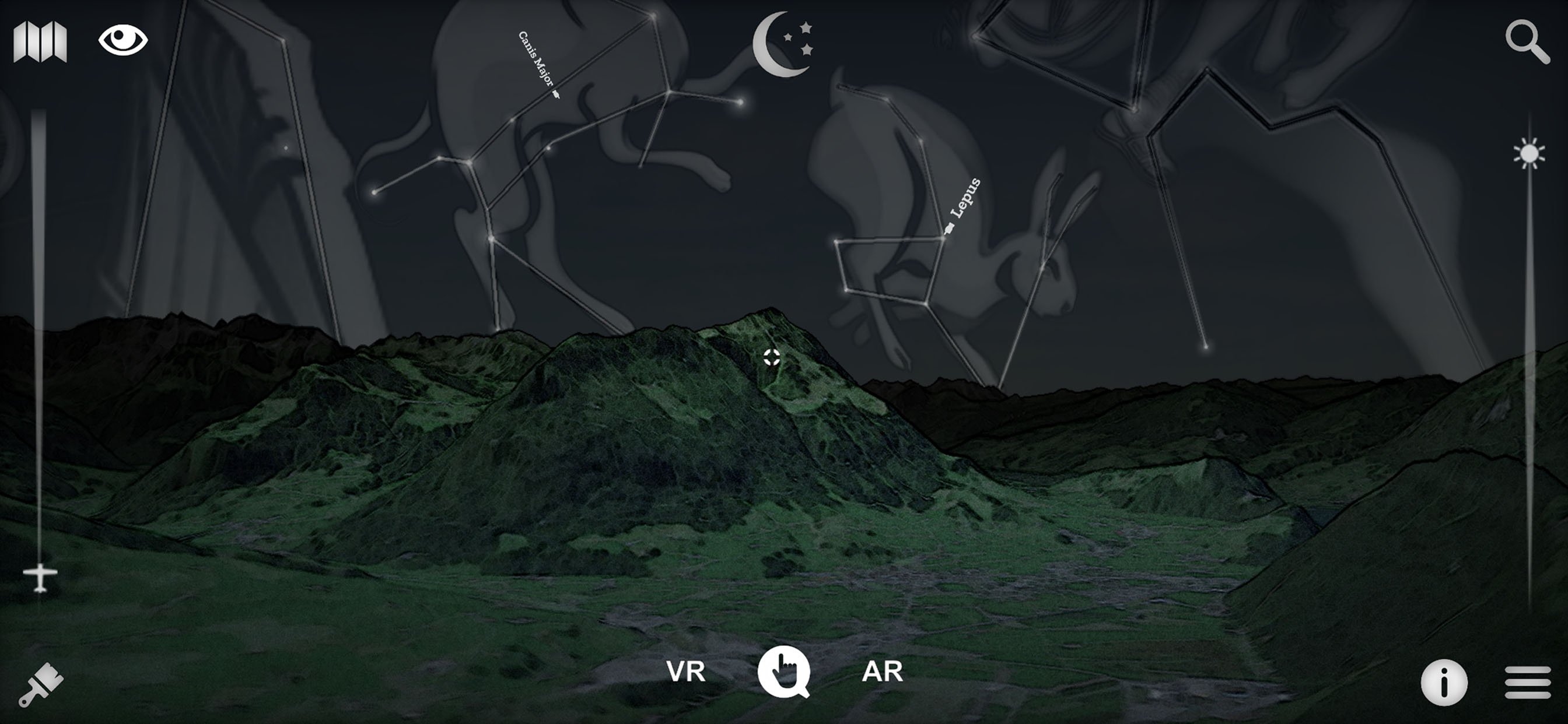
- Is it Jupiter right over this peak?
- The region on this hill has a lot of sun?
- How much walk time is needed to reach that crest, is it steep?
- Is there any message posted by somebody in this area?
- I am asking myself where is the Mattherhorn from here?
- What view do we have from the top of this mountain?
- Is it full moon and where is the moon?
- Is this whole valley over 1000m?
...
It is a question list sample that can be answered with Swiss3D!
Swiss 3D is a, fully offline, precise, real time, virtual 3D map of Switzerland.
It reconstructs your surrounding landscape with accuracy and displays all peaks, towns, cities, places, lakes, passes, glaciers, mountain huts, ...
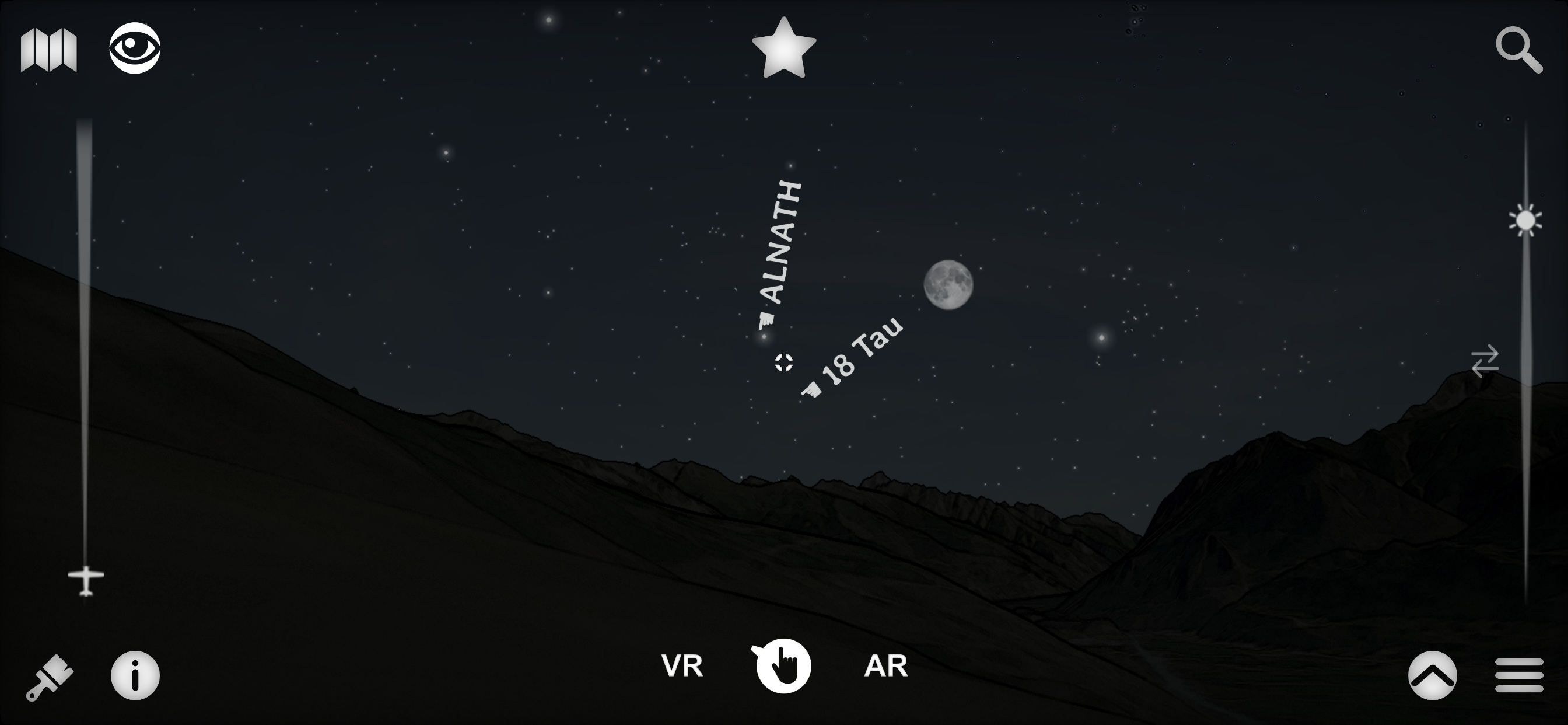
It also rebuild the current time sky and shows all brightest stars, solar system planets and all constellations.
The app contains an VR and AR mode that enable you to see the environment as seen through binoculars.
You can also share your current favorite position to everybody.
Reading a map has never been that fun and easy!
Features:
▫ no internet connection required
▫ virtual and augmented reality (ARKit) or manual mode
▫ accurate Swisstopo data
▫ 54000 places, 15000 peaks, 9000 stars, pass, lakes, mountain huts, ...
▫ landsat satellite imagery
▫ summer and winter
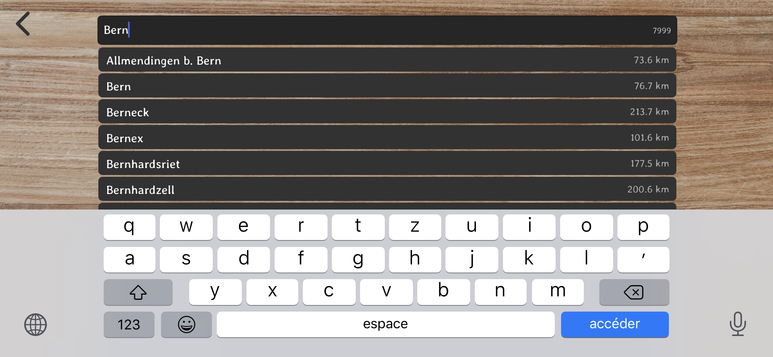
▫ search function
▫ dynamic aerial view
▫ easy controls
▫ map
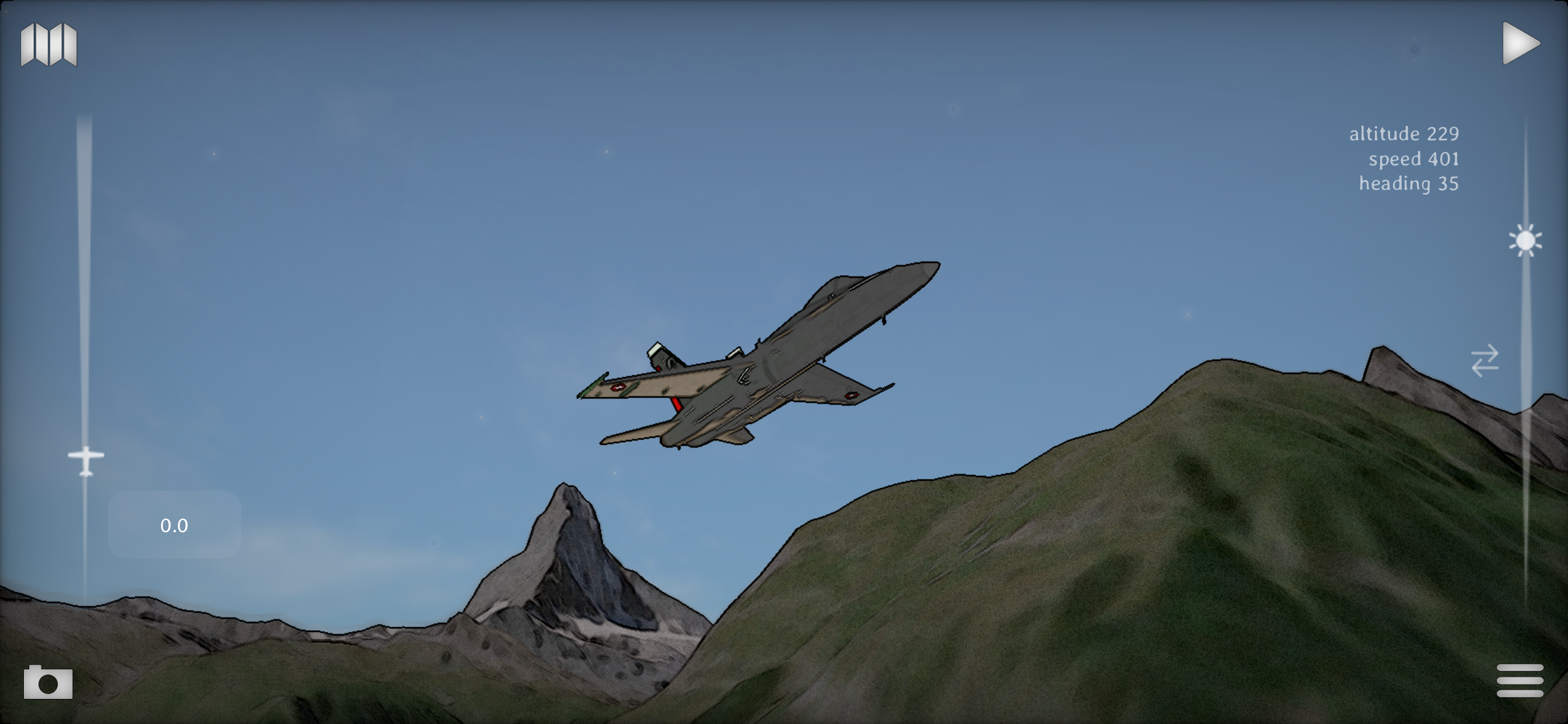
▫ flight simulator
▫ share and comment your favorite location
▫ target information: distance, altitude, slope, sun time, walk time...
▫ only on iOS
▫ made in Switzerland for Switzerland
-> iPhone 6s (A9) and more required for the AR!
Source: Office fédéral de topographie / geonames
Satellite Image: Modified Copernicus Sentinel data [2019] swisstopo, NPOC
Elevation Data: ViewFinderPanoramas
Stars: Bright Star/Hipparcos catalogue, Jean Meeus
Constellations: Stellarium / Johan Meuris pictures
Cockpit: Vertical Reality Simulations
Hide..
Show more..
*** "Best of Swiss Apps Award 2017" nominated
- At which altitude and distance is the cliff over there?
- What is the name of this small town below?
- How is called the peak we are seeing?
- What is the altitude of the Grimsel pass?
- Which mountain is the highest of the region?
- Is there a camping or a mountain refuge nearby?
- What is the name of this glacier or that lake?
- Is it Jupiter right over this peak?
- The region on this hill has a lot of sun?
- How much walk time is needed to reach that crest, is it steep?
- Is there any message posted by somebody in this area?
- I am asking myself where is the Mattherhorn from here?
- What view do we have from the top of this mountain?
- Is it full moon and where is the moon?
- Is this whole valley over 1000m?
...
It is a question list sample that can be answered with Swiss3D!
Swiss 3D is a, fully offline, precise, real time, virtual 3D map of Switzerland.
It reconstructs your surrounding landscape with accuracy and displays all peaks, towns, cities, places, lakes, passes, glaciers, mountain huts, ...
It also rebuild the current time sky and shows all brightest stars, solar system planets and all constellations.
The app contains an VR and AR mode that enable you to see the environment as seen through binoculars.
You can also share your current favorite position to everybody.
Reading a map has never been that fun and easy!
Features:
▫ no internet connection required
▫ virtual and augmented reality (ARKit) or manual mode
▫ accurate Swisstopo data
▫ 54000 places, 15000 peaks, 9000 stars, pass, lakes, mountain huts, ...
▫ landsat satellite imagery
▫ summer and winter
▫ search function
▫ dynamic aerial view
▫ easy controls
▫ map
▫ flight simulator
▫ share and comment your favorite location
▫ target information: distance, altitude, slope, sun time, walk time...
▫ only on iOS
▫ made in Switzerland for Switzerland
-> iPhone 6s (A9) and more required for the AR!
Source: Office fédéral de topographie / geonames
Satellite Image: Modified Copernicus Sentinel data [2019] swisstopo, NPOC
Elevation Data: ViewFinderPanoramas
Stars: Bright Star/Hipparcos catalogue, Jean Meeus
Constellations: Stellarium / Johan Meuris pictures
Cockpit: Vertical Reality Simulations
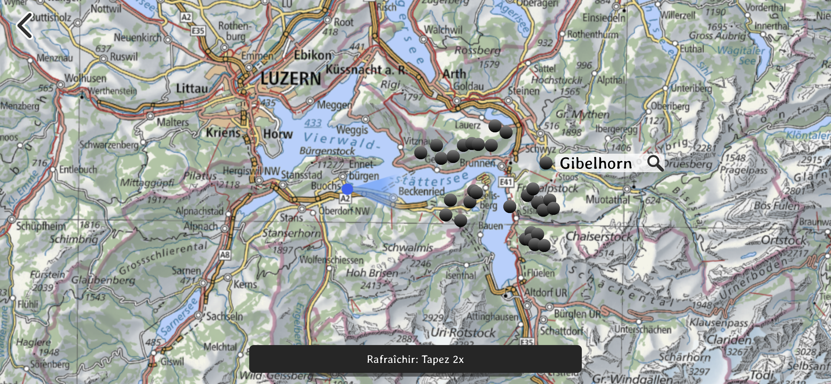
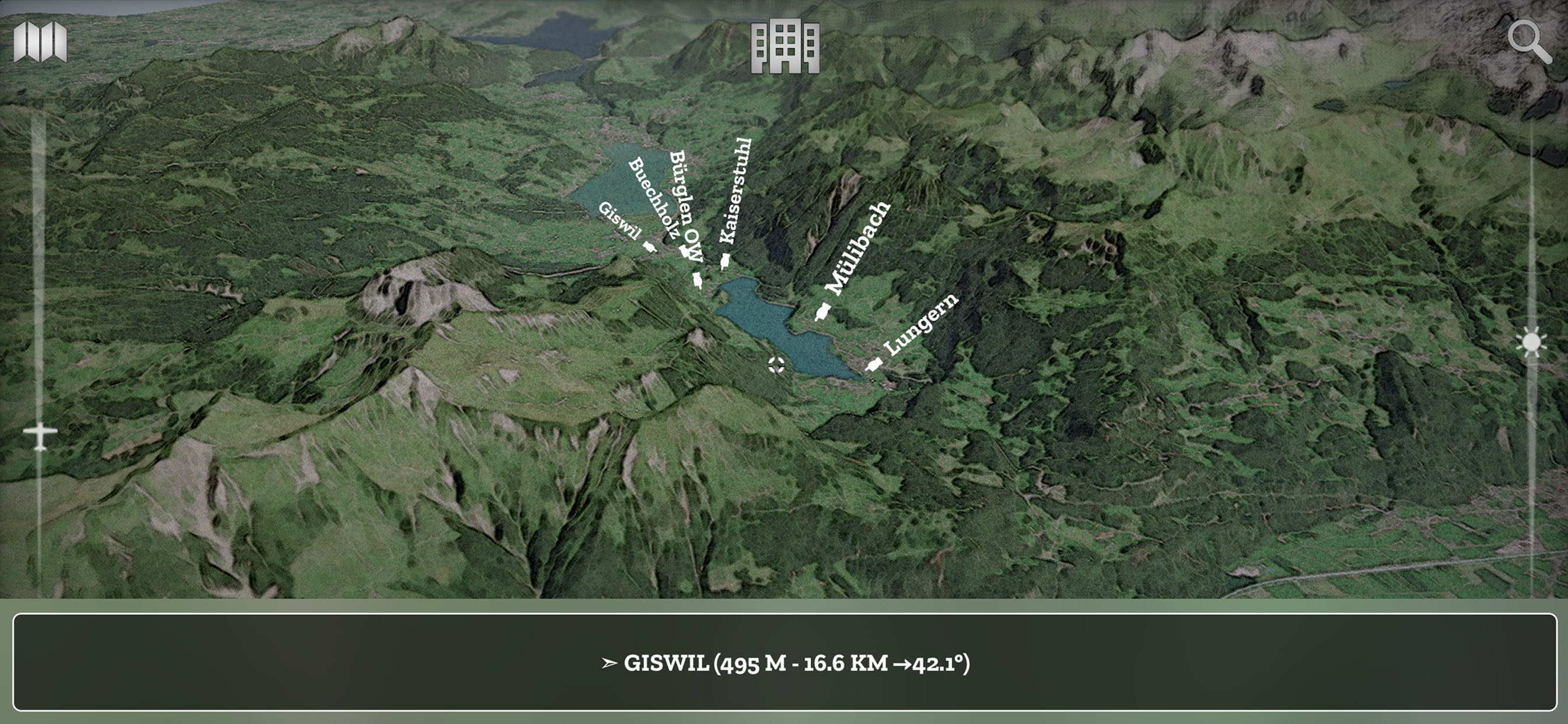
Screenshots

 User Rating
0 out of 5
0 ratings in Belarus
Ratings History
Reviews
App doesn't have any reviews yet
Store Rankings
Ranking History
App Ranking History not available yet
Category Rankings
|
Chart
|
Category
|
Rank
|
|---|---|---|
|
Top Paid
|

|
7
|
|
Top Grossing
|
|
71
|
|
Top Paid
|
|
72
|
|
Top Paid
|

|
99
|
|
Top Paid
|

|
103
|
Keywords
Users may also like
| Name | Reviews | Recent release | |
|---|---|---|---|

SwitzerlandMobility
Non-motorized traffic network
|
0
|
4 months ago | |

Hiking Map Schweiz
|
0
|
4 months ago | |

Tourenplaner SCHWEIZ
|
0
|
2 weeks ago | |

swisstopo
Official Swiss Maps
|
0
|
1 week ago | |

The Swiss National Park
pure wilderness
|
0
|
1 year ago | |

SAC – Swiss Alpine Club
Mountain tours, huts & more
|
0
|
2 months ago | |

Swiss Pro Map
Maps for Switzerland and Alps
|
0
|
2 days ago | |

BoatDriver-Guide Swiss
Harbour and sea guide
|
0
|
2 years ago | |

Pässe.Info
Alpenpässe Pässe Motorrad Auto
|
0
|
1 year ago | |

Swiss Parks App
|
0
|
8 months ago |
Show More
Revenue and Downloads
Gain valuable insights into Swiss3D Pro performance with our analytics. Sign up now
to
access downloads, revenue, and more.
App Info
- Category
- Travel
- Publisher
- Louis-Joseph Mayoraz
- Languages
- English, French, German
- Recent version
- 12.8.6 (5 months ago )
- Released on
- Nov 24, 2012 (11 years ago )
- Also available in
- Switzerland, Germany, France, United States, United Kingdom, Belgium, Netherlands, India, Czechia, Colombia, Spain, Italy, Australia, Austria, Saudi Arabia, Nigeria, Malaysia, Norway, New Zealand, Peru, Philippines, Pakistan, Mexico, Poland, Portugal, Romania, South Africa, Sweden, Singapore, Thailand, Turkey, Taiwan, Ukraine, Vietnam, United Arab Emirates, Finland, Argentina, Azerbaijan, Brazil, Belarus, Canada, Chile, Denmark, Dominican Republic, Algeria, Ecuador, Egypt, Lebanon, Greece, Hong Kong, Hungary, Indonesia, Ireland, Israel, Japan, South Korea, Kuwait, Kazakhstan
- Last updated
- 2 weeks ago