Texas Pocket Maps

Outdoor Guides & Maps

Published by: Alex Gugel
Downloads
Revenue

Description

Seien Sie vorbereitet! Planen Sie Ihre nächste Reise zu einem der großartigen Parks in Texas. Laden Sie Karten und Reiseführer herunter, bevor Sie sich in die WLAN-freie Wildnis wagen.
Entdecken
- Über 110 Nationalparks, Staatsparks, Denkmäler, Wälder
- Über 90 ordentlich gefaltete Karten vom National Park Service, Bureau of Land Management, United States Forest Services und anderen Behörden.
- Motor Vehicle Use Maps (MVUM), Motor Vehicle Travel Maps (MVTM) und Besucherkarten für die Nationalwälder in Texas.
- Über 800 Campingplätze und Zeltplätze
- Über 1.800 Wanderwege und Ausgangspunkte
- Über 130.000 Sehenswürdigkeiten
Planen
- Laden Sie Karten, Parkbroschüren und Zeitungen herunter. Diese Downloads sind bereit, wenn Sie offline und abseits des Netzes in der freien Natur sind.
- Laden Sie beliebige Kartenausschnitte als Offline-Pakete herunter.
- Fotogalerien, Panoramablicke.
- Teilen Sie Links zu Parks und Karten mit Freunden.
Viel Spaß
- GPS- und GPX-Unterstützung: Zeichnen Sie Ihre Wanderungen auf, importieren Sie GPX-Routen, Tracks und Wegpunkte für Ihre Wanderwege.
- Detaillierte Informationen zu Nationalparks: Warnungen, Nachrichten, Besucherzentren, Campingplätze, Wegbeschreibungen, Wetter.
- Öffnen Sie Ihre bevorzugte Karten-App, um eine Route zum ausgewählten Park zu erhalten.
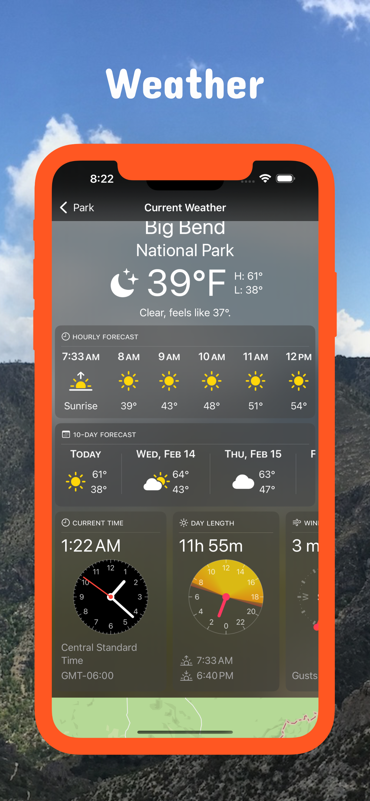
- Aktuelle Wetterbedingungen, einfacher Zugang zu mehrtägigen Vorhersagen, Sonnenauf- und -untergangszeiten.
- Push-Benachrichtigungen für Parkwarnungen, Parknachrichten, Wetterwarnungen.
Laden Sie also Karten und Reiseführer herunter für:
- Abilene, Alibates Flint Quarries, Amistad, Anahuac, Angelina, Aransas, Atlanta, Attwater Prairie Chicken
- Balcones Canyonlands, Balmorhea, Bastrop, Bentsen-Rio Grande Valley, Big Bend, Big Bend Ranch, Big Boggy, Big Spring, Big Thicket, Blanco, Bonham, Brazoria, Brazos Bend, Buescher, Buffalo Lake
- Caddo, Caddo Lake, Caprock Canyons, Carlsbad Caverns, Cedar Hill, Chamizal, Chickasaw, Choke Canyon, Cleburne, Colorado Bend, Cooper Lake, Copper Breaks
- Daingerfield, Davis Mountains, Davy Crockett, Devils River, Devil's Sinkhole, Dinosaur Valley
- Eisenhower, El Camino Real de los Tejas, El Camino Real de Tierra Dentro, Enchanted Rock, Estero Llano Grande
- Fairfield Lake, Falcon, Fort Davis, Fort Parker, Franklin Mountains
- Garner, Government Canyon, Grulla, Guadalupe Mountains
- Hagerman, Hill Country, Hueco Tanks, Huntsville
- Inks Lake
- Kickapoo Cavern
- Laguna Atascosa, Lake Bob Sandlin, Lake Brownwood, Lake Colorado City, Lake Meredith, Lake Mineral Wells, Lake Tawakoni, Lake Whitney, Longhorn Cavern, Lost Maples, Lower Rio Grande Valley, Lyndon B Johnson
- Martin Creek Lake, McFaddin, Mission Tejas, Monahans Sandhills, Muleshoe, Mustang Island
- Neches River
- Padre Island, Palo Alto Battlefield, Palo Duro Canyon, Pedernales Falls, Possum Kingdom, President William Jefferson Clinton Birthplace Home, Purtis Creek
- Ray Roberts Lake, Resaca de la Palma, Rio Grande
- Sabine, Sam Houston, San Angelo, San Antonio Missions, San Bernard, Santa Ana, Sea Rim, Somerville Lake, South Llano River
- Texas Point, Trinity River
- Waco Mammoth, Washita Battlefield, White Sands
Hide Show More...

In-Apps

access all pro features
179.00 r

Screenshots

Texas Pocket Maps FAQ

  • Is Texas Pocket Maps free?

    Yes, Texas Pocket Maps is free to download, however it contains in-app purchases or subscription offerings.

  • Is Texas Pocket Maps legit?

    Not enough reviews to make a reliable assessment. The app needs more user feedback.

    Thanks for the vote

  • How much does Texas Pocket Maps cost?

    Texas Pocket Maps has several in-app purchases/subscriptions, the average in-app price is 179.00 r.

  • What is Texas Pocket Maps revenue?

    To get estimated revenue of Texas Pocket Maps app and other AppStore insights you can sign up to AppTail Mobile Analytics Platform.

User Rating
App is not rated in Norway yet.
Ratings History

Texas Pocket Maps Reviews

Other Great Destinations?

rexjc on

United States

This app contains Texas State Parks and national state parks. Mostly state & federal government stuff wears the other great destinations? Texas has thousands of other great destinations. You don’t have listed here. If you’re considering paying for this, you can get other information on the state parks from other places! I did not see any other great destinations on this App!

Store Rankings

Ranking History
App Ranking History not available yet
Category Rankings
App is not ranked yet

Texas Pocket Maps Competitors

Name
Texas State Parks Guide
Official TPWD Guide
NP Maps
National Park & Topos maps USA
Parks Seeker
Exploring U.S. National Parks
Visit Big Bend!
& Brewster County
Tour Texas
Texas Tourism Information
Texas Historical Marker Guide
Texas Roadtrip
Find Landmarks In Texas
Texas Hill Country Travel App
Backroads Vacation Home Rental
Outdoor Explorer: Texas
TX State Parks
Texas State Park Locations

Texas Pocket Maps Installs

Last 30 days

Texas Pocket Maps Revenue

Last 30 days

Texas Pocket Maps Revenue and Downloads

Gain valuable insights into Texas Pocket Maps performance with our analytics.
Sign up now to access downloads, revenue, and more.

App Info

Category
Travel
Publisher
Alex Gugel
Languages
Catalan, Croatian, Czech, Danish, Dutch, English, Finnish, French, German, Greek (modern), Hindi, Hungarian, Indonesian, Italian, Japanese, Korean, Malay, Norwegian Bokmål, Polish, Portuguese, Romanian, Russian, Slovak, Spanish, Swedish, Thai, Chinese, Turkish
Recent release
6.8 (15 hours ago )
Released on
May 4, 2019 (5 years ago )
Last Updated
6 days ago
This page includes copyrighted content from third parties, shared solely for commentary and research in accordance with fair use under applicable copyright laws. All trademarks, including product, service, and company names or logos, remain the property of their respective owners. Their use here falls under nominative fair use as outlined by trademark laws and does not suggest any affiliation with or endorsement by the trademark holders.