Topo Maps for iPad
#1 Keyword Rankings
Today
Top 10 Rankings
Today
Top 30 Rankings
Today
Top 100 Rankings
Today
Description
* The iPad is a fantastic map viewer, and Topo Maps for iPad gives it access to over 70,000 USGS and Canadian topographical maps. * Ideal for hiking and other backcountry activities. * Map downloads are FREE! * More than 4 million maps downloaded so far! * Users write:
" I've bought all the topo map apps and I like this the best "
" Scans are gorgeous ... the interface is exceptionally clean "
" Downloading maps is easy and fast ... Map displays beautifully and zooms flawlessly "
* Includes Alaska (at 1:24,000 and 1:63,360) and Canada (at 1:50,000), plus Hawaii, Puerto Rico and the U.S. Virgin Islands.
* Locate the maps you need on the satellite view. To install a map, touch for about half a second. Touch again to view it.
* Search by name for over a million towns, peaks, lakes, parks and other features.
* No network connection is needed once the maps have been installed.
* Mark waypoints, and import and export waypoint files in GPX, KML and CSV formats.
* Touch the "current location" button to see where you are, and the compass button to align the map with the ground.
* See coordinates in NAD27 or WGS84 degrees, degrees minutes and seconds, UTM, or MGRS formats.
* Measure distances (miles, feet and km) and bearings (true and magnetic).
Coverage: this app makes available more than 70,000 maps covering the United States, including Alaska, Hawaii, Puerto Rico and the U.S. Virgin Islands, and Canada.
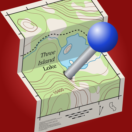
The Maps: This app uses high-quality scans of the traditional USGS and NRCan topographic maps which have been the definitive resource for hikers and other backcountry users for many years. You can make the terrain stand out with hill shading, using simulated sunlight from the direction of your choice. This app does not use the new "US Topo" maps because they do not show hiking trails and lack other details: please see the web site for more details.
Downloading: US maps are around 8 MB in size and download in a few seconds on a typical home broadband connection. Canadian maps are larger. Both cellular data and WiFi can be used, though WiFi is likely to be more reliable in most cases.
- Do please visit http://topomapsapp.com/ for complete instructions, so that you don't miss any features.
We have many ideas for additional features to add to future versions of this app; if you have ideas or other questions or comments, contact details can be found on the website, http://topomapsapp.com/. The website also has more screenshots and other information.
Hide..
Show more..
" I've bought all the topo map apps and I like this the best "
" Scans are gorgeous ... the interface is exceptionally clean "
" Downloading maps is easy and fast ... Map displays beautifully and zooms flawlessly "
* Includes Alaska (at 1:24,000 and 1:63,360) and Canada (at 1:50,000), plus Hawaii, Puerto Rico and the U.S. Virgin Islands.
* Locate the maps you need on the satellite view. To install a map, touch for about half a second. Touch again to view it.
* Search by name for over a million towns, peaks, lakes, parks and other features.
* No network connection is needed once the maps have been installed.
* Mark waypoints, and import and export waypoint files in GPX, KML and CSV formats.
* Touch the "current location" button to see where you are, and the compass button to align the map with the ground.
* See coordinates in NAD27 or WGS84 degrees, degrees minutes and seconds, UTM, or MGRS formats.
* Measure distances (miles, feet and km) and bearings (true and magnetic).
Coverage: this app makes available more than 70,000 maps covering the United States, including Alaska, Hawaii, Puerto Rico and the U.S. Virgin Islands, and Canada.
The Maps: This app uses high-quality scans of the traditional USGS and NRCan topographic maps which have been the definitive resource for hikers and other backcountry users for many years. You can make the terrain stand out with hill shading, using simulated sunlight from the direction of your choice. This app does not use the new "US Topo" maps because they do not show hiking trails and lack other details: please see the web site for more details.
Downloading: US maps are around 8 MB in size and download in a few seconds on a typical home broadband connection. Canadian maps are larger. Both cellular data and WiFi can be used, though WiFi is likely to be more reliable in most cases.
- Do please visit http://topomapsapp.com/ for complete instructions, so that you don't miss any features.
We have many ideas for additional features to add to future versions of this app; if you have ideas or other questions or comments, contact details can be found on the website, http://topomapsapp.com/. The website also has more screenshots and other information.
Screenshots


 User Rating
3.67 out of 5
3 ratings in Spain
5 star
0
4 star
2
3 star
1
2 star
0
1 star
0
Ratings History
Reviews
Store Rankings
Ranking History
App Ranking History not available yet
Category Rankings
App is not ranked yet
Keywords
Users may also like
| Name | Reviews | Recent release | |
|---|---|---|---|

Streets - Street View Browser
360° panorama world tour
|
0
|
7 months ago | |

Ben Nevis, West Scotland Map
Outdoor Topo Map
|
0
|
2 years ago | |

Discover Georgia Trails
|
0
|
1 month ago | |

Flytomap All in One HD Charts
Charts & Maps GPS Navigator
|
0
|
2 weeks ago | |

Hiking Trail Map (Offline)
High-quality worldwide trails
|
0
|
1 year ago | |

Amtrak Destinations Pro
Commuter rail station alerts
|
0
|
4 months ago | |

Hot Spring Iceland
Find pools and hot tubs.
|
0
|
2 years ago | |

Planningcharts Reader
Keep your charts up to date!
|
0
|
1 month ago | |

Discover Angkor Wat - Guide
Audio tour and map, offline.
|
0
|
4 months ago | |

CACams - California traffic
|
0
|
1 year ago |
Show More
Revenue and Downloads
Gain valuable insights into Topo Maps for iPad performance with our analytics. Sign up now
to
access downloads, revenue, and more.
App Info
- Category
- Navigation
- Publisher
- Mappendix Limited
- Languages
- English
- Recent version
- 1.19 (1 year ago )
- Released on
- Apr 24, 2010 (14 years ago )
- Also available in
- United States, Russia, Thailand, Spain, Italy, Japan, India, Singapore, Saudi Arabia, Romania, Portugal, Norway, Kuwait, Austria, Australia, Switzerland, Greece, United Kingdom, France, Indonesia, Poland, Belgium, Sweden, Czechia, Denmark, Dominican Republic, Algeria, Philippines, Malaysia, Hong Kong, Hungary, Israel
- Last updated
- 1 week ago