Refused refund; DON’T BUY IT!
Neither Apple nor this app allowed cancellation. They collect way too much info and sell it. No way found to stop them or to get refund. Very suspicious.


Topographic Maps & Trails is not free (it costs 6.99), however it doesn't contain in-app purchases or subscriptions.
🤔 The Topographic Maps & Trails app's quality is mixed. Some users are satisfied, while others report issues. Consider reading individual reviews for more context.
The price of Topographic Maps & Trails is 6.99.
To get estimated revenue of Topographic Maps & Trails app and other AppStore insights you can sign up to AppTail Mobile Analytics Platform.

4.2 out of 5
15 ratings in Canada
Neither Apple nor this app allowed cancellation. They collect way too much info and sell it. No way found to stop them or to get refund. Very suspicious.
USFS Maps are not as expected, no trail maps, not the online version of USFS Maps. Disappointed. Wish I could get my $5 back
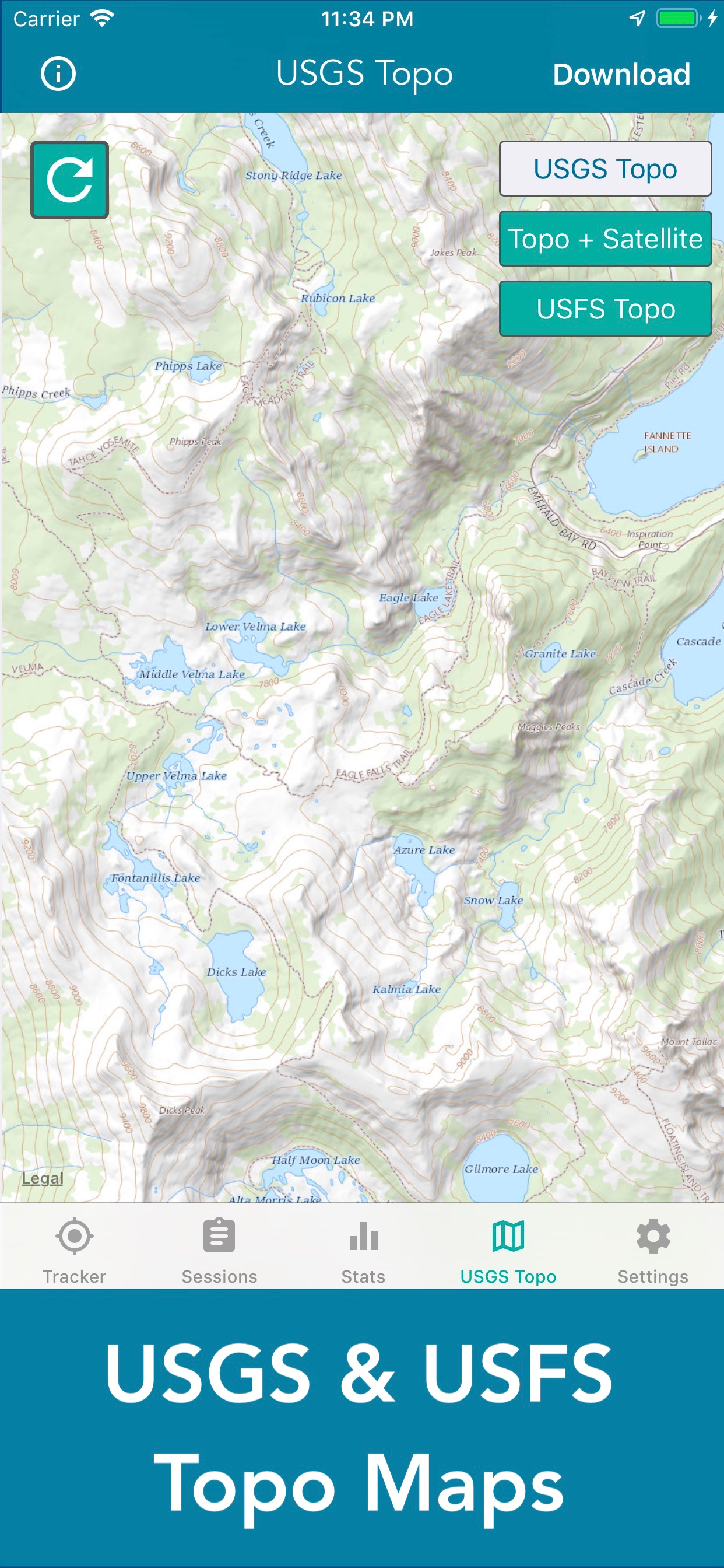
These maps are hard to read and are not USGS 7.5 minute topographic maps. False advertising.
Map does not show detailed i
There are many apps with similar goals and I own some and tried many of them. This is a very good one, simple to use intuitive in controls, etc. What make is stand out head and shoulders above others is the system of prompts and user guidance that pop on the screen, the device memory use and user friendliness. I wish ALL APPS ON MY iPhone were made by this apps author! Wish list: Integration with iPhone health app. If it is already integrated, I did not see it.
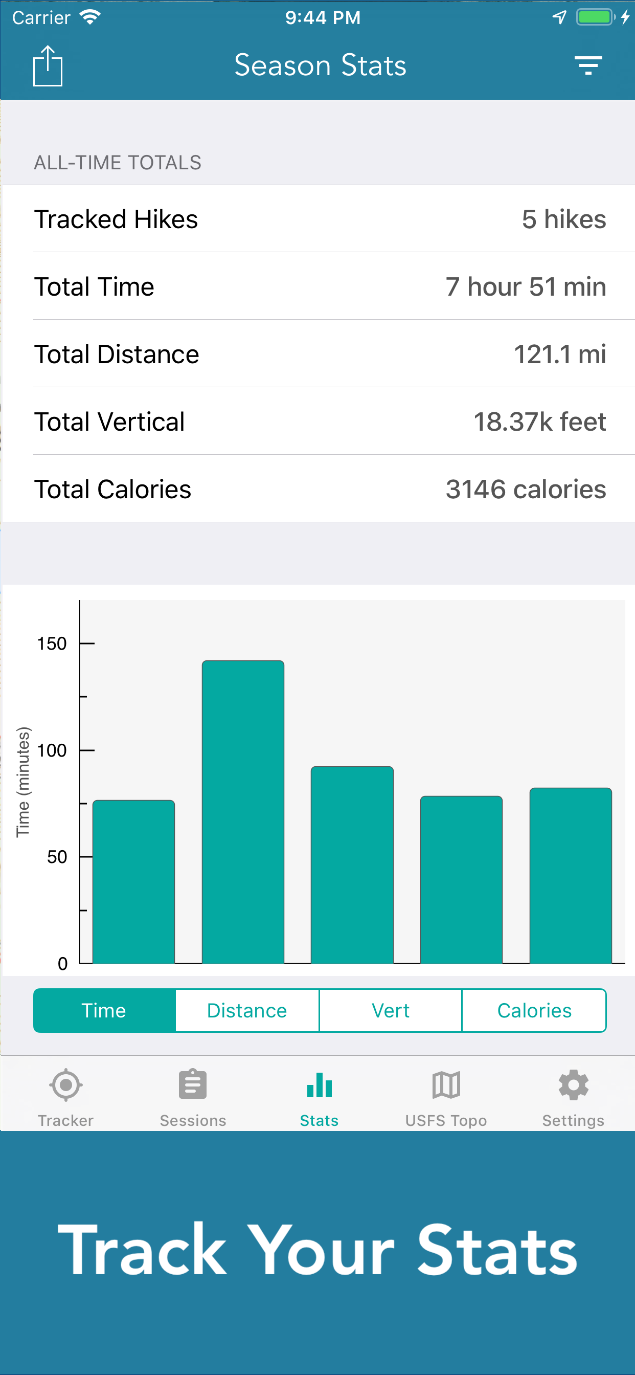
Overall this is my go-to hiking app to make sure I don’t get lost. Saving the sessions is awesome, however I wish I could rename the sessions as I slowly don’t remember which one was on which date.
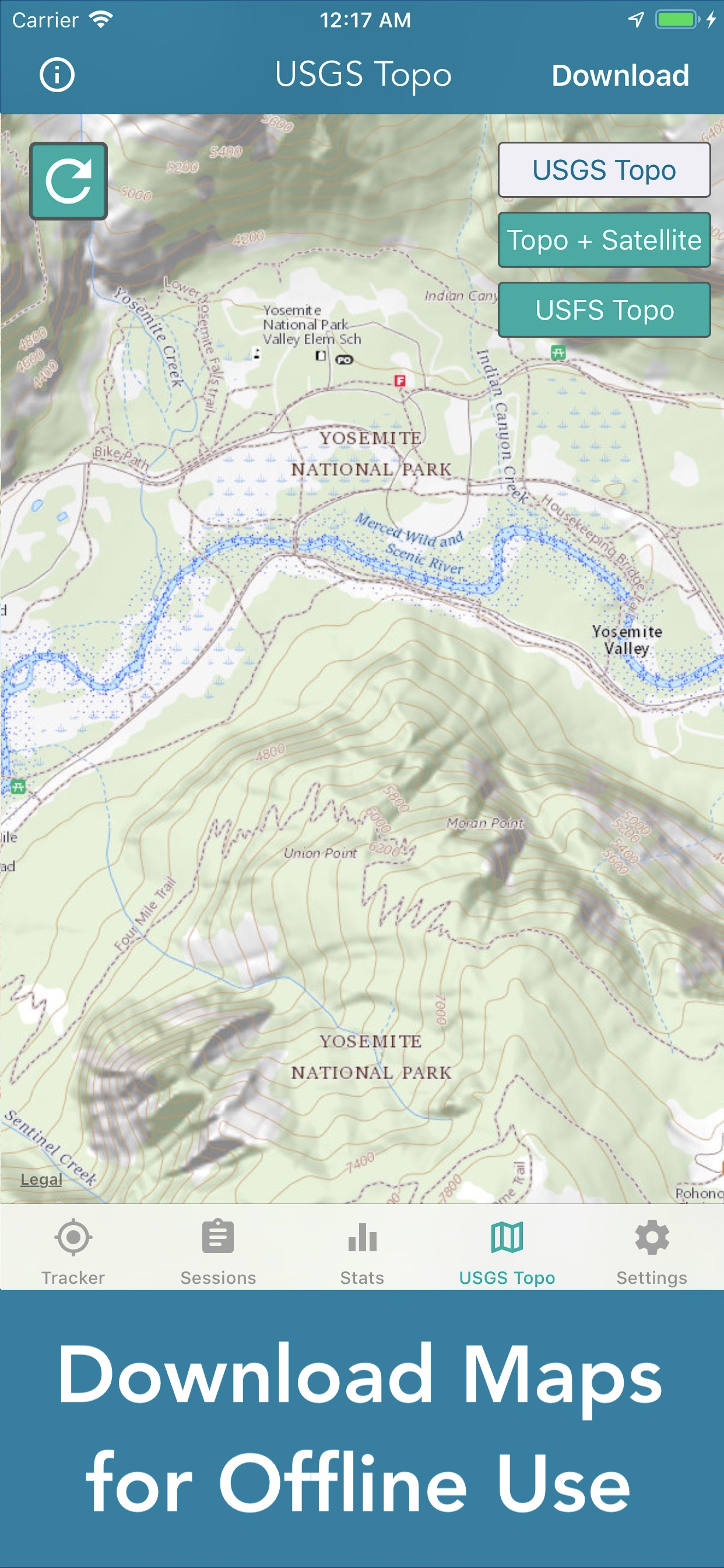
Downloading a offline map couldn’t be any harder, so many other apps where you simply download the map instead of playing the screen recording game this app requires.
Can’t figure out how to use the app. Waste of money.
This is not a product for serious users. I’m moving to Gaia which seems a better fit for me. For me a waste of money. I did get a speedy reply from my email questioning the lack of features however. That is the only reason I give two and not one star.
A compass would be very helpful
|
Chart
|
Category
|
Rank
|
|---|---|---|
|
Top Paid
|

|
113
|
