
UTM For Flight
#1 Keyword Rankings
Today
Top 10 Rankings
Today
Top 30 Rankings
Today
Top 100 Rankings
Today
Description
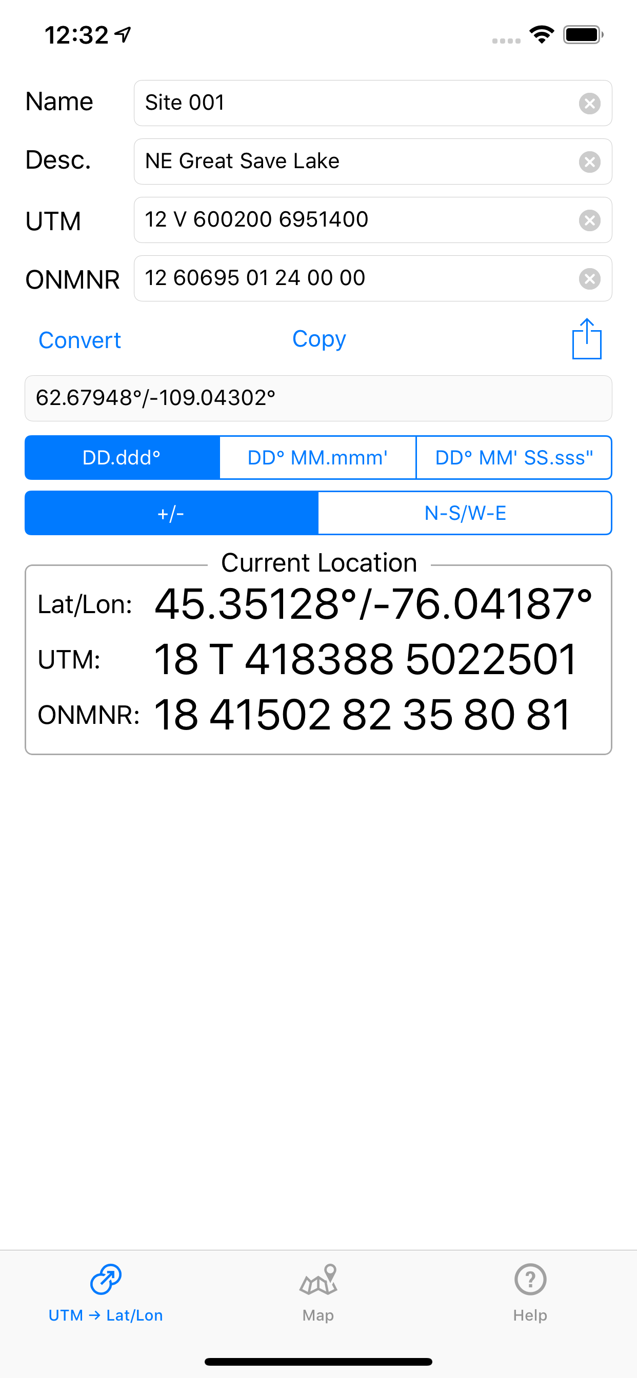
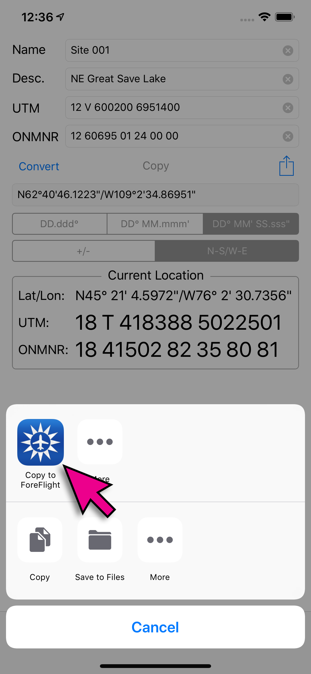
Designed as a companion app to ForeFlight. This utility converts UTM and ONMNR (Ontario Ministry Of Natural Resources) GPS coordinates to Lat/Lon (Latitude/Longitude) and then permits exporting the converted waypoint directly into ForeFlight user waypoints.
ONMNR grid system is the standard used by pilots for forest fire suppression in Ontario.
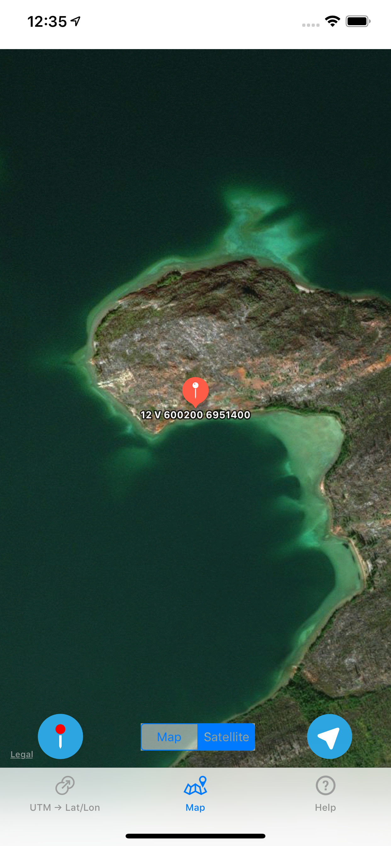
Converted waypoint can also be verified on the map within the app using either street map or satellite imagery.
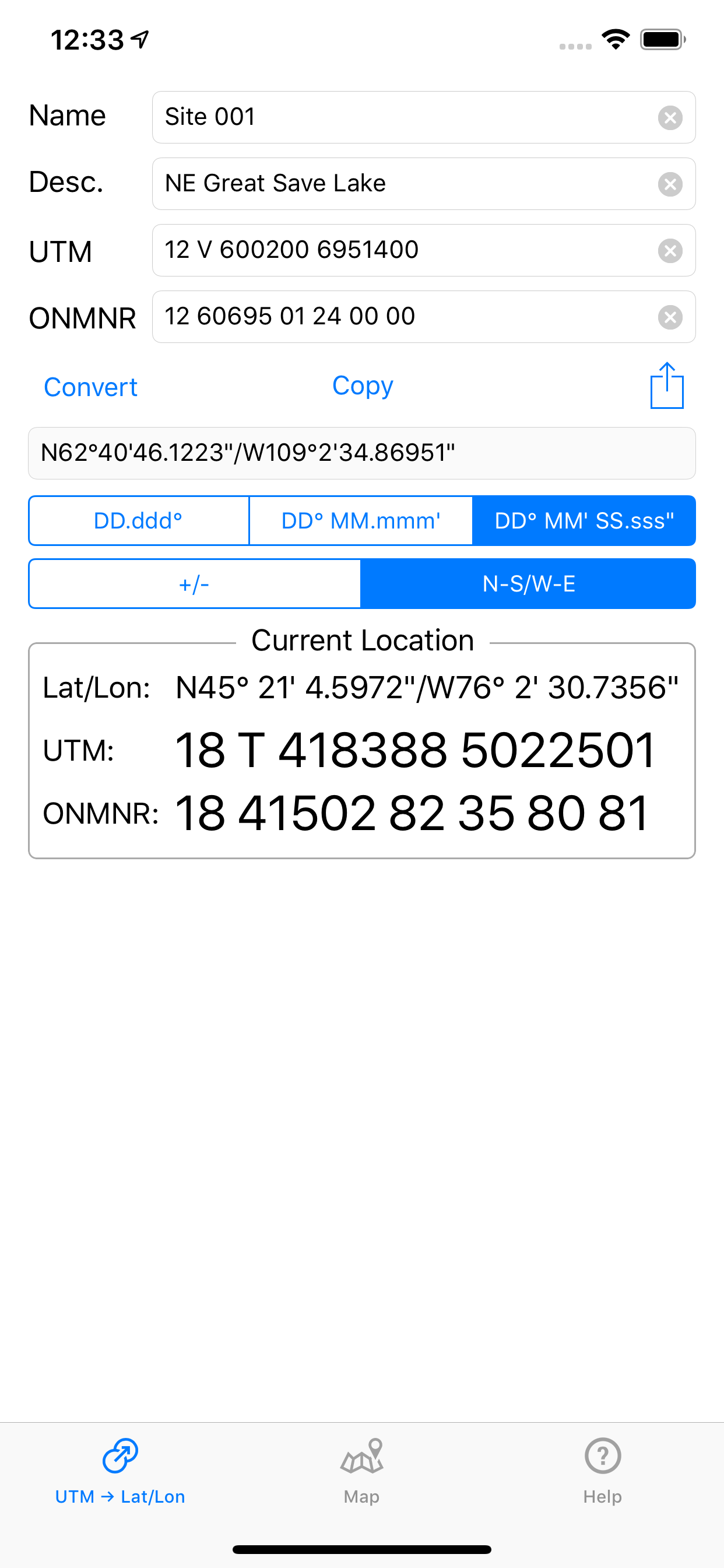
Displays Current location in all 3 formats: Lat/Lon, UTM and ONMNR.
For help and support contact: [email protected]
Hide..
Show more..
ONMNR grid system is the standard used by pilots for forest fire suppression in Ontario.
Converted waypoint can also be verified on the map within the app using either street map or satellite imagery.
Displays Current location in all 3 formats: Lat/Lon, UTM and ONMNR.
For help and support contact: [email protected]
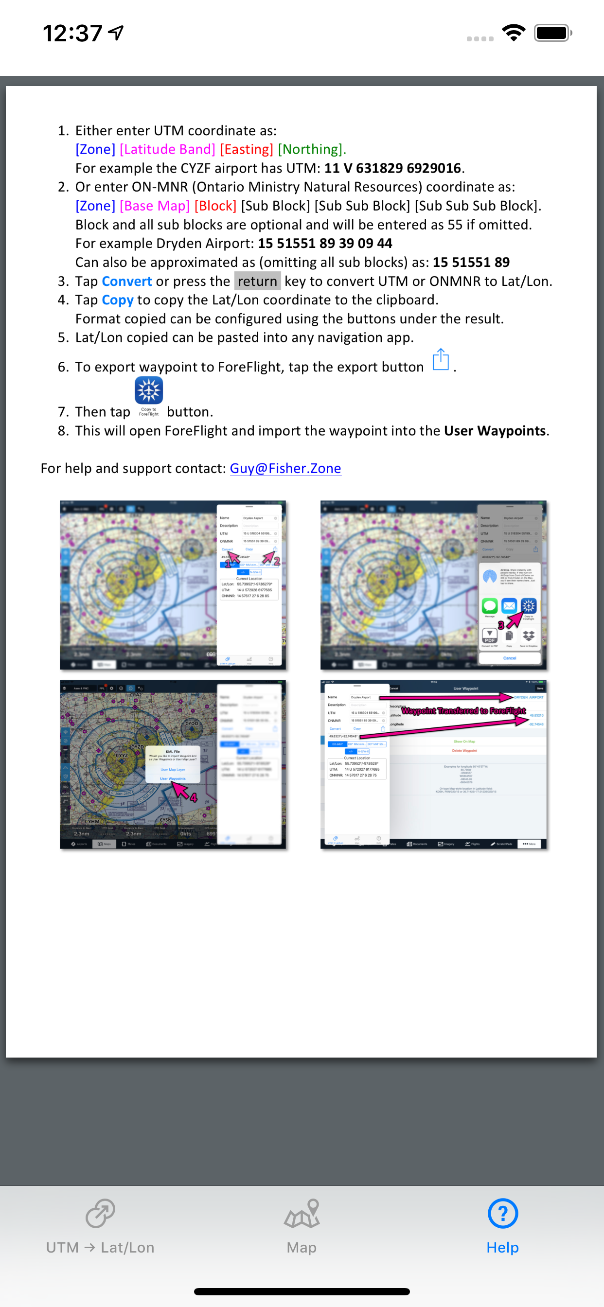
Screenshots
 User Rating
0 out of 5
0 ratings in Algeria
Ratings History
Reviews
App doesn't have any reviews yet
Store Rankings
Ranking History
App Ranking History not available yet
Category Rankings
|
Chart
|
Category
|
Rank
|
|---|---|---|
|
Top Paid
|

|
139
|
|
Top Paid
|

|
196
|
|
Top Paid
|

|
221
|
|
Top Paid
|

|
256
|
|
Top Paid
|

|
350
|
Keywords
Revenue and Downloads
Gain valuable insights into UTM For Flight performance with our analytics. Sign up now
to
access downloads, revenue, and more.
App Info
- Category
- Navigation
- Publisher
- Guy Fisher
- Languages
- English
- Recent version
- 1.12 (3 years ago )
- Released on
- Jun 2, 2017 (7 years ago )
- Also available in
- Canada, Poland, Italy, Japan, South Korea, Kuwait, Kazakhstan, Lebanon, Mexico, Malaysia, Nigeria, Netherlands, Norway, New Zealand, Peru, Philippines, Pakistan, India, Portugal, Romania, Russia, Saudi Arabia, Sweden, Singapore, Thailand, Turkey, Taiwan, Ukraine, United States, Vietnam, South Africa, Dominican Republic, Argentina, Austria, Australia, Azerbaijan, Belgium, Brazil, Belarus, Switzerland, Chile, China, Colombia, Czechia, Germany, Denmark, United Arab Emirates, Algeria, Ecuador, Egypt, Spain, Finland, France, United Kingdom, Greece, Hong Kong, Hungary, Indonesia, Ireland, Israel
- Last updated
- 1 month ago