
Description
The Vanguard Way is a 66 mile (107km) footpath from south London to the south Coast - from East Croydon station to the Seaford cliffs & Newhaven station.
Not too long and not too short it takes a few days to walk it all.
This guide combines the text & information from Colin Saunders with 3,000 photos (at points along the route & of things to see) taken mostly by John Jefkins who also created this app.
You can download the text, offline maps and photos in 10 sections (each of about 12mb) using your own wifi before you set-off to view the whole route.
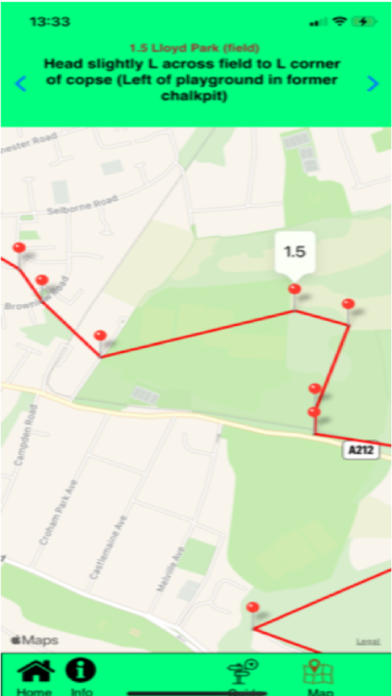
Whilst en-route, the app also allows you to view on-line maps that use location services to display the blue dot (to show where you are on your phone's maps) - should you get lost.
More information about the Vanguard Way and it's history can be found on the Vanguard Way website http://www.vanguardway.org.uk/.
This guidance has all been produced by voluntary effort from members of the Vanguard Way rambling club and this app is offered to you on that basis.
Hide
Show More...
Not too long and not too short it takes a few days to walk it all.
This guide combines the text & information from Colin Saunders with 3,000 photos (at points along the route & of things to see) taken mostly by John Jefkins who also created this app.
You can download the text, offline maps and photos in 10 sections (each of about 12mb) using your own wifi before you set-off to view the whole route.
Whilst en-route, the app also allows you to view on-line maps that use location services to display the blue dot (to show where you are on your phone's maps) - should you get lost.
More information about the Vanguard Way and it's history can be found on the Vanguard Way website http://www.vanguardway.org.uk/.
This guidance has all been produced by voluntary effort from members of the Vanguard Way rambling club and this app is offered to you on that basis.
Screenshots


User Rating
App is not rated in Italy yet.
Ratings History
Vanguard Way PhotoGuide Installs
Last 30 days
Vanguard Way PhotoGuide Revenue
Last 30 daysVanguard Way PhotoGuide Reviews
Store Rankings
Ranking History
App Ranking History not available yet
Category Rankings
|
Chart
|
Category
|
Rank
|
|---|---|---|
|
Top Free
|

|
326
|
Keywords
Vanguard Way PhotoGuide Revenue and Downloads
Gain valuable insights into Vanguard Way PhotoGuide performance with our analytics.
Sign up now to access downloads, revenue, and more.
Sign up now to access downloads, revenue, and more.
App Info
- Category
- Navigation
- Publisher
-
John Jefkins
- Languages
- English
- Recent release
- 1.15 (1 year ago )
- Released on
- Apr 26, 2021 (3 years ago )
- Also available in
- United Kingdom, Poland, Lebanon, Mexico, Malaysia, Netherlands, Norway, Peru, Philippines, Pakistan, Italy, Portugal, Russia, Singapore, Thailand, Türkiye, Taiwan, Ukraine, United States, Dominican Republic, Austria, Australia, Brazil, Canada, Chile, Colombia, Czechia, Germany, Kuwait, Ecuador, Spain, France, Greece, Ireland, Israel, India, Argentina
- Last Updated
- 3 weeks ago